History in maps
The idea that I want to share is very simple, and therefore probably not new. And if you already know the implementation of this idea, tell me about it in the comments, and I will hide the topic.
Map, be it Google Maps, Yandex.Maps or OpenStreetMaps, now surprise no one.
All of us have repeatedly seen maps like this:
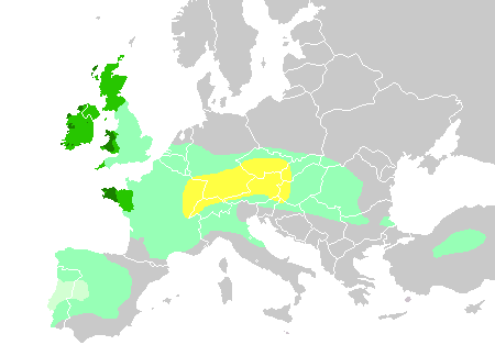
Many, I think, have seen a more advanced version:

So why has nobody made a Google Map with a slider of the year? In order for each year (decade, century, millennium - the deeper into history, the less accurate figures) to show the borders of states, the boundaries of the settlement of nations, major cities, cultural centers, military actions?
Perhaps somewhere near to show the main events, the situation in the world?
After all, it would be a universal source of information about the history of mankind.
It is clear that the implementation of such a project will inevitably face many difficulties. The most obvious of these is the lack of information: about borders, about the time of the division of nationalities, and even more about that. And despite the fact that a lot of information is already available in the public domain (see the Wikipedia article on the year 1050 , for example), building such a map is a task for a large scientific / educational organization.
But I want to live until the moment when I can see on one map that at the time when “Song about the Nibelungen” was recorded in Germany, Ice Battle took place in Ancient Russia, and glasses were invented in Italy.
Map, be it Google Maps, Yandex.Maps or OpenStreetMaps, now surprise no one.
All of us have repeatedly seen maps like this:
Many, I think, have seen a more advanced version:
So why has nobody made a Google Map with a slider of the year? In order for each year (decade, century, millennium - the deeper into history, the less accurate figures) to show the borders of states, the boundaries of the settlement of nations, major cities, cultural centers, military actions?
Perhaps somewhere near to show the main events, the situation in the world?
After all, it would be a universal source of information about the history of mankind.
It is clear that the implementation of such a project will inevitably face many difficulties. The most obvious of these is the lack of information: about borders, about the time of the division of nationalities, and even more about that. And despite the fact that a lot of information is already available in the public domain (see the Wikipedia article on the year 1050 , for example), building such a map is a task for a large scientific / educational organization.
But I want to live until the moment when I can see on one map that at the time when “Song about the Nibelungen” was recorded in Germany, Ice Battle took place in Ancient Russia, and glasses were invented in Italy.
')
Source: https://habr.com/ru/post/85271/
All Articles