Google added photos of the Second World War in Google Earth
During World War II, many European cities were bombarded from the air, some were even completely destroyed. This week, Google adds a new tool to Google Earth: now you can find out how 35 European cities looked like during World War II and evaluate the “effect” of hostilities. Historical photographs date from the period from 1935 to 1945.
To "compare" the current image of the surface and the image of 70 years ago, activate the time scale by clicking on the clock icon (in the toolbar on the top), then move the slider, which is responsible for the time back.
Stuttgart - a city in Germany, over which there were more than 50 air battles:
')
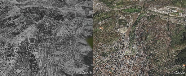
Naples is a city in Italy, most affected by the bombing:

I decided that there is not enough of everything and the news does not deserve habrakata.
To "compare" the current image of the surface and the image of 70 years ago, activate the time scale by clicking on the clock icon (in the toolbar on the top), then move the slider, which is responsible for the time back.
Stuttgart - a city in Germany, over which there were more than 50 air battles:
')
Naples is a city in Italy, most affected by the bombing:
I decided that there is not enough of everything and the news does not deserve habrakata.
Source: https://habr.com/ru/post/83314/
All Articles