Images from GeoEye-1 appeared in Google Earth
In September 2008, Google launched the GeoEye-1 satellite, which provides a resolution of 41 cm / pixel, which is the highest figure for all existing commercial satellites - this exceeds the maximum limit of 50 cm allowed by the US government, so that even before publishing on the Internet.
In October, GeoEye-1 made its first frame , and yesterday, photos from this device were finally introduced into Google Earth, so far as an optional layer (it needs to be downloaded from the GeoEye website ). However, this does not prevent us from assessing their unsurpassed quality. The most inaccessible corners of the globe are now photographed with a quality comparable to the quality of large cities, which were removed from the drone.
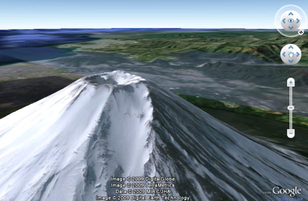
Cult of Fuji among the Japanese.
')
Atoll Nukuoro in Micronesia.

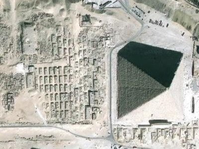
One of the pyramids near Cairo (Egypt).
Over the coming months, these photos will be embedded in the standard layers of Google Earth, Google Maps and Google Maps for Mobile.
via Webware
In October, GeoEye-1 made its first frame , and yesterday, photos from this device were finally introduced into Google Earth, so far as an optional layer (it needs to be downloaded from the GeoEye website ). However, this does not prevent us from assessing their unsurpassed quality. The most inaccessible corners of the globe are now photographed with a quality comparable to the quality of large cities, which were removed from the drone.
Cult of Fuji among the Japanese.
')
Atoll Nukuoro in Micronesia.
One of the pyramids near Cairo (Egypt).
Over the coming months, these photos will be embedded in the standard layers of Google Earth, Google Maps and Google Maps for Mobile.
via Webware
Source: https://habr.com/ru/post/55064/
All Articles