News from the world of OpenStreetMap № 468 (07/02/2019-08.07.2019)
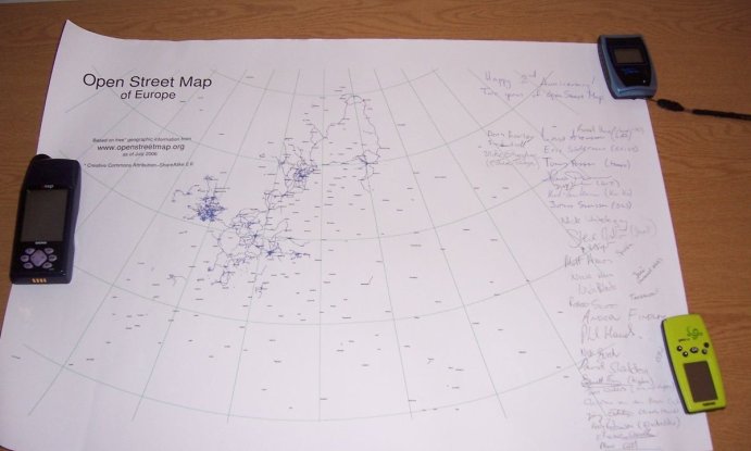
OSM at the celebration of his birthday in 2006 in London - a card with the correct attribution (at that time)
1 | Map data OpenStreetmap OdbL
About Us
- ERROR: In the last issue of WeeklyOSM No. 467, we wrote : “The Japan Times publication reports that a modern digital map of Benin (a state in West Africa) appeared recently, replacing the old map of 1957.” The mention of OSM in the context of this news was wrong. Link led to one of the cities of Nigeria, not Benin. Moreover, the geodata created under this project under the leadership of IGN France International , as in many former French colonies, unfortunately, are closed, despite the fact that the development of such projects is partially funded by public funds of the European Union.
Mapping
- Joseph Eisenberg rewrote the Good Practices wiki page and began a discussion of his changes to the general Talk mailing list. Despite the fact that almost all of his additions, with rare exceptions, were approved by the majority, he was criticized for having edited the article before discussing it with the community.
- Joseph Eisenberg announced the start of voting for the
waterway=tidal_channeltag he proposed to use . - User higa4 studied
 , as was the case in Japan with mapping in the first half of 2019.
 - Maning Sambalé said that he, along with other colleagues from the Philippines, visited Lupang Rent (Taytai municipality, Rizay province) where they were involved in mapping. They also shot street panoramas and took aerial photographs with the help of drones to assist local authorities in their emergency prevention and response programs. In addition, he noted that a series of free seminars are planned for next month in the Philippines, which will be held at the Pista Ng Mapa conference. They will be organized by the same team of volunteers who took Lupang Rent from drones.
- A SilentSpike user's suggestion was discussed: to make a warning in iD when a landuse is connected to a motorway. As usual, there are different opinions on this.
Community
- [1] On August 9, 2019, OpenStreetMap will celebrate its 15th birthday. Information about holiday events is collected on WikiOSM.
- SeverinGeo user tweeted a photo from a two-week course on OSM and geomatics that took place in the capital of Mauritania, Nouakchott. They were conducted for members of the local OSM community, researchers and representatives of local authorities. The courses were organized with the support of the Nigerian and Senegalese communities with the support of the international organization Francophone.
- In 2017, Zoe Gardner conducted a survey on gender and some other demographic issues among cartographers, and also analyzed their profiles in the online service “How did you contribute to OpenStreetMap?” . Her detailed findings were published recently in a scientific journal. As it turned out, the men were more active cartographers. But at the same time between the sexes there were no significant differences in the use of tags, which at that time were displayed in HDYC.
- The OSM forum now has a style that is friendly with smartphones - Victory. You can enable it in your forum profile in the “Display” section.
- The Grab team in the Philippines successfully conducted a cartworm and wrote about it on a blog.
- Harry Potter Wizards Unite is a new augmented reality game that uses user locations from Niantic , the creator of Ingress and Pokémon Go . User Gregory played this game and broadcast it on his Mapper Diaries youtube channel. He also looked at how she uses data from OpenStreetMap.
- June 22 in Moscow (Russia) was offline mapping in the village Kommunarka, where not so long ago was opened a new metro station. The event was attended by 5 people. They slowly walked around several areas of this village and collected a lot of information. Editing a map of this territory in OSM is in process.
OpenStreetMap Foundation
- OSMF Council member Yost Schuppe announced that the Council will now conduct regular polls before each major OSM event. This will be done not in order to increase the Council’s popularity, but in order to get to know the opinions of people that no one else would ever hear.
Developments
- Until July 21, extended the discount on early purchase of tickets for the conference " State of the Map ".
- The SotM team began collecting maps and posters for the exhibition “Posters, respond!” , Which will be held this year during the State of the Map conference in Heidelberg (Germany). You can send your work until August 18, 2019. By the way, the conference program has already been published .
- Branch of the non-profit organization OSGeo in Japan announced the holding of a FOSS4G Niigata conference on September 13 and 14 and start accepting applications for speeches. Applications are accepted until July 31. Please note that this year the conference will take place not in Tokyo, but in Niigata .
- AGIT-2019 ( translation ) - a symposium and exhibition of applied geo-informatics, which was held a week ago in Salzburg (Austria). It worked OSM and OSGeo information booth, which was created and installed by Marcus and Andreas. All day they answered quite complex questions from visitors. Andreas, a Geologist, did a daily report on this event. Please read his posts about how they arrived ( translation ) on the first day ( translation ), the day of OSGeo ( translation ), the second day and Friday ( translation ). Marcus (nickname ScubbX) also wrote his report ( translation ).
- GeoMundus is a free international conference on geospatial technologies, geoinformatics and earth sciences, organized by Erasmus Mundus graduate students in the field of geospatial technologies. Now she is registering. The conference will take place on November 29 and 30 at the University of Jaume I in Castellón de la Plana (Spain).
- Erwin Olario invites people of Asia to the local open cartographic conference " Pista ng Mapa " (Festival of maps). It will be held August 1-3, 2019 at the Foundation University in the city of Dumaguete (Philippines).
Humanitarian OSM
- HOT now draws the contours of buildings to measure exposure risk in Tanzania. For the study, cartographers drew 10,955 buildings, some of them were collected by 20 cartographers "in the fields." The blog tells about the history of the project, how the data was collected, how it will be used, as well as the tasks facing the research team.
Education
- Jean-Francois Perrat published
 A guide to organizing a cartaton or group classroom. In addition to the basics and tools available, he talks about different ways of activities in the classroom. (automatic translation )
Cards
- Dorofey “Komäpa” Proleskovsky wrote about a map showing a comparison of population density and the number of objects in OpenStreetMap.
Go to OSM
- Civil protection services in the Azores used OpenStreetMap, at least during the exercise.
- The Federation of Cycling in Russia in the preparation of a booklet dedicated to the championship and championship in cycling (highway) of Russia, which was at the end of June (June 26-30) in Belgorod, used OSM cards.
Open data
- Nikolai Dzhanakiev made an online presentation where he compared Wikidannas and OSM ..
- The European Commission has published an OSM-based map showing the locations of companies in the EU that trade with MERCOSUR , the South American trading bloc.
Software
- The developers of Maps.Me have greatly simplified the process of installing a map generator for their application. Now it is designed as a docker container, which allows you to independently collect fresh maps for Maps. Me, even for an inexperienced user. While this is possible only in Linux.
- Mateusz Konieczhi published the results of testing the interaction of new users with StreetComplete (UX-testing).
Programming
- Now iD users can change the style of the map during editing. ID developer Quincy Morgan called this feature, which is similar to what is called "card styles" in JOSM, "lenses."
- Andy Allan, in his blog, spoke about the changes that have occurred on the OSM / API website in June. Among other things, handling of downloads of GPX tracks was improved, and a new query
/api/versionsintroduced. With this request, you can find out which versions of the API are currently supported, and also allow you to run several versions of the API in parallel.
Releases
- The iD team has released a new version of the popular editor - v2.15.3. Changes to this version, which is already used by osm.org, can be found on GitHub.
Did you know …
- ... that the Vatican is the source of many secrets. The area of a small country seems to be one of them. Frank Gavaerts claims that both Wikipedia and “every single source ... reports that its area is 44 hectares, even britannica.com,” but the JOSM plug-in shows only 0.49 km² when calculating the area.
- You've probably seen the image of the week on the main page of WikiOSM. But do you know how to offer an image there? It is quite simple .
- ....... what can you render the whole planet in the console? You can access the demo server through telnet or do it on your computer.
- …… how to mark the types of fuel at the gas station? It is recommended to use common names for different types of fuel instead of local names or brands in order to ensure consistency of data around the world. WikiOSM marks these values, but in fact more than 500 different “fuel: *” tags are used in total. Most of them are undocumented and are used only a few times.
- ... ... about the map of lighthouses , which shows how they look and blink? The GitHub project uses
Seark:light:sequence, as well asSeaark:light:rangeandSeaark:light:colortags. - ... that the Russian company NextGIS made the information system of the cultural and historical heritage of the Rostov land (Yaroslavl region, Russia). On the map you can find historical sacred places of this territory, manor houses and even places where healers lived.
- ... that the Russian FreeExec mapper made quite a few different validators? The power supply of the Russian Federation, the validator of substations with voltage over 35kV, railway stations in Russia and much more - you can find on his personal website .
OSM in the media
- Valery Trubin continues a series of interviews with Russian maperami. This time, he spoke with a municipal official from Togliatti, Elena Balashova , who allowed the data from EMGIS to be used in OSM, as well as with maper Anton Belichkov from Magnitogorsk, who dedicated 10 years of his life to OSM.
Other "geo" events
- Alex Parsons tweeted a study, whose authors analyzed the problems left by users on fixmystreet to find out if there is a difference in reporting between the sexes. They found that men are more likely to report driving problems, and women are more likely to walk.
- In France, the General Council for Environment and Sustainable Development published ( translated ) a report stating that the prefectures rather freely interpreted the possibility of revising the IGN hydrographic maps, excluding many small rivers. In a country where open data is considered important, many critical comments have followed ( 1 translation , 2 translation , 3 translation , 4 translation ) in which it was emphasized that in this way the authorities are trying to avoid compliance with environmental legislation regarding these rivers.
- KM Alexander extracted images from old maps, such as Isola di Malta from 1686 or Terræ Sanctæ from 1660, and made them available under the CC BY 4.0 license.
- The Internet portal NZZ talks about the impact of Google Maps on territorial claims and border conflicts (“the war of Google Maps”), as well as what happens if the whole city disappears by mistake for a month ... (automatic translation )
- The Guardian published an article about the Guthook Guides application, which provides information about hiking, wild regions and trails around the world, as well as unforeseen consequences caused by the growing dependence of users on their phones when navigating through the desert.
- Mike writes ( translation ) on his home page #geoObserver that, despite the disappearance of one method that allowed creating a building foundation map from OSM using a request through the Overpass turbo service, it can still be done quite simply in QGIS.
- Video about the new features of QGIS 3.8 (Zanzibar).
Communication of the Russian participants of OpenStreetMap is in the Telegram chat and on the forum . There are also groups in social networks VKontakte , Facebook , but they mostly publish news.
Join OSM!
Previous issues: 467 , 466 , 465 , 464 , 463
')
Source: https://habr.com/ru/post/460599/
All Articles