Urbanism in China: fewer hipsters, more science and IT
For most of the inhabitants of Runet, the word “urbanism” is associated with something, then probably only with a well-known curly blogger. And with hatred of motorists and the fight against high-rise buildings. Recently, this topic has become gaining popularity, and now a lot of people have appeared who are sure that they have learned the essence of urbanism by reading a couple of popular blogs.
However, in reality, urbanism is a science, and science is quite interesting and interdisciplinary, containing within itself many different directions. Now a lot of energy is invested in all sorts of Smart City and in attempts to make urban design and management more transparent, simpler and more technological. Therefore, in recent decades, information technologies have begun to play a major role in urbanistics, it is thanks to them that new types of research, new data collection technologies and new design possibilities have become available.
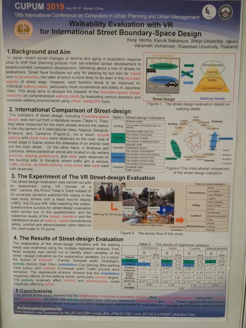
This year marks the 30th anniversary of the international conference CUPUM - Computers in Urban Planning and Urban Management. This conference takes place once every two years, is an A-rank according to Core classification, and this year it brought together urban design researchers in Wuhan, China. I went there to represent my native ITMO University and its Institute of Design and Urban Studies. I told there about the development of my studies of pedestrian modeling, which once began with this article on Habré.
Under the cut, excerpts from the reports that I found interesting to me on urbanistic and IT-related topics, some attempt to analyze trends and, well, some photos of China, without them.
In general, once this conference started with China. For 30 years, China has come a long way, and in general, those who started to move this topic here then can now appreciate how true this path was.
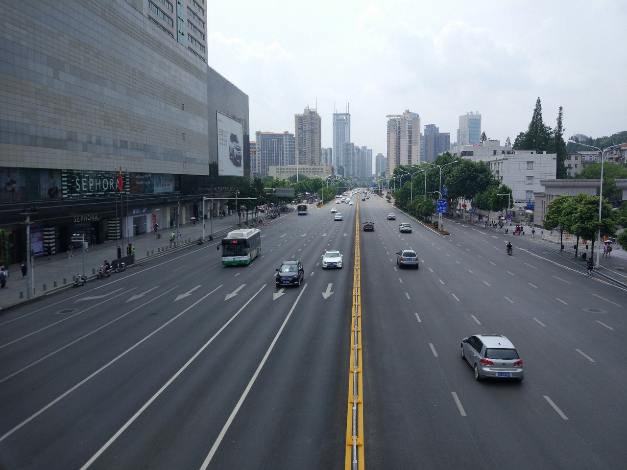
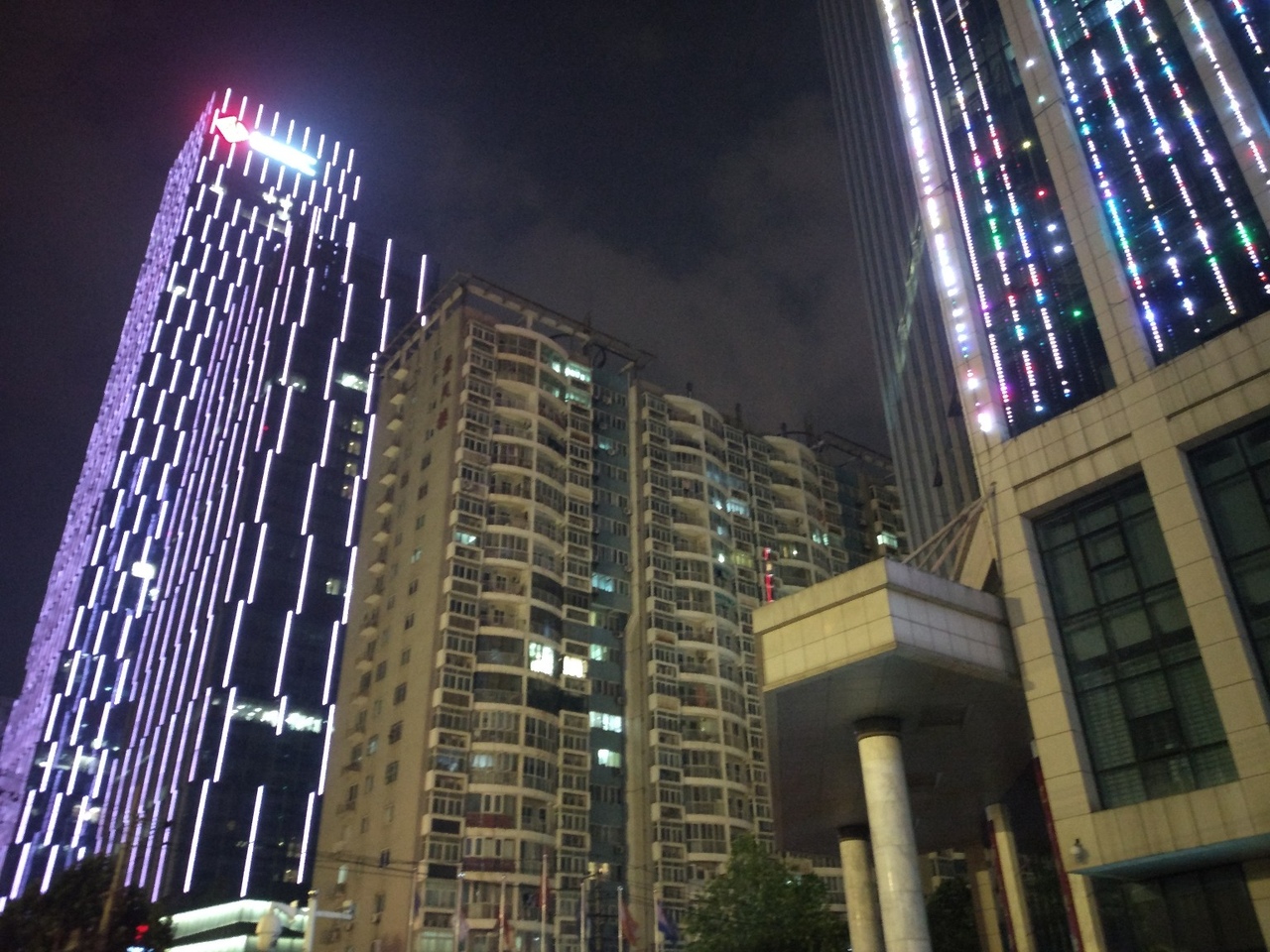
Progress is visible even in the appearance of the city of Wuhan: old shabby panel high-rises are still here and there among the glittering illumination of new skyscrapers, but on the whole it seems that legions of bulldozers have walked around the city, demolished everything that was and rebuilt.
Of course, most of the speakers at the conference were local - namely, 54%, according to the results of the survey. We, two Russians, took a modest 0.4% of places in the final ranking. Therefore, a significant part of the reports focused precisely on local peculiarities, which made it possible to take a look at how the design of cities is treated in the most dynamically developing country in recent decades.
The program turned out to be quite a lot of similar reports, which made it possible to identify certain trends, which will be discussed further. I apologize in advance for the quality of the photographs, but in the dimly lit halls it’s impossible to take pictures of the phone better.
Penetration of urban studies in universities
Previously (and there are still many where) narrow specialists from related industries were engaged in the problems of urban development. However, the city is too complex a system, and one cannot look at it through the prism of only one field of activity, otherwise distortions too often occur. A typical example is when architects begin to lead the development of the city (and the city begins to overgrow with houses according to the principle “only beautiful and fashionable” without thinking about the necessary infrastructure) or transport workers (and hi-hi highways through the city, lack of crossings, an uncomfortable pedestrian environment - because in their context, there are only cars and street capacity in vehicles per hour).
An understanding has now been established that for successful development interdisciplinary specialists are needed who are able to assess the situation from different angles. Representatives of several Chinese universities at once told about the opening of new master's programs in urban colleges in their own universities. These programs include modules from all necessary related disciplines - in addition to the sciences about the city itself, social sciences and information technologies are included there.

It is pleasant to realize that here we are not lagging behind in ITMO - the master program of similar composition appeared here in 2013. Honestly, at one time I was not weakly surprised when I learned about it: "Shta, what does urbanistics have to do with IT?" But it turns out that it has the most immediate.
Ecology and sustainable development
These are also very popular trends lately. At the same time, in China, they generally focus very strongly on them: with such a population, it is necessary to take a very responsible approach to the issues of resource consumption and balancing urban systems. Here the speakers talked about several areas of research at once:
- Government regulation and support of all green technologies - all programs and laws adopted by the government of the PRC to preserve the environment. We also like to talk about this, but in China you believe that much more. It is enough to look out the window, see the wide-open motorways and the forest of skyscrapers to the horizon, to understand that firstly they can develop very quickly and have the resources of the sea, and secondly they simply have nowhere to go if they do not want to drown in garbage and environmental problems.
- Analysis of the existing problems of large cities - emissions, heat generation, problems with sewage, all this is estimated, different models are built, on the basis of which decisions can be made about the future development of areas.
- Various technologies to solve some planning problems. For example, solving the problem of optimal placement of buildings to maximize the use of sunlight.
The need to take care of the environment becomes especially obvious when you climb the mountain near the hotel and see a landscape with endless rows of houses like this:
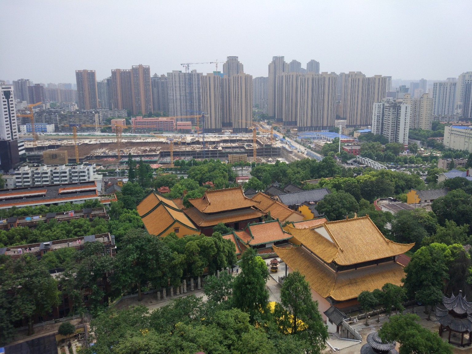
It seems that the Chinese have already begun to understand that it is impossible to build like this, if you don’t want to clear it up later.
Information support for urban planning decisions
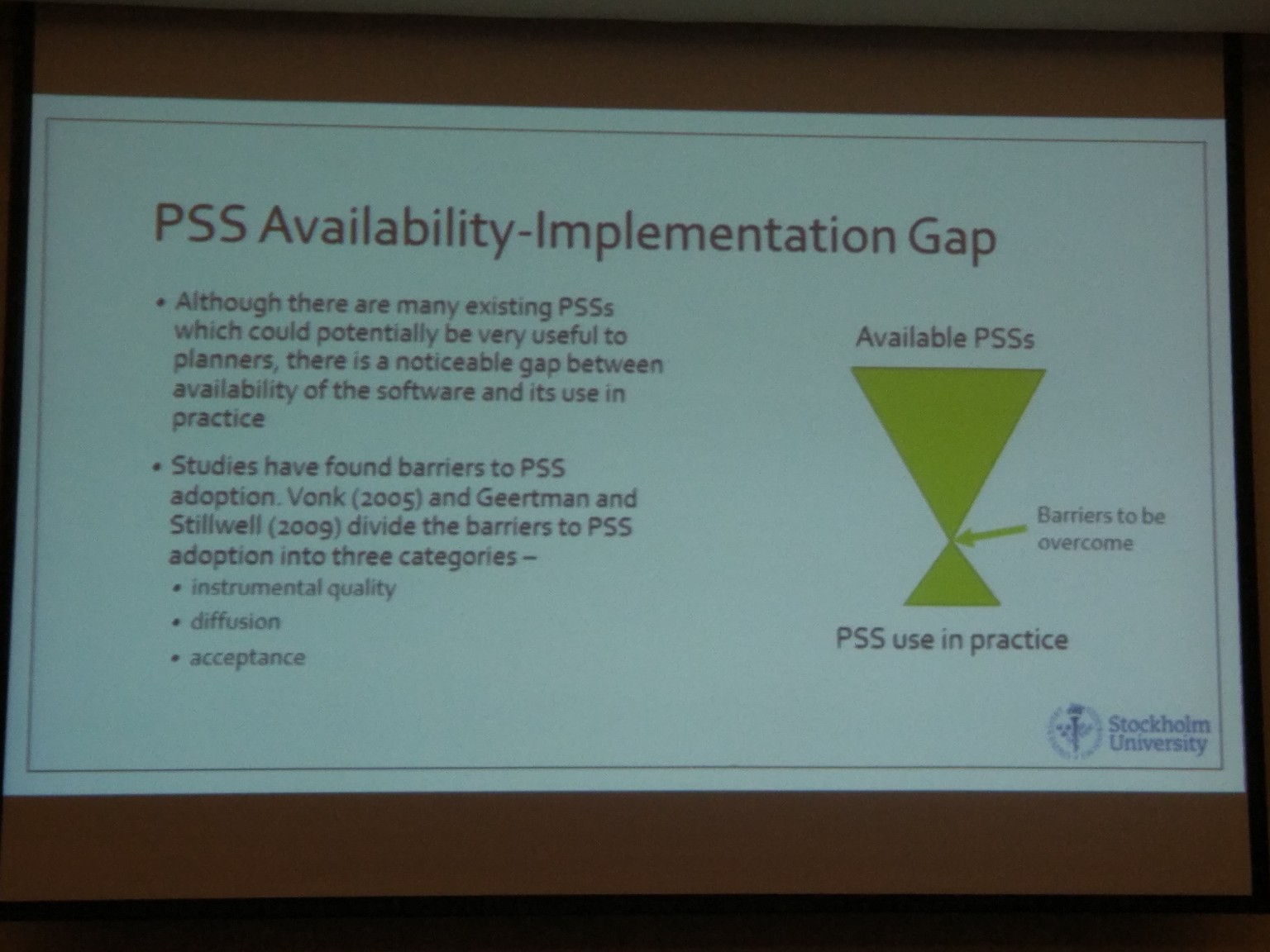
Different teams around the world are now actively trying to algorithmize and optimize urban planning decision-making processes, creating so-called Planning Support System (PSS). Such systems, which would suggest developers (those that are developers, and not those that are programmers), optimal places for construction, helped the officials to draw up development plans, and the residents somehow to participate in all this and express their opinions. Yes, in my opinion, they try to invent something like this from the very dawn of the computer era, almost from the 60-70s of the last century, but right now the rapid growth of IT and mobile technologies has allowed researchers to access a huge amount of data can help with such decisions.
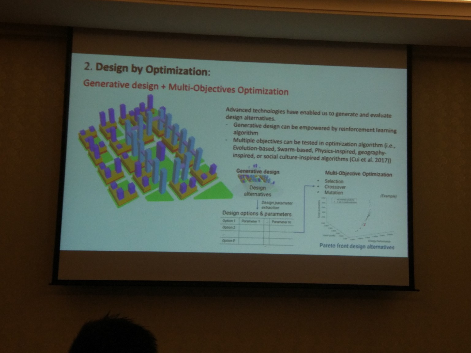
For example, Shenzhen plans to build a new university campus. As planned, it should be built according to all trends of sustainable development, making optimal use of the natural resources available on the ground.
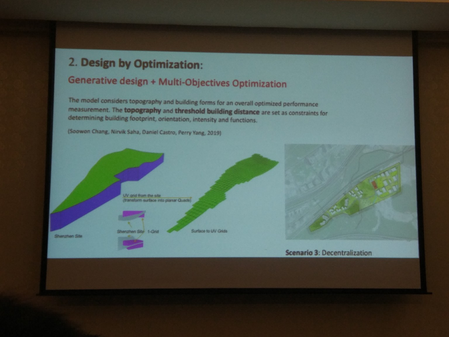
To solve this problem, the authors of the project used evolutionary algorithms, with the help of which they chose the options for placing buildings on the territory of the future campus and carried out multicriterial optimization. As criteria, for example, were selected parameters for the use of sunlight in the classrooms, solar energy on the roofs of buildings and travel time between campus buildings (it is obvious that the first two parameters will try to push the buildings away, and the third - to group closer). At the same time, the task is also complicated by the relief - as well as in many places in China, in the area there are many small mountains and hills, where buildings are difficult to build and there are serious restrictions on height and mass.
A team from Sweden developed the LEAM model to predict development-friendly areas around Stockholm. They had to finish the model with a file, as it was originally developed in the USA, and in Europe, the transport preferences of residents are quite different, the proportion of people using public transport is much higher.
However, not everything is so good: in the same Swedish study, it was separately emphasized that so far there are practically no successful stories of PSS implementation. Many beautiful pictures have been drawn, many models have been made, but so far they are on their own, and developers and officials are on their own. The problem is that all this works incomprehensibly, is not always good, and does not inspire confidence among those employed in the construction industry. Many works are of purely academic interest and divorced from reality.
Big data
A lot of research included analysis of every bigdata. As a rule - data from mobile operators: coordinates of subscribers and lists of calls. Judging by the number of studies, it is relatively easy to obtain such data in other countries. Most often, they are used to solve various transport problems, because a lot of things can be done, knowing the migration routes of city residents. From the trivial prediction of traffic jams and tips to optimize the road network to assess the attractiveness of city streets for pedestrians. But sometimes for something more exotic, for example, in one job they used the number of phone calls as one of the factors by which you can automatically determine the type of urban development.
Moreover, in the case of China, we are talking about handling millions of tracks and calls daily, and there is an opportunity not only for scientific, but also for IT-algorithmic interest.
However, not all so simple. Seattle researchers used travel data from a local carpooling service to analyze the impact of changes in the city’s transport policy on residents' transportation preferences. And revealed a number of problems associated with the use of such data:
- The data is impersonal, which makes it impossible to link several tracks with one person. At the same time, it becomes impossible to track trends and changes in preferences, except at a very gross level.
- A bunch of data access and privacy issues.
- Handling large amounts of data requires competencies and IT infrastructures that many transport agencies do not own.

As a result, in addition to analyzing the data, the researchers were forced to turn to traditional research methods, for example, residents' surveys. And their work concludes that, despite the progress in IT, traditional research methods will not soon recede into the background.
Google street view
GSV is another source of urban data available to researchers. And then you can try different interesting things on the verge of Computer Vision and urban planning. We, at ITMO, also did a small study and created an algorithm capable of detecting illegal signs (violating local laws) on panoramas. And at the conference there were several articles at once devoted to the analysis of the accessibility of sunlight on the streets (again, issues of energy efficiency and the use of solar panels) and visual analysis of the urban environment.
Of course, GSV panoramas have their own problems - they are not everywhere, there are many where they are not very relevant, licensed issues, the need to self-stick panoramas of pieces, etc. But in any case, this is practically the only (except for very limited and expensive personal walks) source of big data for visual analysis of cities.
VR
Virtual reality glasses have found an unexpected use in urban research. Several groups of researchers at once used them for visual assessments of the urban environment.
It is rather difficult and costly to send a group of researchers to some distant city to assess the characteristics of the environment. And polls of local residents are not always suitable - after all, some professional analysis may be required, which can only be done by an expert familiar with the methodology. In this case, VR is a cheap and angry substitute for personal presence. One team member shoots the street he needs on a 360-degree camera, a team of researchers goes through a virtual tour in VR glasses sitting in his laboratory, and then fills in tables and questionnaires.
Pedestrians
Several diverse studies have been associated with pedestrian infrastructure. Attempts were made to isolate environmental factors significant for the convenience of walking, the safety of pedestrian crossings was investigated. I am glad that the issues of pedestrian mobility and security are beginning to study more and more countries.
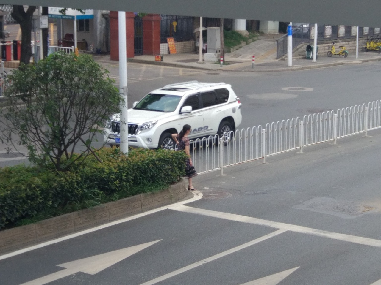
In Asia, this is pretty bad. In the same China, a typical street looks like this:
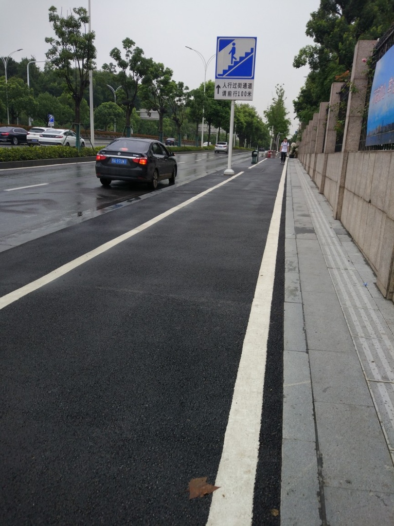
Visually, it may seem that everything is in order, but in fact here we see a 10-12 lane highway for cars, what seems to be a sidewalk is actually a two-wheeled strip, and a pedestrian pavement is that narrow meter strip with tactile tiles on the side. Ground crossings are massively cleaned and replaced with rare off-street ones - exactly the same rake that is now being used by city planners in Russia. It all ends the same way: people do not want to spend time climbing the stairs (and the elderly and people with limited mobility simply cannot), run across the road to the bottom, which ends in heavy accidents. Since drivers do not expect to see pedestrians there and drive fast.
Multi-row fences do not really help.
I myself made a report on our algorithm for determining the best places to accommodate pedestrian crossings. Secret know-how from our laboratory: the audience is very animated, if you show something near the conference venue as examples. Such that the audience may have already seen, walking around the hotel. Therefore, we arrived a couple of days earlier and walked a little along the surrounding streets. In the end, scored and fotochek for the presentation, and conducted a simulation of pedestrian flows on a street near the hotel. It seems the audience has gone quite well.
About presentations
In general, presentations at scientific conferences are, unfortunately, sadness and sorrow. Probably, all these people are good scientists and represent interesting studies, but 3 out of 4 make it incredibly sad and difficult to understand. As a result, half of the audience sleeps, half sits in the telephones.
On Habré already have a number of good articles about how to speak at public events, I like these - one , two , three . And here is my own set of items:
- To prepare for the report: to pronounce many times, to remove bad-sounding and difficult to speak fragments. On paper, it looks good, in a voice - completely different.
- Standard tips: do not read a piece of paper, do not put mountains of text on the slide. 3-4 thesis, KDPV, the rest in a voice. Although there is an exception about the mountains of the text (which I realized at the conference) - if your English is very bad and illegible (and you are ready to admit it), then the mountain of text on the slide will allow the audience to at least understand something in your presentation, not with your eyes so .
- Voice must be told emotionally. Walk along the stage, swing your arms, change the tempo, the timbre of your voice. Do not forget to look into the hall. You, in the end, came to share the fact that you discovered some very cool stuff, from which you (I want to believe) rushing - well, tell us about it accordingly. There is nothing more dismal than the speaker, monotonously mumbling at the pulpit. In general, as for me, a good report is closer in spirit to a short stand show than to a dull academic meeting.
- It is important to remember that the report is not an article. You still can not cram any serious technical details into the 10-15 minutes of the regulations. Anyone who is interested will still then read your article in the conference materials (and they are the main scientific exhaust from participation). The report should also interest people, including those who are not very well versed in your field, so that they can go and read. Therefore, more beautiful pictures, problem descriptions, examples, less formulas and difficulties.
But, of course, the balance must also be maintained. Everything is like on Habré - you put too many details - you get a miserable one and a half thousand views and one plus, because it’s too difficult, you put too little - you will get cries "what it does on Habré" and "go to Peekaboo with such articles." - Well, here is our know-how described above - you need to use local examples, if possible. Of course, it is not enough for what areas it is possible and it makes sense, but for urban planning just right. So you will kill two birds with one stone and demonstrate the applicability of your technology in different conditions (with which many studies have a problem), and cause a greater response from the audience.
Conclusion
The trip brought an interesting experience, and most importantly - confirmed that we are moving in the right direction with a choice of areas of research and education of students. We will continue in the same vein.
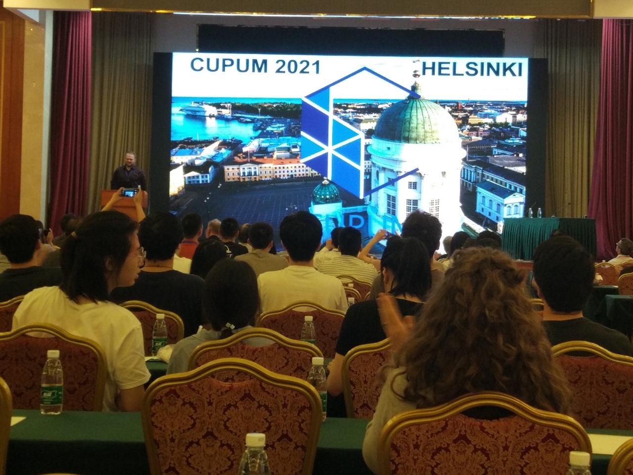
The next CUPUM conference will be held in Helsinki in 2021 - right next to us. It will be necessary exactly to go there. Well, or rather try - because getting to the A-class conference is not so easy, heh.
As advertising
As I already wrote, the trip took place thanks to ITMO University and the Institute of Design and Urban Studies, which is part of it.
It was great to get confirmation that we at ITMO and the IMU are at the forefront of many global trends:
- We have master programs in urban studies. Every year they change their names, this year they are called Urban Studies (more humanitarian) and Digital Technologies of a smart city (more IT)
- We have big data laboratories with transport simulation , VR and AR (for example, this team from ITMO made an AR-application for the opening of the European Games in Minsk)
- We are engaged in the automation of design and PSS, although we still follow the same rake as other teams that were at the conference.
If you are interested in doing such things - come to us to study or work. You can still have time to apply to the magistracy in the third wave in August - there is information in the IMU group . And about the work - we are now recruiting Java juniors to work on such projects in our building on the Exchange line in St. Petersburg. Work involves part-time employment and combination with studies. You can either write to me in PM here, or to evsmirnov@itmo.ru
')
Source: https://habr.com/ru/post/459688/
All Articles