News from the world of OpenStreetMap № 467 (06/25/2019-01.07.2019)
Comparing the quality of the data entered in OSM with open data allows us to make the road network even better 1 | Map data gRoads and OpenStreetMap contributors, ODbL
Mapping
- The new function of the online editor iD, which allows you to add Wikidata and Wikipedia tags to brands of retail chains, does not always work correctly: sometimes institutions with very similar names are mistakenly marked. About this user writes a bikeoid in one of the error messages on GiHub'e. As one of the possible solutions to the problem, it is proposed to use the
not:brand:wikidata=tag, thus avoiding the re-addition of the tag. Quincy Morgan (one of two iD developers) notes that before using a tag, it must first be approved according to OSM rules. - The decision of the iD developers to support the use of the
natural=watertag paired with thewater=reservoirtag instead of thelanduse=reservoirtag led to a discussion on GitHub. The decision itself is not new - it was made in December 2018 - Emily Eros from the SharedStreets project has published a large and detailed article on the use and regulation of parking along the streets (roadside), which has recently been increasingly worrying business and local authorities. In the material, she notes that at present OSM practically lacks such data, she also wonders why this happened. Emily Eros examines the current state of affairs, draws attention to some difficulties and suggests new ways to add such information.
- Joseph Eisenberg turned on the “Tagging” mailing list after two new sections were added to the Good Practices wiki page. He considered that the new sections (“Checking the history of important objects” and “Do not mark insignificant, fixed for a long time and moving objects”) duplicate existing sections, and therefore deleted them.
- Leif Rasmussen said that the voting has begun for the elaborated tagging scheme for complex intersections, which will make it possible to contribute more information about the connectivity of the road lanes.
- Approved tag
tourism=camp_pitch, which now marked the place of installation of tents and a camper on the territory of campgrounds. - Russian osmer Pavel Gavrilov wrote a large and detailed article on WikiOSM about how Strava data can help make OSM more accurate.
Community
- The OSMF data working group reports that it has hidden several entries in the OSM diaries, as there were offensive remarks in the comments to them.
- The local branch of OSM in Germany (FOSSGIS e.V.) stated
 (automatic translation ) that is ready to financially support the mapping in honor of the 15th birthday of OpenStreetMap, which will be held on 10-11 August 2019.
 - Chris Beddow of Mapillary writes on his blog about OSM development, his communities and cartographic technologies. He concludes that all participants in the project, from a regular cartographer to commercial companies, should interact more closely and productively with each other.
- At the request of Maxar (the founders of the Digital Globe service, which is currently in the rebranding stage), the list of satellite images that are allowed to render objects in OSM has changed in the OSM editors. The reasons for this can be found in the diary of Maxar employee Kevin Bullock . Probably, almost all the regular participants of the OSM project noticed that instead of satellite images of Digital Globe, Maxar appeared - Standart and Premium. By the way, they are pretty fresh. This news concerns not only OSM online editors, but also JOSM, into which these layers will be integrated until the end of July. It is important to note that in iD Digital Globe was removed at the request of Brian House.
- At the beginning of June, the June Floors campaign took place in Russia. For a whole week (06/03/2019-10.06.2019), the Russian OSM community indicated the floors to those objects where they were not installed. 184 people took part in the action. The floors were refined at 7643 objects.
OpenStreetMap Foundation
- The user SeverinGeo wrote an e-mail to OSMF, as well as a message to the “Conversations” mailing list, in which he suggested that very few people take the “Guidelines for Organized Editing” seriously. Currently, the discussion of this issue has begun, and ways are being sought to change the current situation. By the way, all current organized editing activities should be noted here .
- Gregory Marler published a post on his blog titled “Why Your Community Should Take a State of the Map,” in which, as the name suggests, he explains why you need to host this conference in your city or country.
Developments
- Twitter's OpenStreetMap recalls how the “State of the Map Latam 2018” conference was held in Argentina, as well as announcing similar events of this year. SoTM Argentina this year will be held on July 27 in Santa Fe, and SotM Latam in Paraguay in November.
- Published video from the conference "SotM CZ / SK" (Czech Republic / Slovenia) 2016.
Humanitarian OSM
- The organization “Doctors without Borders” is looking for helpers for carrying out two cartatons in Hong Kong: August 5 and September 1.
- The minutes of the meeting of the HOT organization council dated June 13, 2019 are published.
Cards
- Kontur has created a map of the density of objects in OSM per unit of population. This development can be useful to assist in humanitarian map mapping.
- The administration of Nizhny Novgorod has made a GIS-portal, which displays objects of non-stationary trade (kiosks) and advertising structures. OpenStreetMap is used as a substrate.
- French search engine Qwant, which emphasizes user privacy, launched its own map service, Qwant Maps , which is based on data from OSM.
Go to OSM
- The local branch of OpenStreetMap in Slovenia drew attention to the fact that the rescue services of this country are using ( translation ). OSM based cards.
Software
- Omgitsgela has published a JOSM installation guide on a Chromebook in her diary on the OSM website.
- A new layer " " OSM Notes " " has appeared on the MapOSMatic web service installed on the website osm-baustelle.de , which displays all the notes available nearby. They can also be arranged as a separate table for convenience.
Programming
- User tchaddad spoke in detail about his work on a project to add information from Wikidata to Nominatim, which he does as part of Google Summer of Code . First of all, as he writes in his blog, it is planned to update and improve the existing mechanisms for extracting information from Wikipedia.
Releases
- The Noticias Aquí E Agora web service is now available in Portuguese , French , Spanish , German and English . With this site, you can quickly find independent (non-networked) outlets (restaurants, cafes and bookstores) that compete with networks such as McDonalds, Starbucks and Amazon. If your favorite cafe or non-network bookstore is not in OpenStreetMap, please add it to OSM and provide a link to its website to make its menu or assortment even closer to people.
- The user of Wambacher always keeps his list of OSM related software up to date. Not so long ago on the forum he was offered (automatic translation ) expand this list and add there some more OSM related services.
Did you know …
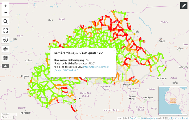
- [1] ... that a methodology has been developed to increase the completeness, accuracy and consistency of the road network in OSM? She was presented at the French conference SotM-Fr 2019 not so long ago. Its work is constructed by comparing the available data in OSM with open data sets, for example, such as gROADS . To search for areas that need improvement, the project manager and task prioritization in the uMap service are used. Developers ask everyone to take part in this project. It was launched in 2015 and is currently being implemented in nine African countries. WikiOSM has created a special page for editing within this project.
- ... that the Russian mapper Rainbow Fox wrote the program WhereIsMyPhoto, which simplifies the search and work with pictures. If the image has geo-data, the shooting location is displayed on the OSM map.
- ... about the project " OpenAndroMaps "? On this site you can freely download various styles of vector maps for smartphones. Styles are regularly updated and improved. Please note that there was an update - Elevate 4 .
- ... about the Wo ist Markt website ? ? Here you can find markets (weekly, vegetable and flea) in different cities of Germany. In addition to the information page (automatic translation ) on the site itself, there is still a page on the GitHub Repo page .
- ... about the ghost city of Kitso in Canada, where only one person lives? The mining community was abandoned in 1983, but the houses, the land, the hospital, and the shops have since been maintained by an investor (helped by several local residents) for the next generation of miners. The article (automatic translation ) of the Stern edition is written in more detail about this place, and there is also a link to a short film about it. (It remains to be seen if the tag with place = city is correct.)
Other "geo" events
- Reporting platform RADar! uses OpenStreetMap and is an online tool used by citizens as part of the Climate Alliance project. Also this app helps to draw attention to dangerous places along the bike trails. These messages can then be seen on the website, which is a good help to update the current status of bike lanes in OSM.
- Michael Marz started (automatic translation ) to engage in a personal project that allows you to get all the basic functions of the card (individual keys) in a separate package that can be downloaded . More information about this can be found on GitHub .
- The Japan Times publication reports that a modern digital map of Benin (a state in West Africa) appeared recently, replacing the old map of 1957. This great work was done by 30 Benin cartographers. The project was initiated by the UN with the financial support of the European Union.
- Saadik Mohiuddin told how he created the correct parking card on the side of the road.
- Is there an OSM key on the keyboard? On the keyboard, the user has such ImreSamu.
- Be careful when working with data, because a small mistake can lead to the fact that the developer as a result will receive a tax benefit , which relies only to the poor.
- In Colorado, in order to avoid traffic jams, Google sent almost 100 cars to detour along a dirt road, where they were stuck.
- The Wikimedia Foundation blocked an experienced administrator of English Wikipedia for a year due to a violation of the Code of Conduct, but did not disclose details. The community has opposed such non-transparent behavior and circumvention of standard decision-making schemes. Some administrators have blocked the “war of edits” with the Foundation. Reports about it BuzzFeed News. There are several articles on this topic in the June issue of the internal monthly magazine of the English Wikipedia " The Signpost ".
Communication of the Russian participants of OpenStreetMap is in the Telegram chat and on the forum . There are also groups in social networks VKontakte , Facebook , but they mostly publish news.
Join OSM!
Previous issues: 466 , 465 , 464 , 463 , 462
')
Source: https://habr.com/ru/post/459350/
All Articles