News from the world of OpenStreetMap № 466 (06/18/2019-24.06.2019)
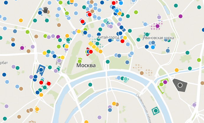
Places in Moscow that are associated with terror during the USSR 1 | NextGIS | Map data OpenStreetMap contributors, ODbL
Mapping
- In the Austrian province of Tirol during the summer holidays, as well as during long weekends, traffic intensity often increases. As a result, this leads to the fact that motorists who go to Italy or Germany, trying to bypass traffic jams, arrange them on local roads. Now local authorities are trying to prevent this by prohibiting transit traffic on local roads until September 14. Information about this was transmitted to manufacturers of navigation equipment through the Ministry of the Interior. Therefore, Reiner Fügenstein in the Austrian “Mailing” mailing list asks the OSM community to pay attention to this and make the appropriate edits.
- Michael Brendner proposes to introduce a new tag -
amenity=power_supply, which could mark the places where you can access (paid or free) to the electrical outlet. In addition, his proposal includes subtags that clarify various nuances: outlet type, payment, operator, power, and much more. (Talk to Nabble ) - The Australian cartographer directly examined the banks of the Gvidir River, which he had previously remotely submitted to OSM, relying only on official sources, and found that in some places it was dry. After talking with the locals, he concluded that this was due to the fact that this river was intensively used for irrigation. Therefore, he proposes to remove most of Guidir. Reflecting on why this river in official documents is still listed as full-flowing, he assumes that this is due to political motives and the will of the government.
- Richard Fairhurst talks about the new features of the online editor Potlatch-2. Now route mapping can be noticeably easier, since it is possible to assign certain relationships to function keys. He also shares several tips in the comments on how the function keys can be used, for example, to add groups of tags.
- The user WoodWoseWulf in his diary tells in some detail about the world of the game Pokenom Go from Niantic from the point of view of OSM. He shares the terms of this game, shows how OSM data affects the mechanics of the game, leads the classification of vandals-pokommoschnikov and explains their motivation, and also shows the different ways of manipulating OSM data for gaming purposes.
Community
- Now the site OpenStreetMap transferred to. As you probably know, this is Burmese - the official language in Myanmar, which is spoken by 33 million people. Andy Allan asks Twitter to help him translate the OSM website into this language. He wants the degree of localization to be more than 25%.
- Andy Allan and Ian Diz are looking for ways to make the aggressive and destructive behavior that the OSM community sometimes displays, especially on some mailing lists and on GitHub, come to naught, and people become more affable and ready to support each other. Ian Diz is ready to tell open source community managers about how to deal with rude manners, which are particularly common and vivid when people use anonymous communication channels.
- Do you know anyone worthy of receiving the annual OSM Awards? Then take your time - applications are accepted until July 15.
- A group of five volunteer cartographers from OSM communities in Ghana and open source lovers traveled around Ghana as part of the Open Source Way project. On the way, they mapped, filmed street panoramas for Mapillary, and also promoted OpenStreetMap and open source software in every possible way.
- The OSMF Council published the results of the OSM community survey, during which it was proposed to choose a topic to be discussed by the Council at the next meeting. Christoph Hormann, in his blog, criticizes some dubious ideas and trends, and also expresses his point of view regarding the study of community opinion.
OpenStreetMap Foundation
- We are joining the JOSM team and many others who are helping to spread the announcement of the OSMF Operations Team, which is now looking for volunteers. Let us clarify that this working group is responsible for the operation of servers owned by the OpenStreetMap Foundation.
Developments
- Kristina Karch on the mailing list of the OpenStreetMap Foundation proposes to discuss where next year you can hold the conference “State of the Map-2020”, as this issue has not been resolved at the moment.
- The conference “State of the Map-2019” is not far off. The program of this major event in the world of OSM, which will be held this year from September 21 to September 23 in the German city of Heidelberg, is posted on the official website of this conference.
Humanitarian OSM
- On World Refugee Day - June 20 - material on joint work of the University of Oregon (USA), HOT and Development Seed to search for refugees and IDPs as a result of military conflicts or natural disasters in order to support them was published on medium.com. The article shows the scale of the problem and how it is solved; it also concludes that in the near future it will be possible to help even more people with the help of artificial intelligence.
- The Maptime Salzburg team (regular cartography conferences in Salzburg) will hold two youth workshops as part of the upcoming AGIT exhibition. At the first meeting, the basics of humanitarian mapping will be discussed, at the second , the creation of youth cartographic clubs in European educational institutions. Note that the youth mapping of OSM - YouthMappers - was founded by students from US universities; currently it consists of 143 branches in 41 countries.
- The nomination of candidates to the council of the non-profit organization HOT ended on June 17, 2017. 8 people apply for 7 vacancies. By decision of the organization’s organization, the number of seats in the council has been increased from 2 to 7.
- Rebecca Firth from the non-profit organization HOT tells how street panoramas help to make OSM more accurate, especially in regions with low quality map rendering. In particular, panoramas provide information on waste management, road conditions and much more.
Training
- The founders of a small online seminar OpenSchoolMaps , implemented as part of the local OSM community in Switzerland, published a tutorial (PDF) - “Independent environmental mapping”. While it is available only in German. It tells you how to organize a field meeting and what you need. The authors are waiting for feedback, but it is desirable that it be framed as a problem (issue) in the Git repository.
Cards
- Sven Geggus turned off the “Open Brewpub Map”, but instead started supporting a new project - the “ Open Brewery Map ” (brewery map), which is based on the osmpoidb technique.
- Updated Portuguese version of the site Historic Place. Currently, the site is fully translated into Brazilian Portuguese.
Open data
- Yandex allowed using the information from Yandex.Panor to update data in OpenStreetMap. This time by e-mail.
Software
- Mateusz Konieczhi received a grant from NLnet under the NGI Zero project to work on StreetComplete . He mainly plans to work on solving problems that were raised on GitHub.
- Online service Sight Safari , which is able to build interesting routes to attractions in unfamiliar cities, has now become a mobile application for Android. Beta testing is underway. Of course, OSM data is used as the basis.
Releases
- New QGIS versions have been released: 3.8 (Zanzibar) and the long-supported version (LTR) 3.4.9 (Maider). LTR versions are usually relevant throughout the year.
Did you know ...
- ... a PostgreSQL periodic table ?
- ... that the Russian maper Konstantin Moshkov developed the OsMo Monitoring mobile application? This is a tracker that allows you to share your location with others. There is also the possibility of organizing group monitoring. OSM is used as a card, but attribution is “lame”.
- ... that the Russian company NextGIS, together with the international non-profit organization Memorial, developed the map " This is right here: Moscow. Topography of terror. "? The map shows the places in Moscow that are associated with terror during the USSR. OSM is used as the basis.
- ... the difference between the
amenity=post_boxandamenity=letter_box? The first indicates the place where you put the letters to send them, the second - a personal mailbox to receive letters. By the way, they can serve as landmarks in the rural outback, where mailboxes are located along the main roads away from homes.
Other "geo" events
- Twitter user cartocalypse posted a souvenir photo from a QGIS-CH meeting.
- WGS84 is the coordinate system in which OSM data is stored, but it turns out that it is not as simple as it seems at first glance.
- The African Conference on Geospatial Data and the Internet in 2019 will be held on October 22-24 of this year in Accra, the capital of Ghana.
- The ORF.Tirol report shows how important geodata is for the work of all services related to saving people (doctors, firefighters, rescuers, police, etc.). It mentions GIS-Tirol, which supports the work of 358 fire calculations in the form of web GIS.
- According to thedailystar.net, Facebook has made a unique high-precision map, which was created by an artificial intelligence team. The company claims that its population density map is three times more accurate than other suppliers. Facebook plans to make this map available to the public for humanitarian purposes.
- Michael Sumner writes on Twitter about scientific research, in which he studies the geolocation of animals using photosensitive sensors.
- Google seems to be struggling with hundreds of thousands of fake POIs of various businesses and organizations that appear on Google maps every month. According to the article The Verge, there are currently more than 11 million unreal profiles on Google Maps.
- A number of economists analyzed user reviews for various food outlets and came to the conclusion that the closer the establishment is to a tourist site, the lower its rating will be. At the heart of their research are data from Yelp and OSM.
- The Berlin district of Friedrichshain-Kreuzberg published a map of drinking fountains, which also contains various information about them.
Communication of the Russian participants of OpenStreetMap is in the Telegram chat and on the forum . There are also groups in social networks VKontakte , Facebook , but they mostly publish news.
Join OSM!
Previous issues: 465 , 464 , 463 , 462 , 461
')
Source: https://habr.com/ru/post/458460/
All Articles