News from the world of OpenStreetMap № 465 (06.11.2019-17.06.2019)
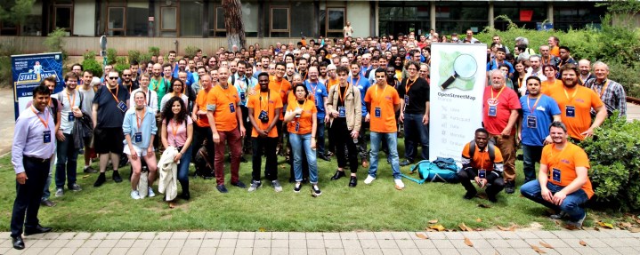
Proceedings of the conference " State of the Map France " are publicly available. 1 | Photo by Thomas Lombard, CC0
Mapping
- Mateusz Koniechni is going to remove duplicate tags such as
sustenance=fast_foodandamenity=fast_foodoratm=yesoramenity=atm. Like all plans for mass OSM automatic editing, this one also caused some discussion on the “Tagging” mailing list. - Joseph Eisenberg again suggests marking individual camp sites with the tag
tourism=camp_pitch, which he invented earlier. The last tagging scheme he developed that was rejected wascamp_site=camp_pitch. - Christian Iger on the Austrian Talk mailing list asked ( translation ) how to mark schools where Shiatsu is taught (traditional Japanese practice therapy). Because he did not find anything suitable in WikiOSM, he asked: can he use the following pair of tags
amenity=educationandeducation=shiatsu. The answer was negative becauseamenity=educationoutdated . He was asked to contact the German OSM forum with this question. - A revised tagging scheme for changing tables was adopted ( changing_table = * ). She replaced the key
Key:diaper. The author of this sentence, Valor Naram , wrote a guide for cartographers who may be familiar with the old key. - Geofabrik rewrote the Routing View in the OSM Inspector online service, which is used by many cartographers to search for unlinked roads and other routing problems. More details about the changes can be found in the corporate blog of the company.
- Now in the OSMCha online service, you can create groups of osmer , as well as filter or hide changes made by members of such a group.
Community
- On June 12, 2019, the OSM-UK community (Great Britain) launched a series of daily cartons to improve the UK map. The Milton Keynes-South constituency was chosen as the first territory. The parliamentary electoral districts were not chosen randomly as a unit of territorial division: approximately the same number of residents live in each of them.
- The Swiss Association OpenStreetMap has published a report on its activities for 2018 and a work plan for the near future.
Imports
- Alexis Atlan (Alexis Athlan) from the French animal protection organization "L214" said that he was going to import specifications for 1,400 restaurants in France, which will deal with the availability of vegan and vegetarian dishes.
- David Morais Ferreira is waiting for comments, as he is about to import nearly 500 significant trees in Luxembourg.
- User Atakau shared his discoveries and observations that he made while importing land use data and land cover in Sweden. His detailed post, which describes a lot of nuances, should be read by anyone interested in this topic (massive data import into OSM), because it contains many practical recommendations, as well as it is more informative than an article on this subject in WikiOSM.
OpenStreetMap Foundation
- OSM Foundation published an annual report (PDF) of FOSSGIS e.V. - local branch of OSM in Germany.
- The minutes of the meeting of the working group on licensing of the OSMF Council of May 9, 2019 are published. During this meeting, the draft “Attribution Guidelines” was discussed. Most likely, readers will remember that the topic of specifying the attribution of OSM has recently become more and more discussed.
Developments
- [1] Proceedings of the conference " State of the Map France " are publicly available.
 .
. - Engineers from the French railway company SNCF presented a collaboration with Geofabrik - Karlsruhe , which represents their own routing tool for calculating train routes on the European railway network. Also, many at the SotM France conference were impressed by their innovative clothing.
- Osmer ScubbX on the Austrian Talk mailing list wrote that 10 free tickets are still available for AGIT-2019. AGIT (July 2-5) - the largest geo-exhibition in the German-speaking region. The OSM community will be represented by a booth, which requires volunteers.
- Philippine participant OpenStreetMap GOwin announced that from August 1 to 3, the city of Dumaget will host the local conference “Pista ng Mapa” . The conference will include seminars, talks about open geodata, OpenStreetMap and discussions about the problems of local cartographic communities. Participation in the conference is free, but because it is open to everyone ( RSVP required).
Humanitarian OSM
- HOT welcomes 38 new members with voting rights .
- The daily German newspaper Trierischer Volksfreund reports on a past cartaton in the city of Saarbrücken. Students of vocational schools who learned mapping in the JOSM editor as part of the Erasmus + project supported the non-profit organization Doctors Without Borders . The guys together improved the map of Congo.
Education
- Inspired by some of the presentations at the SotM-FR conference, Polyglot user decided to conduct a series of streams in Hangout in French to tell everyone who wanted to edit public transport routes using the PT_Assistant plugin. The first stream will be on Wednesday, June 26 at 19:30 Central European Time.
Cards
- The local office of OpenStreetMap in Belgium has updated the method of displaying the relief on its online map . The basis of the new layer lay publicly available data on the heights of the Flemish region and Wallonia.
- Using the service to create online maps based on OSM - uMap - are becoming increasingly popular. The local branch of OSM in Germany (FOSSGIS e.V.) financed
 ( translation ) launch of its own similar service on the openstreetmap.de domain.
 - Since mid-May 2019, a Twitter bot called “OSMTrekkingTips ( @trending_places ) has been tweeting about Swiss castles and palaces from the “ Castle Dossier Map ” map. Tweets out at 12 noon on Tuesdays and Thursdays. The bot was developed by Geomet’s laboratory (Professor Stefan Keller) with the aim of developing tourism in Switzerland. ( Python source code ).
Open data
- At the conference " State Of The Map France " in Montpellier, the French Geospatial Agency IGN and the local branch of OSM in France signed a partnership agreement. IGN will use the OSM-FR style and its tiles on its official geoportal, and OSM-FR is now allowed to use the satellite images of this agency (BD ORTHO) for editing OpenStreetMap.
- Currently, German Wikipedia is conducting a survey among users about which areas of technical improvements it should focus on. Among other things, there is a proposal to improve support for geoinformation. ( translation ), the essence of which is to more closely integrate OSM into Wikimedia projects.
Licenses
- The OSMF Council Licensing Working Group completed a study (PDF), which focused on finding a better license for tiles made by OSMF servers than the current CC-BY-SA 2.0.
Software
- Frederick Rodrigo forked the iD online editor, which is now available at: id.openstreetmap.fr . He removed the controversial changes that had previously caused heated debate.
- The directors of OSMAnd and Maps.Me merged (link leads to a post in Telegram) and began work on a new project - OpenPlaceReviews . It is assumed that this project will simplify the introduction of POI in OSM, and will also store feedback about them.
- From 21 to 30 June in the Azores (Portugal), namely in the city of Angra do Heroismo on the island of Terceira, a rather large festival takes place. With the help of Azoid Eco technology (automatic translation ), an application and a map (based on OSM) are collected for each event. The application is available for iOS and Android . To learn more, go to the website www.sanjoaninas.pt (automatic translation ). Maybe in 2020 they will be able to correctly indicate where the data came from.
- The MapOSMatic online service, which runs on osm-baustelle.de , now supports uMAP GeoJSON files via the Umap API without interacting with the browser. User Hartmut in the project blog tells how he did it.
Programming
- There is an assumption that the company Mapbox has stopped working on version 3.0 of its specification of vector tiles from Mapbox. However, the fact that the open Geospatial consortium is working on the specification of vector tiles.
- The user JasonManoloudis in his denim on the OSM website tells in detail about his project on "Google Summer of Code". He wants to “teach” the 3D render of OSM2World to visualize traffic signs with custom text.
- Now the process of loading user edits to OSM is handled by cgimap (written in C ++), and not by the Rails port (an implementation of Ruby on Rails OSM API), as it was before. This made it possible to significantly increase the speed of loading custom edits from JOSM and iD editors. The details of this update tells Ilya Zverev in his blog "SHTOSM."
- The developer of 2GIS in the corporate blog on Habré tells how you can create your own navigator using opensource solutions and OSM in just a couple of days.
Releases
- The latest version of Maps 9.1.6 (fork of Maps.Me from F-Droid) has finally fixed a long-standing bug that prevented users from logging into OSM. Now using this application, you can edit the OSM again.
- In his diary, Simon Poole talks in detail about the changes that were included in the minor release of the mobile editor Vespucci . The improvements mainly concern the user interface.
- The developers of the online editor iD have created a request to include a code that will cancel a number of controversial innovations that provoked a heated discussion not so long ago.
Did you know …
- …… how to mark a public bookcase for bookcrossing? This is
amenity=public_bookcase.
Other "geo" events
- The world is a flower ball in the coastal garden on the flower island of Mainau in Lake Constance.
- An online cartographic portal for European geodata was presented at the World Geospatial Forum in Amsterdam. It was designed by thinkWhere to demonstrate the convenience of a single point of access to publicly available data.
Communication of the Russian participants of OpenStreetMap is in the Telegram chat and on the forum . There are also groups in social networks VKontakte , Facebook , but they mostly publish news.
Join OSM!
')
Previous issues: 464 , 463 , 462 , 461 , 460
Source: https://habr.com/ru/post/457404/
All Articles