News from the world of OpenStreetMap № 463 (05.28.2019-03.06.2019)
Multimapas is a combination of many historical, topographical, satellite and road maps. 1 | CC BY 4.0 National Geographic Institute of Spain | Leaflet | map data OpenStreetMap contributors
Mapping
- The latest version of the service “ How Did You Contribute ", which is being developed by Pascal Nays, now uses osmose to display information about the quality of user edits.
- The Facebook cartographic team announced the release of the RapiD editor (puns - fast and iD) based on iD, which allows data obtained through machine learning to be added to OSM.
- WiGeoGIS, an OMV contractor (engaged in gas stations), announced that it plans to update and keep up to date at OSM the information on filling stations of the following brands: OMV, AVANTI, Petrom, FE Traiding and EuroTruck. See also the discussion on the Talk mailing list ( May , June ).
- Valor Naram voted on a revised tagging scheme for changing tables (
changing_table=*). - The developers of the Maps.Me navigator, which uses OSM data, presented the validator metros around the world.
Community
- Simon Poole on the Tagging mailing list expressed several thoughts on how to cope with the growing number of messages and offers. He was answered by many.
- Not so long ago, the OSM community in Kazakhstan created a Telegram chat for communication.
OpenStreetMap Foundation
- Jost Schuppe on the OSM Foundation blog tells how the next in-person meeting of the OSMF Council, which this time took place in Brussels, was held. It also discussed the study that was conducted earlier.
Developments
- The OSM community in Argentina has announced the holding of a local cartographic conference called “State of the Map”, which will be held on July 27 in the city of Santa Fe.
Humanitarian OSM
- HOT talks in his blog about an experimental version of Task Manager, which can help solve specific tasks using machine learning algorithms.
- Simon Johnson writes on Medium that the use of “big data” for humanitarian purposes often does not comply with the principle of “minimum viable data”, which is as follows: less data is more valuable because their quality is much higher and easier to recheck .
- In the article “ Better Bombing with Machine Learning ”, “Frederick Ramm draws attention to the fact that computer vision / machine learning can eventually be used by the military for aerial bombardment, and therefore the OSM community should think hard: whether rejoice at those companies that use these technologies to improve OSM.
Cards
- In his tweet, Richard Fairhast gives an example of using a Lua script for automatic transliteration of names when processing OSM data for rendering. Post-processing OSM data in this way often makes it unnecessary to use tags with name: <iso-code>.
- The site of the Magnitogorsk City Duma contains a map of constituencies. OSM is used as a substrate.
- The site of the Russian state program for the repair of roads "Safe and high-quality roads" uses OSM as a substrate (you need to select a region).
Releases
- New stable version JOSM (15155) released. Added category icons and a field for filtering background image parameters. Dynamic entries in the background menu are displayed in a submenu, as well as many other improvements .
- GPS-tracker Online from OsmAnd updated to version 0.5. There are new features: contact search, proxy settings, GPS and active markers.
- Thanks to the new version of the Babykarte service (v2.0), children will no longer be lost. Although, rather, it became much easier for their parents to look for something that is suitable for children and toddlers ( map ).
Did you know…
- ... about the OpenTrailView project?
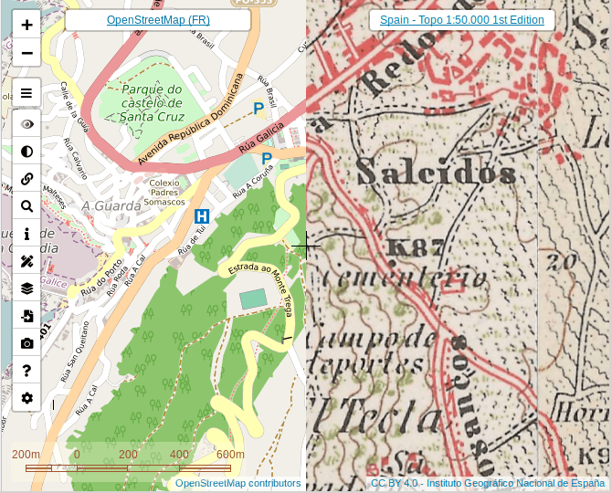
- ... that Spanish software engineer Javier Jimenez Shaw, who lives and works in Berlin, has combined many historical, topographical, satellite and road maps. We have already talked about this, but now he translated the page with the card on the Leaflet.
- ... about the map of all uMap cards?
- ... that the Russian maper Roman Shuvalov using OSM made not only the " Bicycle Map of the Samara Region ", but also developed the game " Generation Streets ", which is available on Steam.
OSM in the media
- In this short podcast on BBC-4 radio, one wonders: Is there more stars in the universe or sand grains on Earth’s beaches? A member of the program, using an OSM file, Planet calculated the approximate amount of beach sand on planet Earth.
- On Habré a great interview with the Russian Osmer Ilya Zverev was made. He told what he had been doing at OSMF for two years, why the American community was the friendliest and why it was necessary to participate in offline conferences.
Other "geo" events
- How to make a card, inspired by the Simpsons, with expressions .
- John Murray used the latest version of the Rapids AI - a library for processing large data on graphics processors - to calculate the distances between any two points within the UK. The calculations took a few seconds.
- An excerpt from the book “What makes a map good?” By Barbarian Tversky
- The company, which produces outerwear, has sneakily added photos of its models to Wikipedia articles in order to promote the brand in the Google Image results. We need to know that this is another threat that open wiki systems can be exposed to.
- Daniel JH announced the release of a new version of the program RoboSat, which is able to determine the roads and buildings on aerial photographs.
- The Die Welt website has published an article about the best apps for water sports enthusiasts.
Communication of the Russian participants of OpenStreetMap is in the Telegram chat and on the forum .
There are also groups in social networks VKontakte , Facebook , but they mostly publish news.
Join OSM!
')
Source: https://habr.com/ru/post/455455/
All Articles