News from the world of OpenStreetMap № 462 (05.21.2019-27.05.2019)
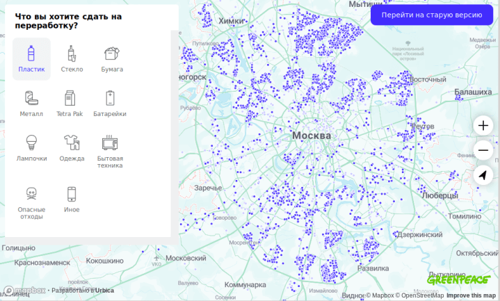
Russian branch of GREENPEACE moves to OSM 1 | Map data OpenStreetMap contributors, ODbL Mapbox
Mapping
- Christopher Beddow of Mapillary wrote a post about two ways to use Mapillary data to edit OpenStreetMap.
- Joseph Eisenberg prepared a description page for the new
golf=cartpath, with which he proposes marking golf course tracks located within golf courses. - Leif Rasmussen wants to once again discuss and collect all the wishes about the tagging scheme (
connectivity=) offered by him for complex intersections before going on to vote. The author of this scheme believes that its use will allow you to store much more information about lanes than theturn:lanes=tag allows you to do now. - Joseph Eisenberg suggests making one single tag to designate a place for a tent and a camper on the campgrounds -
tourism=camp_pitch. In turn, the tagscamp_site=camp_pitchandcamp_site=pitchnow used for these purposes are prohibited .
Community
- Recently, the developers of the online editor iD have increasingly become independent, without attracting and discussing with the OSM community, to introduce new tags. But the last straw that led to intense discussions of this situation was that the OSM community prohibited them (on GitHuB , on the OSM tag mailing list and in the general mailing list) to additionally “hang” another one on the
railway/public_transport=platform-highway=footway.
The proposal to introduce thenosquare=yestagnosquare=yescaused controversy, which would allow iD developers to "solve the problems of objects that do not have right angles." This proposal was challenged by the OSM community, both on GibHub and in the general mailing list.
During the discussion, some ideas were voiced, for example, creating a fork of iD or developing separate rules for developers. Unfortunately, the heated discussion led to the fact that iD developer Brian Housel blocked one of the tickets on GitHub, which was perceived by others as too loud a gesture, which in turn forced the user SomeoneElse to complain about the comment, which explained the reasons blocking.
The discussion of this situation reached the OSM fund mailing list. Christina Karch proposed to do it at the SotM conference site, which will be held on September 21-23, 2019, but the proposal was rejected by the chief iD key developer, Brian Housel. - Researchers from Denver and Singapore published an article entitled “Corporate Editors in the Evolving Landscape of OpenStreetMap” ( “Corporate cartographers in the ever-evolving world of OpenStreetMap” ) in the Isprs International Journal of Geo-Information magazine (published in MDPI) . The material describes the impact of corporate cartographers working for companies such as Apple, Microsoft and Facebook on the development of OSM in the context of the gradual development of the companies themselves. The study was conducted on the basis of 10 specific companies. One of his conclusions: most often corporations are interested in drawing roads. Also, the authors of the article raised the question: how should OSM cope with the growth of edits from corporate cartographers.
- The latest issue of the International Journal of Geographical Information Science contains a number of articles on “volunteer geoinformatics,” many of which are based on an analysis of the contributions of OpenStreetMap members. These materials are briefly reviewed in a review article prepared by Khakali and other authors.
- It seems that the platform on which the OSM forum is hosted is not quite suitable for the languages in which they write from right to left . This impedes the implementation of the OSM mission to create and support local communities. (In order to view the contents of the link, authorization is required on the OSM forum)
- The new UN report notes a growing interest in crowdsourcing cards, and about OpenStreetMap it is said that this is “the main basis for almost all the sciences involved in risk research.”
Developments
- The preliminary program of the conference “State of the Map France”, which will be held in the middle of June this year in Montpellier (France), has been published. Sign up !
- The sale of tickets for the conference “State of the Map Germany”, which will be held this year in Heidelberg (Germany), has begun. Those who buy tickets in advance are promised discounts.
Humanitarian OSM
- Missing Maps, a non-profit organization, told in a blog about a recent campaign by CartONG, which is also a member of their association, in Burkina Faso. Previously, unofficial settlements around the city of Ouagadougou (the capital of Burkina Faso) were only remotely marked on the map: there were maps, during which satellite images were outlined. But CartONG representatives together with the local group Yaam Solidarité trained the cartographers and went out to the field to collect various data.
Cards
- In Chelyabinsk, elections of municipal deputies began. The site, which shows the boundaries of constituencies and candidates running in them, uses a map based on OpenStreetMap.
- Steve Coast shared a link to the online article “First You Make a Map,” which tells and shows how international trading has become possible thanks to maps.
- Mapbox has announced that it now offers traffic data (traffic jams) to everyone who can use it in combination with HERE, TomTom and OSM maps. Data is collected using 45,000 applications for Android and iOS, which transmit traffic information every day to 500 million kilometers of roads around the world.
- The gicycle user used OSM data to show that the planned ban on the work of the bookmakers at a distance of 800 m from schools in Salzburg (Austria) in fact means their total ban in the city.
- On the Internet portal “Present” an interactive map based on OSM was published, which shows: what is the status of the Russian language in all countries of the former Soviet Union.
Go to OSM
- [1] The Russian branch of Greenpeace transferred its " Recycle map " from Google to OSM. While the project is in beta testing.
Licenses
- Nuno Caldeira in his Tweet complains that Facebook does not explicitly indicate that it uses OSM data.
Software
- Maps.Me again began doing weekly unloading of maps for your navigator. Only this is an update that you need to do "hands".
- The Russian public organization Greenhouse Social Technologies has written a plugin for WordPress, which allows you to embed an OSM-based map into the system of this blog. The guys will be happy if someone tests it and provides them with feedback.
Programming
- Pierre Beland placed in the OQ_Analysis repository on Github preliminary versions of orthogonal functions for PostGIS, which allow transforming polygons of buildings.
Releases
- A new version of iD has been released - v2.15.0, in which the built-in validator has been significantly improved, the ability to make the corners straight at unclosed lines and individual angles has been added, now you can not straighten the entire line, but only its specific part. In addition, the new version has a lot of improvements, new features and bug fixes.
Did you know ...
- ... the R242 on Malin Head on the Inishauen Peninsula in County Donegal, Ireland, was recently renamed R2D2 in honor of the Star Wars robot. Because in this area several scenes were shot for the film “The Last Jedi” (Episode VIII “Star Wars”), which was released in 2016. The old name is still preserved in OSM, as there were doubts that this news was a fake.
- ... how to mark a historical stone? It can be megalith:
historic=archaeological_siteandsite_type=megalith
Other "geo" events
- Ed Freygogl (OpenCageData) talked about geocoding during an interview for the MapScaping podcast.
- Mapillary launched an online platform where you can post a request for shooting a particular territory or manually validate geospatial data that was extracted from images using Mapillary machine learning technology.
- Mapbox has changed its pricing scheme and now use a new calculation method. Details can be found on the Mapbox blog . Old prices can be found in the “Internet Archive” service.
Communication of the Russian participants of OpenStreetMap is in the Telegram chat and on the forum .
There are also groups in social networks VKontakte , Facebook , but they mostly publish news.
Join OSM!
')
Source: https://habr.com/ru/post/454556/
All Articles