World War with private cars: MaaS strides across the planet
For several years now, the future of transport has been discussed in narrow circles. It is said that all types of transport and all means of movement of people should be united in a single “mobility” service, simple and convenient in receiving and paying. This concept is called Mobility-as-a-Service (MaaS) - the merging of all transport operators, private and "public", into a single virtual supplier. Clear? Hardly. Let's try to figure out what kind of MaaS it is and what role technology and, in particular, smartphones will have in the future transport revolution.
How does this work for transport?
The concept of mobility as a service does not have a single clear definition, but it implies a number of attributes that the transport infrastructure must meet in order to be considered a service. Transport service should be carried out through a single application - through it plan routes and pay for travel, no matter what kind of urban transport is not discussed and whoever owns a bus, car or bicycle. As part of this concept, the user does not need an application with a metro map, a navigator with information about the situation on the roads, Google Maps with routes, an application for replenishing the transport map, car sharing applications from different companies, bicycle sharing, intercity buses, and so on. All transport related functions should be combined together.
The implementation of Mobility-as-a-Service (MaaS) requires the emergence of a single digital platform that will unite transport operators of various kinds and make it easy to pay for their services and subscribe to service packages. The ultimate goal of MaaS is to abandon a personal vehicle in favor of convenient, fast and low-cost transport services.
')
For MaaS states it has its advantages. First, the transport will be used with greater efficiency, which will reduce its number and relieve the roads. Secondly, the number of private cars will decrease, and because of this, traffic jams will again decrease and the environment will improve, which is what European cities are especially striving for. Thirdly, the full digitalization of transport will allow collecting Big Data, and the data in turn will help to determine the vector of development of the city more rationally.
And now the paradox: we have been using elements of MaaS for a long time, but at the same time, there is no real high-grade MaaS anywhere in the world. There are dozens of services around the world with different features of MaaS - we’ll tell you about the most interesting of its kind. But first a bit of theory.
MaaS Topology
There is no official gradation of MaaS implementation, but enthusiasts have proposed a seven-step system, each level in which implies that transport services meet certain criteria. By the way, the concept of the levels of MaaS was created under the impression of the levels of the autopilot.
Level 0: the complete absence of MaaS. Imagine urban public transport as it was 20 years ago - different tickets for land transport, subway, electric trains, timetable on a paper poster and complete ignorance of why there is no tram for 20 minutes and whether it will appear at all.
Level 1: partial integration of private companies. The first level is the partnership of private transport companies offering combined tickets. For example, in one ticket a passenger gets a trip by train and bus from the station to the city center.
Level 2: integration with municipal transport. Similar to the first level, the public transport is included in the combined tickets.
Level 3: single ticket booking interface. At the third level, MaaS appears a certain interface through which a passenger can build his route using different types of transport from different operators - for this, transport operators need to share publicly information about their routes and schedules.
Level 4: planning and buying a ticket in a single interface. If an application appeared in the phone that allows you not only to build a route according to Level 3, but also immediately pay for the trip on all modes of transport without having to buy several tickets.
Level 5: taking into account personal preferences. AI plans routes taking into account the profile of the passenger - which places of the city and which types of transport he likes and avoids. AI in real time reacts to traffic jams, delays and cancellation of transport, optimizing the path.
Level 6: Smart City Ecosystem. The last level of MaaS implies the emergence of a “smart” city, in which everything that is somehow connected with the movement of people and goods is combined into a single interface, and AI controls the flow. While there is no clear description of the sixth level of MaaS, rather, it is some distant goal.
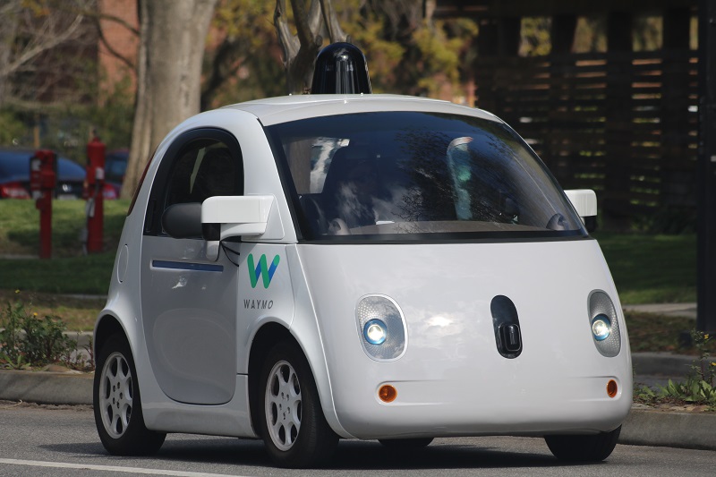
Another element of the MaaS system is unmanned vehicles, such as this is a prototype from Waymo. Source: Grendelkhan / Wikimedia Commons
MaaS car
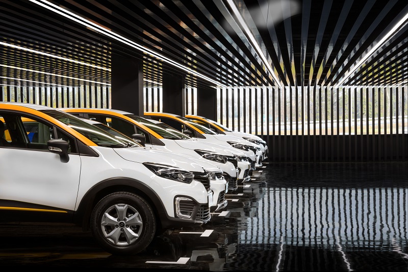
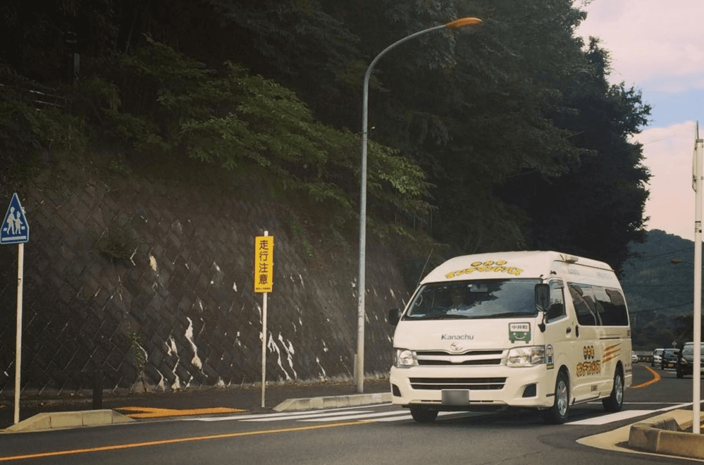
If integration into one system of all types of public transport (hereinafter OT) is an obvious step, it is worth commenting separately on the automobile component of MaaS. Meanwhile, it is possible to assume with high confidence that the most efficient way to avoid private cars is ... cars, and not affordable and convenient public transport. The popularity of car sharing in Russia (17 million trips in Moscow in 2018) and the world only confirms this - it is more pleasant for a person to travel alone or with his company from point A to point B than to get to stops and make transplants. And therefore, car sharing is a full stage in the development of automotive MaaS, although not the last.
The main harbinger of the transformation of cars into an element of transport service have become unmanned cars. Unlike car-sharing, to which you need to go on foot, if the machine is in general within reach, the drone arrives at the client himself. Uber, which develops drones, immediately announced that it plans to use autonomous cars as a taxi without a driver. The same plans were voiced by Tesla, Waymo, Lyft, Toyota and GM. Moreover, Toyota particularly emphasizes the fact that it is going to supply its unmanned vehicles for MaaS around the world. In theory, traveling by unmanned taxi will be cheaper than it is now - taxis and paid drivers drop out of the chain.
MaaS aggregation
At the end of 2016, the startup Whim was launched in the Finnish capital Helsinki, which later expanded to the Belgian Antwerp and English Birmingham. This MaaS service is a mobile application for planning and paying for trips around the city. Now no one is surprised by applications for building a route that take into account different types of transport. But in 2016, Whim stood out in that it was possible not only to see where and on which tram or bus to get to the destination - through the Whim application you could immediately pay for the trip by transport.

At first glance, Whim resembles Google Maps - the same route planning, the same options with different types of public transport. Source (hereinafter, unless otherwise specified): Toshiba
Whim operates not only public transport, but also taxis, car- and bikking, if the user wants to use them on the trip. Since Whim turned the transport into service, the tariff policy has become much more service. The user can stay at a free fare with a separate payment for each trip - this is not the most attractive offer for obvious reasons.
Whim is very close to the implementation of MaaS upper levels, but, as they say, there is a nuance: in Helsinki, the service has only 5,100 users with a paid subscription (and it’s not known how many of them have the Ultimate). In order to establish partnership with transport service providers, offer low prices to customers and get profit themselves, Whim needs to get at least 60,000 paid subscriptions. While the service lives on investment.
MaaS on call
In order to turn mobility into service, it is not at all necessary to adapt the existing urban public transport infrastructure. You can run commercial transportation services, but this is not about taxis.
British ArrivaClick, the project of the largest English bus operator Arriva UK Bus, is a “bus on call” service - something between a taxi and regular route transport: if a taxi only carries its customer from one point to another, and FROM follows strictly well-known route and nothing else, then the buses ArrivaClick dynamically change their route depending on the wishes of customers.
Roughly speaking, ArrivaClick buses have some approximate routes around the city, from which they deviate to pick up service users closer to home and land closer to their destination - not “door to door”, like a taxi, but with a difference of only tens of meters from points.
Suppose you need to get from the north of the city to the south to the train station. You choose your location and destination in the ArrivaClick application, and the service finds a bus for you that can drive as close as possible to you as soon as possible and take you as close as possible to the station directly, without transfers. The peculiarity of ArrivaClick is that, unlike a taxi, which takes you personally, the service bus carries passengers. While you go from home to the station, the bus will deviate slightly from the shortest route to pick up or drop off other users who are on their way with you (or you along the way with them).
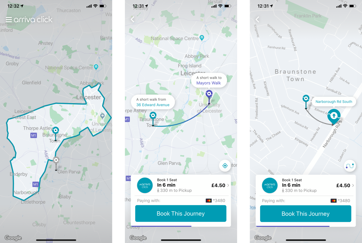
In a very concise application ArrivaClick shows the area of work of buses, the cost of travel to the selected point, the nearest place and time of arrival of the bus for the client. In this example, a resident of Lester would have to walk 330 meters to the nearest intersection in order to catch the bus
What are the advantages of ArrivaClick in comparison with taxi and OT? Firstly, it is much cheaper than a taxi: the cost of the trip is slightly higher than the cost of a ticket in the city public transport. Secondly, unlike OT, the ArrivaClick buses will arrive to you within 5-15 minutes, or at the time indicated through the application. Thirdly, the bus will arrive at the nearest intersection near your location - it may have to be walked to it, but not longer than five minutes; They will also drop you off at the intersection nearest to the destination. True, it is better not to be late for landing, the bus waits only 60 seconds, after which it leaves, and the cost of the trip is written off from the client.
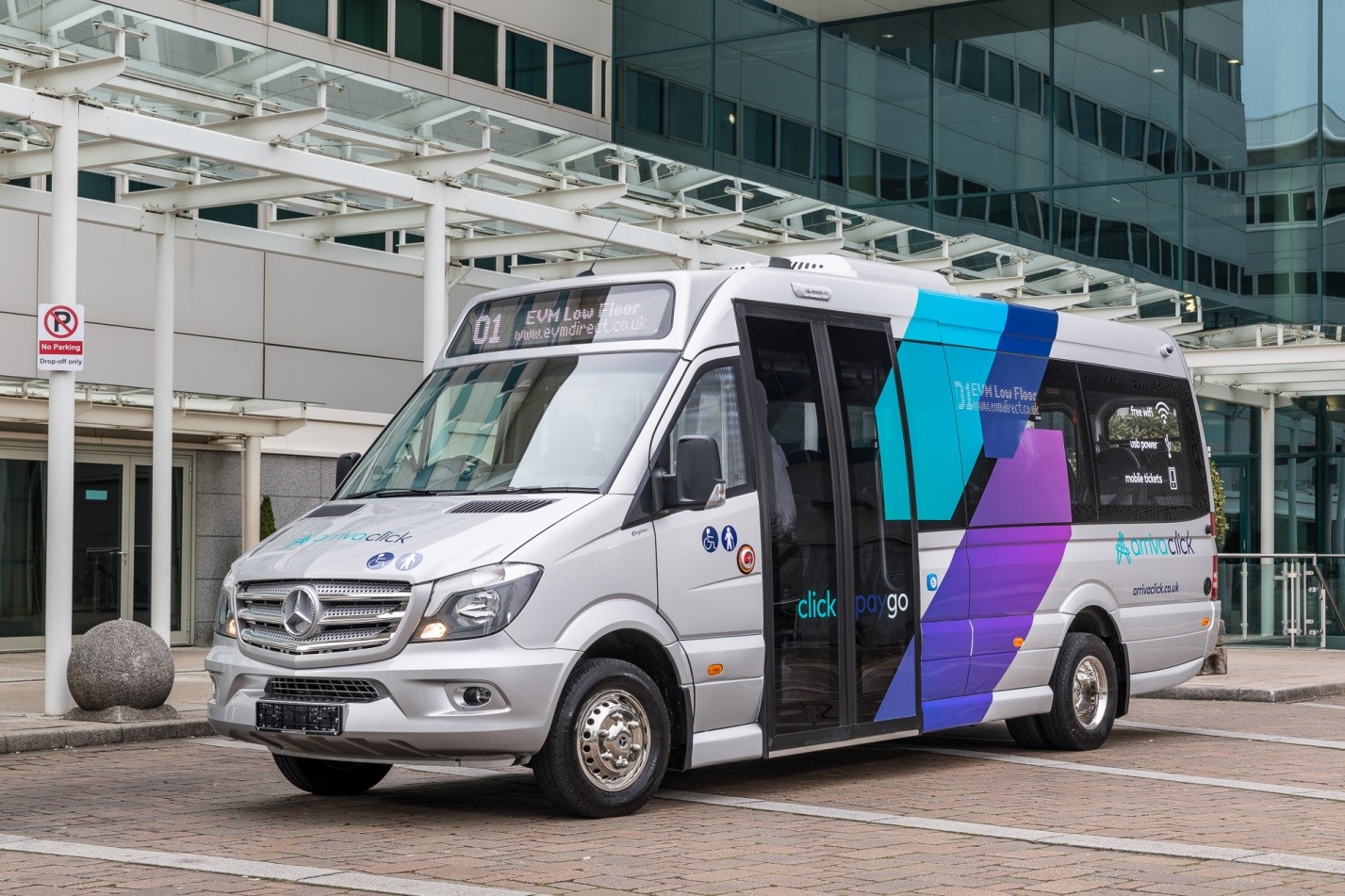
ArrivaClick uses comfortable Mercedes-Benz Sprinter with a ramp for wheelchairs, tables and Wi-Fi. Source: Arriva
Japanese MaaS and boot problems
Remember the classic situation: in the evening you are standing at the bus stop and waiting for your bus, and empty buses of another route pass by one after another. There is a planning error - there is an overabundance of cars on unclaimed routes, and exactly the opposite on claimed ones. Without proper planning of the route grid and its loading, the public transport park can be inflated to enormous size, but the efficiency of its use will only fall.
Within large cities, such errors can be corrected without too much difficulty. But the organization of public transport in agglomerations can become a headache, especially in sparsely populated areas. Such a situation was encountered in Japan, where, due to the motorization and moving of young people to major cities, the suburbs began to become empty, and the elderly mostly began to make up their population. The former OT route network began to decline, as the number of passengers decreased significantly.
The company JUNPUZI, which launched the MaaS-bus service called Convenicle, the Japanese equivalent of ArrivaClick, which appeared much earlier, undertook to solve the problem. Their buses move along flexible routes, picking up passengers at public transport stops, if they have previously received an application for this stop. Since applications are collected in advance, the bus route is also calculated in advance.
Convenicle bus on the march through the sparsely populated Japanese suburbs
Okay, the bus is moving according to the wishes of the workers, so what's the problem? And the problem is that in trying to take into account all the desired stops, the route of the bus can become very complicated, the risk of getting stuck is higher, the trip time increases, and as a result, traveling on such a “bus call” can turn into a long torture. In addition, on some sections of the route the loading of the bus is less, on some strongly more, and the capacity of the minibuses of the service is very limited. To increase the minibus fleet is to repeat the path of the municipal public transport with bloated staff and low load.
Toshiba SATLYS pulls route puzzle
The only possible solution was to calculate and predict the load on the service in order to preliminarily build the best routes even before customers place orders. The owner of the Convenicle service, JUNPUZI, turned to Toshiba with this task.
During the nine years of its existence, Convenicle collected a tremendous amount of travel data that it had to analyze and derive patterns in order to predict the demand for buses and not drive them empty. This was done by a specially developed Toshiba SATLYS AI. At first, SATLYS derived 100 of the most sought-after routes, but no particular pattern was found - no AI is needed to identify popular routes.
After the first result, the most interesting part of the analysis began. SATLYS imposed all Convenicle data on weather reports from the Japan Meteorological Agency. And then the dependencies manifested themselves: it immediately became apparent that on rainy days in certain areas the demand for Convenicle services was growing. To satisfy it, in these areas it is necessary to increase the number of buses passing through them by 20%. Every day, such a flow of cars is not needed, but in case of bad weather, route priorities must be rebuilt. Or, for example, on a certain popular route on Sundays the bus moves twice as long because of traffic jams, and this is a reason to change the way a bit.
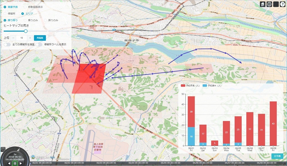
Heat map with demand for Convenicle depending on the day of the week, time and weather
According to the results of Toshiba SATLYS, a heat map of the demand for Convenicle buses and “hot” routes was created depending on the day of the week, time and weather.
In the end, SATLYS helped to find a balance between optimizing routes for a uniform load on buses and the quality of passenger service - that is, to reduce the bus service time and reduce standing in traffic jams.
MaaS in Russian
Mobility as a service has long been penetrated into Russia - if you look at the list of MaaS levels, you can see familiar signs: for example, the Moscow Troika transport card first combined ground transportation and the subway, which previously required different travel cards, and then became a payment method for others of services: bicycle sharing, Aeroexpress, parking, ice rink at the Exhibition of Economic Achievements and so on.
In terms of the development of the IT infrastructure of MaaS, Yandex was particularly successful. With the help of Yandex.Transport, you can track the position of ground transportation on a map in real time, build routes, book car sharing and replenish transportation cards - this is the third level MaaS. In the future, the possibility of paying for transport services via the Yandex application is likely to emerge, which will mark the transition of Russian transport to the fourth level of MaaS.
In 2016, a new public transport route network “Magistral” was launched in Moscow, compiled on the basis of the statistics of the popularity of Moscow's points of attraction. Each route of the system is much longer than the usual local routes, the “highway” penetrates almost the entire city from beginning to end, passing through the central regions. Let the "highway" and can not be attributed to the MaaS, but it represents a new approach to the organization of traffic. In terms of the proven efficiency of the “Highway” (the growth of passenger traffic in directions from 30% to 55%), the appearance of buses on call in Moscow seems to be real, although so far there are no such plans.
Source: https://habr.com/ru/post/453380/
All Articles