News from the world of OpenStreetMap №457 (16.04.2019-22.04.2019)
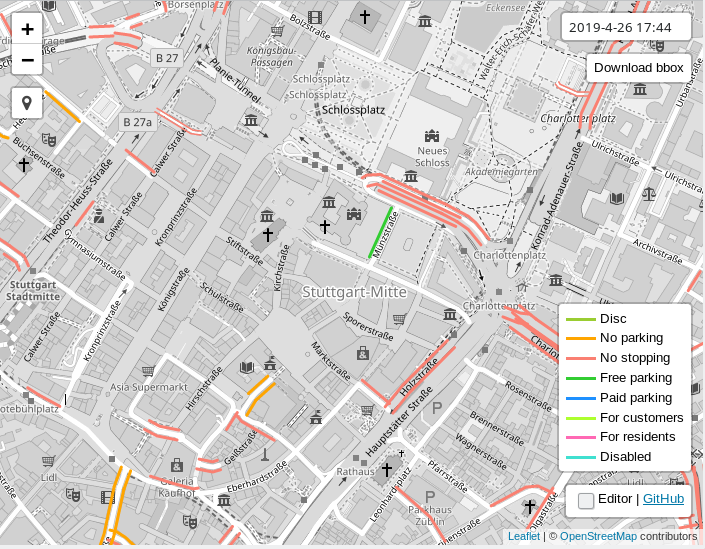 "
"View and change parking schemes on roadsides 1
| Leaflet | Data Members OpenStreetMapCards
- Philip Pierdomenico posted on Twitter the “Coffee Map” of the Philadelphia Center (Pa.), Which he recently made based on OpenStreetMap.
- According to Mapillary in his blog, the US Department of Transportation departments of Utah, Florida, Arizona, Connecticut and Vermont uploaded 430,000 km of roads to Mapillary. They were automatically processed in order to detect various elements of the road network (traffic signs, traffic lights, etc.).
- Publication of the Neue Züricher Zeitung published
 ( translation ) material about Raoul Krauthausen and his project "Wheelmap" - a map of the places available in a wheelchair, which was supported by the association Sozialhelden.
Mapping
- Andy Mabbet looked at some of the frequently used Wikidata tags (he also discovered random errors) and raised the question: should each branch of a company be marked with
wikidata=, like the head office, or with the exception of headquarters, other branches should be labeled withbrand:wikidata=orfranchise:wikidata. - Dave F asked if
junction=yesused anywhere in the test sites. According to the answers of Mateusz and Tobias , is used. - Valor Naram has developed a tagging scheme for changing tables and is waiting for comments.
- New tagging scheme "Police institutions" , which was supposed to introduce new keys for objects used by the police, did not get the necessary number of votes.
- Leif Rasmussen developed a tagging scheme that contains more information about the connectivity of road lanes, because he believes that the existing model using
turn:lanes=does not retain all the necessary details for complex intersections. Simon Poole recalls that a similar tagging scheme (transit=-key) was developed in 2015, but was never adopted. - Joseph Eisenberg wants to map plateaus, flat hills, hills and plateaus, and therefore asks on the "Tagging" mailing list to find suitable values for their designation. Some offer their options, while others believe that some of these objects represent vast territories without clear boundaries, which, moreover, people cannot always determine, and this in turn does not correspond to the OSM data model. Therefore, such information, in their opinion, should be stored elsewhere.
Programming
- A member of yaugenka asked me in 2017 to add to iD the ability to “disconnect” the entire land use landfill from the lines. Quincy Morgan recently implemented this feature and made a short gif about how it works.
- PgAdmin4 added a great feature for viewing geometry , and OpenStreetMap acts as a background. When testing PostGIS scripts, programmers simply switch between viewing data and viewing geometry, and now they don’t need other visualization tools.
- Member jguthrie100 suggested pullrequest for iD web editor to warn if the same address is used several times.
Programs
- Published MapRoulette version 3.3 . The latest update adds a completely new review system. You can mark each task that you solve as “check required.” Some cartographers can view the tasks of other cartographers themselves. Also appeared the Portuguese localization and email notifications.
Do you know …
- ... about the new validator Jochen Topf “ Osmoscope ”? It shows superimposed points, single points and lines without tags.
- ... about the Parking Lanes Viewer tool from ascd, with which you can view and edit parking along roads in OSM?
- ... what tag to put, if there is a landing zone in a store or in another infrastructure facility (a place to sit or eat)? There are two keys for this:
indoor_seatingandoutdoor_seating. For the veranda itself, which is located outside the object, there is aleisure=outdoor_seating. In some places, even the type of chairs (outdoor_seating:comfort) or the degree of protection against precipitation (weather_protection) or the sun isweather_protection.
OSM in the media
- The website of the Spanish newspaper El Pais' in the article on the 2016 general election in Spain contains voting cards . 11 of the 12 cards presented in the article do not have the required copyrights. The 2019 elections took place on April 28th.
Other “geo” events
- The Guardian talks about the struggle of one of the residents of the northeast London area of Ilford with the authorities for E19, which indicates that the area belongs to London. This is due to the fact that the index IG1 – IG6, which is now assigned to this area, is not always recognized as London and may be misinterpreted as part of Essex . His "struggle" lasts as much as 15 years.
- Mapbox at the Shanghai Auto Show announced the release of its Vision SDK . This development environment allows you to add the following functions to driving applications: augmented reality navigation and lane selection recommendation, warnings while driving, and many others. The SDK can also correlate data from sensors and cameras with classic cartographic information, which is processed using AI Maps .
- Kenneth Field and Max Roberts showed that schematic maps are a topic on which very emotional public debates can be held.
- The Bill and Melinda Gates Foundation blog describes how spatial analysis of data collected by GPS navigators helps track malaria.
- National Geographic reports that the melting of ice in the Himalayas is a greater threat than originally thought, as the zone is gradually increasing, which may be affected by sudden flooding. By the way, the researchers used data from OSM in their work.
- Nico Belmonte became the main card manager at Mapbox. Previously, he headed the visualization department at Uber.
- There is a reception of reports and speeches at the URISA 2019 Caribbean GIS conference, which will be held November 18-21 in Port-of-Spain, Trinidad.
Open data
- Owen Boswarva tweeted that the Canadian province of New Brunswick (New Brunswick) completed the Lidar study and published the data under an open source license GeoNB Open Data License .
- Uli Deiters announced the publication of 350,000 road signs (collected since 2014) in the city of Berlin as open data. It has a markup map and provides shapefile data on GitHub .
Community
- Ilya Zverev announced the launch of nominations for the OpenStreetMap Awards 2019.
- OpenStreetMap this year marks 15 years. At the time of the preparation of this news release, only one event dedicated to this date is known. Michael, thanks for the reminder .
- The Portuguese OSM community, through the Talk-pt mailing list, discussed mapping a new hospital on Madeira Island. If this hospital is under construction, how should it be mapped? If built, but just closed? If it works without a license, and therefore illegally? How to check license availability? What should the cartographer do and when exactly to put this hospital on the map? These are some of the questions that the Portuguese OSM community discussed.
 (automatic translation )
 - Michael Reichert offers ( translation ) on OSM-Wikicamp to discuss issues related to the OSM-wiki, since they have accumulated quite a lot. As he notes in his blog, most likely, the local branch of OSM in German, FOSSGIS eV, will pay for accommodation.
- “Cleaning” WikiOSM has recently become quite a popular activity. After all, some pages that were deleted 7 years ago, as outdated, are still available to readers. Ilya Zverev criticized the deletion of an article about testing API 0.6. Unfortunately, but quite predictably, further discussion of the rules for deleting articles from WikiOSM led to a dispute about the meaning of the recent progress of the OSM API , the use of the word “vandalism” and the existence or absence of “janitors” in OSM.
- Last week API 0.6 was 10 years old: it was released on April 21, 2009. Ilya Zverev remembered how the switch from API 0.5 took place and explained why he believes that we will never see version 0.7 of the API.
Imports
- Grigory Rechistov (Grigory Rechistov) prepared the import of forests, farmland and other types of vegetation from the Swedish Agency for Environmental Protection and documented his plan in the wiki. But the criticism voiced in the Imports mailing list seems to be ignored .
OpenStreetMap Foundation
- Christoph Hormann discovered that the April 24th OSMF board meeting contains a closed agenda item on GlobalLogic.
- Rory McCann asks whether GlobalLogic pleads guilty because they themselves have proposed to terminate the OSMF membership of their employees.
Developments
- Potential organizers of the next State of the Map 2020 conference can already apply. Completion of acceptance of applications June 15, 2019.
- Christine Karch and Denis Helfer are planning organize OSM meetings in Strasbourg since May of this year. Meetings will be held every six months and will be held in several languages (German, French, English).
')
Source: https://habr.com/ru/post/450090/
All Articles