News from the world of OpenStreetMap №455 (04/02/2019-08.04.2019)
View hidden infrastructure contained in the OpenStreetMap 1 database | OpenInfraMap | MapTiler | Map data OpenStreetMap contributors
Mapping
- In a series of tweets, Tyler Busby talks about the success of using machine learning to identify solar cells on rooftops in Austin, Texas. These data formed the basis of one of the tasks of the MapRoulette project in order to further add them to OSM.
- Nuno Caldeira spoke on Twitter about the work done by the OSM Portuguese working group at Telegram. For 35 days, its participants mapped over 4,000 buildings on the Flores and Corvo Islands in the western part of the Azores archipelago.
- Brian Prangle invited the OSM community in the UK in the second quarter of this year to focus on improving the quality of POI data. He believes that first of all it is worth paying attention to those organizations that have ceased to exist or changed their name. It is worth noting that in the first quarter a project was successfully implemented in the UK, within the framework of which more than 70,000 addresses were clarified or confirmed using the Agency’s food standards rating.
- Dan S (Dan S) proposes to mark solar panels on the map as a project for the UK. He also links to articles on wiki OSM about solar panels on rooftops and large solar farms . Information in these articles can help in solving the problem proposed by him.
- User JM82 surprised
 (automatic translation to Google from German) by the fact that the number of buildings mapped in Austria seems to be decreasing.
 - The Cleper member from Colombia invites all active Osmer to help him map the Choco area ( task number 121 ). This territory has always attracted migrants from different regions, but recently they have become much more due to the political crisis in Venezuela.
- The German OSM forum is now being actively discussed. intensive mapping of access roads in residential areas, which was performed by employees of various publishing houses. The user boldtrn notes that on his street this is done with errors (from 30 to 50%).
- Lorezno Stucci proposed three new tags for a landcover tag. He suggests that areas that are cultivated by people, such as agricultural land or meadows, be marked
landcover=cultivated. Areas modified as a result of construction, mining or other human activities should be mapped aslandcover=artificial, and spaces without vegetation, where only bare soil is,landcover=barren. Discussion of his proposal goes from April 6, 2019. - CapitaineMoustache offers places for storing crops (areas where silos and barns are located) to mark with the pair
industrial=grain_storage_centre. The discussion began on April 5, 2019. - The British National Cartographic Agency Ordnance Survey tweeted a photograph of the geodesic works that they began to carry out at the Tottenham Hotspur stadium. Despite the fact that the stadium opened in early April, he, as noted by Steve Chilton, has already been drawn in detail in OSM.
Education
- A collection of more than 200 videos in English (and another 200 in German) about projects OpenStreetMap, FOSS4G, OSGeo, GIS, etc. Available on the TIB AV-Portal website.
- The Mapbox article “Your First Steps with a JOSM Reactor” has been published, it will help you more efficiently add data to OpenStreetMap.
Cards
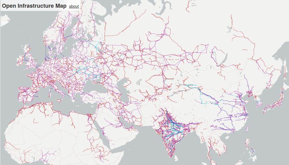
- Russ Garrett improves the OpenInfraMap map: various types of infrastructure are now displayed as separate layers, and a layer with a thermal map of solar electrical panels has been added.
Programming
- GIScience University Heidelberg Research Group has released the announcement of a new client for mobile devices Openrouteservice.
Programs
- The OSM Software Watchlist report contains new versions: Cruiser Android & Desktop 1.6; Magic Earth iOS 5.05; Mapbox Navigation; OsmAnd + Android 3.3.7; StreetComplete 11.0 ; Umap 1.1 ; Vespucci 13.0
Do you know …
- ... about the comparemaps.drona.ro tool that allows you to compare OSM maps with Google Maps, Bing and Nokia maps?
- ... about the KartaGPS application?
- ... what appeared NotesReview, which you can use to search among OSM notes using different search conditions?
- ... about Pic4Review ? It allows you to map, use Mapillary images, and participate in various missions, such as adding wheelchair access, adding ecopoint or integrating missions into public restrooms. You can also add your own quests!
- ... about the concept of an “advanced stop line” for cyclists? This marking allows the bikes to wait at a traffic light ahead of other road users. In OSM, they can be marked with the
cycleway=asltag.
Other “geo” events
- Vultures began to avoid Portugal. As it turned out, this was influenced by legislation that forces Portuguese farmers to bury or burn cattle carcasses.
- Many economists believe that the success of large cities, when compared with small ones, is due to the so-called. "Agglomeration effect". Tom Force from ODI Leeds, in his material on CityMetrics, proves that this statement does not apply to Birmingham, since the work of public transport is poorly organized in it.
- Simon Küstenmacher on Twitter shared a link to an article of the World Economic Forum, which contains maps of five wild places in the world.
- Mike Blackmore (Mike Blackmore) tweeted an animation that demonstrates how the “development” of European rivers took place, or rather their gradual straightening. William du Ploi’s tweet is no less shocking: it shows how many forests have been cut down in Mozambique over the past 19 years.
Community
- Colin Blackburn (Colin Blackburn) is intrigued by the name of the beach in OSM "Clothes of choice" on the route on which he planned to run. We hope that he will not use Mapillary at this time.
- In his diary, a member of hvalentim wrote (automatic translation ) some reflections on the mapping of nationally registered Portuguese heritage sites in OSM: some gaps were found and many other suggestions were made to improve and standardize tagging.
Imports
- Jason Owen has developed a plan for importing water wells in Harare, Zimbabwe, and announced this in the mailing list for imports.
Developments
- The reception of reports for the HOT Summit 2019 conference, which will be held on September 19-20, 2019 directly in front of SotM 2019 in Heidelberg, is open.
- Registration is now open for the SotM France conference, which will be held in Montpellier from 14 to 16 June 2019!
 (automatic translation )
Humanitarian OSM
- HOT has made the payroll process transparent to its employees. Despite the fact that the size of each salary was not disclosed, the formula and methodology by which it is calculated are now available to everyone. On this occasion, the HOT team prepared an article in which it explained in detail why they attended to the transparency of payroll and what difficulties they encountered when trying to find a more fair payroll model. In addition, the material reveals how exactly the new model has eliminated the previously existing inequality and how its introduction affected the amount of wages.
- The stage of nominating candidates to the HOT America team has begun, which will last until April 16, 2019. As Natalie Sidibe points out on the mailing list, this year HOT will allow self-nomination to increase the number of candidates.
- Gaurav Thapa of Kathmandu Living Labs shared how he collected geospatial data in the Kathmandu Valley (Nepal) as part of a project that studies natural disasters to reduce damage from them.
- Jorieke Vyncke, on behalf of Doctors Without Borders, a non-profit organization , thanked the HOT team for their work that took part in the aftermath of the Idai cyclone in Africa.
')
Source: https://habr.com/ru/post/448286/
All Articles