DJI Phantom 4 RTK: New Generation Cartography
Yesterday at Frankfurt EDS 2018 (European Drone Summit) DJI presented a new modification of its most popular and functional quadcopter: Phantom 4 RTK. Of course, for an average user this copter will not be the subject of special attention, but for the industrial segment it will become one of the key tools. According to the manufacturer, Phantom 4 RTK was created to occupy one of the main niches of commercial drones: geodesy and cartography. What can give the new kopter industrial segment? We are telling!
Analytical company Skylogic, in one of its annual research on commercial drone, claims that DJI quadcopters hold a dominant position both in the field of software and in technological equipment. And the new company only confirms the words of analysts. “Phantom 4 RTK is designed to meet the specific needs of users who are used to relying on DJI products as a powerful mapping and inspection tool,” says Sani Liao, DJI Europe Director. Yes, the words are excellent, but what exactly do they suggest to us at DJI?
Possibilities of the built-in RTK module

')
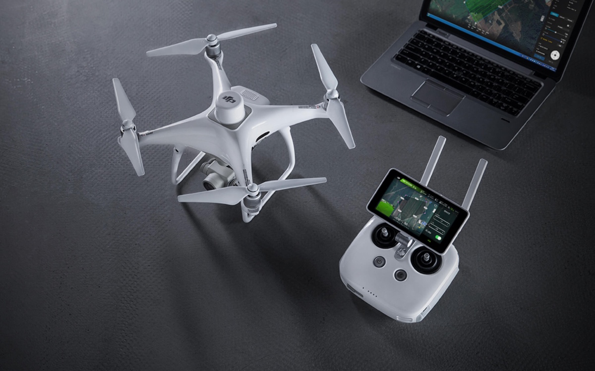
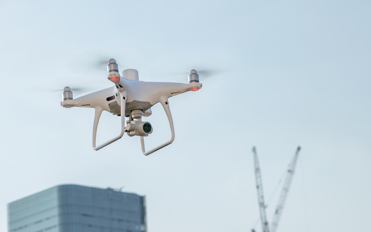
If you do not pay attention to the cylindrical protrusion on the back of the device, then you can imagine that we have Phantom 4 Pro or its updated version 2.0. All sensors (front, bottom, rear and side), as well as the 20-megapixel camera, which is so beloved by many photographers, is in its usual place. But just in this cylinder lies the main innovation of the model. This is an RTK module (GPS L1 L2, GLONASS L1 L2, Galileo E1 E5a and BeiDou B1 B2), which transmits data about the location of the copter in real time to centimeter. This module allows to increase positioning accuracy up to 1 cm + 1 md horizontally, 1.5 cm + 1 md vertically, and the absolute horizontal accuracy of the photogrammetric model is 5 cm. For comparison, to get accurate results of a topographic survey (that is, with 3 cm) a typical drone needs to set about 40 control points (GCP) per square kilometer, which takes several hours.
Each Phantom 4 RTK camera is calibrated at the factory, and lens distortion data is saved and subsequently added to the metadata of each shot. In the process of aerial photography, the system takes into account the spatial displacement of the center of the CMOS-matrix relative to the RTK module and records the positioning parameters of the photographing center in the same metadata of each image, which allows to optimize the photogrammetric processing process and to achieve high accuracy of model reconstruction.
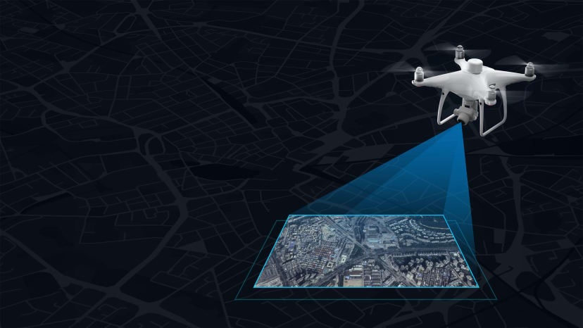
The use of the new TimeSync system in the Phantom 4 RTK allowed us to achieve the most efficient use of positioning modules and constant communication between the flight controller, camera and RTK module. Their collaboration and high resolution of images allow you to spend 75% less time on setting parameters. Ground resolution reaches 2.74 cm from a height of 100 meters, and the required number of reference points tends to 0.
At the same time, to achieve even more accurate results, especially in areas with poor mobile network coverage, Phantom 4 RTK can be easily connected to a D-RTK 2 mobile station (using a 4G modem or WiFi, using the NTRIP protocol). The D-RTK 2 transmits a differential signal to the Phantom 4 RTK in real time, and the OcuSync 2.0 transmission system allows the Phantom 4 RTK to receive data at high speed and in all conditions.
The perfect surveyor tool
By the way, in areas where there is no RTK coverage, DJI Phantom 4 RTK also works. In such a locality, it uses the original satellite observations and ephemeris data and saves them to the PPKRAW.bin file in RTCM version 3.2 format. In addition, the copter converts satellite data “on the fly” into the RINEX (Receiver Independent Exchange Format) format and writes them to the RINEX.obs file, and also saves the GNSS and camera position synchronization results to the Timestamp.MRK file to ensure high accuracy of image position . All operations and related data are stored on the microSD card in a unique folder for each flight.
Phantom 4 RTK is designed to make mapping easy, convenient and efficient, allowing the user to create large area maps in one flight. Even if the area of the study area is too large to be examined in 30 minutes, the copter will automatically resume operation after replacing the battery. Also for easy customization, the Phantom 4 RTK is compatible with the Mobile SDK mobile application developers package.
Data processing
The obtained data from Phantom 4 RTK is very easy to import into any photogrammetry program, for example, Pix4Dmapper, to create an accurate 3D model. This allows on-site review of construction work and the following construction steps. Due to the high level of detail and the large amount of data obtained during the site survey, surveyors and CAD-technicians do not need to return to the construction site to collect additional information, thereby saving time.
A specialist can create an effective model after processing data from a drone, which includes the classification of point clouds for filtering unwanted objects, such as vegetation, vehicles and artificial objects, the vectorization function and extraction. The processed data is then used to create a digital elevation model (DEM) and surface modeling, calculate volumes and mass, as well as for building information modeling (BIM).
In addition to the 3D result, 2D orthophoto maps can be created using third-party software to provide an excellent overview of large construction sites from a bird's-eye view.
Phantom 4 RTK is a powerful tool for surveying and building site inspection. Integration with a large number of photogrammetry programs, compact dimensions, an accurate image processing system, and other features will help make the mapping process fast, efficient, and low-cost.
Source: https://habr.com/ru/post/426593/
All Articles