Detailed road maps are needed for smart cars, not for people.
Over the past couple of years, robomobic and automatic vehicle control systems have reached a new level of development. Many companies already have their own systems of this type, and who do not have them, are urgently engaged in development. According to representatives of the automotive industry, smart cars will be driving around the roads of many countries in five years. That is, it is no longer a question of tests, which are already being conducted, but of the commercial use of robots.
However, in the near future, it is hardly possible to release on the roads high-grade robots on wheels that move at all without human participation. This is still a rather distant goal, to achieve which we will have to work a lot, including in the field of lawmaking. But systems like Autopilot from Tesla, more advanced counterparts, are quite real. But in order for their introduction to be massive, cars with such modules must know exactly where they are at any given time. Moreover, the accuracy of localization should be higher than that of GPS. In this case, ultra-precise road maps with applied markings come to the rescue.
Subsidiaries of such auto industry giants as BMW, Audi, Mercedes-Benz and Ford are already working on their creation. These are companies like Here and Civil Maps . Employees of these companies collect a huge amount of data that is used to build virtual 3D roads with the markup required for cars with a computer control system. Such roadmaps have a very high degree of detail, and information is updated as often as possible.
')

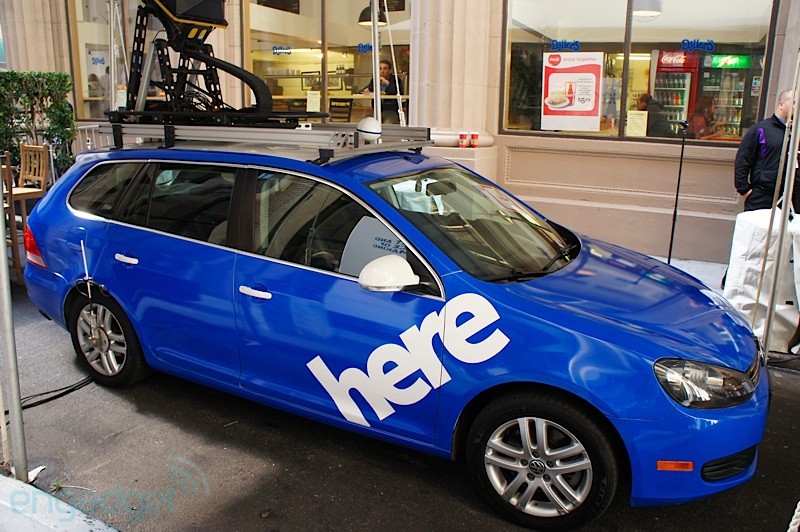
Here is no stranger to cartography. This company began work on the creation of HD-cards in 2013, using the base created in previous years. The initiators of the creation of virtual cards for smart cars made concern Daimler, who allocated initial funds. According to representatives of Here, the need to create an HD version of roadmaps is now clear to almost all representatives of the automotive industry. “When it comes to automatic machine control systems, the card is one of the main factors that allows an on-board computer to make a decision,” says Sanjay Sud, head of Here.
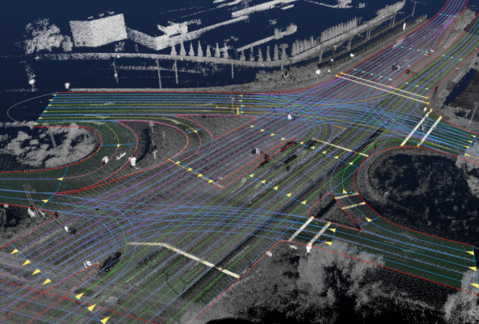
The first step in creating such systems is a high resolution base map, on which markup and virtual elements are applied, allowing the computer to operate more efficiently. High-resolution virtual maps are much more accurate than those of Google or other companies. When collecting information for their creation, 96 MP cameras, modern lidars and other technological innovations are used to collect accurate information of a cartographic nature. After processing the collected data, developers get a model of roads and roadside facilities. It remains only to apply the markup and other information that may be useful for computer control systems.
The developers of the mapping system for smart cars believe that this platform can be put into commercial use by 2020.
Other companies that are working on the creation of virtual roadmaps work in a similar way. For example, Civil Maps uses optical, ultrasound equipment, lidars, and anything else that may be useful to solve this problem to build their models of roads.
As mentioned above, maps, no matter how accurate they are, need to be updated in a timely manner. Smart cars must be able to "understand" the situation on the roads, "understanding" what obstacles can be encountered on the way and how they can be avoided.
The update will be provided through a developed network of special vehicles with equipment for collecting information. Data on the changes on the roads will also be supplied by the authorities of large settlements. The fact that any section of the road is going to be modernized / closed is known in advance. And these data should be used in time to match the map of the real state of affairs.
Other, less significant changes will be able to “notice” special vehicles that will transmit such information via LTE and other communication channels. The data will be introduced, if not in real time, then close to this - now various systems of automatic construction of road models are being created, people are hardly needed here.
Nvidia also helps to process the information needed to build highly detailed roadmaps. Its specialists widely use machine learning and neural networks, automating the construction of the necessary system.
Initially, the service Here belonged to the Finnish company Nokia, which developed it for a long time. Then an alliance consisting of Audi, BMW and Daimler bought out this service for 2.6 billion dollars. The goal is to create an alternative to Google Maps. After that, Here began to be considered as the basis for creating a new generation of navigation services.
Now Here is one of the largest services of the site, whose data is used in many cartographic platforms, including Garmin, BMW, Nissan. Last year, China’s Tencent Internet Group, along with NavInfo and Singapore’s GIC, acquired a stake in Here.
Source: https://habr.com/ru/post/402235/
All Articles