Lakhta Terra Incognita: The Battle for Sustainability of a Skyscraper
For a skyscraper to grow up, you must first go down. The higher the building, the deeper the descent. For the construction of the “Lakhta Center”, 462 m high, 40 km of wells had to be dug, including a depth of 150 meters. Today's post is about a trip to the center of the earth.

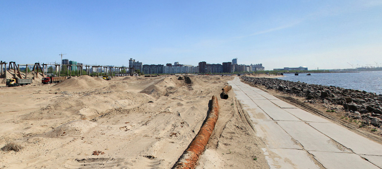
Petersburg, 2011 Prior to the construction of the tallest building in Europe, the Lakhta Center skyscraper - three years. Before the builders - a site in Lakhta, on the isthmus of the Gulf of Finland and the Lakhta spill. And standing here at this moment is a bit scary.
The site is a former sand farm, the border of the city and resort area.
')

There are fourteen hectares of sand underfoot, cut off from the bay by a strip of granite boulders.
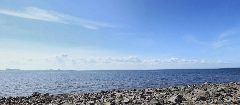
In the air - sand, salt and dampness. Before the eyes - the sea horizon. To the south - Petersburg, to the north - Sestroretsk, to the west nothing is visible, but there is a path to Scandinavia: you will sail past Kotlin, between Kotka and Narva, between Helsinki and Tallinn and you will rest straight into Stockholm.
And it is terrible to stand and look at it, because it is not yet clear whether it is possible to build a skyscraper here, whether there will be surprises under the ground in the form of an abyss under bearing soil or karst cavities, or a particularly rich cultural layer. The last is pleasant to find, but still not on the site ...
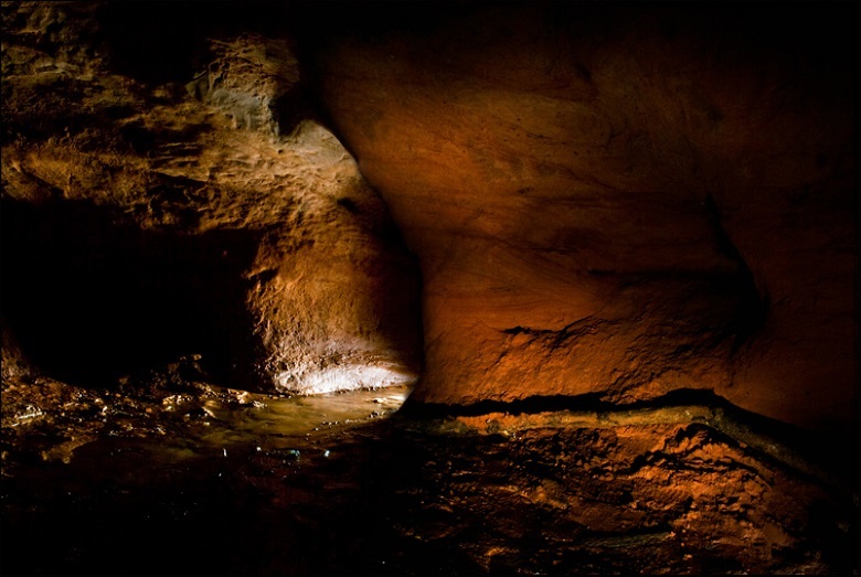
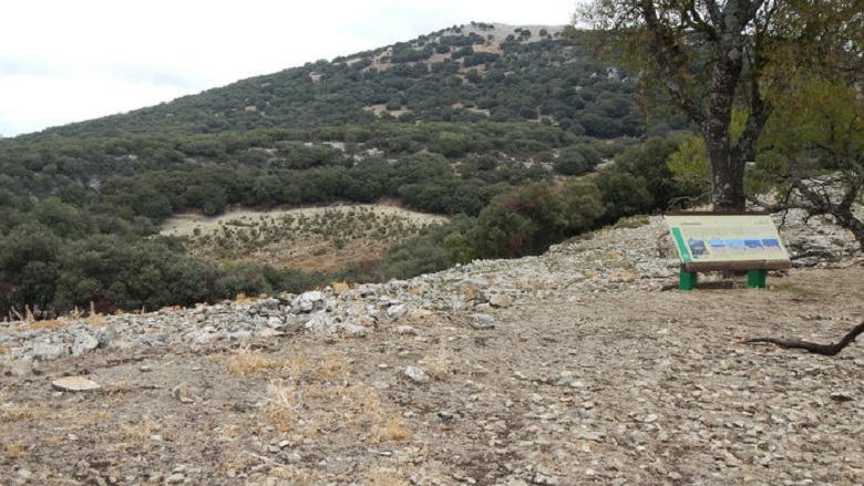
Karst formations in the Leningrad region. Rozhdestveno village
Give answers to all questions must surveyors. They will settle in Lakhta first and spend three years here. Exit from the site - through the plan: what is underground, what and how to lean on the tower.
In 2011, many researchers worked in Lakhta. On the site, closer to the bay, is the observation point of the ornithologists. They rewrote the quantitative and qualitative composition and routes of "bird migrants" - to predict the impact of development on the behavior of birds and to develop recommendations for the prevention of "air incidents". Environmentalists made measurements on noise, composition of water and air - reference points for assessing the subsequent impact of the construction and operation of a skyscraper. Meteorologists refined data on the microclimate - then it will be required for design constructions, tests on aerodynamics, anti-icing measures. Archaeologists ... this time - by, without discovery.
We are now interested in engineers and prospectors - the discoverers of the Lakhta bowels.

Their work covered field and laboratory engineering and geological studies. Then geotechnics were connected. Behind them are calculations on the foundation structures of the complex. At various stages involved 13 companies, including the world's "stars".
First, we will deal with the cultural layer, in which sometimes stumbling blocks are dug up.
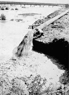
The 20th century is the time of the revolutionary offensive of man on nature, the symbol of which can be considered the projects of turning the rivers backwards. Lakhta economic activity is not spared. Since the 1930s, peat has been mined here, the swamps have been drained, and since the 1960s they have begun to change the coastline altogether.
Alluvium Sand - from the bottom of the Lakhta spill (Photo from here )
New land - for new quarters. In the city plans of Leningrad in 1966-1986, a “dominant” and a park were planned 2 kilometers from the “Lakhta Center”, and around (in the place of Lakhta-Olgino) - 20 blocks of residential buildings.

A model of the north-western part of the Primorsky region, 1975. Photo from N. Mikhailov’s book “Lakhta: Five Centuries of History”, Quarterly Overseer )
Planned dominant (green arrow) and today's construction site of Lakhta Center (blue arrow):
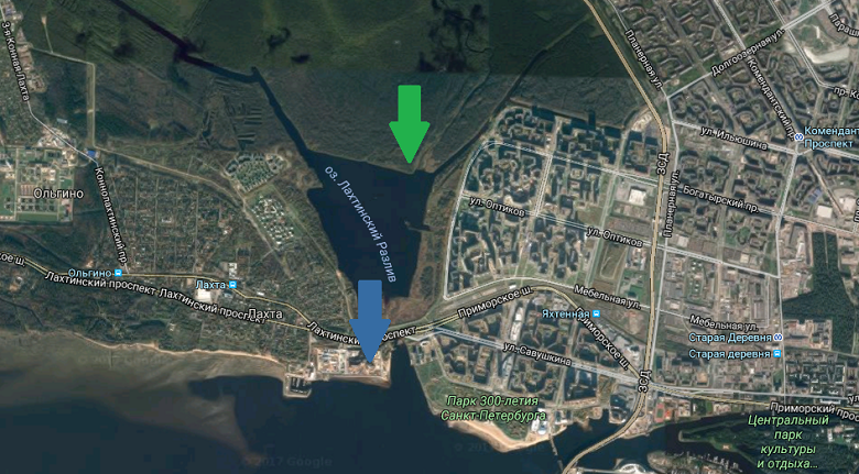
Screen from google
So they intended to realize the idea of the “Sea Facade”, making Leningrad “a beautiful seaside city, embracing the wide front of the Gulf of Finland” (quotation from here ).
***
Neither the quarters nor the dominants were built in the end. But in 1980 they began to build a dam, the route of which passed through Sestroretsk and Coltin to the south.
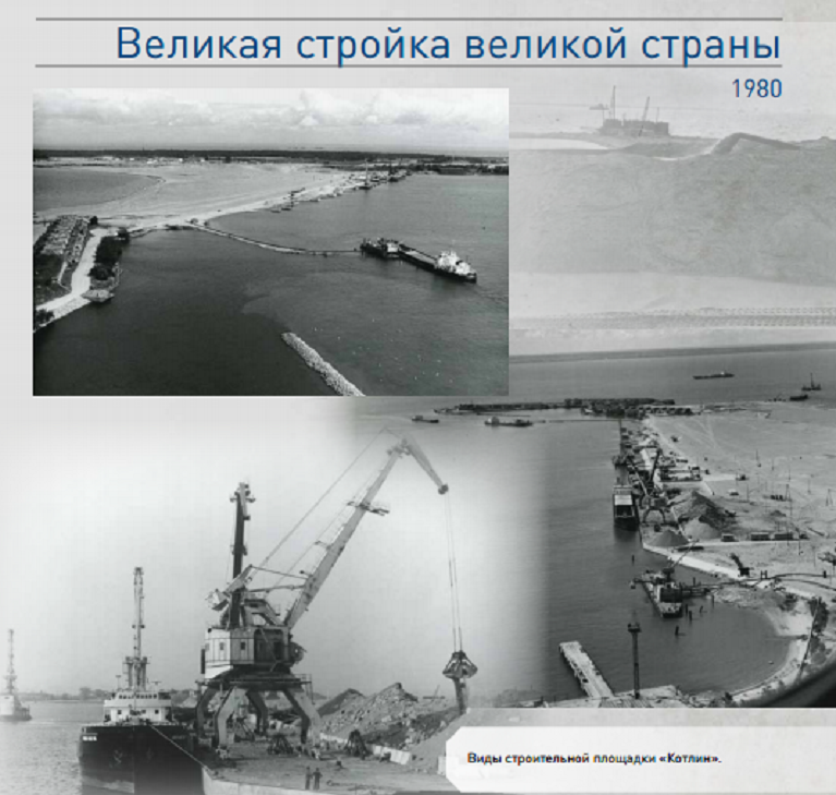
Photo from album 1 “Protecting Petersburg from floods. Photos, events, facts, people "
The historical curiosity is that the construction site of the super-skyscraper contributed to the mega-project with the dam. Here, the sand for the construction of protective structures was stored and brought into condition. The sandy mountains went to a height of 30 meters - on a par with ten-storey buildings through Lakhta harbor.
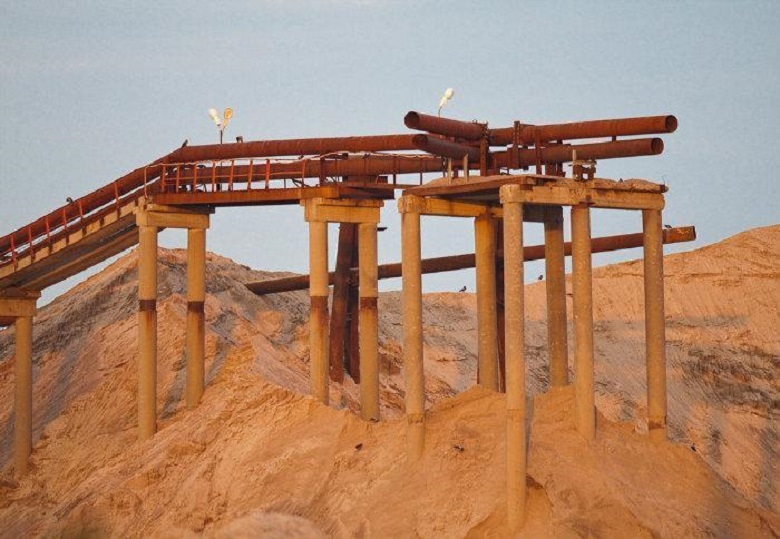
Of course, when the foot of the first prospect “Lakhta Center” stepped here, the “dunes” were taken out. From them remained "man-made layer" - sand, with a capacity of about a meter. Of course, this cultural ground is of no historical value.
***
Interestingly, before the sand was removed, did anyone manage to do this:

Soil studies can be divided into three blocks: field, laboratory and calculations, which are based on the results of the first two.
As we told here , the ground is a kind of “puff pie”. The main task is to find out at what elevations different layers lie and to clarify their properties - to conduct tests in the field and in the laboratory. To do this, drill wells. The probability of "surprises" during construction is directly dependent on the depth and frequency of drilling.
Over the year, more than 200 wells were drilled in the Lakhta Center area, the total length of which is over 40 km. Well grid - 20 * 20 meters. This is the densest grid, which is used only for special occasions - unique buildings erected in difficult ground conditions.

Well pattern
Drilling depth - to the level of minus 150 meters. They did not reach the crystalline basement - in Lahta, it begins at depths from minus 187 to minus 211 meters.
Wells are drilled to conduct various test series. We learn about some.
Looks like that:

Scheme:

Simplistically, a stamp is a piston, the cylinder of which is pressed into the ground. The surveyor measures how deep the stamp has gone and what efforts have been made for this. Stamp studies show the strength of the soil.
The typical design is suitable for work at depths up to minus 20 m. Especially for the Lakhta tests, a “double range projectile” has been developed - with a reinforced piston. He was able to sink to depths of up to minus 40 m - despite the fact that the “roof of the Upper Kotlin deposits of the upper Vendian” is located on the site at a depth of about minus 20 m. This means that clay of solid consistency begins with minus 20 m. The consistency name is not a formality. Already with minus 40 m, the clay is so hard that there are no pistons capable of pressing a stamp into it.

They do not press into this dense clay, they drill holes in it - these are such serious drills. Or such - with retractable knives for cleaning the bottom hole:
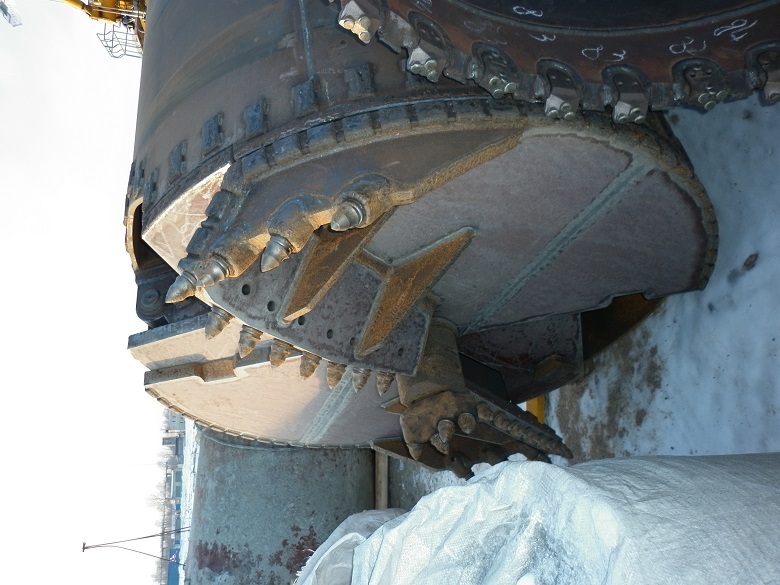
Both drills are pile, and we will tell about them.
Minus 40 is the record depth of the work of stamps and, according to the calculations of geotechnicians, the limit.
Below minus 40 meters in the course went pressometric equipment.
The principle of its work is as follows. Prepare well in advance. Then the elastic chamber is lowered into it. Pressure is applied to the chamber, it increases and presses against the ground, after which the deformation of the sequence from the impact is measured. And here there is one discrepancy. The camera puts pressure on the ground horizontally, and the future building will press vertically. It seems that there is not much difference, but this is not so. If you go back to the puff pie analogy, this is easy to understand. Push it from above - there will be one strain, and if on the side there will be another, because you will press on a specific layer: the cream will shrink in one way, and the biscuit will be different.

(Photo from here )
To obtain reliable data from pressiometric tests, correction factors are introduced, plus cross-checking values by additional methods - for example, static sounding. The rest of the test is universal and suitable for work at any depth. In Lakhta, it was used at elevations from minus 25 to minus 130.5 m.
The result of the tests - the standard value of the deformation modulus was not less than 100 MPa from a depth of 30 m and below.
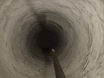
Shooting in the well at the mark - 80 m.
Another field method is soil testing with piles. Conducted using the Osterberg Cell technology (O-Cell). During the test, the pile is installed in the ground, then it is affected by hydraulic jacks - it is pressed from above and along the side surfaces. This shows how the pile in the ground works under load, at least equal to the one that the building will have. The test is considered complete when one of the three “participants” does not stand: either the limit of the surface friction of the pile on the ground is reached (that is, its carrying capacity is not enough), or - the pile is deformed, or - the maximum power of the equipment is reached.
There were 4 test piles in Lahta. The testing process was delayed for many months. Engineers waited patiently for the pile to slack under the growing load. As a result, the jack came down first.
So revealed that one pile can withstand 4.5 thousand tons. Maybe more, but there is no equipment to check. Yes, actually, it is not necessary - there will be “only” 2.5 thousand tons of weight per one pile under the tower.
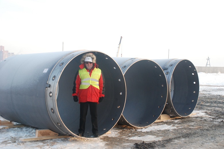
The testing process itself looks like this. Casing pipe, this size:
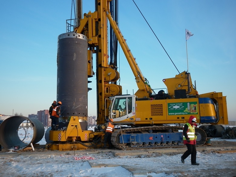
Sent to the mine:
There - armokarkas with sensors and jacks:

Concretes:

We are waiting for it to harden. We press jacks.
The soil is gaining density with depth. Under the "cultural" sand begins the weakest - sea and lake glacial deposits. They are light, dusty, stinging and plastic. Imagine a "dense" swamp - and you will see this layer. It goes to the level of minus 14 m.
Behind it is a more durable moraine, with a capacity of 3 to 8 meters. It is composed of debris, from pebbles to boulders. The size of the potential "surprises" can be represented by the magnitude of the Thunder-stone.
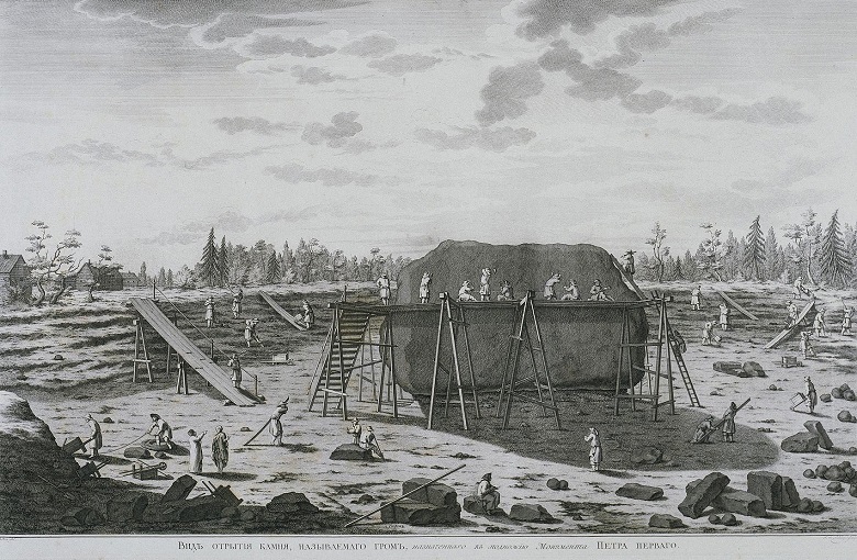
In the 18th century, a pedestal for the Bronze Horseman was searched all over Russia, and found in Lakhta. Initial weight - 2 thousand tons, dimensions - 13m * 8m * 6m. The painting "View start processing Thunder-stone." Artist Jacob van de Schleit, 1770s
At the level of minus 18.9 m, solid clay begins with small interlayers. They go to minus 102.9 m. This stratum, with a thickness of approximately 85 m., Is the supporting layer, the goal of exploration and study. To his "roof" - less than 20 meters. Not bad! Not Manhattan, but we have something to compare.
What is under the base layer? The sandstones begin below the mark of minus 102.9 m. This is a hard rock, its strength is higher than that of clay.
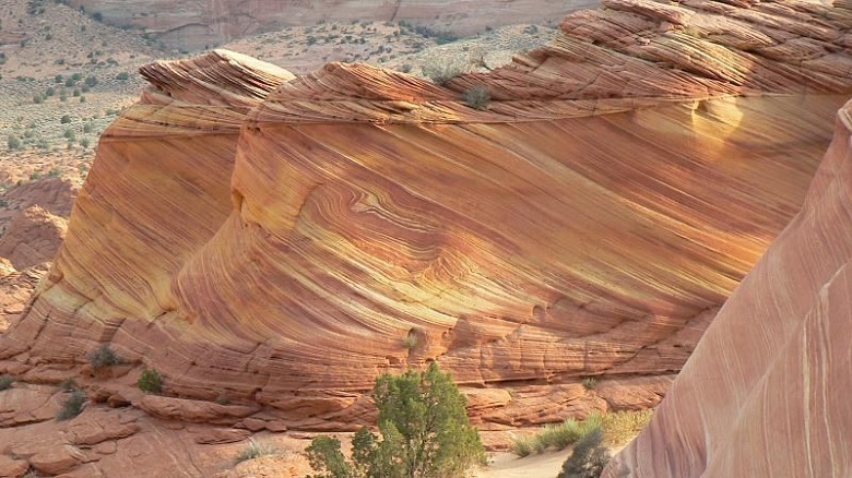
Sandstone rock
In the end - a horror story with exposure. In the St. Petersburg media roam this story:

Citizens get scared - if under Lakhta (it turns out on the way) there is a huge river, then how to build there? You can build - neither the big nor the small river, the researchers did not find, and did not count. Petersburg is not threatened with flooding by underground rivers either.

Princess Tarakanova. 1864 Hood Konstantin Flavitsky
The basis of the history was probably the peculiarly understood information about the buried pale-valleys - that is, the beds of the former rivers that flowed into the Gulf of Finland after the Great Glaciation melted. Now there is no watercourse.
Paleodolin. Petersburg is much smaller and - under the thickness of the soil.
In the north of St. Petersburg, the buried bed is a complex geological object, 1.5–2 km wide and 25 km long, with a heterogeneous section and, as a result, the rocks are looser — high groundwater levels — something that can hardly be surprised by Petersburg builders Petra. Will consider, but will not be frightened.

Paleo-valley scheme. The data of FSUE “Mineral” from the article of T.N. Nikolaeva, L.P. Norovoy "Engineering and geological conditions of construction in the paleo-valley region in the north-west of St. Petersburg"
The “Lakhta Center” (red arrow) section of the paleo-valley is completely bypassing, although relatively close.
-
There is a tactic in relying on a layer of hard clay. It takes into account that a skyscraper weighing 600 thousand tons will put pressure on the ground with a small area: each of the 3 base plates of the whole - 5,700 sq. M. Most of the vertical loads are perceived by the core, whose area at the base is about 500 square meters. m. How to redistribute the load from the center of the building and make the most of the carrying capacity of the soil? Read about it in the following posts.
-
Consultants:
V.M. Lukin - project manager for reinforced concrete structures "Lakhta Center", Ph.D. R.V. Inamov - Chief Designer of Lakhta Center, Candidate of Technical Sciences
Petersburg, 2011 Prior to the construction of the tallest building in Europe, the Lakhta Center skyscraper - three years. Before the builders - a site in Lakhta, on the isthmus of the Gulf of Finland and the Lakhta spill. And standing here at this moment is a bit scary.
The site is a former sand farm, the border of the city and resort area.
')
There are fourteen hectares of sand underfoot, cut off from the bay by a strip of granite boulders.
In the air - sand, salt and dampness. Before the eyes - the sea horizon. To the south - Petersburg, to the north - Sestroretsk, to the west nothing is visible, but there is a path to Scandinavia: you will sail past Kotlin, between Kotka and Narva, between Helsinki and Tallinn and you will rest straight into Stockholm.
And it is terrible to stand and look at it, because it is not yet clear whether it is possible to build a skyscraper here, whether there will be surprises under the ground in the form of an abyss under bearing soil or karst cavities, or a particularly rich cultural layer. The last is pleasant to find, but still not on the site ...
Karst formations in the Leningrad region. Rozhdestveno village
Give answers to all questions must surveyors. They will settle in Lakhta first and spend three years here. Exit from the site - through the plan: what is underground, what and how to lean on the tower.
Discoverers
In 2011, many researchers worked in Lakhta. On the site, closer to the bay, is the observation point of the ornithologists. They rewrote the quantitative and qualitative composition and routes of "bird migrants" - to predict the impact of development on the behavior of birds and to develop recommendations for the prevention of "air incidents". Environmentalists made measurements on noise, composition of water and air - reference points for assessing the subsequent impact of the construction and operation of a skyscraper. Meteorologists refined data on the microclimate - then it will be required for design constructions, tests on aerodynamics, anti-icing measures. Archaeologists ... this time - by, without discovery.
We are now interested in engineers and prospectors - the discoverers of the Lakhta bowels.
Their work covered field and laboratory engineering and geological studies. Then geotechnics were connected. Behind them are calculations on the foundation structures of the complex. At various stages involved 13 companies, including the world's "stars".
Engineering surveys and geotechnical calculations are carried out:
Construction Department No. 299, VNIIG them. B.E. Vedeneyeva, IPE them. O.Yu.Schmidt of the Russian Academy of Sciences (seismic), PI "Petrokhimtekhnologiya" (ecology), TekhnoTerra, CJSC Firma Unikom (hydrometeorology plus radon), CJSC Geostroy, Fugro RoadTest (testing of soils with piles), scientific center of geomechanics and problems Mining Production University of Mining, NIIOSP them. N.M. Gersevanova (soil laboratory tests), Inforsproekt Design Bureau under the supervision of Academician V.I. Travush, Moscow State University laboratory. Mv Lomonosov. Verification of calculations and design decisions - ARUP.
Uncultured soil
First, we will deal with the cultural layer, in which sometimes stumbling blocks are dug up.
The 20th century is the time of the revolutionary offensive of man on nature, the symbol of which can be considered the projects of turning the rivers backwards. Lakhta economic activity is not spared. Since the 1930s, peat has been mined here, the swamps have been drained, and since the 1960s they have begun to change the coastline altogether.
Alluvium Sand - from the bottom of the Lakhta spill (Photo from here )
New land - for new quarters. In the city plans of Leningrad in 1966-1986, a “dominant” and a park were planned 2 kilometers from the “Lakhta Center”, and around (in the place of Lakhta-Olgino) - 20 blocks of residential buildings.
A model of the north-western part of the Primorsky region, 1975. Photo from N. Mikhailov’s book “Lakhta: Five Centuries of History”, Quarterly Overseer )
Planned dominant (green arrow) and today's construction site of Lakhta Center (blue arrow):
Screen from google
So they intended to realize the idea of the “Sea Facade”, making Leningrad “a beautiful seaside city, embracing the wide front of the Gulf of Finland” (quotation from here ).
***
Neither the quarters nor the dominants were built in the end. But in 1980 they began to build a dam, the route of which passed through Sestroretsk and Coltin to the south.
Photo from album 1 “Protecting Petersburg from floods. Photos, events, facts, people "
The historical curiosity is that the construction site of the super-skyscraper contributed to the mega-project with the dam. Here, the sand for the construction of protective structures was stored and brought into condition. The sandy mountains went to a height of 30 meters - on a par with ten-storey buildings through Lakhta harbor.
Of course, when the foot of the first prospect “Lakhta Center” stepped here, the “dunes” were taken out. From them remained "man-made layer" - sand, with a capacity of about a meter. Of course, this cultural ground is of no historical value.
***
Interestingly, before the sand was removed, did anyone manage to do this:
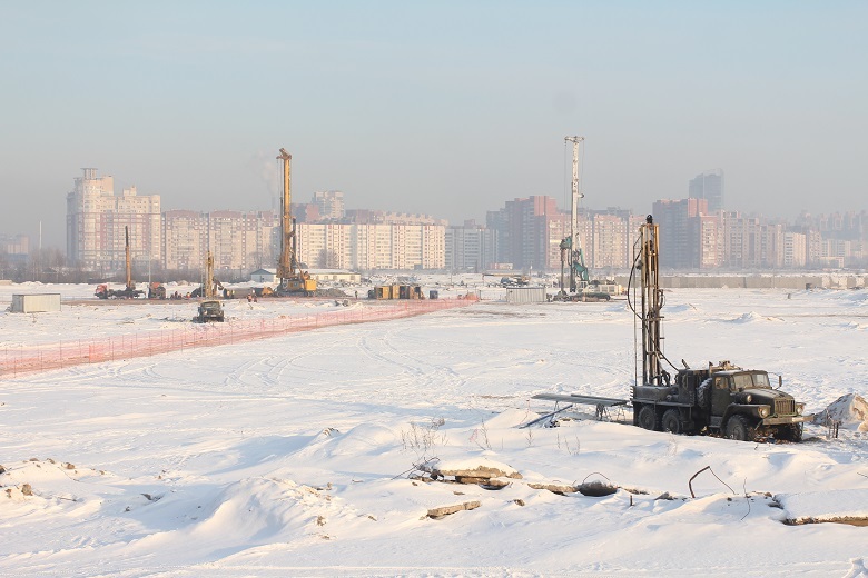
Way down!
Soil studies can be divided into three blocks: field, laboratory and calculations, which are based on the results of the first two.
As we told here , the ground is a kind of “puff pie”. The main task is to find out at what elevations different layers lie and to clarify their properties - to conduct tests in the field and in the laboratory. To do this, drill wells. The probability of "surprises" during construction is directly dependent on the depth and frequency of drilling.
Over the year, more than 200 wells were drilled in the Lakhta Center area, the total length of which is over 40 km. Well grid - 20 * 20 meters. This is the densest grid, which is used only for special occasions - unique buildings erected in difficult ground conditions.
Well pattern
Drilling depth - to the level of minus 150 meters. They did not reach the crystalline basement - in Lahta, it begins at depths from minus 187 to minus 211 meters.
Why was drilling stopped at minus 150 meters?
To understand where to stop, builders are helped by SNiPs. Go to the shield or platform is not necessary. The depth of drilling depends on the size of the compressible stratum. The sole of the pile is taken (it is already in the project at that time) and it is counted from it 20 meters down. It's enough. The heels of the deepest piles under the Lakhta Center tower are at minus 82 m. To confirm the structure of the subsoil, calculated by geophysical methods, two wells were drilled to a depth of minus 150 meters.
Soil with shells
Wells are drilled to conduct various test series. We learn about some.
Screw stamp
Looks like that:
Scheme:
Simplistically, a stamp is a piston, the cylinder of which is pressed into the ground. The surveyor measures how deep the stamp has gone and what efforts have been made for this. Stamp studies show the strength of the soil.
The typical design is suitable for work at depths up to minus 20 m. Especially for the Lakhta tests, a “double range projectile” has been developed - with a reinforced piston. He was able to sink to depths of up to minus 40 m - despite the fact that the “roof of the Upper Kotlin deposits of the upper Vendian” is located on the site at a depth of about minus 20 m. This means that clay of solid consistency begins with minus 20 m. The consistency name is not a formality. Already with minus 40 m, the clay is so hard that there are no pistons capable of pressing a stamp into it.
They do not press into this dense clay, they drill holes in it - these are such serious drills. Or such - with retractable knives for cleaning the bottom hole:
Both drills are pile, and we will tell about them.
Minus 40 is the record depth of the work of stamps and, according to the calculations of geotechnicians, the limit.
Pressiometric tests
Below minus 40 meters in the course went pressometric equipment.
The principle of its work is as follows. Prepare well in advance. Then the elastic chamber is lowered into it. Pressure is applied to the chamber, it increases and presses against the ground, after which the deformation of the sequence from the impact is measured. And here there is one discrepancy. The camera puts pressure on the ground horizontally, and the future building will press vertically. It seems that there is not much difference, but this is not so. If you go back to the puff pie analogy, this is easy to understand. Push it from above - there will be one strain, and if on the side there will be another, because you will press on a specific layer: the cream will shrink in one way, and the biscuit will be different.
(Photo from here )
To obtain reliable data from pressiometric tests, correction factors are introduced, plus cross-checking values by additional methods - for example, static sounding. The rest of the test is universal and suitable for work at any depth. In Lakhta, it was used at elevations from minus 25 to minus 130.5 m.
The result of the tests - the standard value of the deformation modulus was not less than 100 MPa from a depth of 30 m and below.
Shooting in the well at the mark - 80 m.
Test piles
Another field method is soil testing with piles. Conducted using the Osterberg Cell technology (O-Cell). During the test, the pile is installed in the ground, then it is affected by hydraulic jacks - it is pressed from above and along the side surfaces. This shows how the pile in the ground works under load, at least equal to the one that the building will have. The test is considered complete when one of the three “participants” does not stand: either the limit of the surface friction of the pile on the ground is reached (that is, its carrying capacity is not enough), or - the pile is deformed, or - the maximum power of the equipment is reached.
There were 4 test piles in Lahta. The testing process was delayed for many months. Engineers waited patiently for the pile to slack under the growing load. As a result, the jack came down first.
So revealed that one pile can withstand 4.5 thousand tons. Maybe more, but there is no equipment to check. Yes, actually, it is not necessary - there will be “only” 2.5 thousand tons of weight per one pile under the tower.
The testing process itself looks like this. Casing pipe, this size:
Sent to the mine:
There - armokarkas with sensors and jacks:
Concretes:
We are waiting for it to harden. We press jacks.
What else did you do?
Other studies include sampling, triaxial tests of the VFS method (Phase Composition Recovery Method), compression tests of the stress relaxation method, non-standard methods using relaxometers to calculate soil repacking, soil anisotropy calculations (to calculate the correction factor to the deformation modulus). Seismic microdistribution was carried out - vertical cracks and block structure of Vendian sediments were not recorded.
Sugar powder, molasses and roast
The soil is gaining density with depth. Under the "cultural" sand begins the weakest - sea and lake glacial deposits. They are light, dusty, stinging and plastic. Imagine a "dense" swamp - and you will see this layer. It goes to the level of minus 14 m.
Behind it is a more durable moraine, with a capacity of 3 to 8 meters. It is composed of debris, from pebbles to boulders. The size of the potential "surprises" can be represented by the magnitude of the Thunder-stone.
In the 18th century, a pedestal for the Bronze Horseman was searched all over Russia, and found in Lakhta. Initial weight - 2 thousand tons, dimensions - 13m * 8m * 6m. The painting "View start processing Thunder-stone." Artist Jacob van de Schleit, 1770s
Support layer
At the level of minus 18.9 m, solid clay begins with small interlayers. They go to minus 102.9 m. This stratum, with a thickness of approximately 85 m., Is the supporting layer, the goal of exploration and study. To his "roof" - less than 20 meters. Not bad! Not Manhattan, but we have something to compare.
Geotechnical conditions in the city center are much worse. The evidence of black_semargl from the discussion to the previous post - “in the center is still hard - when driving piles they go into the ground almost under their own weight,” can be backed up by surveyors. Solid clays on Okhta begin, for example, only at a depth of 40 meters, plus three aquifers along the route of deep piles at once!
More interesting is the geological atlas of St. Petersburg. On his maps you can see that from the entire area of the St. Petersburg agglomeration there is no worse place for building than the city center. It is exactly where the northern capital was born that all possible ground risks are encountered in the region. The builders were just able to reconcile the city with the ground. And they continue to do it today.
What is under the base layer? The sandstones begin below the mark of minus 102.9 m. This is a hard rock, its strength is higher than that of clay.
Sandstone rock
These rivers go nowhere
In the end - a horror story with exposure. In the St. Petersburg media roam this story:
“The city is being washed away by underground rivers ... two huge underground rivers, nearly 50 large and many small ones, flow near St. Petersburg. The largest and longest river goes under the bottom of the Gulf of Finland. At Sestroretsk, she turns and then moves underground along the coast, crosses Petersburg and moves on to Vsevolozhsk ... ”.
Citizens get scared - if under Lakhta (it turns out on the way) there is a huge river, then how to build there? You can build - neither the big nor the small river, the researchers did not find, and did not count. Petersburg is not threatened with flooding by underground rivers either.
Princess Tarakanova. 1864 Hood Konstantin Flavitsky
The basis of the history was probably the peculiarly understood information about the buried pale-valleys - that is, the beds of the former rivers that flowed into the Gulf of Finland after the Great Glaciation melted. Now there is no watercourse.
Paleodolin. Petersburg is much smaller and - under the thickness of the soil.
In the north of St. Petersburg, the buried bed is a complex geological object, 1.5–2 km wide and 25 km long, with a heterogeneous section and, as a result, the rocks are looser — high groundwater levels — something that can hardly be surprised by Petersburg builders Petra. Will consider, but will not be frightened.
Paleo-valley scheme. The data of FSUE “Mineral” from the article of T.N. Nikolaeva, L.P. Norovoy "Engineering and geological conditions of construction in the paleo-valley region in the north-west of St. Petersburg"
The “Lakhta Center” (red arrow) section of the paleo-valley is completely bypassing, although relatively close.
-
There is a tactic in relying on a layer of hard clay. It takes into account that a skyscraper weighing 600 thousand tons will put pressure on the ground with a small area: each of the 3 base plates of the whole - 5,700 sq. M. Most of the vertical loads are perceived by the core, whose area at the base is about 500 square meters. m. How to redistribute the load from the center of the building and make the most of the carrying capacity of the soil? Read about it in the following posts.
-
Consultants:
V.M. Lukin - project manager for reinforced concrete structures "Lakhta Center", Ph.D. R.V. Inamov - Chief Designer of Lakhta Center, Candidate of Technical Sciences
Source: https://habr.com/ru/post/401085/
All Articles