How to deceive the whole world and become famous with the help of Google Maps
The world's major media outlets, and after them the Russian ones, carried the news about a Canadian schoolboy who discovered the lost city of the Mayan civilization with the help of satellite images. The boy accepts official greetings, gives interviews in dozens and collects money for an expedition to the jungle.
This news would have looked good on April 1, but it was published on May 7 on the website of the Canadian newspaper le Journal de Montreal . Judging by its main content, this is something like “Komsomolskaya Pravda”, and not “Questions of Archeology,” from where I would like to gather such information.
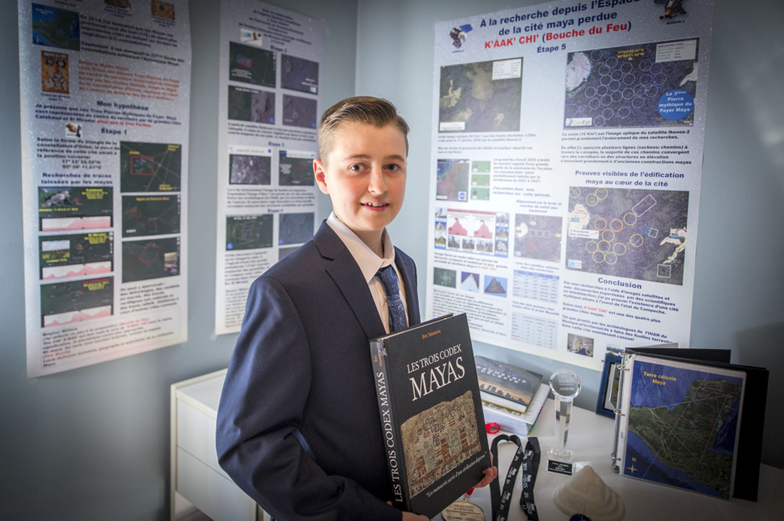
The news is about a Canadian schoolboy, William Gadoury, who was preparing a project for some kind of school competition about the use of satellite imagery data. He won the contest, and there, apparently, journalists noticed him. And it started ...
')
According to the student, specialists from the University of New Brunswick helped in his search, and additional satellite images were provided by the Canadian and Japanese space agencies. The university’s website has an entry dedicated to this story, where it can be seen that the participation of specialists from this institution consisted in the fact that they advised the student to use satellite imagery for different years. Although on the whole, the rhetoric is approving and there is no critical skepticism there. On the website of the Canadian Space Agency in the same way you can see congratulations to William.

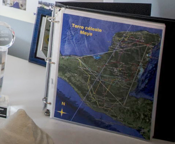
William says he managed to find a Mayan city when he plotted a map of 23 constellations on the map of Yucatan. Of the 142 stars of the constellations, he found a match for 117 Mayan cities. And in one place a particularly bright star did not find a match on the ground. Then he used the satellite imagery data and found signs of a lost city. According to him, it was possible to detect 86 meter pyramid (although it is not clear about the height or width of the base), more than 30 man-made structures, and even estimate the approximate area from 80 to 120 sq. Km, which makes the found “city” the fourth largest in Mayan civilization. .

Despite congratulations from official Canadian structures, this whole story smacks of an unscientific tinge characteristic of the “studies” of Muldashev, Demin, and other space searches.
Firstly , the position of the journal le Journal de Montreal, which publishes just one slide from William's presentation, is surprising, and at the same time declares that “the images are at the disposal of the journal”. Who do you cherish for?
Secondly , the search for conformity of constellations in terrestrial settlements implies an impeccable geodesic service of the ancient Maya, which made it possible to build maps of Yucatan with high accuracy, and then to plan the construction of all the cities of civilization on them.
More likely just a coincidence. As one of users of Geektimes commented:
Give me a map of any terrain in Russia and in half an hour I will drive under it some fragment of the starry sky, playing with the scale and rotating the constellations. Will this serve as proof that the construction in Russia is conducted in accordance with the location of the stars?
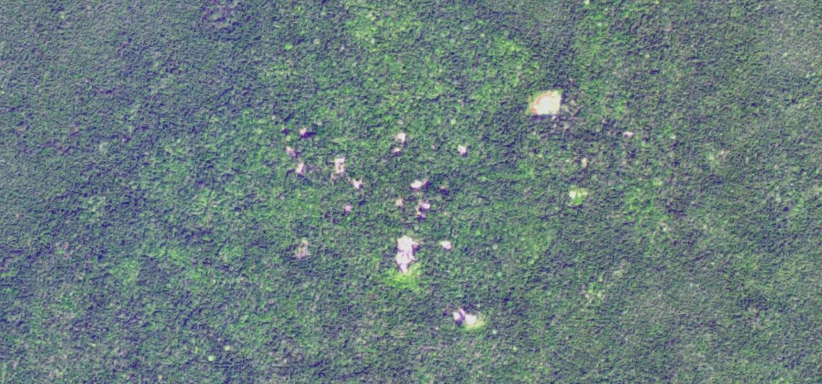
Thirdly , if you find these ruins of the “city” on Google maps, and compare them with the real ruins of the ancient Mayan cities that are nearby, then you will doubt whether it is possible to find at least something hand-made under dense forest cover. Those. no 30 structures could be found there even if they were.
For example, the remains of the city of Calakmul , once a population of 50 thousand people, in the center - 45 meter pyramid.
But Tikal is a major political and cultural center of the Mayan civilization. The population is up to 90 thousand people. Now - a major tourist center.

Many buildings under the trees managed to consider?
Fourthly , indeed, in the given pictures one can see obviously anthropogenic structures: until nature learned to cut forests into rectangles.
Most likely this is the area the child took under the remnants of the pyramid. Journalists from le Journal de Montreal support his hypothesis by saying that “there is not a single modern city at a distance of 100 km”. However, ordinary villages there are only 15 km away, and they are all surrounded by exactly the same anthropogenic rectangles - these are ordinary forest clearings.
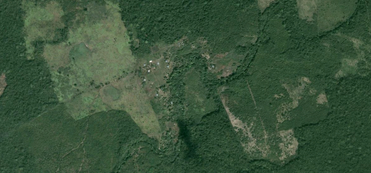
The “pyramid” that the boy found was most likely knocked out a few years ago and now she is beginning to overgrow, but this was clearly not in Maya.
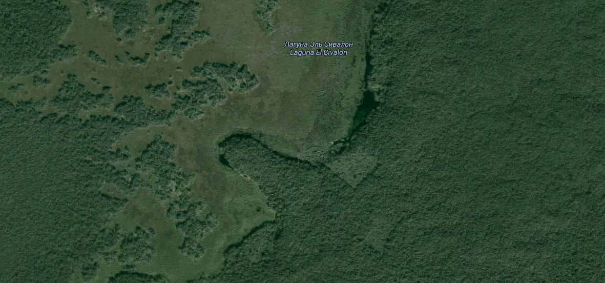
For the jungle, even 15 km is a lot, so it is unlikely that it was the inhabitants of the nearest village who went to clear the field on the bank of the swamp. But there are similar old cuttings and closer to the “pyramid”. Traces of 10-20-year economic activity can be found in 5 kilometers.
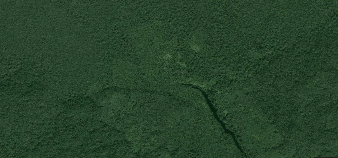
Upd: In the comments in LiveJournal, they advised us to use the Google Earth Engine service , which allows you to "rewind time back." And exactly, the cutting down appeared in 1999:

Fifthly , it would be good to see comments of this news not only by specialists in space imagery, but also by professional archaeologists specializing in this region and at this period. Apparently, the boy fell victim to the standard paranoia of the discoverer - “I will tell others, and they will appropriate my discovery”. Or maybe just the journalists did not want to debunk a beautiful fairy tale about a child prodigy.
The guy, of course, well done, despite the erroneous basic hypothesis, did a lot of work, touched the applied use of space imagery data, and certainly deserved the victory in his school competition. I do not think that he seriously wanted to deceive someone. I hope in the future this mistake will not prevent him from becoming a cartographer, archeologist or space imaging specialist, i.e. to connect your life with science. But the staff of the Canadian Space Agency, universities and all the major world media outlets who replicated this “success story” deserve a solid deuce.
Source: https://habr.com/ru/post/393829/
All Articles