Video: launch of the last satellite of the Indian navigation system
The US has GPS, Russia has GLONASS, and India has IRNSS, the Indian regional satellite navigation system. The seventh satellite, which completed the deployment of IRNSS, was successfully launched from the cosmodrome in the Bay of Bengal. The system provides navigation services with high accuracy only in India.
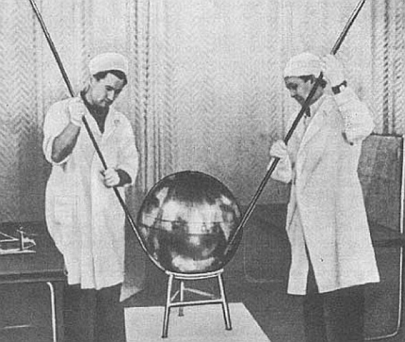
In 1957, the first artificial Earth satellite was launched in the USSR. Due to the Doppler effect, the frequency of the received signal increases as the satellite approaches and decreases with distance - knowing the position of the satellite, you can determine your own speed and coordinates.
')
In the United States in 1974, they launched the first of 24 GPS satellites that are needed to cover the entire Earth. The last of the satellites of the American system was launched into space in 1994. In the USSR, the GLONASS project began to be developed in 1976, but the first two satellites were launched only in 1984. Although the system was launched in 1995, it was not widely used, but in 2010 it resumed full-scale work. For several years we have been buying smartphones with GPS and GLONASS on board.
GPS Satellite at the San Diego Museum

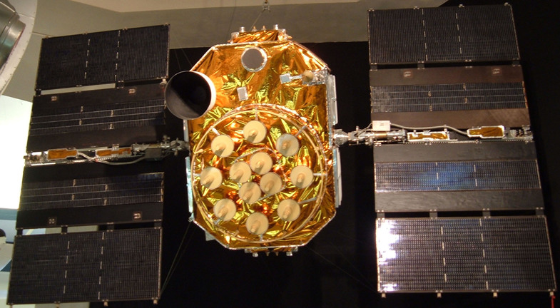
Second-generation GLONASS satellite
India decided to acquire its own navigation system. The IRNSS system consists of seven satellites in geosynchronous orbits at an altitude of 36 thousand kilometers. The first satellite of the system, IRNSS-1A, was launched on July 1, 2013, the seventh one - on April 28, 2016. The satellite weighs 614 kilograms and is equipped with two solar panels, generating up to 1660 watts. The navigation system will work only in India, a little beyond its borders.

The first satellite system IRNSS-1A
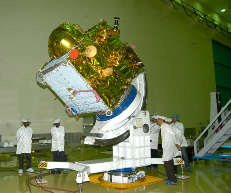
The first satellite system IRNSS-1A
In 1957, the first artificial Earth satellite was launched in the USSR. Due to the Doppler effect, the frequency of the received signal increases as the satellite approaches and decreases with distance - knowing the position of the satellite, you can determine your own speed and coordinates.
')
In the United States in 1974, they launched the first of 24 GPS satellites that are needed to cover the entire Earth. The last of the satellites of the American system was launched into space in 1994. In the USSR, the GLONASS project began to be developed in 1976, but the first two satellites were launched only in 1984. Although the system was launched in 1995, it was not widely used, but in 2010 it resumed full-scale work. For several years we have been buying smartphones with GPS and GLONASS on board.
GPS Satellite at the San Diego Museum
Second-generation GLONASS satellite
India decided to acquire its own navigation system. The IRNSS system consists of seven satellites in geosynchronous orbits at an altitude of 36 thousand kilometers. The first satellite of the system, IRNSS-1A, was launched on July 1, 2013, the seventh one - on April 28, 2016. The satellite weighs 614 kilograms and is equipped with two solar panels, generating up to 1660 watts. The navigation system will work only in India, a little beyond its borders.
The first satellite system IRNSS-1A
The first satellite system IRNSS-1A
Source: https://habr.com/ru/post/393447/
All Articles