Facebook Internet drones will work on the basis of maps processed by Facebook AI
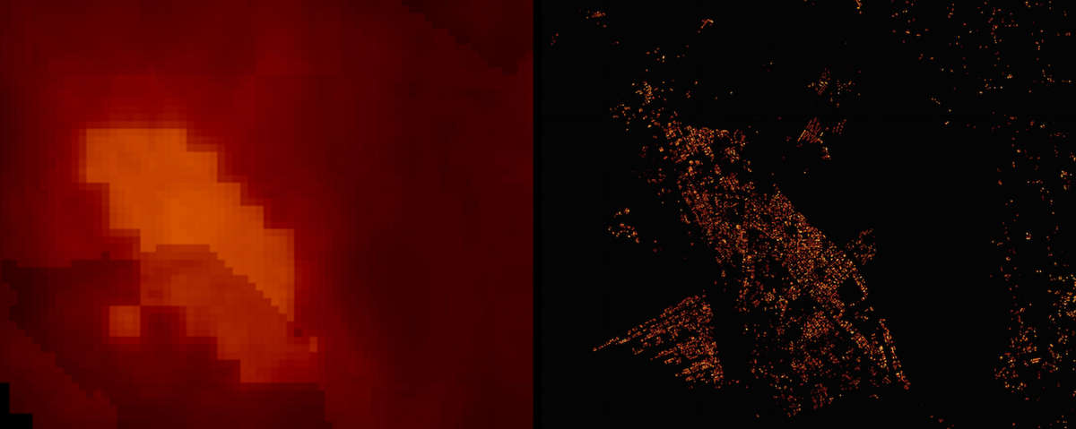
The map on the right is the population density map obtained by the algorithm, on the left - the source code (photo: World Bank, Facebook)
Maps have always been valuable - they are needed by scientists, military, government agencies and ordinary citizens. Now maps and cartographic material are becoming an increasingly important source of information - they are used in a huge number of services. For example, Google’s mobile works are based on detailed maps (map information is used with a number of other data).
Facebook Connectivity Lab announced the creation of its own high-resolution population density maps for 20 countries. The accuracy of the cards is about 5 meters. The map material will be used for Facebook drones , which will be able to provide residents of remote remote regions with access to the Network. To know where to fly, drones will use these cards.
The original maps were obtained by a social network from the World Bank and Columbia University: 14.6 billion images totaling 350 terabytes. In order to determine exactly where people live, Facebook used an AI algorithm that identified objects. On shared maps, Facebook was able to identify houses, industrial buildings, roads.
')
For the training of the algorithm, the project team “fed” to the service about 8,000 originally labeled maps of the country, with a description of whether there are buildings in the photo or not. Then the algorithm was trained to determine the presence of buildings independently. This method then allowed to improve the resolution of the original source cards.

The original map from the World Bank (above) and the modified map from Facebook (below) (photo: World Bank and Facebook)
What should be the resolution of the card? The main task is to identify objects whose size is close to the range of a conventional Wi-Fi network. This is approximately 5 meters. Facebook is seeking such permission for its cards.
Maps can be used for other purposes, Facebook will soon put them in open access. So other organizations will be able to determine where improvement of the existing energy infrastructure or water supply system is required.
Well, the Internet in these regions is taken to provide Facebook.
Source: https://habr.com/ru/post/390929/
All Articles