Iceland Greenland in 3D from NASA
Studying the Greenland ice sheet is an important task. Climate warming is gradually affecting the dynamics of glaciers, and there is more water in the Greenland ice sheet than in any other glacier (except Antarctica). If all this starts to thaw (and is already melting), then many regions can simply be flooded, which is already observed in the case of Maldives, Manhattan and other regions.
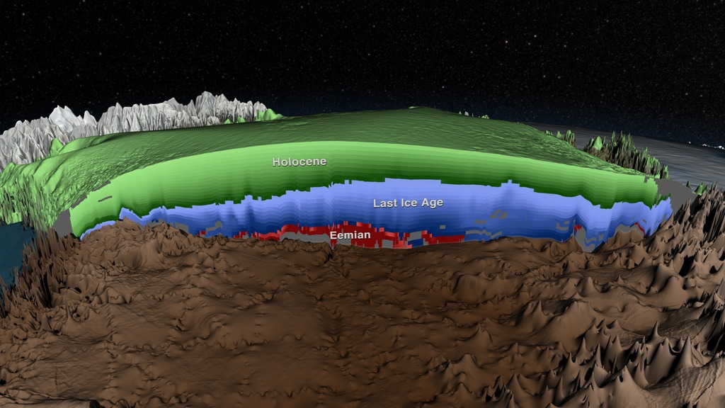
Scientists have been studying the Greenland ice sheet for many decades, observing glaciers from airplanes, studying them from satellites, conducting aerial photography and “scanning through” the ice mass. NASA even has a special plane to study the glaciers called Operation Icebridge. This aircraft has made hundreds of sorties since 2009, flying from one end of the island to the other in different directions. A radar that “shines through” the ice is working on the plane.
Measurement of the reflection time of a radio signal from rocks lying under the ice, as well as signal strength, allows you to find out how thick the ice lies in a particular region.
')
In addition to the aircraft, experts use radar to study the glaciers of Greenland, from 1993 to this day. Now NASA scientists have combined this data with data obtained from Operation Icebridge and some other information. The study of glaciers is necessary not only to understand how quickly they melt, but also to compare the climatic changes of previous eras with the climatic changes of the current epoch (some periods in the history of the Earth were very similar to the current, in terms of climate).

The video model was created by experts from the Scientific Visualization Studio from NASA. A detailed description of the model is in the Journal of Geophysical Research Earth Surface .
Source: https://habr.com/ru/post/376103/
All Articles