Six types of clouds you need to know - and what they say about the weather
Current weather forecasts are based on sophisticated computer simulations . These simulations use physical equations that describe the atmosphere, including the movement of air, solar heat, the formation of clouds and rain. The gradual improvement of forecasts over time means that today's five-day forecasts are as accurate as the three-day forecasts were 20 years ago.
But you do not need a supercomputer to predict how the weather will change over your head in the next few hours - similar signs have been known in different cultures for many thousands of years . By following the sky and having some knowledge of cloud formation, it is possible to predict whether it will rain.
Moreover, a small understanding of the physics of cloud formation underscores the complexity of the atmosphere and sheds light on the reasons why weather prediction for more than a few days turns out to be such a difficult task.
')
Here are six types of clouds that can be seen, and how they can help you understand the weather.
1) Cumulus clouds
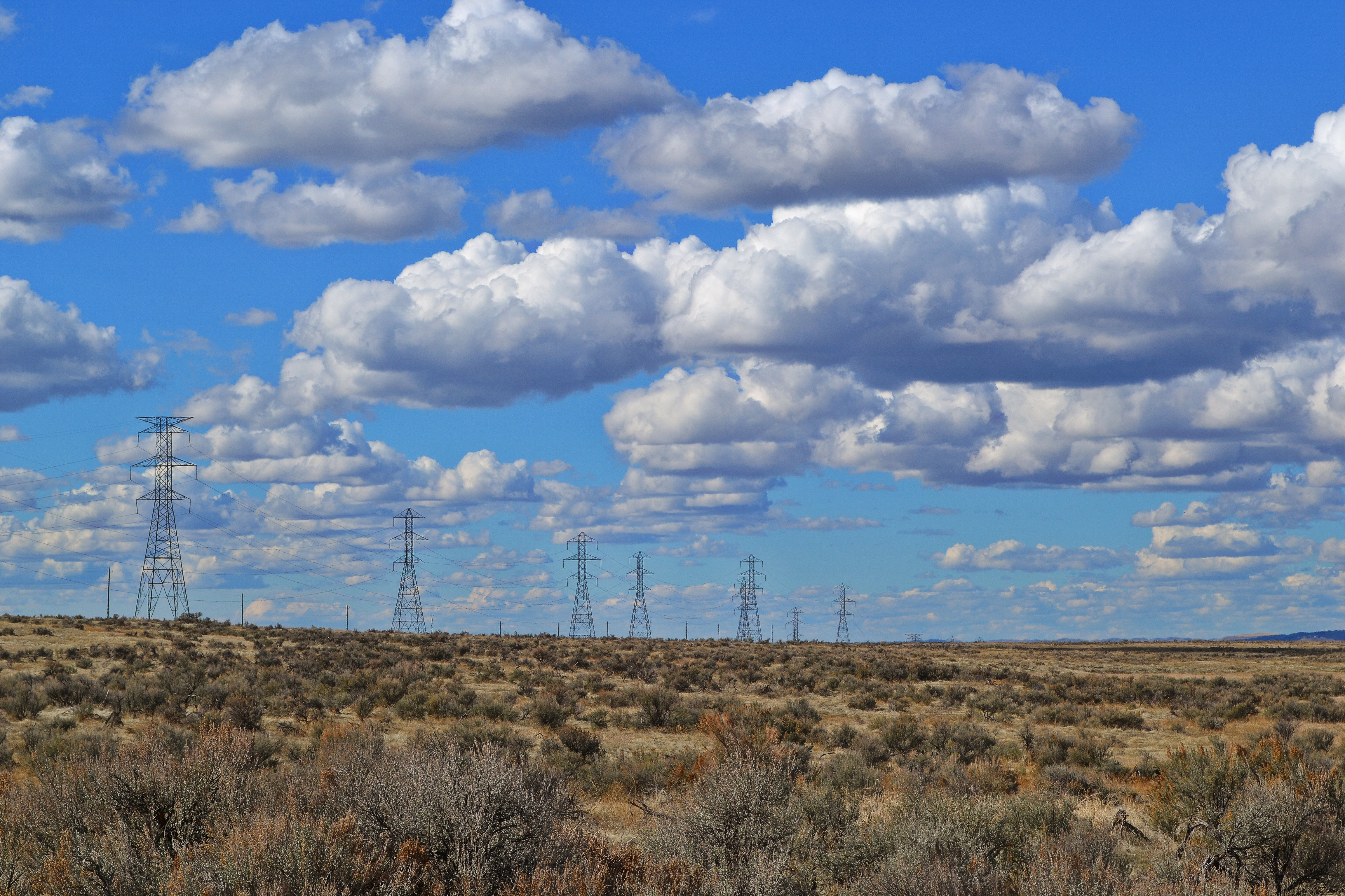
Small white fluffy clouds
Clouds appear when the air is cooled to the dew point , the temperature at which the air can no longer cope with the water vapor contained in it. At this temperature, water vapor condenses and forms droplets of liquid water, which we see as a cloud. For this to happen, the air must be forced to rise in the atmosphere, or humid air must come in contact with a cold surface.
On a sunny day, the rays warm the earth, which warms the air just above it. Heated air due to convection rises and forms cumulus clouds . These “good weather” clouds look like cotton wool. If you look at the sky filled with cumulus clouds, you can see that they have a flat bottom, located at the same level for all clouds. At this altitude, air that rises from the ground level is cooled to the dew point. Rain does not usually come from cumulus clouds - which means that the weather will be good.
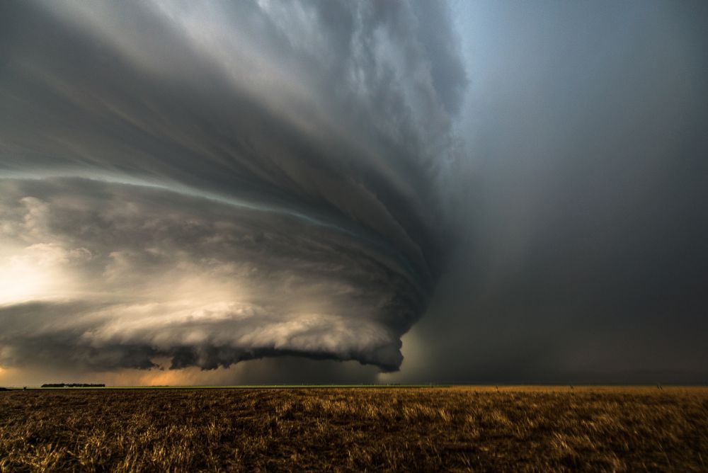
2) Cumulonimbus Clouds
Small cumulus clouds do not rain, but if they grow and grow in height, this is a sign that it will soon be raining heavily. This often happens in the summer when morning cumulus clouds turn into cumulonimbus in the afternoon.

Not far from the earth, cumulonimbus clouds are clearly defined, but with height they begin to become more smoky at the edges. Such a transition indicates that the cloud no longer consists of water droplets, but of ice crystals. When the gusts of wind blow water drops out of the cloud, they quickly evaporate in a drier environment, which is why the water clouds have very sharp edges. Ice crystals, which are carried outside the cloud, do not evaporate so quickly, due to which the edges of such a cloud look more smoky.
Cumulonimbus clouds often have a flat top. Convection of air takes place inside such a cloud, and it gradually cools until it reaches the temperature of the surrounding atmosphere. At this point, he loses buoyancy and can no longer rise higher. Instead, it spreads to the sides, forming the characteristic shape of the anvil.
3) Cirrus clouds
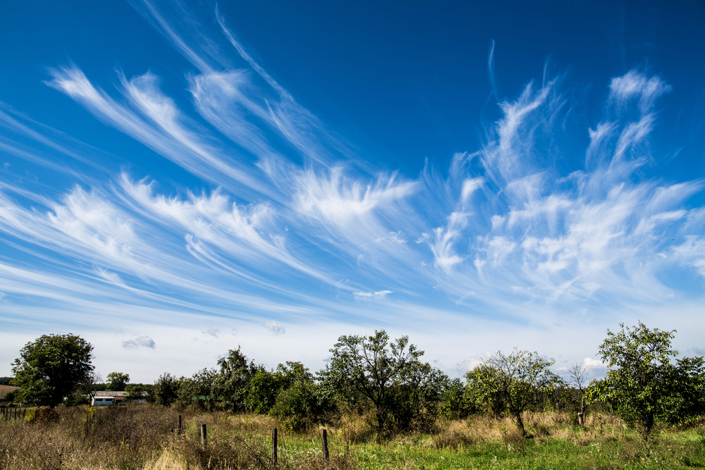
Cirrus clouds can mark the approach of a warm front and rain
Cirrus clouds form in very high layers of the atmosphere. They are smoky because they are completely composed of ice crystals falling in the atmosphere. If cirrus clouds carry winds moving at different speeds, they acquire a characteristic curved shape. And only at very high altitudes or at high latitudes, cirrus clouds give out rain reaching the ground.
But if you notice that cirrus clouds begin to cover a large area of the sky, become lower and thicker, then this is a sure sign of a warm front approaching. In the warm front there are warm and cold air masses. Lighter warm air rises above the cold, which leads to the formation of clouds. The descent of the clouds indicates the approach of the front, and that it will rain in the next 12 hours.
4) Stratus clouds

Layered clouds: dark
Stratus is a low lying, continuous cloud sheet covering the sky. Stratus clouds are formed slowly by ascending air or a gentle wind covering cold land or the surface of the sea with moist air. The stratus clouds are thin, therefore, despite the gloomy picture, it is unlikely to rain from them, with a slight drizzle at most. Layered clouds are identical to fog, so if you ever walked through a mountainous area on a foggy day, you were inside a cloud.
5) Lenticular clouds
The last two types of clouds will not help you to predict the weather, but will give a primary idea of the extremely complex movements of the atmosphere. Smooth and lenticular lenticular clouds form when air is blown up and through the mountain range.

Having passed through the mountain, the air descends to its former level. At this time, it warms up and the cloud evaporates. But it can slip further, with the result that the air will rise again and form another lenticular cloud. This can lead to the formation of a chain of clouds extending far beyond the boundaries of the mountain range. The interaction of wind with mountains and other surface features is one of many details that must be taken into account in computer simulations to obtain accurate weather predictions.
6) Kelvin - Helmholtz
And finally, my favorites. The Kelvin-Helmholtz clouds resemble a breaking ocean wave. When air masses at different heights move horizontally at different speeds, their condition becomes unstable. The boundary between the air masses begins to become rippled and forms large waves.
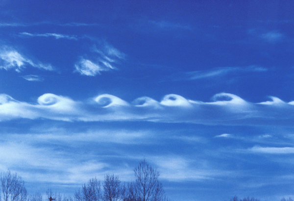
Such clouds are quite rare - I personally saw them only once over Jutland, western Denmark - since we can observe this process in the atmosphere only if there is a cloud in the lower air mass. Then it can describe breaking waves and detect intricate movements occurring above our head, which are usually not visible.
Source: https://habr.com/ru/post/374459/
All Articles