Google has significantly improved the quality of satellite maps
Thanks to Landsat 8 satellite

Old maps of Google Maps: New York City Central Park area
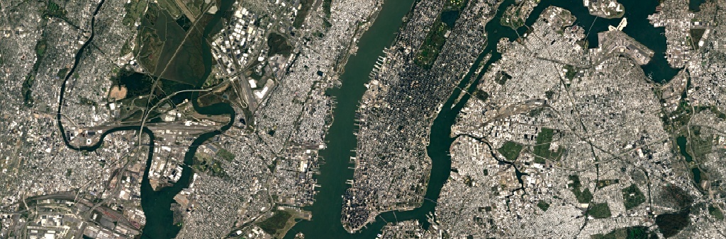
New Google Maps
Every few months, Google updates its satellite maps with Google Maps and Google Earth, adding new satellite photos and improving processing methods. For example, three years ago the company learned how to make a cloudless sky mosaic .
Today, Google conducted the largest satellite map update in the last few years, using Landsat 8 satellite imagery.
Landsat 8 satellite remote sensing satellite was launched into orbit in February 2013. He takes photos with a resolution of 15/30/100 meters on the spot. Operational Land Imager (OLI) and Thermal InfraRed Sensor (TIRS) sensors have a higher signal-to-noise ratio (SNR) and allow you to shoot up to 12 bits per pixel. The OLI sensor receives images in nine ranges of visible light and near infrared range, and TIRS - in two ranges of the far (thermal) IR. The positioning accuracy of the tools is 12 and 41 meters, respectively.
')
Google reports that the new satellite photo database not only uses higher quality images, but also uses new photo processing and gluing techniques. Not the last role in this was played by better source data, because the new Landsat 8 satellite uses long linear arrays of photosensors, which immediately remove the entire width of the satellite's field of view - 185 kilometers.
The cloudless mosaic technique has been improved, so that the seamless mosaic as a whole has become clearer and clearer. This is an important improvement, because every day the clouds cover about 70% of the earth's surface .
New photos improve the quality of only satellite photos of medium and general plan (zoom from 0 to 12) , but not the most detailed photos of cities at maximum zoom, which are supplied by other private and public satellites, including those from DigitalGlobe.
Despite this, the difference in quality is amazing.
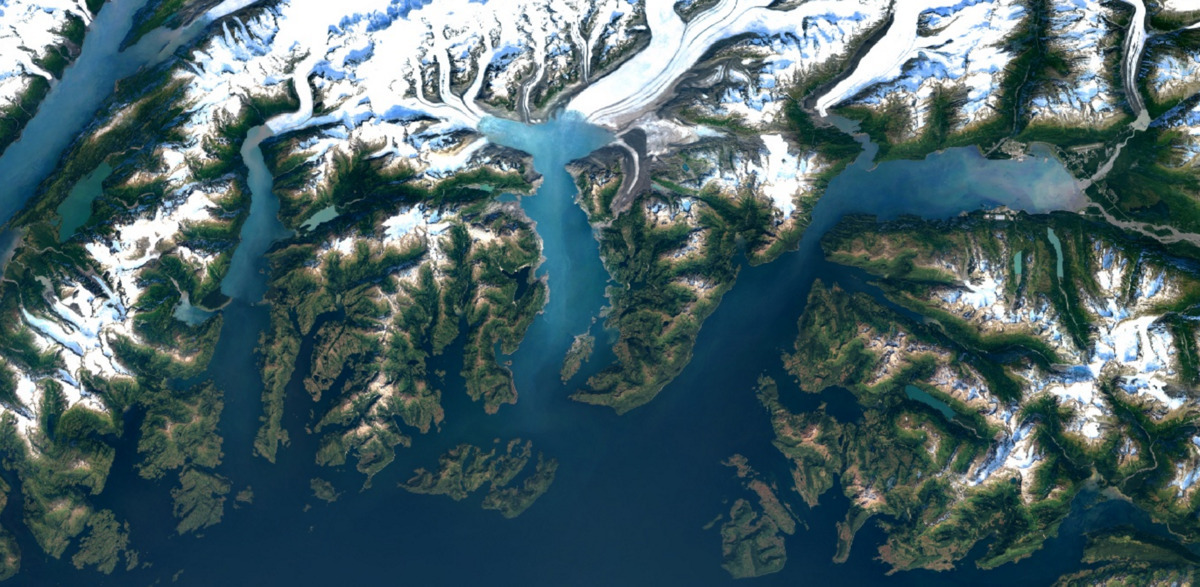
Columbia Glacier in Alaska
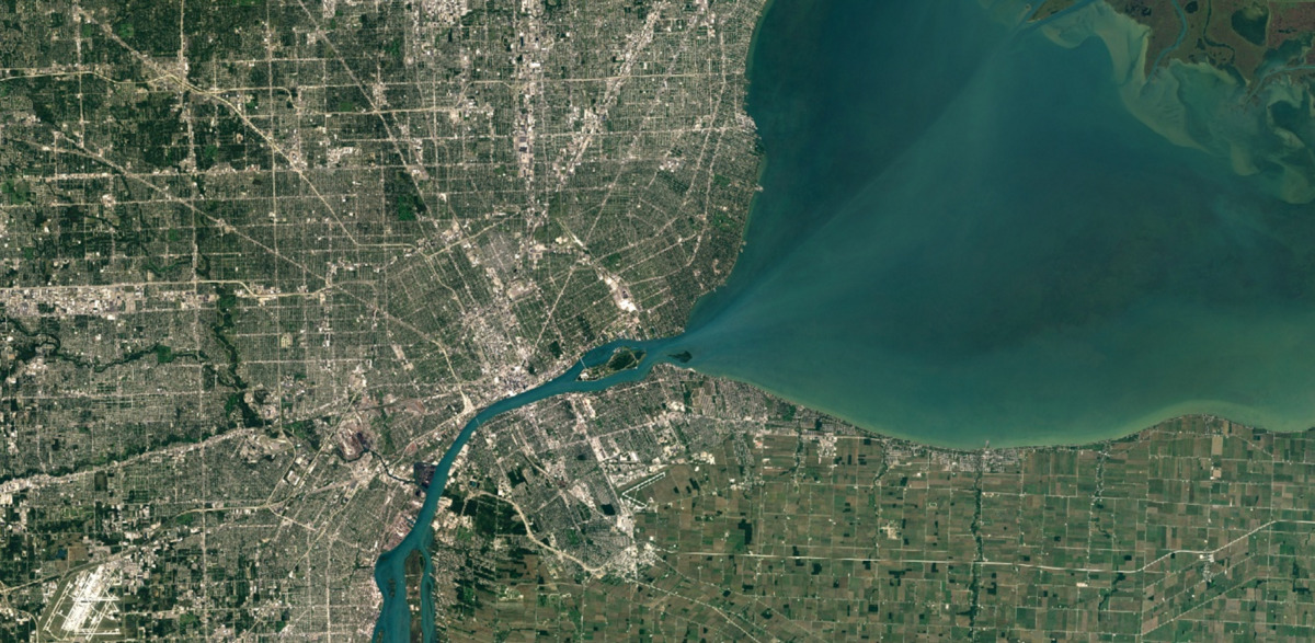
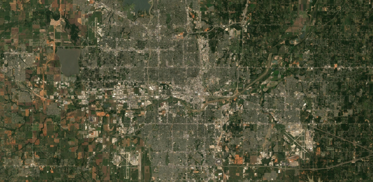
Detroit City, USA (north and west of the river)
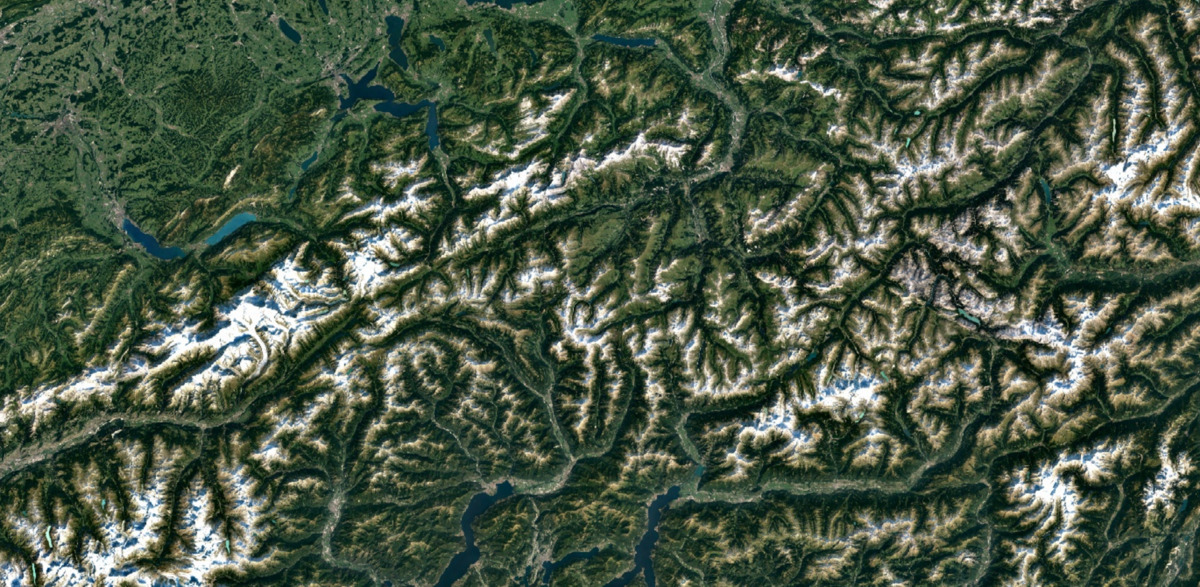
Swiss Alps
The Landsat 8 toolkit is much more advanced than that of Landsat 7 - and this is immediately evident in the photographs, which are distinguished by better detail, more saturated colors. In addition, Landsat 8 is characterized by an unprecedented frequency of updating images: every day it takes almost twice the area than Landsat 7 (400 scenes per day for Landsat 8 versus 250 scenes per day for Landsat 7).
Google admits that in recent years it has made a mosaic of satellite maps only from Landsat 7 photos, which, after a hardware failure in 2003, began to send poor-quality data — photos with large diagonal white stripes. For example, here are the pictures of the same territory in the American city of Oklahoma City in 2000 and 2003.
Oklahoma City, July 9, 2000
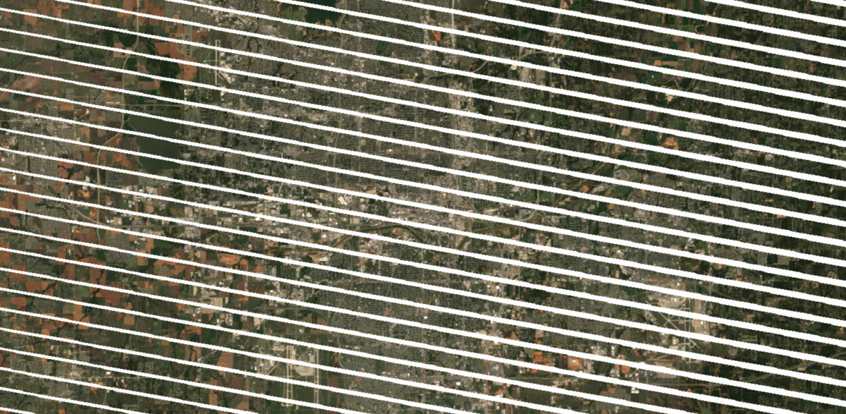
Oklahoma City, September 20, 2003
Photos with such stripes are more difficult to glue into a single mosaic.
For processing, standard Earth Engine APIs were used, including those available to third-party researchers. The same API was used by scientists to compile interactive maps of changes in the forest cover of the planet and maps of malaria risk .
The mosaic of the entire surface of our planet, Google, was made up of Landsat 8 photos with a total volume of about 1 petabyte , with a cumulative resolution of 700 trillion pixels . For comparison, this number of pixels is about 7000 times more than the estimated number of stars in our Milky Way galaxy, or 70 times more than the estimated number of galaxies in the Universe.
It took more than 6 million hours of CPU time to stick together 1 petabyte of Google photos: the task was calculated for almost a week on a cluster of 43,000 computers in the Google computing cloud.
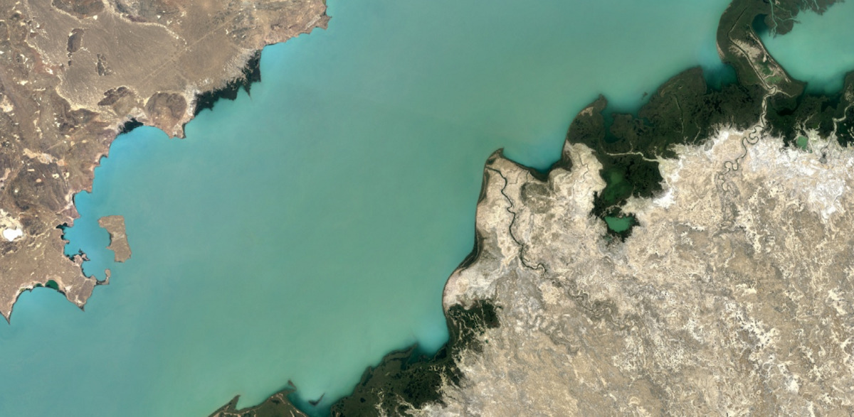
Lake Balkhash, Kazakhstan
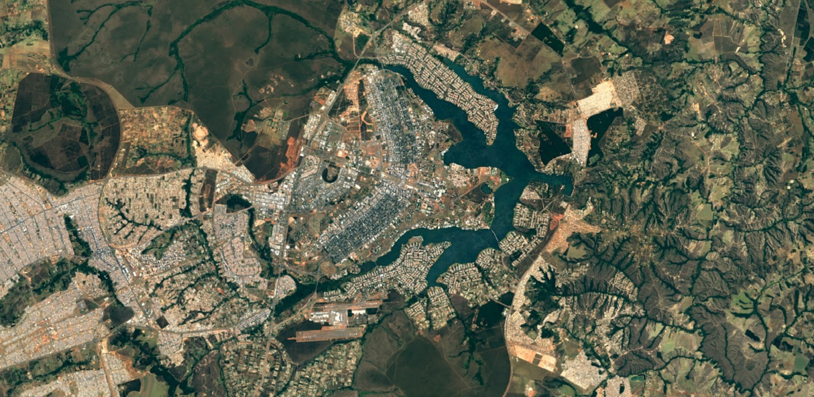
Brasilia City, Brazil
From today, new satellite photos are open in all Google map products, including the Google Maps satellite layer.
Source: https://habr.com/ru/post/372427/
All Articles