Flight to Venus and Mercury, or sorting and sorting RAWs 40 years ago
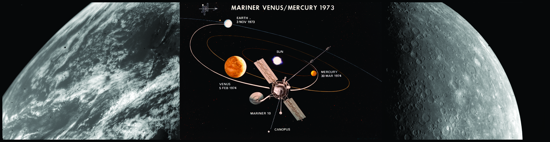
At the end of 1973, the Mariner-10 station was launched. In February 1974, she flew past Venus, transferring the first photos of her cloud cover, and then headed for Mercury. Reaching him, she successfully photographed and its surface. It was the only station that visited Mercury in the twentieth century, because of which the “Venusian” part of its mission was somewhat forgotten. And this is despite the fact that the pictures transmitted by her were of very high quality.
Picking up good photos of Venus, I first wanted to take already prepared and processed frames from the Mariner 10, but for various reasons they did not fit me. After that, I decided to independently try to collect the pictures I needed from the source materials transmitted by this station. I knew for sure that her telemetric information is publicly available, and anyone can download it.
')
We are talking about this site here: pdsimage.wr.usgs.gov
We are interested in the folder: pdsimage.wr.usgs.gov/Missions / Mariner_10
There are 57 folders with files. Each has approximately 230 images. And I have a suspicion that each folder in 1975 was a separate coil with a magnetic tape, on which images were recorded. Judging by the date of the file, in 1993 they were digitized, transferred to a more familiar look, in 1999 they were copied onto a CD, after which anyone could order pictures from NASA, and in 2009 they were posted on the Internet, for general access.
What are these files like? First I want to say that the software for viewing these images has existed for a long time. Here you can download the 2001 program from Piotr A. Masek petermasek.tripod.com/mariner.html
In addition to converting files, it also removes noise, restores skipped fragments and performs color correction. It is very convenient to process individual files. But in my case, it was necessary to view thousands of files (altogether there are 13029 photos), and I began to think about ways of automated processing. Moreover, a careful look at the source materials revealed two points. First, they are stored there in a manner far from chronological. This became quite obvious when I discovered a snapshot of the Earth from the departure trajectory among the images of the cloud cover of Venus. Secondly, often the same photo was stored in different folders under different names.
In general, it was decided to create a program that processes all the images and converts them into a more familiar graphic format, and also changes the name to a convenient sort.
This turned out to be possible after the EXIF of 40 years ago was found in the header of each file, using which you can accurately determine the parameters of each image (see screenshot).
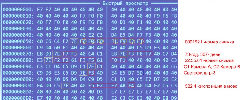
It can be seen that this picture was taken in 1973. November 3 (307 day from the beginning of the year) at 22:35:01. A long-focus lens, through an ultraviolet polarizing lens (came at number 3). Exposure for half a second. Each shot had a unique number, but during the flight the counter overflowed, and the countdown started from scratch.
The only moment in EXIF that could not be understood is highlighted with a blue rectangle. However, I think that the angles of rotation of the television platform or the temperature of the cameras are encrypted there.
Knowing all this information, a small file was written that read the source file and converted it to a .bmp file with a name like 74_036_17h43m13s_0057856_02U.bmp. That is, with the exact time of the image, the internal unique number, the type of camera and light filter. The first versions of the program threatened to process 13 thousand files (approximately 9 GB) in 20 hours, but it was possible to reduce this time to 15 minutes.
Equipment
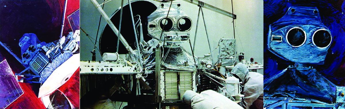
The cameras are clearly visible on this collage.
In fact, these files are among the very first digital photos in history. A station like Marinera-10 is one of the earliest prototypes of digital cameras. They are even more suitable for the role of such prototypes than the first Kodak digital camera of 1975. Yes, the Vidicon was used for image acquisition, not VCDs, but the rest of the processing was digital. For the processing of photographs, the station’s standard computer was used, it could also select exposure parameters, and the pictures could be saved to the onboard memory. As shown, each snapshot was marked with detailed attributes to facilitate processing, and there were even certain techniques for saving images with losses. However, the memory is rarely used. Usually used direct transfer of images to Earth. The cameras and the antenna had an individual guidance system, and usually the station directed the antenna to Earth, and the cameras to the object of interest and transmitted photos in almost real time. The transfer rate was 14.7 KB / s. On transfer of one picture 42 seconds left.
Vidicons Mariner-10 gave a picture with a resolution of 832x700 elements with 256 shades of gray. That is, 8 bit. As it was written then in the NASA advertising booklets, 256 grayscale is much more than the human eye can distinguish. However, in the files themselves the information is stored in lines of 968 elements. I suspect that extra elements have been added when recording on Earth.

The appearance of the cameras can be seen in the diagram. The television system consisted of two cameras with a focal length of 1500 mm. Shooting was carried out through different light filters, it was also possible to switch to a wide-angle lens with a focal 62 mm. Crop factor vidicon was 2.7, which means that EGF was 4050 mm and 167 mm. Among the light filters were blue, orange, ultraviolet, ultraviolet-polarizing (wavelengths 3550A, 4740A, 4820A, 5120A, 5780A, 3580A).
Result
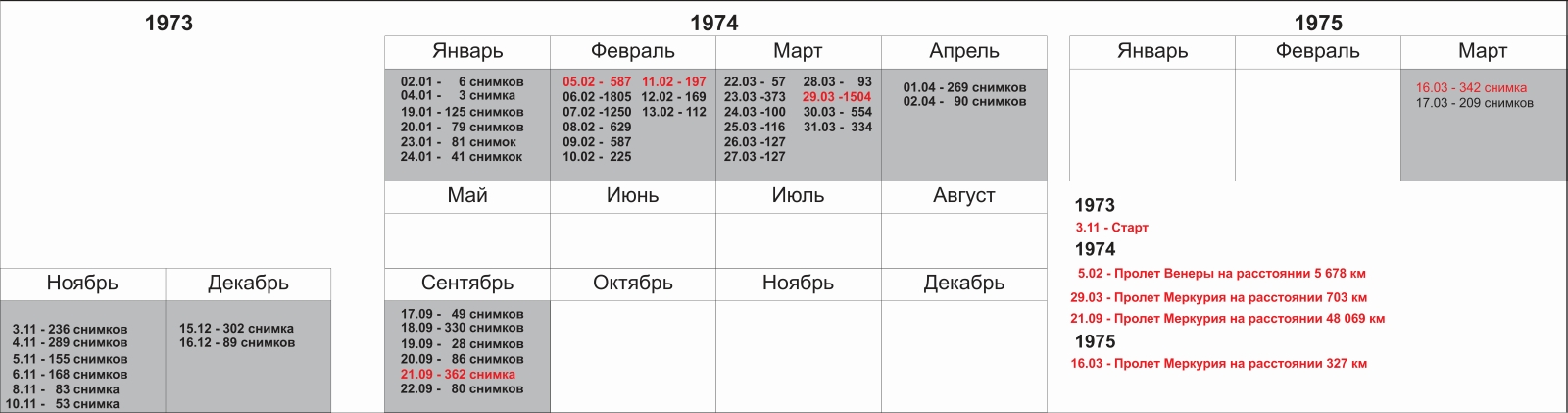
After processing, it was possible to obtain such statistics on files. Among other things, it was discovered that the photographing of Mercury from 1975 was marked 1974. Processed and sorted photos can be downloaded here: cloud.mail.ru/public/Gd9d/TdUPRrjPy
What have we got?
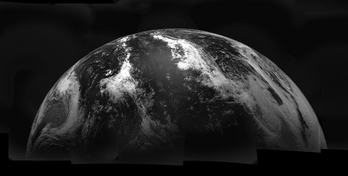
Earth and moon
Soon after the start, the Earth was photographed from the departure trajectory. First, several pictures were taken with a wide-angle lens, and then switched to telephoto.
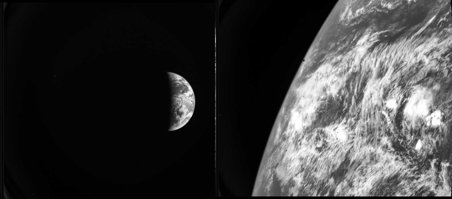
If you collect all the pictures and process, you get such a panorama.
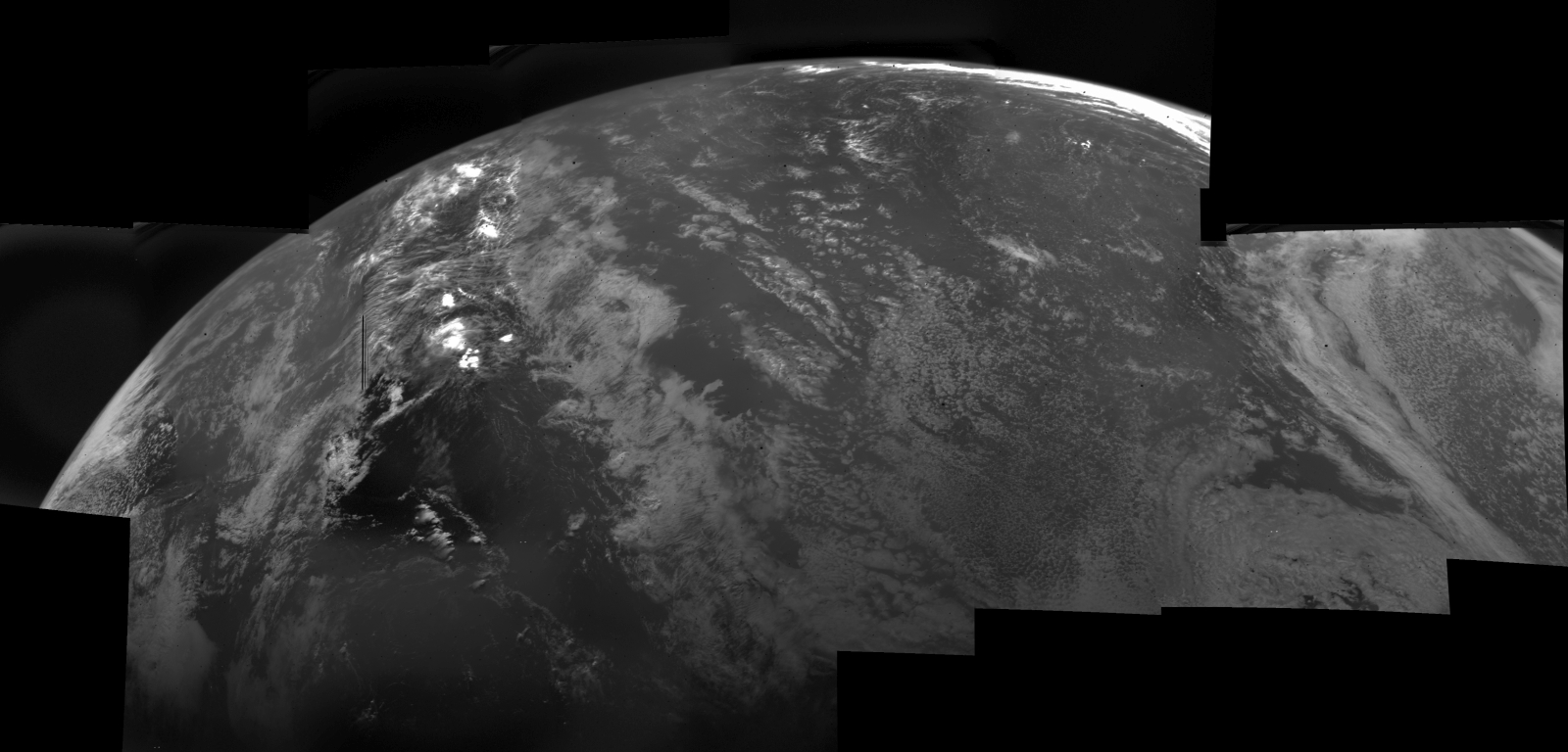
Land. November 3, 1973.
And this is November 4
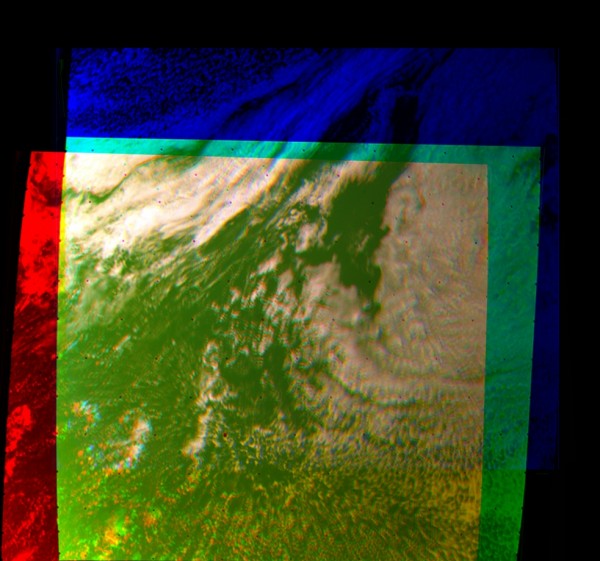
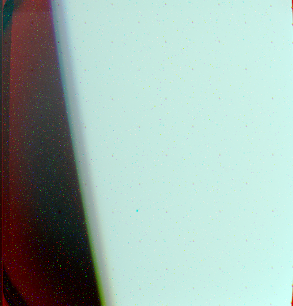
Unfortunately, the RGB filter was not there. So I tried to assemble a color image using blue, orange and ultraviolet light filters. Alas, nothing much happened.
More spectacular were the panoramas of the moon. However, unfortunately, more fragmented
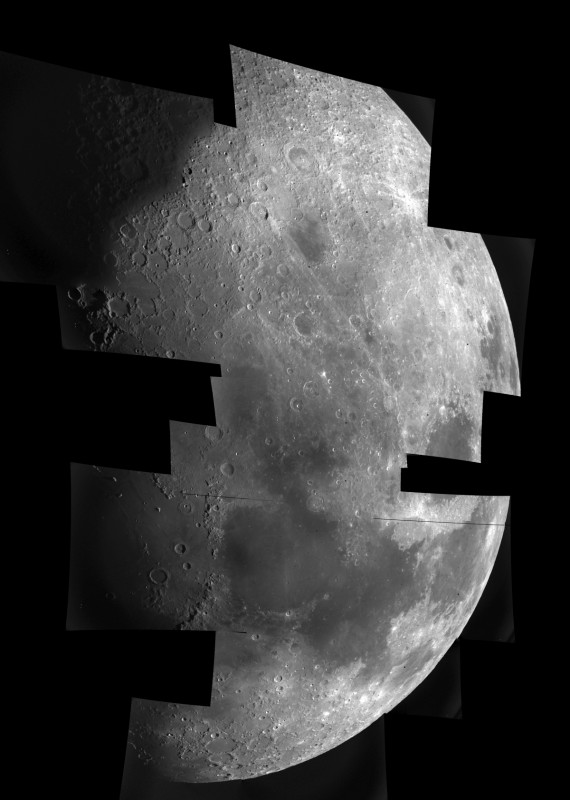
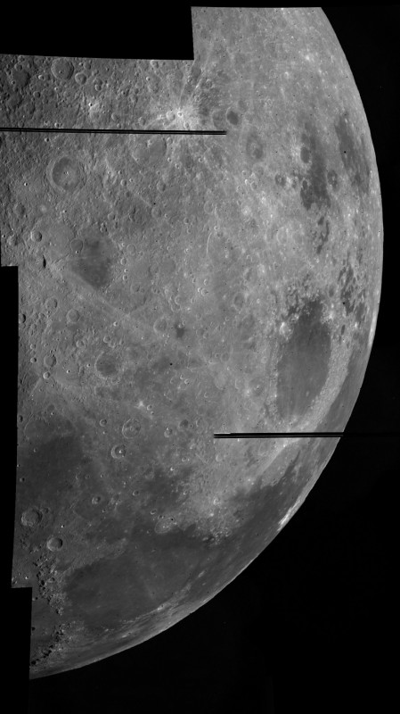
If we compare them with images of the Moon from the surface of the Earth, then at first it is very difficult to correlate them. Only after some time it becomes clear that just the point of shooting was much higher than any point on the surface of the Earth.
For example: www.pa.msu.edu/people/frenchj/moon/moon-5day-1807.jpg
This becomes even more obvious when studying the photographs of the far side of the Moon, taken by Mariner 10 the next day.
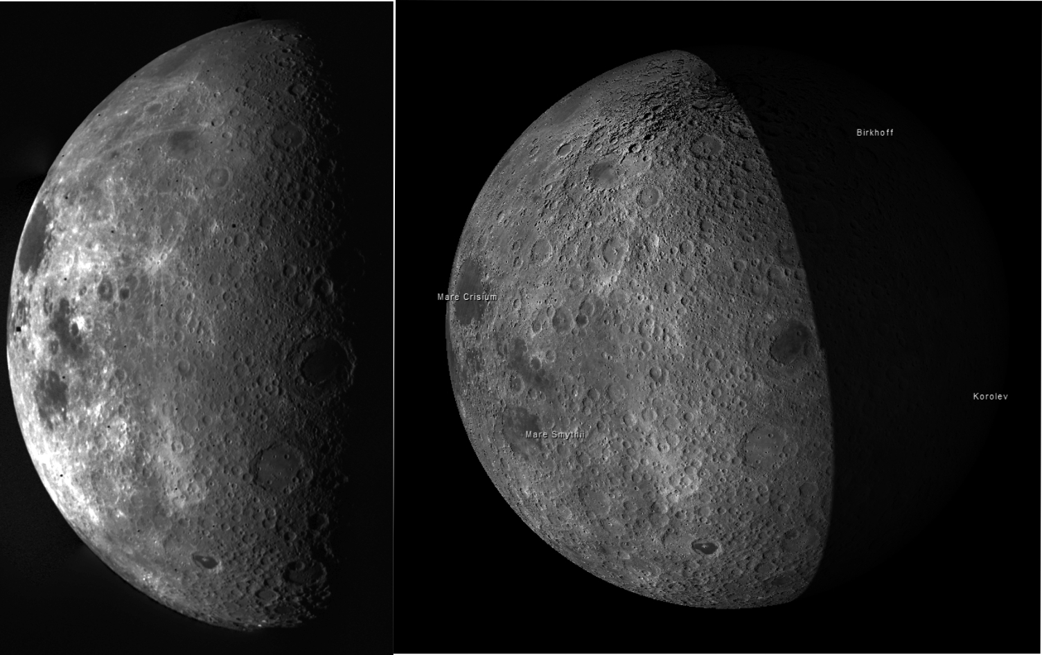 ic.pics.livejournal.com/pilot_pirks/5998240/48827/48827_original.jpg
On the left is a photograph of the Moon with Mariner 10, on the right is a model of the Moon from a virtual atlas. It can be seen that in the area of the pole in the atlas is a rather unusual picture, caused by gluing pictures, when the lunar terminator passed through this region. In the photo from the station you can see how the region of the North Pole of the Moon really looks.
There are oddities. In particular, on November 8 and 15 a photo session was held. What it is is not clear. Maybe they decided to take a picture of the accelerating block "Centauri", which led the station to Venus. Maybe in the frame itself Venus. The form in the picture hardly corresponds to the real form of the object. All photos were taken with a very long exposure, about 11 seconds. I think it was just to assess the possibilities of stabilizing the platform and this photographing was carried out.
A lot of pictures from January 19-24, 1974. In this case, nothing but interference, they can not be seen. These days they tried to photograph the comet Kogutek, but it turned out to be so weak that the cameras did not record it.
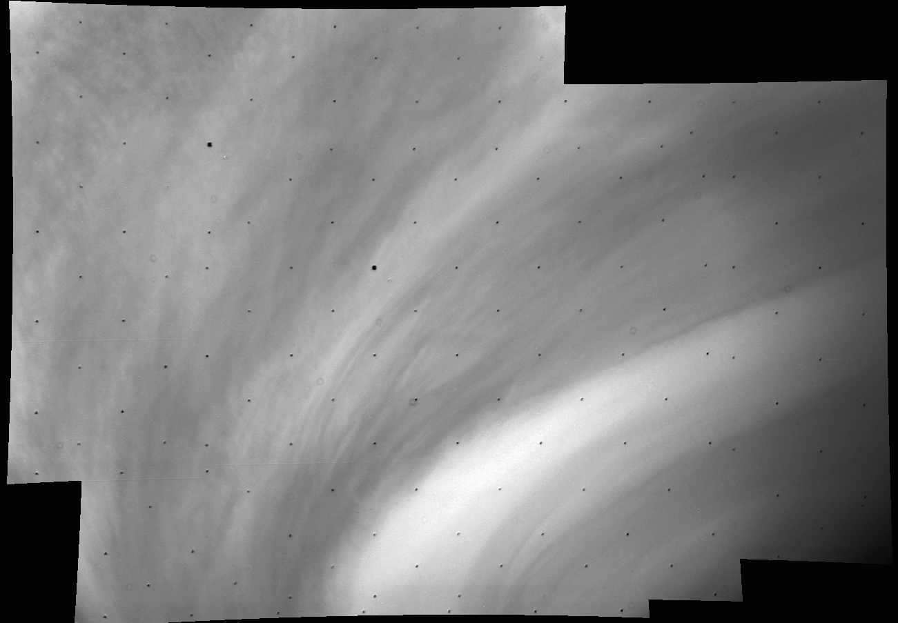
Venus
Finally, in early February, the station approached Venus. The ballistic features of the flight were such that the station approached the planet from the unlit side, and it was possible to see its surface only during the passage. In the first pictures there was only noise, until finally the outline of the planet appeared on the screen. The clock was 16:47:13 seconds on February 5, 1974.
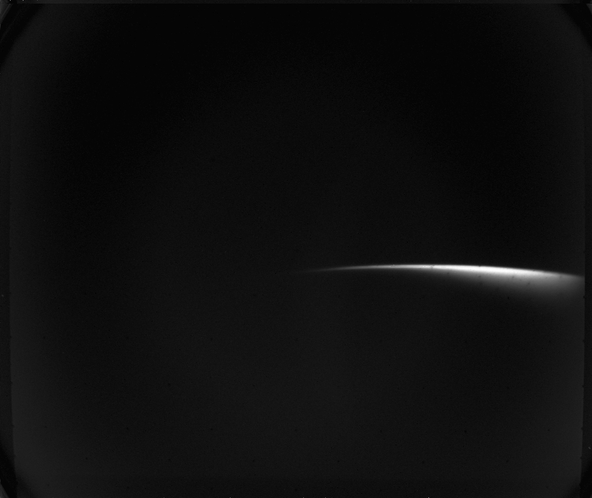
Due to the large number of images, you can pick up a lot of beautiful frames.
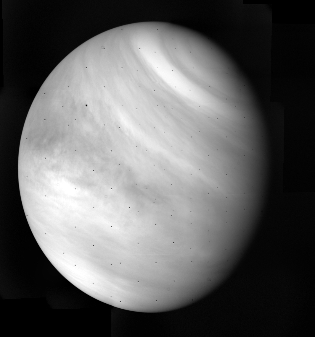
I tried to collect and color. Alas, nothing special again
Pictures of Venus passed a week. The latter was adopted on February 13.
Mercury
Unlike Venus, Mercury station spotted another on approach. If during the session on March 22 it was not possible to catch him in the cameras, then on March 23 it became possible to distinguish the dim sickle, yet without any details. On March 25, details began to appear on the disk of the planet, and on March 29, the station flew past Mercury at a minimum distance of 703 km from it.
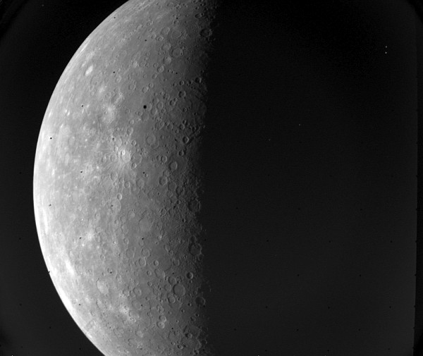
Mercury. March 29, 1974.
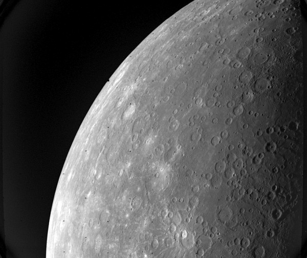
We did not have time to process the images from this span on Earth, as the station returned to Mercury two more times. The span of September 21, 1974 was at a distance of 48,069 km from the surface of Mercury, and on March 16, 1975 - at a distance of 327 km. And only after that the mission of the station was over. Mariner-10 left thousands of files with images of Venus and Mercury.
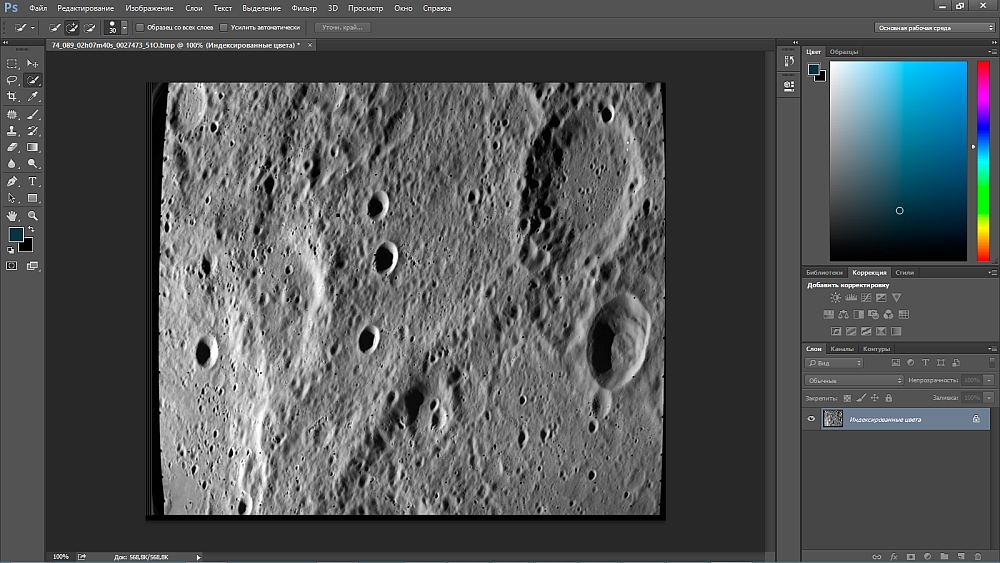
This is how the processing of photographs of Mercury from Mariner 10 looked like in 1974

And in 2015 :)
In conclusion, I would like to write a few words for those who suddenly want to do this kind of work. I have already provided a link to the converted files, here you can download the source files.
cloud.mail.ru/public/Gd9d/TdUPRrjPy
cloud.mail.ru/public/NHfB/G5RktxoCD
Also there are programs for their processing and their sources. Only two programs. The first simply converts the source files to the .bmp format, the second is needed to apply the filter. It indicates the desired day, after which it finds all the files related to the day, and applies a filter to them to remove interference. The fact is that due to the transmission of real-time images, the more noise appeared on them, the farther the station was moving away from the Earth. If the photos of the Earth and the Moon are almost perfect, then many pictures of Mercury "drowned" in the noises. The filter used in this file is quite soft. He copes with noises around Venus successfully, but noises around Mercury are too tough for him. In the above program, Piotr A. Masek, a much more efficient algorithm has been applied, and I am sure that readers can offer something of their own.
Also, if anyone interested in this mission, I can advise the book
history.nasa.gov/SP-424/sp424.htm
It describes this flight in detail.
Source: https://habr.com/ru/post/367461/
All Articles