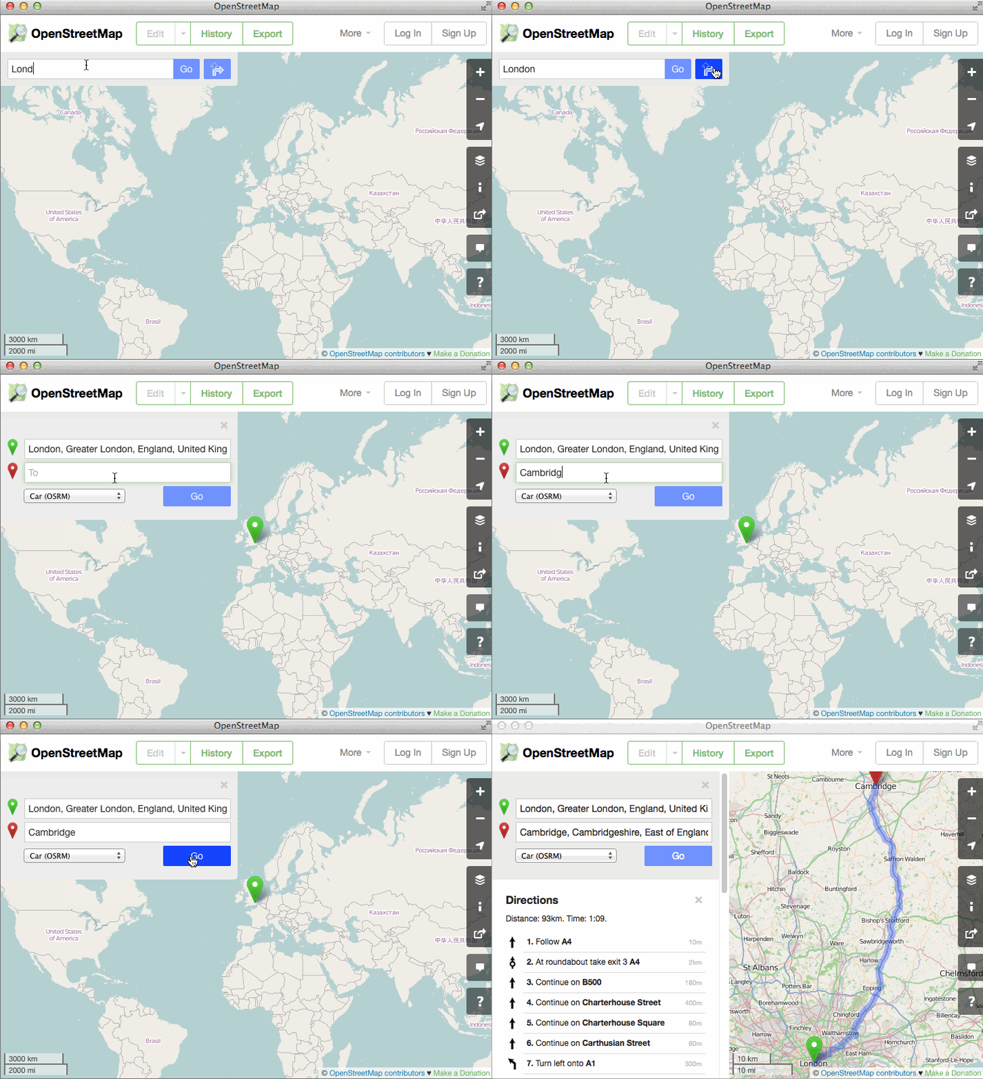
Routes appear on OpenStreetMap.org

Good news from the OpenStreetMap free cartographer camp. The main site OpenStreetMap.org implemented the function of laying a route from point A to point B ( code on Github ).
At first glance, it seems strange that the Directions function appeared on the main site only now, because OSM based on navigation, Mapquest, Graphhopper, Cyclestreets, Komoot, cycle.travel and many others have been working on OSM for a long time.
But all of these are third-party programs and mobile applications that use an open and free OSM database. Often, even users of these same applications do not realize that without the power of OSM, their program does not make any sense.
')
One way or another, but now the laying of the route is implemented on the main site too.
The interface is written in Javascript, and the routes themselves are imported from third-party services. At the moment, it is OSRM, GraphHopper and MapQuest Open. This is quite an original and smart solution: in which case, the provider can be quickly changed. The providers themselves use the OSM database, so it’s quite fair to load them with routing requests and retrieve the result.

OpenStreetMap is able to create a route for traveling by car, bicycle or on foot. Each option has two external providers, for reliability.
In turn, OpenStreetMap hopes that when using the built-in navigator, users will increase their activity in editing the map and describing unlabeled objects. After all, when moving along a route, a person sees the terrain from a different angle, in more detail. That is, you can notice such details that are not visible in the usual study of the map without routes. For example, the absence of a left turn on the map, although this turn is possible on a real road. Or a section of the road "only for buses."
In general, all those who are not indifferent are invited to edit and further improve the map. Map data should belong to people, not be owned and controlled by corporations!
Source: https://habr.com/ru/post/365117/
All Articles