Non-satellite positioning and navigation systems

“It’s useless to argue with wives, even the navigator agrees with them.”
(From the memo to the newlyweds)
This story did not begin today or yesterday. And not in Russia. Just passed the time when its fruits have become, as they say, there.
Not so long ago, the captain of the American ship located not far from Novorossiysk discovered that the satellite GPS global positioning system had incorrectly established its location and shows that the ship was located at the kebab house Zhorik Vartanov, which is at Gelendzhik airport. Not finding any flaws in the navigation equipment, the captain contacted the neighboring vessels and learned that all of them were also “visiting” with Zhorik. And now, New Scientist wrote that “reports of satellite navigation problems in the Black Sea suggest that Russia may be experiencing a spoofing system (masking by distorting data).” With reference to a satellite system, spoofing is a fake signal from a ground station that simulates the operation of a satellite and misleads a subscriber receiver. It was further written that, apparently, “Russia is experimenting with a new form of electronic weapons. Last year, GPS spoofing chaotically disturbed the work of receivers in applications for smartphones in the center of Moscow. The fake signal, which seems to be concentrated around the Kremlin, “throws” everyone who is nearby for 32 km to Vnukovo Airport. This is probably done for defense purposes: many of the guided bombs, rockets and UAVs are guided by GPS navigation, and successful spoofing will not allow them to hit targets. ” Well, Zhorik apparently does it for marketing purposes, expanding the virtual client base.
However, if the journalists and “dug up” here is something new, then perhaps “the technology of signal concentration around the Kremlin”. Not otherwise, this helps the ruby stars on the towers. For the rest - nothing new ...
A little more foreplay
Tests of systems that allow suppressing GPS signals in interference have already been carried out, and this technology has been sufficiently developed to be applied in practice. In 2013, for example, one of the University of Texas specialists demonstrated how GPS-spoofing can knock a yacht with the latest equipment off course. Well, if you think that you can launch something directly into someone’s window, today you shouldn’t be surprised if something suddenly flies right into the window from which you gave the order to start it.
However, the dual use of the GPS system was laid at the very beginning of its development. During the US wars with Iraq, a spokesman for the US Department of Defense said that the US military could suppress GPS signals from a civilian range regionally, and are not going to refuse this opportunity, and suppressing access to GPS in a non-military range within the “theater of operations” can significantly weaken capabilities of the armed forces of Iraq. Civilian users around the world have access to high-precision GPS signals previously available only to the military and special US government services, opened by decree on May 1, 2000, by US President Bill Clinton. Up to this point, civilian GPS signals were deliberately deafened to reduce the accuracy of determining the coordinates (approximately 5 times). Civilian GPS signals use a so-called C / A code (coarse / acquisition). The military use the so-called. "High-precision" code p (precise code), which is transmitted in a wider band than the civil one. This allows the civilian signal to deliver narrowband interference, while the military will continue to function. The jammers can be placed on elevated terrain, on high antennas or on board specialized aircraft.
It is said that the local deification of GPS signals has already taken place during the fighting in Afghanistan, so that the Taliban’s armed GPS receivers wander the mountains longer. And during the Iraq events, a whole flotilla of fishermen wandered around the Indian Ocean for more than one day in search of the road to the house, wondering at their GPS receivers. South Korean fishing vessels have recently been returning to the port more often ahead of time when they lose their GPS signal. Responsibility is placed on North Korea, which is supposedly jamming the signal, but does not recognize this. It was also reported that in 2014 and 2015 a similar problem interrupted operations of the US Coast Guard in two ports, but the competent persons did not specify which ones.
Be that as it may, here is another type of electronic weapon that the military has long been aware of, and now journalists have also heard about it. And sometimes the subscriber receiver itself acts as a “weapon”. However, the system itself or interference is not always to blame. - Once a young girl from the Canadian province of Ontario almost died, relying on the instructions of the GPS navigator, who at night in the rain sent the car to the desired point right across the lake. Fortunately, plunging into the lake, the girl managed to lower the glass and get out.

Concept change
There is nothing to do, both GPS and other global navigation satellite systems (GNSS or GNSS), were forced to change the concept of development and to insure systems built on slightly different principles. And all this current availability, high accuracy and low cost of GNSS services for consumers have a “reverse side of the coin” in the face of vulnerability to interference. For low-power GNSS signals (in particular, GPS transmits a signal from satellites located at a distance of 20 thousand km from the Earth’s surface and, of course, having energy restrictions), the risk of external attacks with signal substitution and intentional interference, as well as reduced performance, increases. some operating environments.
All this has led those who make decisions, as well as representatives of user communities, to the need to reconsider their expectations regarding GPS and associates in the direction of searching for alternative PNT resources (APNT - Alternative Positioning, Navigation, and Timing). As the name implies, there is still an exact time, which today is also often taken from GNSS. And if in a nutshell, because of the threat of cyber attacks, the shipping industry is abandoning GPS in favor of World War II technologies. But 90% of world trade is carried out by sea, and, unlike air transport, ships do not have a backup navigation system. In addition, on busy sea lanes there is a high risk of landing aground or collisions with other ships, which, in fact, we could observe recently with the example of a series of incidents with ships of the 7th US fleet.
By the way, back in 2004, the Presidential Directive approved the creation of a backup system for GPS to ensure the uninterrupted provision of PNT services. This is a modernized system based on the pulse-phase navigation system Loran (Long Range Navigation), which was developed in the United States during the Second World War. The enhanced e Loran system (enhanced Loran) will be complemented by digital signal processing. Not long ago, the House of Representatives of the US Congress approved a bill that provides for the creation of e Loran in the United States.
Initially, the Loran system was designed to provide navigational support to the strike forces of aviation and the navy in their combat missions. High tactical and technical characteristics of this system predetermined its massive use by civilian consumers in most countries of the world for solving economic problems. Unlike GNSS systems, the Loran system transmits a signal from ground masts, where the energy is potentially unlimited.
However, Loran is not the first radio positioning and navigation device in the world.
What was before
At the dawn of aviation there were no radar, so the aircraft crew determined its location independently and informed the dispatcher about it. The crew focused on the terrain visually by settlements, lakes, rivers, hills and found its place on the map. This method required constant visual contact with the ground, which was simply absent in bad weather, limiting the possibilities of flying.
The first navigation tools were radio beacons (NDB - Non-Directional Beacon), transmitting an identification signal in a circular pattern (these are two or three letters of the Latin alphabet, which are transmitted by Morse code) at a certain frequency. Well, the receiver on the aircraft indicates the direction to such a beacon. To determine the exact location, at least 2 radio beacons (two azimuths from them) are necessary, and the aircraft began to fly from the lighthouse to the lighthouse. Thus, the first air routes for instrument flights, including in the clouds and at night, appeared. True, the accuracy of determining the coordinates soon became insufficient. Then the radio engineers created a high-frequency omnidirectional radio beacon VOR (Very high frequency Omni-directional Radio range). VOR transmits its identifying index in Morse code of three Latin letters.
The need to know the two azimuths to determine their position required too many beacons. To solve this problem, the so-called distance measuring equipment DME (Distance Measuring Equipment) was developed, and with the help of a special receiver on board it became possible to find out the distance from DME. And if the VOR and DME devices are located at one point, then it is easy to calculate your location in azimuth and distance from the VORDME system.
However, to place beacons everywhere, they need too much, and often it is necessary to define their position even more accurately. So there were so-called “points” (fixes, intersections), which always had known azimuths from two or more beacons. That is, the aircraft could easily determine that it is currently just above this point. Now the airways began to pass between radio beacons and points. The appearance of the VORDME systems allowed to stir up points not only at the intersections of azimuths, but at radials and distances from the VORDME objects. Well, everything that has been developed for aircraft can be successfully used for marine.
Modern aircraft have satellite navigation systems, inertial calculus systems and flight computers, the accuracy of which is sufficient to find points that are not connected with either VORDME or NDB, but simply have geographic coordinates. As a result, there may not be a single VOR or NDB beacon in modern global airspace on a flight route lasting several hours. And it turns out that this is not always good.
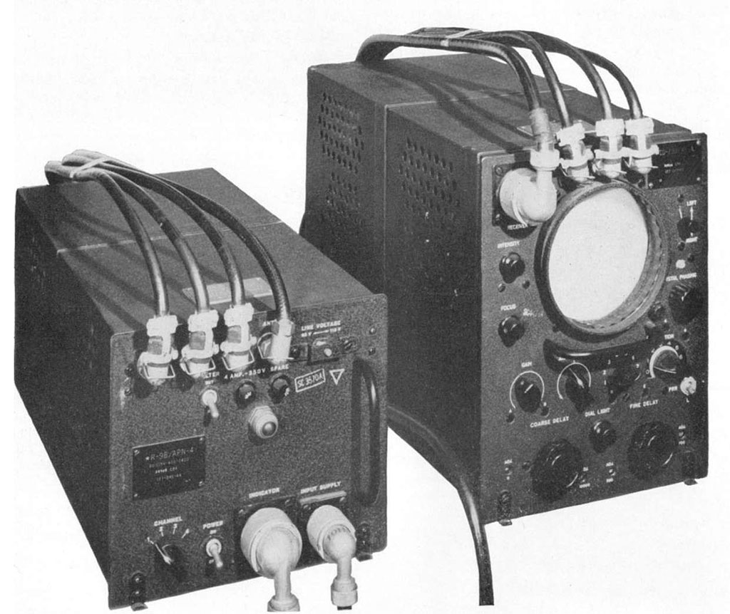
Loran-c
When the use of GNSS became overgrown with risks, the topic of creating something alternative became a source of lengthy discussions in the APNT community, in which there is as yet no general agreement in several areas guaranteeing reliability, integrity / accuracy and accuracy (synchronization or positioning). But in general, the general direction of movement is already clear, and this is an upgrade of the Loran-C system.
The above-mentioned Loran system in its development has gone through several stages of development. In particular, the Loran-C system was originally designed to provide US military users with more coverage and accuracy than its predecessor (Loran-A system) to military users.
Loran-C was commissioned for civilian use in 1957. The system used radio signals from 24 towers on the coast, managed by the US Coast Guard, for positioning at sea and in the air. Later it was selected for use as a civilian fleet as a radio navigation system.

The Loran-C radio navigation system (RNS) (the domestic analogue is “The Seagull”) refers to difference-ranging RNS with synchronization of the radiation moments and the phase of the pulse signals emitted by ground transmitting stations. Stations are arranged in chains of 3-5 stations, which transmit signals at the same frequency with the same repetition period for a group, some stations operate simultaneously in two circuits at two repetition periods. Each PHC circuit consists of one master and slave stations operating with the same, only this circuit, assigned period of repetition of a series of pulses.
This repetition period is the hallmark of the chain. The station signal contains a series of 8 pulses, following in 1 ms. The master station additionally emits a 9th pulse. Slave stations emit signals with different delays - with a certain delay relative to the master signals. The radiation delay is the hallmark of the pair.
For simultaneous measurement of at least 2 differences of distances, the system operates on the principle of synchronized emission of signals (bursts of pulses) by the master and slave stations at one carrier frequency of 100 kHz and the total repetition frequency for them. The signals of the stations are emitted with such a shift in time so that at any point of the system coverage area a temporary separation of the signals is provided. To fulfill this condition, it is necessary that any of the slave stations begin to emit their signals after the last pulse of the previous one (in turn) of the slave station arrives at this station, taking into account the delay of this pulse due to its repeated reflection from the ionosphere. The master station synchronizes with its signals (both on the pulse envelope and on the high-frequency filling) the work of the slave stations.
The range of the Loran-C system on land and at sea is 1400-1800 and 1800-2000 km respectively. Radiation power of transmitting stations - 200 ... 1000 kW. Reliability - 99.7%. The speed of determining the location - 10-20 serifs / sec. The synchronization error of the stations inside the circuit is 30-50 ns. Accuracy of positioning - up to 10-50 m in a radius of up to 150-200 km.
In general, the radio navigation field of 25 stations Loran-C USA and 4 stations of Canada at one time covered the territory of North America with an area of 9,629,091 square meters. km
For decades, Loran-C has been the standard navigation system for commercial fishing, small fleet and other ships, as well as for many aircraft. The system used from 1.2 to 1.5 million users. The work areas of the Loran-C chains also expanded, covering the territories of the USA and Canada, almost the entire coast of the North American continent, the North Atlantic, Scandinavia and Western Europe, the North and Norwegian seas, the Atlantic coast of France and the East Atlantic, the Mediterranean Sea, and the central and north-western regions Pacific Ocean, the entire Arabian Peninsula, areas of the Middle and Far East, the Red Sea, the Persian Gulf, the Gulf of Aden, part of the coast of India. The total area of the working zones of the Loran-C chains exceeded 95 million sq. M. At present, in the territory of Northern Europe, the coverage area of the Loran-C system is 100 nautical miles from transmitting stations.
Well forgotten old
The commissioning and rapid development of GNSS GPS logically led to the gradual refusal of seafarers and pilots from Loran-C services. In addition, GPS technology has evolved rapidly, becoming cheaper and more accessible, and the Loran-C system was morally aging. As a result of several years of discussions, based on the interests of US national security, it was decided to upgrade the Loran-C system and replace it with an improved digital eLoran, which will complement GPS in cases of its disconnection or disruption. According to the developers, the signal in eLoran will be 1.3 million times more powerful than the GPS signal, and, of course, can also be drowned out, but for this, respectively, a very high transmitter power is needed along with a large antenna, etc., which is easier to track. In addition to supporting the backup working area, signal intensity and penetrating ability, the eLoran system can provide operational response services and other operators in conditions that are not supported by GPS. The system was supposed to use modernized transmitting stations and a communication network. $ 160 million was spent on the development of the system, but in October 2009, the Coast Guard announced that the Loran-C system was not required for maritime navigation, which left the continued existence of Loran and eLoran in the United States at the discretion of the US Department of Homeland Security. In 2009, the President of the United States signed a bill that actually froze the creation of the eLoran backup system with the conservation of the Loran-C system, and the US Coast Guard stopped transmitting all Loran-C signals on February 8, 2010, and recommended that users use the GPS system. However, in April 2014, the House of Representatives of the United States Congress approved a law prohibiting the US Coast Guard dismantling previously mothballed Loran-C ground station equipment.
And on March 26, 2015, a draft law “Act on ensuring noise immunity and safety of the National Positioning, Navigation and Time System in 2015” was submitted to the US Congress. (National Positioning, Navigation and Timing Resilience and Security Act of 2015). It was proposed to require the US Secretary of Defense, together with the Coast Guard Commandant and the Transport Minister, to make the final decision on deploying a ground-based navigation and positioning system, which should use all the capabilities of the existing Loran infrastructure and act as a reliable reserve for GPS , and for civilian purposes. This system, as noted in the bill, should use all the capabilities of the existing Loran infrastructure.
The backup system will be based on signals from 19 eLoran masts located in the United States with a range of about 1,000 miles each. Funding for the backup system will be several times lower than the current cost of maintaining GPS (a few cents in a dollar of GPS costs).

The eLoran navigation and communication signal has features that complement GPS, making it more difficult to break; and in addition, it could be an important component for ensuring the safety of unmanned aerial vehicles in airspace.
The United States Federal Radio Navigation Plan prescribes not to be dependent on a single system in location, navigation, and time service as a goal of national policy. The plan specifically points out eLoran testing as an important step towards achieving this goal.
An alternative GPS system is being deployed in other countries. According to the representative of the Ministry of Oceans and Fisheries of South Korea, by 2019 it is planned to equip three sites for testing eLoran, and then go further. The South Korean government hopes for further expansion of the eLoran coverage area throughout Northeast Asia, for which it will cooperate with Russia and China. True, not without problems. The authorities have already faced the resistance of the inhabitants of the island on which it is planned to deploy antennas. Actually, they needed an area of more than 132 square meters. m with a height of masts more than 120 m, and not everyone likes it.
The General Administration of Lighthouses of Great Britain and Ireland (GLA) published the strategic document “2020 - The Vision”, which concludes that the Loran-C system should be upgraded to be used as a backup marine navigation system for GNSS. The Royal Institute of Navigation expressed the belief that the European Loran-C should be maintained and modernized in order to transform it into an eLoran system.
The system is most actively used by the UK and Ireland, successfully introducing into operation the “modernized” eLoran. Tests showed that eLoran is not inferior to GPS in terms of coordinate and time characteristics and offers seamen a positioning accuracy of less than 10 m (95%) with a high level of integrity, which meets international operational requirements for ships approaching the port. At the same time, the future of the Loran network in Northern Europe currently remains uncertain, since if the transmissions of French and Norwegian eLoran stations are stopped (there are such plans to save money, of course), all opportunities for marine navigation in the UK waters will also be lost.
China, Korea and Japan continue to work on improving the ground transmitting stations Loran-C. Saudi Arabia and India have expressed serious interest in the modernization of Loran-C and the further development of eLoran in the territory of their states. According to some data, plans for the development of its own noise-resistant ground-based RNS are also available from Iran. The interaction of the states participating in FERNS (Russia, Korea, China, Japan) on the creation of integrated radio navigation services continues.
Discussions about the future
However, the debate continues on the future of APNT. For example, although it is obvious that APNTs should work out in the event of GNSS failure, there is no consensus on the duration of their work and the breadth of coverage, in terms of choosing the regions where APNT will function. After all, there have already been several major incidents of GNSS jamming or signal spoofing, and the use of PNT continues to improve, creating new threats. In addition, different stakeholders have different time horizons for APNT. For example, a number of goals and threats in 2035 will be formulated differently from those that exist today, or will be in 2025. And the range of promising systems APNT is not limited to eLoran. In addition, it will take considerable time to create, commission or change the existing infrastructure of the PNT or APNT system. From the point of view of consumer devices (receivers) or software, consumer navigation equipment (NAP) APNT is not similar to GNSS GNP, and here you cannot count on rapid sales growth or regular software updates.
However, it is necessary to think and plan for the future, sometimes the distant future, and to reach a consensus on what is required. For example, in accordance with the requirements of the FAA (Federal Aviation Agency of the USA), APNT is currently required to ensure the accuracy of the position of about one nautical mile. However, in the future (from 2025) it will be necessary to improve the accuracy from 0.3 to 0.5 nautical mile. Experts believe that such questions will arise in the telecommunications area, where today the accuracy of time synchronization at the microsecond level is sufficient, but tomorrow even 100 ns may be needed.
As for the subscriber equipment, people have become accustomed to the constant updating of smartphones, so if necessary, new technologies can be quickly applied in case of problems with PNT. Well, even consumer devices such as lawn mowers, which can lick your spouse’s flowerbed in the event of a GPS signal, can stimulate APNT development.

Publication author:
Alexander GOLYSHKO, Systems Analyst, Technoserv Group of Companies
Based on: internavigation.ru, insidegnss.com, SecurityLab.ru, vestnik-glonass.ru, radioscanner.ru, airspot.ru, CNews.ru.
The article was published in the magazine "Radio" .
')
Source: https://habr.com/ru/post/339756/
All Articles