10 years of Google Maps: from Slashdot to Ground Truth
10 years ago, Google maps quickly broke into the Internet space, displacing MapQuest service, which at that time was a leader in this field. Google Maps gained popularity, having settled on the pages of the global network, constantly updating and without requiring users to install any software. Moreover, it made it possible to use the cards for owners of a wide variety of gadgets.
The first pancake is lumpy
')
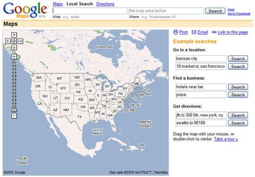
Even before the release of the beta version of 2005, enthusiasts gained access to maps and began the first discussions on the popular news resource Slashdot . In addition to the pleasant reviews, there were also serious claims: first, by that time they had only managed to create maps for the USA, Canada and Mexico. Secondly, the rest of the space looked like ... an ocean! But that was only the beginning. Next, it was necessary to collect an incredible amount of data from other countries around the world. But how to do that?
Three Musketeers
Google needed new resources, technologies and ideas. In 2004, the company made 3 small acquisitions: Keyhole, Where2 and Zipdash.
Keyhole was the largest of the three. They had their own technology for forming a world map based on images obtained from a satellite. Images were divided into small fragments, after which it was possible to view the map with a sufficient degree of detail.
Where2 was at that time a small start-up, the idea of which was to display a map fragment of interest in the center of the display with the possibility of scaling. Their project was called Expedition.
Today it is already difficult to imagine how people on the road would manage without this function in online maps. However, then there was no demand for Expedition.
Google believed that maps would have great prospects as a desktop, but even more like a web application. To speed up the transfer of data over the network, a new approach was developed, which consisted in the background exchange of data between the browser and the web server. As a result, when updating data, the page did not reload completely, and the web application worked several times faster. Subsequently, this technology became widespread and was called AJAX.
Zipdash is a company that deals with the technology of transferring traffic between mobile applications. One of their developments was a real-time traffic delay estimation service. At that time, no one dared to assume that it was their technology that would provide the basis for the mobile version of Google Maps.
One for all and all for one
Teaming up with Google, the teams started working together, but each of them worked in their own direction: Where2 - Google Maps on the Web, Keyhole - Google Earth, Zipdash - Google Maps for Mobile.
It was then that Jens Rasmussen from Where2 came up with the famous pin (Google Maps pin), which serves to mark the place on the map. Such a mark does not complicate further viewing of the map and, moreover, contains information about the marked place.
John Hanke from Keyhole made a proposal to improve the mechanism for obtaining and processing images from a satellite. As a result, many millions of dollars were invested in the technology for obtaining data through special channels with high bandwidth.
Moscow was not built in a day
However, the scale of this serious work was not immediately appreciated. At first, both Google Maps and Google Maps Mobile services even in the amount of traffic was ridiculously small. It was only a year later that we managed to reach attendance rates comparable to the rush at Slapshot when the beta version was released.
But, nevertheless, by the end of 2006, 2 years after launch, Google Maps became the first online-card service in attendance.
And soon, Google Maps Mobile repeated the way of its older brother.
Apple deal: jealousy and prejudice
The idea to strengthen the position of Google Maps in the market of mobile devices lay on the surface. After all, it is very convenient to determine your location, route and destinations, using only one phone.
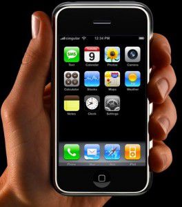
Great success in this regard for Google was cooperation with Apple. This has made Google Maps applications even more popular. However, the cooperation lasted only a few years. Further, their paths diverged due to numerous disagreements, Apple’s distrust towards Google. Moreover, Apple was unhappy that Google began working with Android. In general, in 2012, Apple developers released their own mapping application.
Streets in 3D
In May 2007, Google begins work with a research group from Stanford. Together they create the Street View project, which uses 3D scanning technology. Street View allows you to make a kind of virtual 3D-tour through the streets, choosing a city and country. And all this can be done without leaving your home, sitting in front of a computer or smartphone screen. At the moment, this project has already been implemented in 65 countries.
Ground Truth - X-Files
This is an episode of the history of Google Maps for many years kept in strict confidence. In 2007, TomTom bought Tele Atlas, and Nokia bought Navteq. As a result, Google was left without data providers for maps. It was decided to make their own databases and maps. In addition, new ideas emerged that required more detail from the cards. Therefore, a project called Ground Truth was launched. The project leader is Megan Quinn.
When the first part of the map work for the USA was completed, Quinn sent each employee an email asking them to test the service. For each bug found, homemade chocolate cookies were promised. "I spent the whole weekend baking cookies," admits Quinn. "I baked 7,000 pieces!"
Now, like 10 years ago, Google is keeping up with the times. And sometimes it is one step ahead of the rest.
No one knew what would come out of the Google Maps project, and no one imagined that it would become an integral part of the users daily life. But the game was worth the candle, right?
The first pancake is lumpy
')
Even before the release of the beta version of 2005, enthusiasts gained access to maps and began the first discussions on the popular news resource Slashdot . In addition to the pleasant reviews, there were also serious claims: first, by that time they had only managed to create maps for the USA, Canada and Mexico. Secondly, the rest of the space looked like ... an ocean! But that was only the beginning. Next, it was necessary to collect an incredible amount of data from other countries around the world. But how to do that?
Three Musketeers
Google needed new resources, technologies and ideas. In 2004, the company made 3 small acquisitions: Keyhole, Where2 and Zipdash.
Keyhole was the largest of the three. They had their own technology for forming a world map based on images obtained from a satellite. Images were divided into small fragments, after which it was possible to view the map with a sufficient degree of detail.
Where2 was at that time a small start-up, the idea of which was to display a map fragment of interest in the center of the display with the possibility of scaling. Their project was called Expedition.
Today it is already difficult to imagine how people on the road would manage without this function in online maps. However, then there was no demand for Expedition.
Google believed that maps would have great prospects as a desktop, but even more like a web application. To speed up the transfer of data over the network, a new approach was developed, which consisted in the background exchange of data between the browser and the web server. As a result, when updating data, the page did not reload completely, and the web application worked several times faster. Subsequently, this technology became widespread and was called AJAX.
Zipdash is a company that deals with the technology of transferring traffic between mobile applications. One of their developments was a real-time traffic delay estimation service. At that time, no one dared to assume that it was their technology that would provide the basis for the mobile version of Google Maps.
One for all and all for one
Teaming up with Google, the teams started working together, but each of them worked in their own direction: Where2 - Google Maps on the Web, Keyhole - Google Earth, Zipdash - Google Maps for Mobile.
It was then that Jens Rasmussen from Where2 came up with the famous pin (Google Maps pin), which serves to mark the place on the map. Such a mark does not complicate further viewing of the map and, moreover, contains information about the marked place.
John Hanke from Keyhole made a proposal to improve the mechanism for obtaining and processing images from a satellite. As a result, many millions of dollars were invested in the technology for obtaining data through special channels with high bandwidth.
Moscow was not built in a day
However, the scale of this serious work was not immediately appreciated. At first, both Google Maps and Google Maps Mobile services even in the amount of traffic was ridiculously small. It was only a year later that we managed to reach attendance rates comparable to the rush at Slapshot when the beta version was released.
But, nevertheless, by the end of 2006, 2 years after launch, Google Maps became the first online-card service in attendance.
And soon, Google Maps Mobile repeated the way of its older brother.
Apple deal: jealousy and prejudice
The idea to strengthen the position of Google Maps in the market of mobile devices lay on the surface. After all, it is very convenient to determine your location, route and destinations, using only one phone.
Great success in this regard for Google was cooperation with Apple. This has made Google Maps applications even more popular. However, the cooperation lasted only a few years. Further, their paths diverged due to numerous disagreements, Apple’s distrust towards Google. Moreover, Apple was unhappy that Google began working with Android. In general, in 2012, Apple developers released their own mapping application.
Streets in 3D
In May 2007, Google begins work with a research group from Stanford. Together they create the Street View project, which uses 3D scanning technology. Street View allows you to make a kind of virtual 3D-tour through the streets, choosing a city and country. And all this can be done without leaving your home, sitting in front of a computer or smartphone screen. At the moment, this project has already been implemented in 65 countries.
Ground Truth - X-Files
This is an episode of the history of Google Maps for many years kept in strict confidence. In 2007, TomTom bought Tele Atlas, and Nokia bought Navteq. As a result, Google was left without data providers for maps. It was decided to make their own databases and maps. In addition, new ideas emerged that required more detail from the cards. Therefore, a project called Ground Truth was launched. The project leader is Megan Quinn.
When the first part of the map work for the USA was completed, Quinn sent each employee an email asking them to test the service. For each bug found, homemade chocolate cookies were promised. "I spent the whole weekend baking cookies," admits Quinn. "I baked 7,000 pieces!"
Now, like 10 years ago, Google is keeping up with the times. And sometimes it is one step ahead of the rest.
No one knew what would come out of the Google Maps project, and no one imagined that it would become an integral part of the users daily life. But the game was worth the candle, right?
Source: https://habr.com/ru/post/285838/
All Articles