Zabyty on Mars: explore the travels of Mark Watney from The Martian movie

Translation of the post Jeffrey Bryant " Stranded on Mars: Exploring Travel on Mars in The Martian ".
The code given in the article can be downloaded here .
Many thanks to Kirill Guzenko KirillGuzenko for his help in translating and preparing the publication.
Not so long ago, Andy Weyr 's popular book The Martian (The Martian) was filmed, which was released on October 2nd. The Martian - a film about the astronaut Mark Watney, left alone on Mars. The crew of Ares 3, the third manned flight to Mars, believed that he was killed during the evacuation. The crew at the time of departure took with him only the basic means for salvation and communication. The next manned flight to Mars was to take place in four years, because Watney had to either come up with a plan for survival during this period, or accept and die. The book perfectly presents the various technical details about the conditions and available means, as well as the problems that arise as a result of using various things for other than their intended purpose. And these details give us a great opportunity to explore the adventures of the main character along with the Wolfram language.
I think that now is the very moment when it is necessary to write: CAUTION, SPOILERS! From this point on, the article will appear and explore various aspects of the storyline, its moments and turns. And if you would not like to know some details of the plot now, then I would recommend reading the book first, and then returning and reading the article.
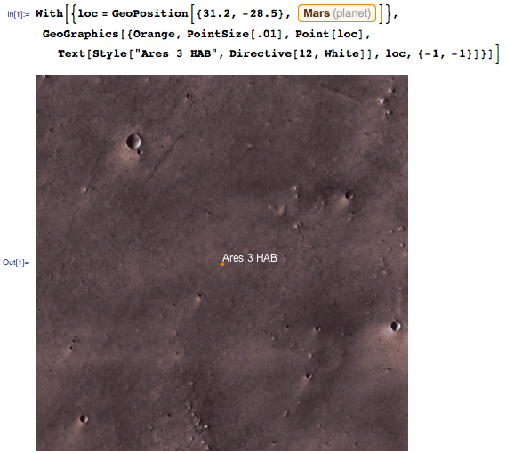
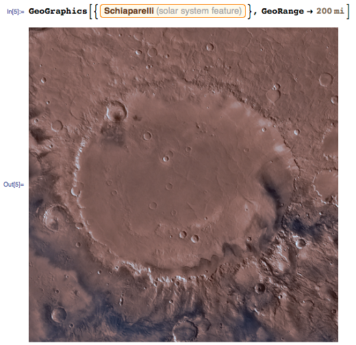
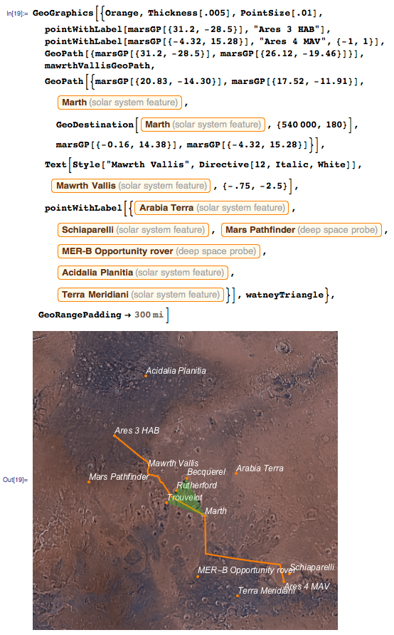
Moving and communicating with NASA are some of the most important issues that Watney faces. He decides to remake the abandoned rover for longer trips in order to get to the nearest point of contact, the Mars Pathfinder landing site. The book contains the coordinates of the main base of the Watney, which is called the habitat (habitat - letters. Transl.), Or briefly - HAB. To visualize the region around Ares 3 NAB, I used Mathematica 10.2 (which contains embedded high-resolution images of Mars) and GeoGraphics :
')
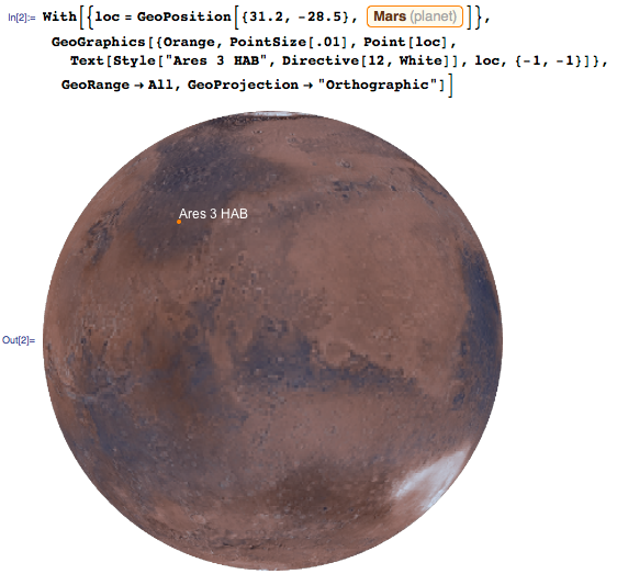
To view this area in more distance, you can use the GeoRange and GeoProjection functions:
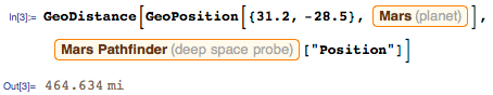
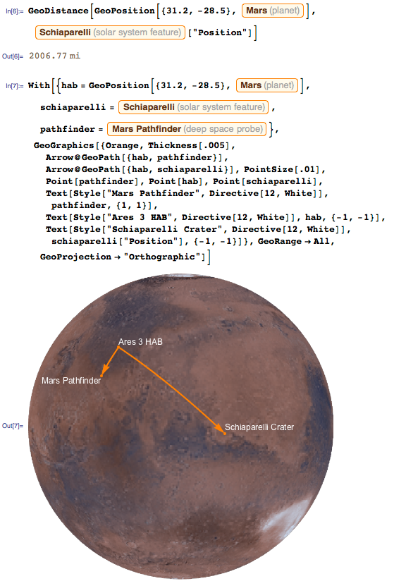
The distance from NAV to Mars Pathfinder can be calculated as follows:
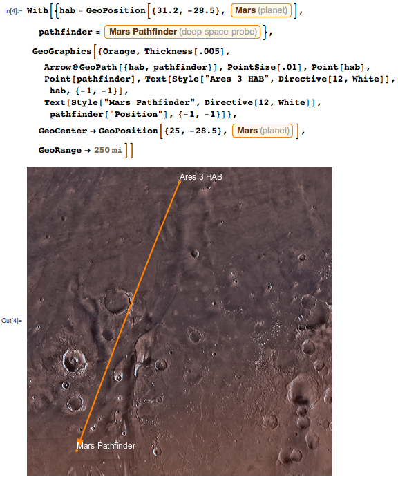
The path of Watney can be visualized using GeoGraphics :
After Watney found the Mars Pathfinder and established a connection, he began to plan his own evacuation. Due to the nature of the mission, Ares, the Martian take-off module (Mars Ascent Vehicle, or MAV for short) arrived long before the arrival of the next crew (way to leave the planet). That is, the crew of Ares 4 will be only in four years, but their MAV is already in place. The problem is that the MAV of Ares 4 is located in another point of Mars - in the Schiaparelli crater.
Quite far from the HAB Ares 3 - more than two thousand miles. It turns out a much longer journey than before the Mars Pathfinder:
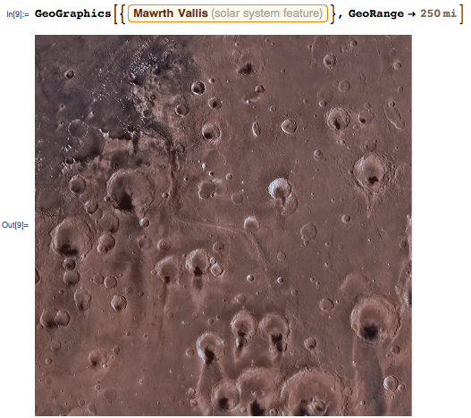
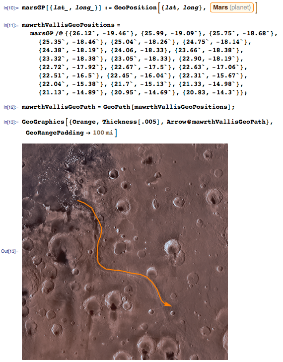
In fact, it is still more difficult. Because of craters, valleys and other obstacles, the path will deviate from a straight line. One of the first deviations of the path falls on the Martian valley (Mawrth Vallis). This is a water-carved valley that connects the relatively flat Acidalian plain (upper left in the figure below) with the more massive, higher-level and dotted craters Arabia of Terra (lower right in the figure below):
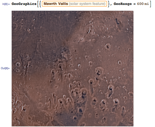
Although the path through the Martian valley makes you deviate from a straight path, however, a smaller angle of ascent in this area will facilitate the path. We can take a closer look at the Martian Valley using the GeoRange feature :
In the CDF file attached to this post (which can be downloaded from the link below), if you click on the picture and press the "." Key, the current coordinates (latitude and longitude) will be displayed by moving the cursor over the image. In addition, by clicking on the picture, you can set a certain set of points along which a trajectory through the Martian valley will be built later. After the path is laid, we can simply copy the resulting array of points. I also rounded the obtained values to 0.01 angular degrees - that's about half the pixel in the image above. Now let's create a trajectory for these points using GeoPath :
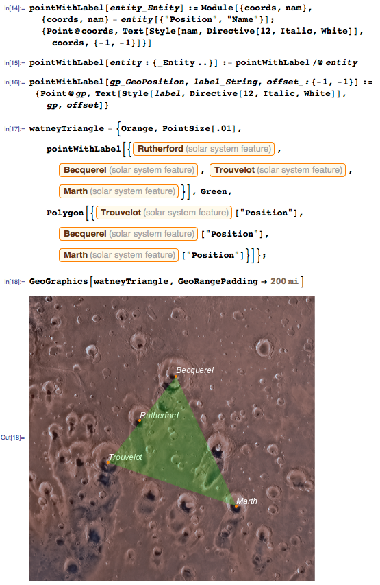
Heading toward the crater of Schiaparelli, Watney drives past various geographic features, some of which he gives his own names. For example, he called the area bounded by Becquerel, Truvalé (Trouvelot) and March (Marth) craters the “Watney triangle”. Or, to quote his speech from the book: “I will call it the Watney triangle, because after what I went through, this Martian shit simply must be named in my honor.”
Considering all the data in the book, we can get a fairly detailed picture of Watney’s trajectory and the areas he visited:
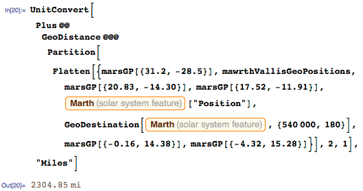
The actual distance traveled strongly deviated from a straight line, so that the actual distance turned out to be greater than the one we calculated for a straight path. Combining all points of the trajectory of Watney, we get that he actually had to overcome 300 miles more than he would have gone in a straight line:
But the story does not end there. After Watney reached Mav Ares 4, he still needed to get on Hermes - a large spacecraft used to transport astronauts between Earth and Mars. Due to the fact that Hermes uses ionic engines, he cannot quickly change his speed, and because of sudden changes in plans he does not have the opportunity to enter the required orbit. The mission of Watney is to fly with the help of MAV, which is designed only to reach the orbit, to the height at which Hermes will fly at the point of minimum distance from Mars, and which significantly exceeds the calculated height. The proposed solutions for these problems are almost as scary as the problems themselves. I enjoyed reading the book. Mark Watney faced a lot of challenges that needed to be overcome in order to survive. I will not talk about the ending - the film is still going to the cinema, and you have the opportunity to read it yourself.
Source: https://habr.com/ru/post/271469/
All Articles