Rainy map
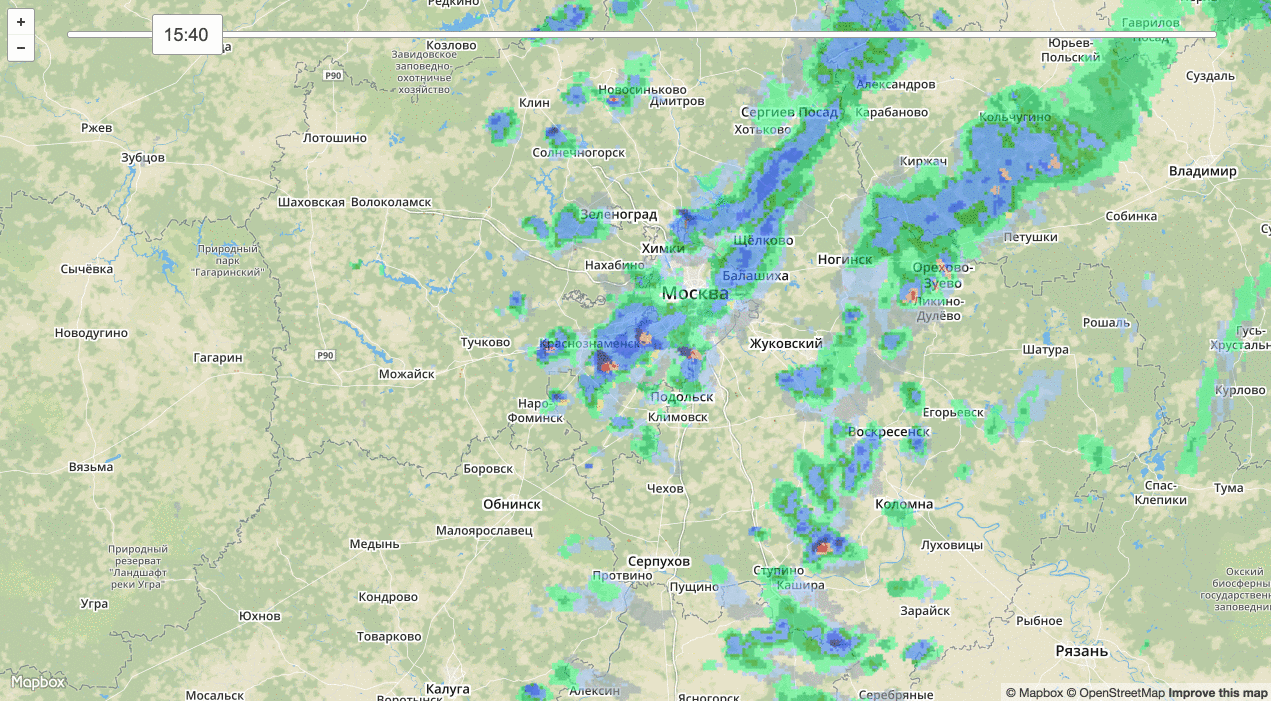
I often ride a bike and a motorcycle, so the question “will there be rain” bothers me often enough. As it turned out, the Central Aerological Observatory regularly uploads images from meteorological radars on its website . To use them, two things are missing: the ability to zoom in on the map and see how the clouds moved in the last hour. If you add these two features, you get a useful thing:
Bad news: Roshydromet has forbidden the Central Administrative District to publish data in real time, now they are available with a delay of 24 hours. Put likes, it is possible, in some form, to get actual data back.
Nichosi, there’s even a petition about it - “ Returning open access to DMRL (radar) images ”. And Roshydromet already wrote letters .
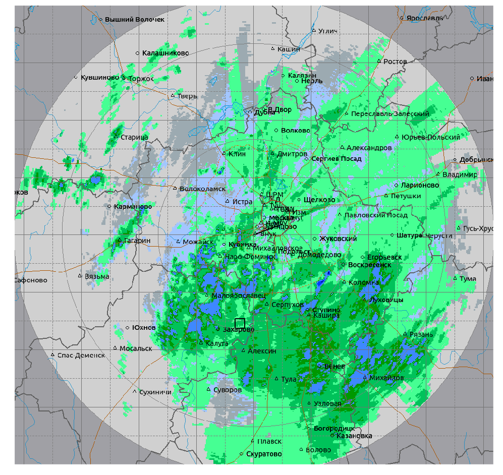
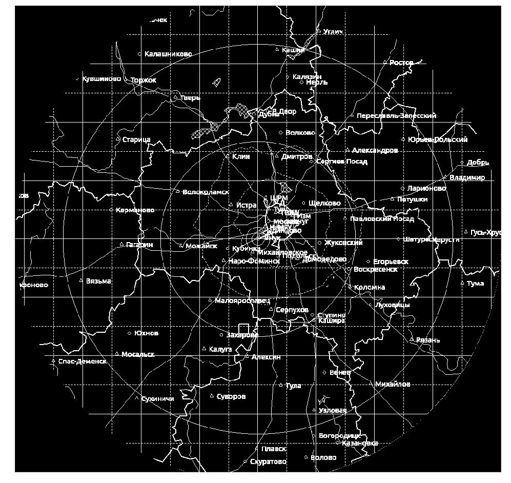
The CAO publishes pictures of the form :
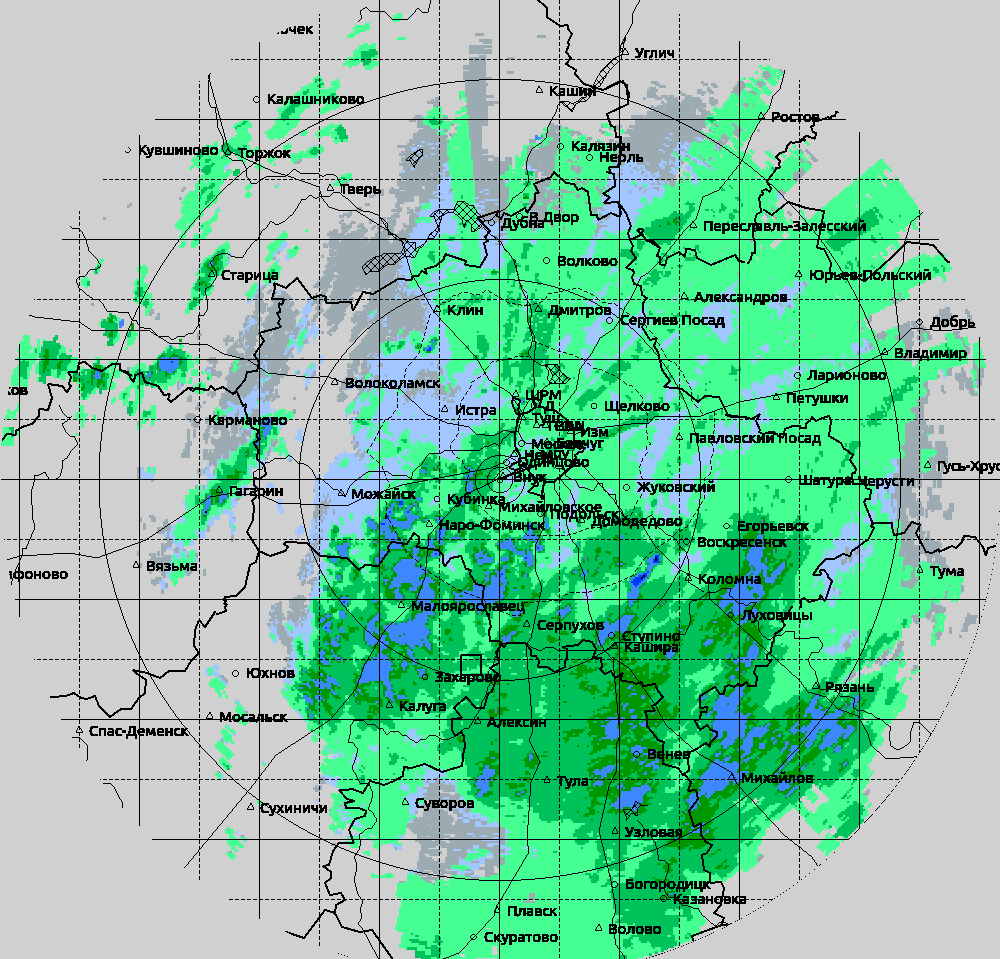
It is necessary to somehow remove all symbols, leave only areas with precipitation:
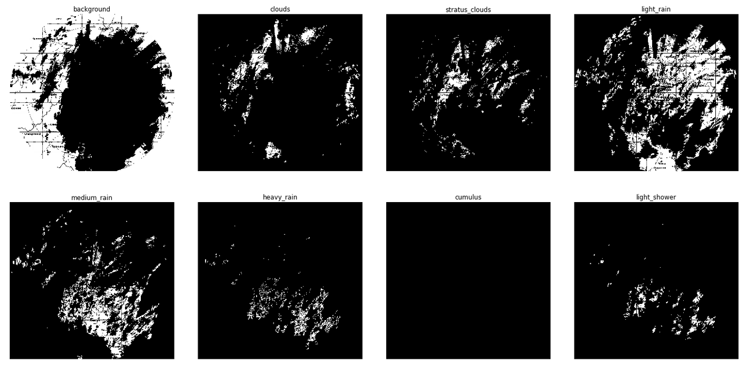
First, select the areas that need to be left . This is easy to do because a certain pixel color corresponds to each area:
')
What pixels do not fall into the selection ? Names of cities, borders of regions, rivers. In short, all notation:
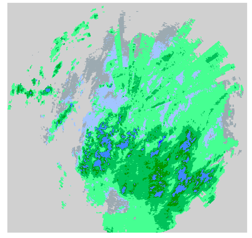
For each such pixel, we will look at its neighborhood of radius 9 and count the color pixels . If the neighborhood has the most green pixels, then paint our pixel green, if it is more blue, blue. And lo and behold:
Then we put the monitoring on the site of the Central Administrative District . Every ten minutes we download and process a new image. We put it all on a normal interactive map. Using Leaflet.js is easy . And we get a useful simple prototype of alexanderkuk.imtqy.com/analyze-meteorad .
Then we contact the Central Administrative District, we find out that funding for the operation of locators is not enough and therefore no one is going to provide data for free. And the pictures on meteorad.ru were overlooked.
Let us all write that you are interested in this kind of data and we will go to talk with Roshydromet.
Bad news: Roshydromet has forbidden the Central Administrative District to publish data in real time, now they are available with a delay of 24 hours. Put likes, it is possible, in some form, to get actual data back.
Nichosi, there’s even a petition about it - “ Returning open access to DMRL (radar) images ”. And Roshydromet already wrote letters .
The CAO publishes pictures of the form :
It is necessary to somehow remove all symbols, leave only areas with precipitation:
First, select the areas that need to be left . This is easy to do because a certain pixel color corresponds to each area:
')
What pixels do not fall into the selection ? Names of cities, borders of regions, rivers. In short, all notation:
For each such pixel, we will look at its neighborhood of radius 9 and count the color pixels . If the neighborhood has the most green pixels, then paint our pixel green, if it is more blue, blue. And lo and behold:
Then we put the monitoring on the site of the Central Administrative District . Every ten minutes we download and process a new image. We put it all on a normal interactive map. Using Leaflet.js is easy . And we get a useful simple prototype of alexanderkuk.imtqy.com/analyze-meteorad .
Then we contact the Central Administrative District, we find out that funding for the operation of locators is not enough and therefore no one is going to provide data for free. And the pictures on meteorad.ru were overlooked.
Let us all write that you are interested in this kind of data and we will go to talk with Roshydromet.
Source: https://habr.com/ru/post/266303/
All Articles