Pedestrian Routing - New Challenge for OpenStreetMap

An interesting situation has developed around pedestrian navigation and the open map community. Pedestrian OSM map data is already unique. No supplier in the world is currently capable of providing as many sidewalks, transitions and paths as OpenStreetMap has. But at the same time, the convenient industrial use of this data is still very far away. As a result, OSM and its community will again have to pass a test of strength.
Pedestrian Routing Problems
He is next to the car
The main problem of pedestrian routing is that it is not alone. On the OSM maps, there are already highways, which through the efforts of the community are connected to a good graph. But pedestrians can not walk on most highways. Ideally, close all pedestrian roads and draw a separate road network with separate pedestrian tags. But now this “ideal” is unattainable. Footpaths are outlined by disconnected islands in different parts of the map.
As a result, the community and manufacturers of navigation software have such a dilemma: in order to build pedestrian routes in general, you have to use the roads from the car graph. But it is unambiguous to understand whether there is a sidewalk at this road and whether it is marked on the map, without special tags it is impossible. Therefore, the algorithm can build a route along the roadway, next to the painted sidewalk. To avoid this, manufacturers of navigation software have to invent various heuristics, which complicate the already complex and costly routing algorithms.
')
New cartographers, seeing the road on the map, do not think about its pedestrian accessibility, draw separate sidewalks or connect the road with the existing sidewalks. As a result, the pedestrian graph develops much more slowly than the road one. Unlike many other route data, pedestrian data is not separated into a separate layer. They exist along with the main map data.
It requires more from cartographers
Since we have already started talking about cartographers, it can be noted that the graph requires more from the cartographers themselves. The usual intersection of two roads with sidewalks turns into a big denouement.
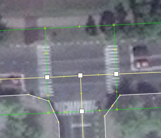
Each underpass turns into a set of at least two stairs, a tunnel and two connecting roads. A bunch of tags appear that are not displayed either in editors or on standard OSM styles. Zebras, sidewalk, stairs. For example, ladders have a direction (up - rise), but it is not drawn on the map, and many ladders are marked incorrectly. Agree, for a pedestrian there is a difference - to rise or descend. If we take into account the needs of “non-standard” pedestrians (people with scooters, wheelchairs and wheelchairs), then they require even more data, for example, the presence of ramps and ramps. Although there are tags for all this, very few people know them even from experienced participants, and even fewer those who arrange them.
Squares
In general, pedestrians do not walk on clearly defined lines. They have different areas where you can walk as you like. Although everyone still follows the shortest route, the area is drawn on the map separately. And the shortest hiking trails under it are often forgotten to indicate. Neither MAPS.ME, nor any other application or engine can do routing by area. Moreover, the community is actively discussing the issue of converting highways into asphalt areas with separately drawn markings. So the problem of space can still touch us and in the road graph.
He is worse in the pictures
To top it all off, the pedestrian roads are almost impossible to draw from space imagery. All independent trails and roads that are not laid along highways are blocked by treetops and are not visible. Also, as some fences standing between the houses are not visible. Not to mention the forest paths.
Destructive minor edits
And still mapping on a live graph resembles bomb disposal. Without special skills. All edits instantly go to a common database. No matter how hard we try to improve our routing algorithms, they are very susceptible to the quality of the graph by which the route is built. And I have already said that together with the sidewalks, each intersection is a difficult interchange, and it is very easy to mess with it. For example, forget to add common points to intersecting lines. So it turns out that during each data update you are waiting for where it broke this time.
Community Lease-Free Change
Well, and finishes all the general awkwardness of a large cartographic community. New tags come up hard. Proposals, the official proposals of the new designation systems, are not added to the end. Initiatives rarely go beyond regional communities. To describe the scale of the problem for the uninitiated, I will give just one example: in OSM there is still no mechanism for designating any areal objects. All areal on the map, including the continents themselves, are closed lines and conjectures of drawing programs.
Solution Options for OpenStreetMap
In general, if you look closely, you can understand that all the problems listed separately are not new. The community in one form or another has already met with them and somehow solved them. Therefore, I will describe some solutions that might resolve the situation.
Run as it is and wait for the activists who will correct
The main mechanism of OSM is time. Enthusiasts will use the first navigators, collect rakes and edit the map. The higher the quality of the data becomes, the more people will be willing to use the product. So, step by step, first districts, then big cities will reach the level of high-quality pedestrian graphs. This week MAPS.ME officially began to support walking trails. You can appreciate all the advantages of pedestrian routing by simply downloading the application to your phone.
Facilitate the first entry to beginners. ID and wizards
The mapbox does a great job developing tips during the mapping. No matter how powerful JOSM is, but when a beginner is taken as a card, it is better to provide him with an easy way to find out what other tags you can fill. And here we could have come across all kinds of clues and wizards. Ideally, you should minimize the search for tag names in the OpenStreetMap wiki. As a bonus, this will ease the problem of typos in the tags.
Mobile mapping applications
Continuing to simplify, mapping applications should become more mobile. Let beginners be able to make easy edits directly from their mobile phones. Let's leave the process of collecting data on a bypass list and transfer them to the program for experienced community members. This is especially important for information that cannot be seen from the satellite. For example, information about stores.
Validators
The problem of data breakdown is also not new to OpenStreetMap. Road graph is regularly broken, and validators help to cope with this. Look at projects like KeepRight and Peirce QA . So far there are few such tools for the pedestrian graph, but the technology itself has proven itself and can be used here. In addition, such sites are elements of gamification when making major changes or maintaining the quality of maps. However, not all members of the open map community know about these sites.
findings
As you can see, none of these solutions can not become a silver bullet for OSM. It takes a lot of strength to be able to take all the best from each decision and move the map to a new level. However, the goal is ambitious. For any cartographic company, the pedestrian count of the world is unprofitable. This is precisely the opportunity that can reinforce the triumph of open data over proprietary ones.
Source: https://habr.com/ru/post/265249/
All Articles