Smart Cities and Big Data
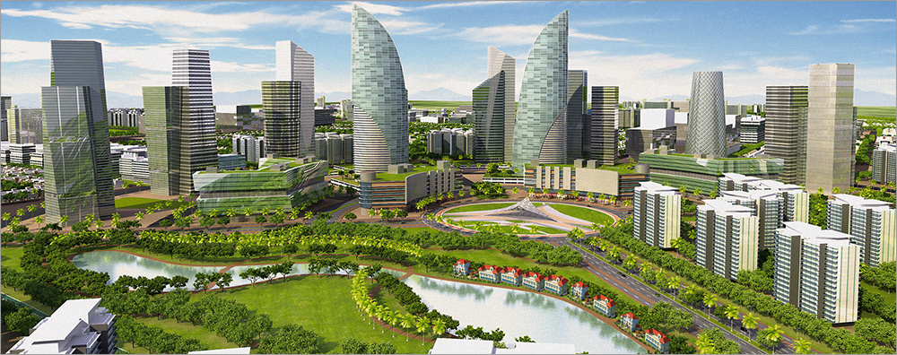
Worldwide, there is an increase in urban population. Scientists estimate that by 2050 it will be 70% of the world's population. With the enlargement of megacities, there are numerous problems associated with high population density, urban traffic, efficient use of resources. In many countries, ambitious projects are being implemented for the development of modern urban infrastructure based on the use of modern technologies - this concept has been called Smart City . A “smart city” should be characterized by highly efficient economies and governance, high living standards, mobility, and respect for the environment for long-term sustainable development.
For a “smart city”, it is important to have effective managerial and analytical tools to maximize possible negative trends. To solve the problems of modern cities, IT systems of a new generation are being developed and tested, which use Big Data analytics, integrated computer modeling, apply the latest scientific research in the field of sociology and human behavior.
Using information and communication technologies (ICT), one can visualize data and solve various problems of sustainable development and rational organization of the urban environment across the entire ecosystem of a city and its surroundings.
')
The number of Smart City projects in the world, proposed or already implemented, has exceeded 400. However, only a few clearly define the use of ICT and their role. Most of the projects are focused on energy and traffic management. Only 27 of them are dedicated to the development of ICT. And this imbalance was one of the reasons why Smart City projects face serious problems. Meanwhile, ICTs can play a decisive role in bringing different approaches together, become a kind of “circulatory system” connecting various infrastructure levels and ensuring the exchange of information between them.
Smart City projects should take into account a variety of aspects - from people's behavior to resource and infrastructure management. In essence, this is a network of interconnected mechanisms, and ICTs allow visualizing their interaction, managing these flows, covering not only urban structures of different levels, but also neighboring settlements and even other cities. From the point of view of ICT, the overall optimization in various areas, the balance of material (material resources, food, waste, etc.) and intangible flows (energy, information, etc.) are important.

In the model created with the help of ICT, it is important to take into account a variety of aspects, such as traffic and passenger traffic, energy consumption, in various areas - construction, traffic management, energy, industry. ICT, in particular, cloud technologies, play an important role in optimizing these links between cities and settlements at different levels. Information technologies offer opportunities for monitoring, data visualization, stream analysis, their optimization and management.
To implement these concepts and analyze the huge amounts of data generated by human activity and the movement of various objects, Fujitsu developed the SPATIOWL basic infrastructure. It uses data collected from a large number of sources, accumulates, processes them and gives recommendations on possible actions. This allows us to develop unique offers on its basis, for example, to solve urban planning tasks and provide residents with new services, such as real-time traffic information, and manage traffic.
The data in this case comes from sensors installed on vehicles on the roads. SPATIOWL also receives data from local residents and even from social networks. As information is constantly updated, the system builds a dynamically changing virtual model of the real world.

Fujitsu SPATIOWL can be used in many areas.
The real and virtual worlds are connected by data streams transmitted between mobile or stationary devices and the SPATIOWL system, which extracts information from this data and logically organizes it. Based on data from the real world, analytics tools generate reports, build trends and forecasts, and make recommendations. All these results are transmitted to users or real-world control systems. Thus, SPATIOWL helps to solve specific problems for building an intellectual society and creating new services.
The SPATIOWL system was originally designed to work with Big Data. Physically, it is in the cloud - in the data center. Between the real world and IT systems in the cloud, huge amounts of data are indeed transmitted, but examples are best explained. One of them is the slippery road information service. Many modern cars have ABS and electronic stabilization systems that produce millions of measurements. This data enters a powerful analytical platform based on Hadoop. Analysis of such data helps to give tips on driving on slippery roads, to identify particularly dangerous areas. All drivers with devices connected to the SPATIOWL system will receive a warning when approaching such sites.
As already noted, SPATIOWL can collect data from a wide variety of sources. For example, it can be cars and public transport. The location of the objects is known in the SPATIOWL coordinate system. If the routes of cars are planned using the system, then they are known. If, according to information from social networks, SPATIOWL finds out, for example, that a flash mob is being organized on a certain street, this factor is taken into account in the forecast. In addition, the system collects traffic statistics and also uses it to predict traffic jams. The system can advise the driver instead of a car to use urban transport - tram or subway.

Based on the accumulated data and current traffic information, the SPATIOWL system is able to predict the situation and make decisions. It can identify potential conditions for traffic and warn drivers in advance by preventing congestion.
Essentially, SPATIOWL is a Big Data infrastructure that encompasses both internal corporate and client solutions and cloud services. It includes analytical and infrastructural products, as well as various improvements to standard tools such as Hadoop.
Since the creation from scratch of a system that collects and processes huge amounts of data in real time, requires significant investments and resources, companies creating their own solutions and services for a “smart city” can use the existing cloud services and the necessary analytics results. This is a fast and relatively inexpensive way to generate business-friendly data analysis results. Fujitsu experts can help customers implement Big Data projects — from consulting to integration.
For transport and logistics companies, the SPATIOWL system will help in choosing the best routes, individual drivers can use it to get information about traffic, and city authorities can use the information they receive to control traffic. However, the use of SPATIOWL is not limited to traffic management. It can be used as a platform for the implementation of various services in vertical industries - in agriculture, utilities, energy, health care. After all, the potential of SPATIOWL and Big Data is huge.
Our previous publications:
» Servers for business: energy efficiency matters
» Fujitsu ETERNUS CD10000: Ceph without worries
» New server park Fujitsu
For a “smart city”, it is important to have effective managerial and analytical tools to maximize possible negative trends. To solve the problems of modern cities, IT systems of a new generation are being developed and tested, which use Big Data analytics, integrated computer modeling, apply the latest scientific research in the field of sociology and human behavior.
Using information and communication technologies (ICT), one can visualize data and solve various problems of sustainable development and rational organization of the urban environment across the entire ecosystem of a city and its surroundings.
')
The number of Smart City projects in the world, proposed or already implemented, has exceeded 400. However, only a few clearly define the use of ICT and their role. Most of the projects are focused on energy and traffic management. Only 27 of them are dedicated to the development of ICT. And this imbalance was one of the reasons why Smart City projects face serious problems. Meanwhile, ICTs can play a decisive role in bringing different approaches together, become a kind of “circulatory system” connecting various infrastructure levels and ensuring the exchange of information between them.
Smart City projects should take into account a variety of aspects - from people's behavior to resource and infrastructure management. In essence, this is a network of interconnected mechanisms, and ICTs allow visualizing their interaction, managing these flows, covering not only urban structures of different levels, but also neighboring settlements and even other cities. From the point of view of ICT, the overall optimization in various areas, the balance of material (material resources, food, waste, etc.) and intangible flows (energy, information, etc.) are important.
In the model created with the help of ICT, it is important to take into account a variety of aspects, such as traffic and passenger traffic, energy consumption, in various areas - construction, traffic management, energy, industry. ICT, in particular, cloud technologies, play an important role in optimizing these links between cities and settlements at different levels. Information technologies offer opportunities for monitoring, data visualization, stream analysis, their optimization and management.
Platform for smart city services
To implement these concepts and analyze the huge amounts of data generated by human activity and the movement of various objects, Fujitsu developed the SPATIOWL basic infrastructure. It uses data collected from a large number of sources, accumulates, processes them and gives recommendations on possible actions. This allows us to develop unique offers on its basis, for example, to solve urban planning tasks and provide residents with new services, such as real-time traffic information, and manage traffic.
The data in this case comes from sensors installed on vehicles on the roads. SPATIOWL also receives data from local residents and even from social networks. As information is constantly updated, the system builds a dynamically changing virtual model of the real world.
Fujitsu SPATIOWL can be used in many areas.
The real and virtual worlds are connected by data streams transmitted between mobile or stationary devices and the SPATIOWL system, which extracts information from this data and logically organizes it. Based on data from the real world, analytics tools generate reports, build trends and forecasts, and make recommendations. All these results are transmitted to users or real-world control systems. Thus, SPATIOWL helps to solve specific problems for building an intellectual society and creating new services.
The SPATIOWL system was originally designed to work with Big Data. Physically, it is in the cloud - in the data center. Between the real world and IT systems in the cloud, huge amounts of data are indeed transmitted, but examples are best explained. One of them is the slippery road information service. Many modern cars have ABS and electronic stabilization systems that produce millions of measurements. This data enters a powerful analytical platform based on Hadoop. Analysis of such data helps to give tips on driving on slippery roads, to identify particularly dangerous areas. All drivers with devices connected to the SPATIOWL system will receive a warning when approaching such sites.
As already noted, SPATIOWL can collect data from a wide variety of sources. For example, it can be cars and public transport. The location of the objects is known in the SPATIOWL coordinate system. If the routes of cars are planned using the system, then they are known. If, according to information from social networks, SPATIOWL finds out, for example, that a flash mob is being organized on a certain street, this factor is taken into account in the forecast. In addition, the system collects traffic statistics and also uses it to predict traffic jams. The system can advise the driver instead of a car to use urban transport - tram or subway.
Based on the accumulated data and current traffic information, the SPATIOWL system is able to predict the situation and make decisions. It can identify potential conditions for traffic and warn drivers in advance by preventing congestion.
Essentially, SPATIOWL is a Big Data infrastructure that encompasses both internal corporate and client solutions and cloud services. It includes analytical and infrastructural products, as well as various improvements to standard tools such as Hadoop.
Since the creation from scratch of a system that collects and processes huge amounts of data in real time, requires significant investments and resources, companies creating their own solutions and services for a “smart city” can use the existing cloud services and the necessary analytics results. This is a fast and relatively inexpensive way to generate business-friendly data analysis results. Fujitsu experts can help customers implement Big Data projects — from consulting to integration.
For transport and logistics companies, the SPATIOWL system will help in choosing the best routes, individual drivers can use it to get information about traffic, and city authorities can use the information they receive to control traffic. However, the use of SPATIOWL is not limited to traffic management. It can be used as a platform for the implementation of various services in vertical industries - in agriculture, utilities, energy, health care. After all, the potential of SPATIOWL and Big Data is huge.
Our previous publications:
» Servers for business: energy efficiency matters
» Fujitsu ETERNUS CD10000: Ceph without worries
» New server park Fujitsu
Source: https://habr.com/ru/post/258925/
All Articles