TeleGeography World Wide Web Map. 2015 version
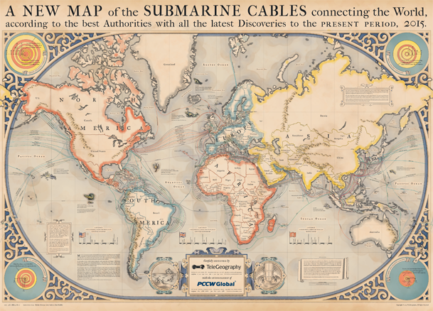
Continuing the tradition begun in 2013 by this post, I want to announce the release of the updated map of Internet backbones from TeleGeography.
The map contains ping information; cable laying steps; cable hazards. Under the cut are details from TeleGeography and glued highres for printing from me.
Inspiration
This year, cardmakers paid tribute to medieval and Renaissance cards. In addition to the practical navigation functions, maps of that era were real works of art, decorated with illustrations. The main source of inspiration was the book Chet Van Duzer "Sea monsters on the maps of the Middle Ages and the Renaissance", which is probably the most complete information on sea charts and the monsters on them, in that era.

Information component
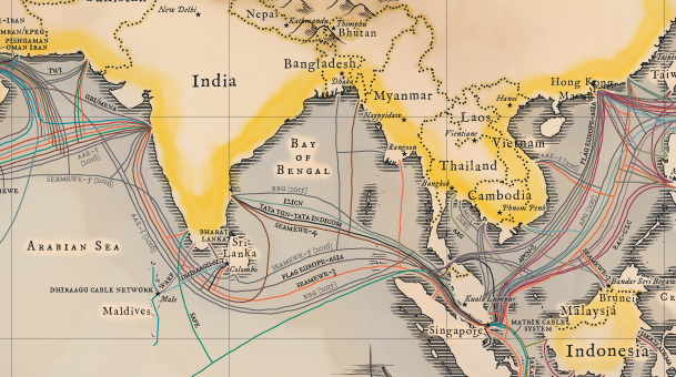
The map shows 278 active and 21 planned highway this year. Also for all states, the capitals are marked (so the map can be used as a political one).
')
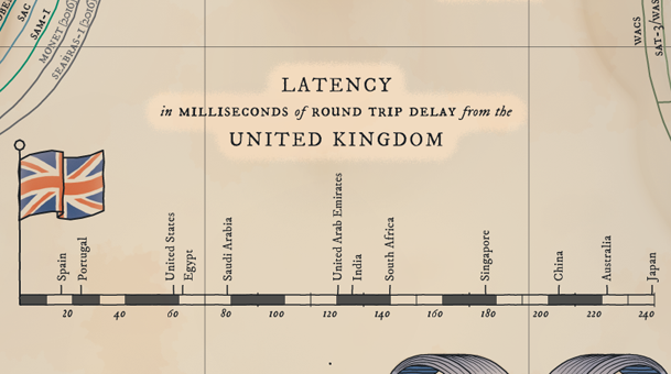
Ping Information
On the sidebar there is an infographic about ping from the USA, Great Britain and Hong Kong to a number of other countries.
Cable hazards
The map is decorated with images of common causes of cable damage, including fishing boats, anchors and trenches on the ocean floor, and, for example, the Tenth of Giant Lobster (O_o) .

It is possible to buy a wall version of the card (for $ 250).
Well, for a sweet high-res for print (16384x12800) compiled for you by a wonderful ImageMagick in collaboration with Wget. I hope Mega cope with the influx (just in case duplicated on YandexDisk ).
Source: https://habr.com/ru/post/252269/
All Articles