Google Ocean: 3D World Ocean Map
Google continues to make a detailed map of the surrounding world. After the Google Earth earth map and the Google Sky space map, another project is scheduled to launch: the 3D ocean map Google Ocean.
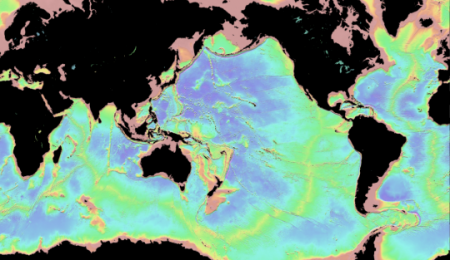
Google Ocean will be implemented in a convenient interface with familiar navigation, as in Google Maps. At first it will be a base layer with a three-dimensional model of the ocean floor, but over time, Google plans to fill it with high-resolution photos (according to experts, it will take about 100 ship-years). As additional layers, maps with temperature, currents and other weather conditions, a map of coral reefs, etc. will be applied.
')
As is known, the oceans cover 70% of the earth's surface, but so far only a tiny part of the bottom has been studied by the method of echolocation. In fact, the world's oceans are still a vast unexplored space, with thousands of undiscovered species of animals and many unsolved mysteries.
To discuss the project, Google last December invited researchers from around the world to its Googleplex, and also organized the work of a special supervisory board, which included prominent oceanographers. Although the company itself maintains official silence, but ochenanologists already speak with admiration about this idea and say that such a tool would be extremely helpful in their work.
The new Google project should not be confused with the French design of the same name, which is a bunch of additional layers for Google Earth, including the coordinates of the seaports, the plan of all submarine fiber cables and much more.
via News.com
Source: https://habr.com/ru/post/24640/
All Articles