Openstreetmap-based navigation apps for Windows Phone

Almost a year ago, I moved to the Nokia Lumia 920 as the main mobile device. The difference with the previous phones (on Android) was a little scary, but quickly passed. The market was not so empty, as described in all sorts of articles and at the moment I found almost all the software that I need, except perhaps the navigator based on Openstreetmap. I took the OsmAnd app for Android as a standard - indeed, it suited me for everyone, on foot and in car navigation.
Criteria for evaluation
- Discretion and usability
- Map drawing speed
- Offline map features
- Route planning
- Design
- Subjective personal opinion
To save text, I will not attach screenshots to all descriptions, they are already available via links to the market at the end of the text.
List of programs in the review
- Geogps
- MapUse
- maaloo outdoor
- MapCache
- Geo-navigator
- Multi map
- Outdoor navigation
- xMaps
- OutdoorMaps
- Simple osm
- openstreetnav
- NaviComputer
- GeoNet
All the above programs are in the market on request openstreetmap.
')
Geogps
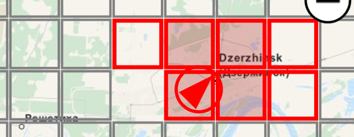
The cost of the full version of the program - 309 rubles, which looks wildly, because "not at all". A sufficiently large number of sources of maps (more than 10). The speed of drawing the map is not satisfactory. Setting the end point is not obvious at first glance - in the center of the map there is a crosshair that you need to point to the place where you want to go. After that, you need to call the menu item "Navigate to here". Different types of navigation are available - directly, for pedestrian, bicycle, the shortest and fastest way. The path is described in Russian. As far as I remember, this is the only program that contains a large number of information layers displayed on top of the map (odometer, speed, average speed, current position and many others), all of them can be included in any order. Route routing works only when the Internet is connected. Downloading maps, although less painful than its counterparts, is very far from ideal - for downloading, you need to select small squares instead of one large one, there is no choice of regions or countries.

MapUse
In this program, I was pleased with the download of maps broken down by region and country. The speed of drawing the map leaves much to be desired, I have not remembered such a long time, and the map itself looks strange, as if a raster is being rendered with a small resolution. Maps are available for download for free, but layers with POI, divided into categories are sold, for example, the category of food is divided into 4 subcategories - bars, fast food, restaurants and cafes, each at 44 rubles. In this program, I did not find any buttons for laying a route at all, as there is no sense in navigator.
maaloo outdoor
The program was surprised by a beautiful start-up screen and almost useless functionality. Useful, perhaps, as a monitor and as a store of points in the tabs. Navigation to the points is laid in a straight line. Several types of cards are available. Loading maps by region is not possible - only squares. The speed of drawing maps is strange, it feels like fragments outside the screen are not supposed to be drawn at all until you enter it. It looks as if the program is stuck for a few milliseconds.
MapCache
Reminds “Hello, World." No offline (apparently only in the paid version), no favorites. There is a search for coordinates and address. In other terms, the search by address did not find anything, and the search by coordinates did not pass validation during input, although I tried to enter these points in all three options presented, therefore, the route was not tested. The map is drawn and loaded without delay.
Geo-navigator
The program is intended only for two functions - laying a route from the starting point to the end point and recording tracks, works exclusively online. No POI, favorites, etc. When you click on the stop button, the track instantly crashes.
Multi map
Another "Hello, World". The program can only show the current position and speed. In addition to OSM, there are several other types of cards. Works only online.
Outdoor navigation
One of the "monsters." Laudatory reviews in the market forced to pay attention to this program. Pleasant and harmonious interface. Places photos from the library at the points where they were taken. Has, perhaps, the largest list of sources of maps, divided into categories. Three types of route - auto, pedestrian and off-road. Good search by addresses. Record tracks with export to SkyDrive. Route routing and search are online only. Loading maps is only a rectangular area. In principle, it can be used as a navigator with Bing maps embedded in the phone, but here I consider only the functionality in conjunction with Openstreetmap.
xMaps
The program, first of all, was remembered by horrifying icons and fonts. They are pixelated. Pave the track failed - when you click the search button crashes. Offline map downloads are present in an even more perverted form than their counterparts — the area within the screen is loaded, and then the level of detail is selected. Drawing maps is not in a hurry, but there is a map tilt, which is regulated by a slider between the zoom buttons and constantly interferes.
OutdoorMaps
Another program with a nice design. Strange enough work with offline maps - downloads a square with an edge of 1, 5 and 10 km around the current location. He knows how to write tracks, but not to create routes. Found places you can add to your favorites, but what to do with them is not clear.
Simple osm
Almost standard functionality: recording a track, laying a route. Everything is just online. Tracks can be uploaded to the site of the creator, there is no synchronization with SkyDrive. The speed of work and design at a good level, in principle, there is nothing to slow down. There is a traffic layer from Google, but in our country, as you know, this service is not popular.
openstreetnav
There are no additional functions, except for showing the map, which also slows down when drawing.
NaviComputer
The program with a claim to good functionality, in fact - only recording tracks. Able to synchronize maps and tracks with SkyDrive, but the format of maps is closed, they are supposed to be downloaded using a PC program in which you can draw a polygon different from a rectangle. The download speed depends on the number of levels, from the inside of the program you can only download rectangles ... The size of the maps with all levels, of course, turns out to be just huge. There is no search and routing
GeoNet
I deliberately put this program at the end of the list. At the moment I have not found anything better. POI, laying a route, maps - absolutely everything works offline. Maps of Russia are divided into federal districts, the world - the country. The cards are pretty fresh. There is support for the source of CityGid maps with their traffic information. Controls and design are standard for "iron" car navigators. The design, of course, came from the mid-2000s and is not at all in line with the Metro ideology. Pseudo-volume, strange colors and lurid icons, what is called, a rod "from all cracks". The program's logo resembles the SEGA logo, and the boot indicator at startup shows a series of red stars, like on a tank turret. Sound alerts include an error sound from Windows XP. But despite the slightly confusing menu, the functionality is simply different, other alternatives, in my opinion, are simply not to be found.

Summary table of ratings
It was difficult enough to count in some “parrots” from 0 to 5 functions of the program, but in principle, the average estimate is quite in agreement with the general opinion.
| Title | Convenience | Speed | Cards | Route | Design | Subjectively | average rating |
|---|---|---|---|---|---|---|---|
| Geogps | four | five | 2 | 2 | 3 | 3 | 3.16 |
| MapUse | 2 | one | four | 0 | four | four | 2.5 |
| maaloo outdoor | four | four | one | 0 | four | four | 2.83 |
| MapCache | 2 | four | 0 | 0 | 2 | 2 | 1.66 |
| Geo-navigator | four | five | 0 | 2 | five | four | 3.33 |
| Multi map | one | five | 0 | 0 | 2 | 0 | 1.33 |
| Outdoor navigation | four | four | 2 | 2 | five | four | 3.5 |
| xMaps | 0 | 0 | one | 0 | 0 | 0 | 0.16 |
| OutdoorMaps | 3 | five | one | 0 | five | four | 3 |
| Simple osm | 3 | five | 0 | 2 | four | 3 | 2.83 |
| openstreetnav | 2 | 2 | 0 | 0 | 2 | 2 | 1.33 |
| NaviComputer | 3 | four | 3 | 0 | four | 3 | 2.83 |
| GeoNet | four | five | five | four | 3 | five | 4.33 |
What other Openstreetmap navigation software with offline maps I missed?
Source: https://habr.com/ru/post/235213/
All Articles