Wikiroutes 1.0
A long time ago (in 2009 and in 2010 ) we wrote about the crowdsourcing project to collect data on public transport in Habré.
During this time, the project has been slowly but surely developing, taking into account the wishes of our users and our plans. Much has changed as in the architecture of the project, in the design, made a mobile site, earned some money, and most importantly, we changed the name to WikiRoutes, which reflects the idea of the project.
Now we are ready to talk about a new step for us and a step back for users - the appearance of our application in the AppStore .
Unfortunately, while the application will be available only for the iPhone, but in the near future, we should expect the appearance of the application for Android (support only from version 4.0 and higher).
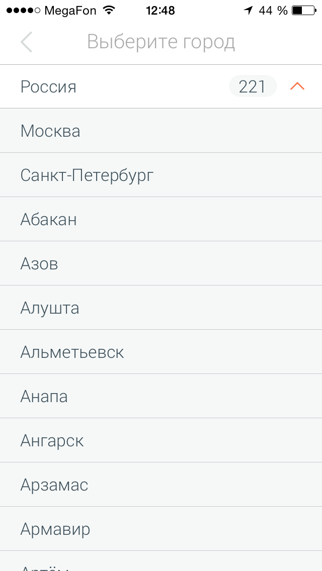
Like the site WikiRoutes.info , the application is a directory of urban public transport “of the whole world,” but at the moment we have the most information on cities in Russia and cities in the CIS countries (something about 30,000 routes in 600 cities, and in 2009 there were only routes of Moscow and St. Petersburg), however, thanks to users adding routes (more than 5000 active editors and moderators), the project geography is constantly expanding.
We will not show the start screen of the application, as there is nothing interesting there, but the post would be small and we decided to tell a little about the possibilities of the application.
')
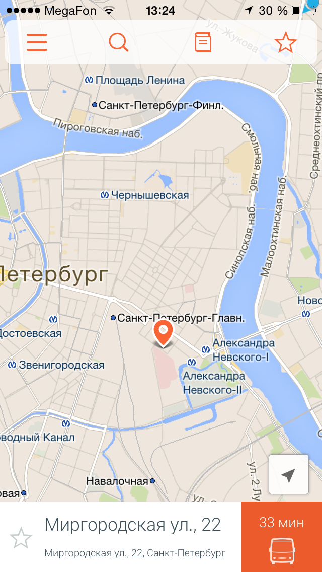
In general, the application partially repeats the capabilities of the site, except for the ability to add a new route. Now there is a standard opportunity to find route options from point “A” to point “B” by entering addresses, but you can also select points on the map or select points from previously saved ones as well as in a number of other applications and specify the type of transport in the route settings (if you do not like the subway, you can exclude it).

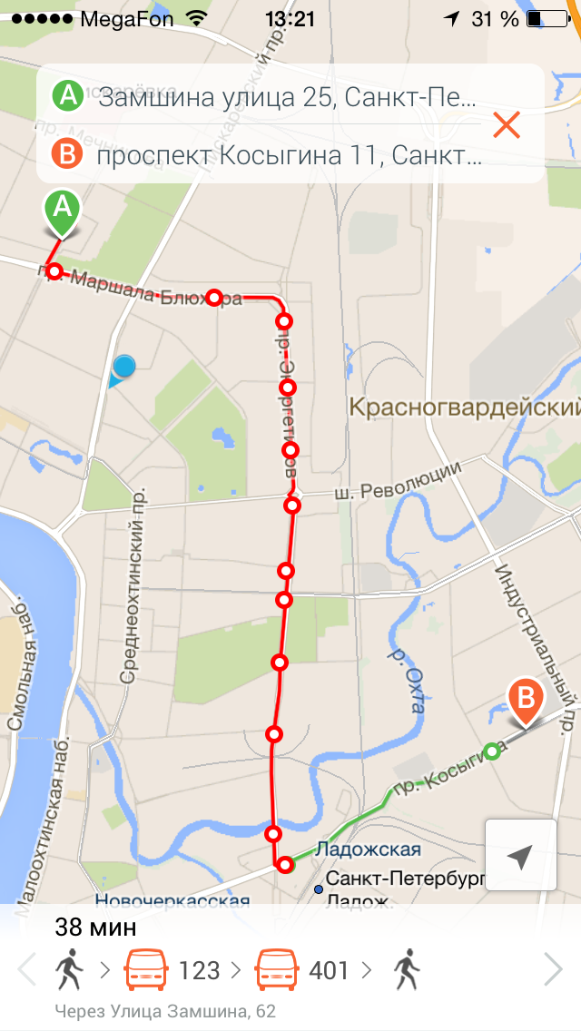
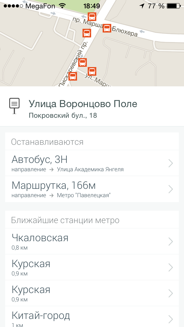
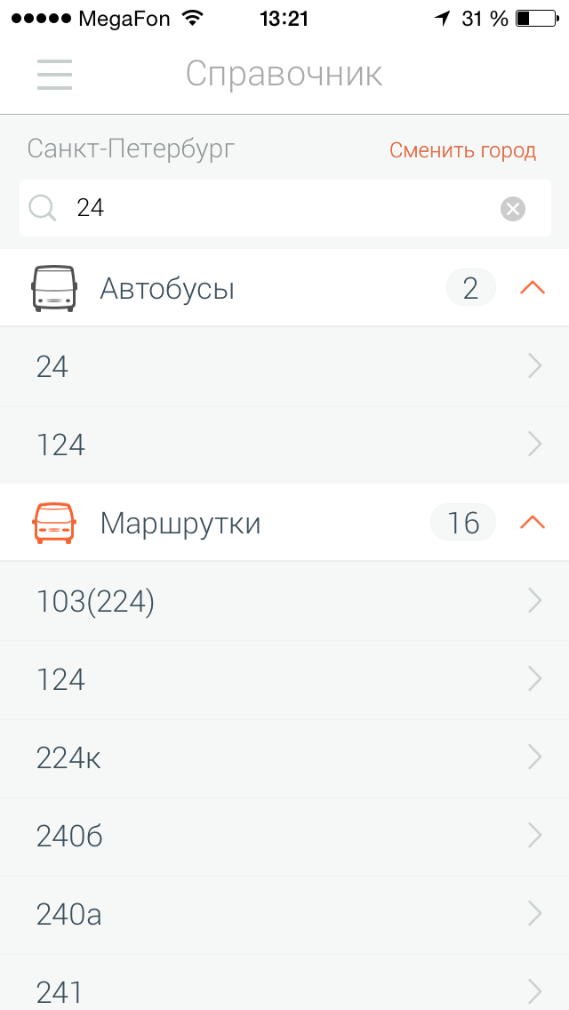
In addition to the ability to search for a route, you can use a directory that not only allows you to find out what routes there are, but also find out all the available information: the carrier company, schedule or traffic interval, comments from other users who use it, as well as a visual display on the map.

All route information provided by users is checked by us and other users, but we are not limited to the data received from them and add information that we receive from carriers. As a result, the information on the site is sometimes more relevant and complete, as compared to the information on the official websites of the carrier companies.
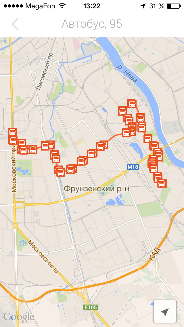
Now we have started working on the display of vehicles in real time, but so far this information is available only for St. Petersburg and only as the time of arrival of the transport at the bus stop, but in our plans we also need to display the position of the transport on the map (appear in about a couple of weeks).
In other cities of Russia, such information will also appear, but now the timing of its appearance is difficult to voice, as it is rather difficult to agree with all the “small” project and any help will not be superfluous to us.
If you have data about carriers or other organizations that provide data on the location of transport in real time, we would be grateful for such information, which would allow to improve the project. Please write or comment to this address info@wikiroutes.info .
Put the application or view a brief video review, write suggestions, suggestions and just “criticism” it will be useful for us :)
PS: While we were writing this post, our application was already installed by 500 users.
PPS: We will comment as much as possible. Thank.
During this time, the project has been slowly but surely developing, taking into account the wishes of our users and our plans. Much has changed as in the architecture of the project, in the design, made a mobile site, earned some money, and most importantly, we changed the name to WikiRoutes, which reflects the idea of the project.
Now we are ready to talk about a new step for us and a step back for users - the appearance of our application in the AppStore .
Unfortunately, while the application will be available only for the iPhone, but in the near future, we should expect the appearance of the application for Android (support only from version 4.0 and higher).
Like the site WikiRoutes.info , the application is a directory of urban public transport “of the whole world,” but at the moment we have the most information on cities in Russia and cities in the CIS countries (something about 30,000 routes in 600 cities, and in 2009 there were only routes of Moscow and St. Petersburg), however, thanks to users adding routes (more than 5000 active editors and moderators), the project geography is constantly expanding.
We will not show the start screen of the application, as there is nothing interesting there, but the post would be small and we decided to tell a little about the possibilities of the application.
')
In general, the application partially repeats the capabilities of the site, except for the ability to add a new route. Now there is a standard opportunity to find route options from point “A” to point “B” by entering addresses, but you can also select points on the map or select points from previously saved ones as well as in a number of other applications and specify the type of transport in the route settings (if you do not like the subway, you can exclude it).
In addition to the ability to search for a route, you can use a directory that not only allows you to find out what routes there are, but also find out all the available information: the carrier company, schedule or traffic interval, comments from other users who use it, as well as a visual display on the map.
All route information provided by users is checked by us and other users, but we are not limited to the data received from them and add information that we receive from carriers. As a result, the information on the site is sometimes more relevant and complete, as compared to the information on the official websites of the carrier companies.
Now we have started working on the display of vehicles in real time, but so far this information is available only for St. Petersburg and only as the time of arrival of the transport at the bus stop, but in our plans we also need to display the position of the transport on the map (appear in about a couple of weeks).
In other cities of Russia, such information will also appear, but now the timing of its appearance is difficult to voice, as it is rather difficult to agree with all the “small” project and any help will not be superfluous to us.
If you have data about carriers or other organizations that provide data on the location of transport in real time, we would be grateful for such information, which would allow to improve the project. Please write or comment to this address info@wikiroutes.info .
Put the application or view a brief video review, write suggestions, suggestions and just “criticism” it will be useful for us :)
PS: While we were writing this post, our application was already installed by 500 users.
PPS: We will comment as much as possible. Thank.
Source: https://habr.com/ru/post/222903/
All Articles