TeleGeography Underwater Internet Map 2014
World map of the underwater Internet from TeleGeography and 8banks , which specializes in the collection and processing of telecom data in the financial sector:
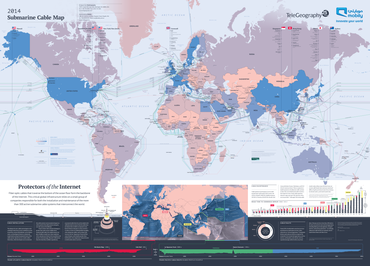
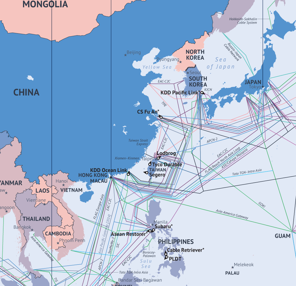
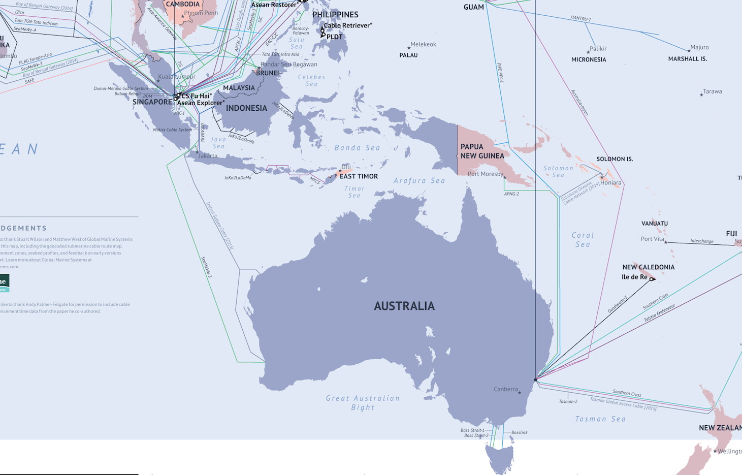
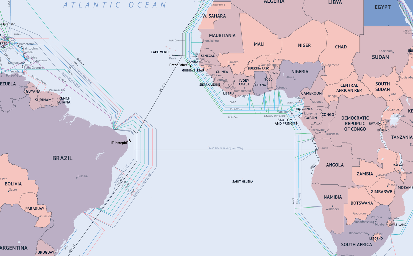
The map displays fiber optic cables that run across the ocean floor, connecting countries. Of course, there is still a mass of fiber-optic connections by land, but they are not displayed on the map, you can search for information about them here .
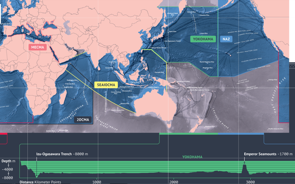
Paul Brodsky, TeleGeography analyst, commenting on the map, explained: “The vast majority of Internet traffic travels via fiber optic cables. Many people think Internet connections are via satellite, but this is not true. They pass through these submarine cables. Companies that run these fiber optic cables place a huge coil on the ship and send the ship to sail from country A to B, unwinding the coil along the way. That is, the cable literally just lies at the bottom of the ocean. And only on the approach to the shore the cable is buried in a trench.
It is these cables that give us the communication speed in milliseconds between New York and London. The biggest risk for these cables is fishing boats and ships anchored. Sometimes there are natural disasters like earthquakes. But if the cable is damaged, then the traffic is simply redirected to another cable. Brodsky says that the management and laying companies constantly monitor the condition of the cables and, in case of any malfunction, go to sea, pull out the problem area and replace it.
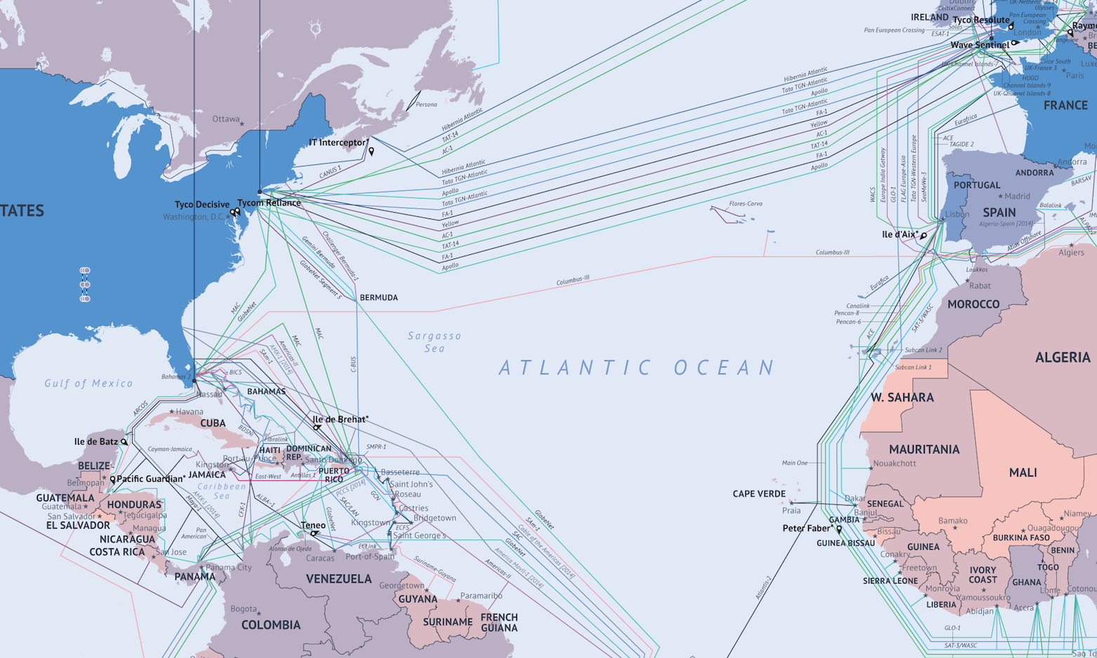
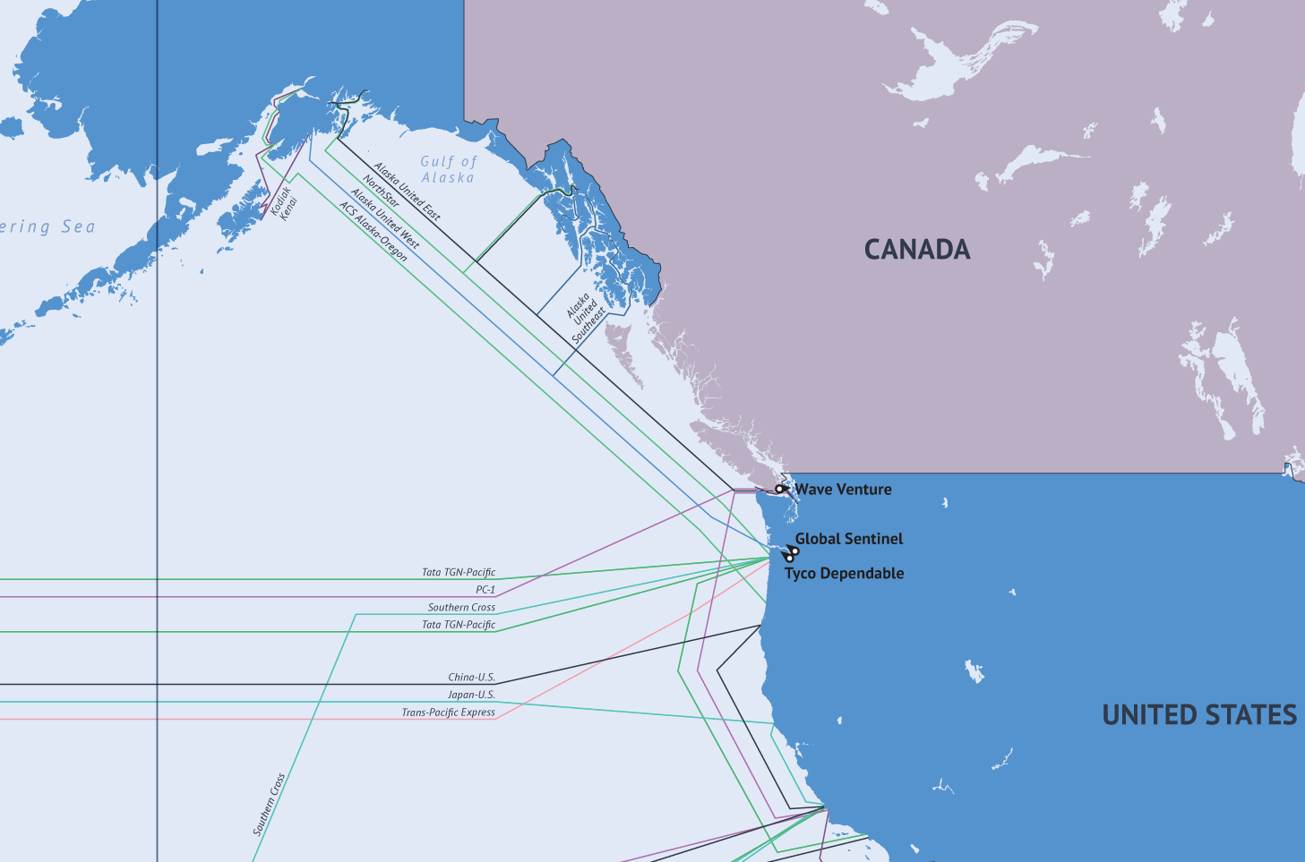
As you can see in the map, most countries that have access to the sea are connected to these channels. And in the future it is worth waiting for an increase in the number of connections. According to Brodsky: “Every country that has one connection also wants the 2nd and 3rd”. Below are enlarged sections of the map:
')
Original Business Insider .
Post about the card for 2013 here . TeleGeography github .
Source: https://habr.com/ru/post/215281/
All Articles