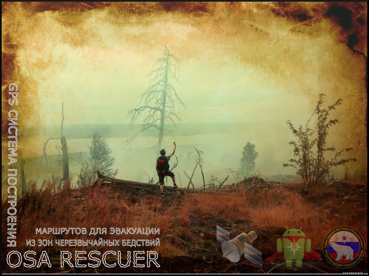
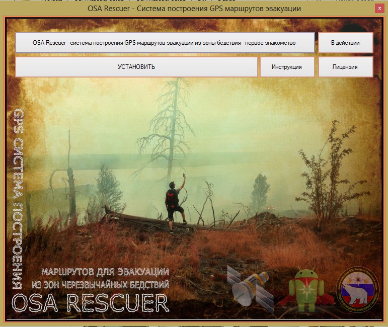
OSA Rescuer - a system for building GPS routes for evacuation from disaster zones [First Experience]
“OSA Rescuer is an automated complex to assist the Ministry of Emergency Situations and build GPS routes for evacuation from disaster zones.”
All over the world, we will not affect only our country, forests are burning, man-made and natural disasters happen, which we do not always have time to predict, and people often get into these emergencies.
')
Within the framework of the MES assistance program, a prototype automatic complex is being developed, which will be used in real conditions in various emergency situations. At the first stage, the project is aimed at a limited area, and is designed for use in rescue services in small cities and settlements - fire departments, emergency situations, forest areas. The complex is designed as simple as possible in order to maximize speed.
In such situations, it is impossible to manage with simple extinguishing of a fire, here the injured person can do little at all independently. But using the “OSA Rescuer” application developed for mobile devices, it can request from the rescue service, the Ministry of Emergency Situations or the local lesnichestvo a route that can be used to exit the emergency zone and, following which, we will be found and met by 100%.
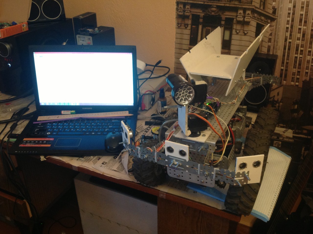
The project “OSA Rescuer” is a whole complex of autonomous ground and air platforms, as well as software that provides the operator with the necessary means of monitoring emergencies. Autonomous search platforms based on drones and ground-based ATVs should be able to independently get to the place of emergency, after which the operator remotely takes control for a better overview and assessment of the situation. The software package includes a terminal (Fig. 1), where the operator receives requests from mobile devices for evacuation from victims, interactive maps of Russia, mobile mobile control panels with video cameras installed on them for remote attendance TV, GPS systems for autonomous movement at the specified coordinates in the emergency area. Also, the program complex includes a client application program developed for the Android platform (Fig. 2).
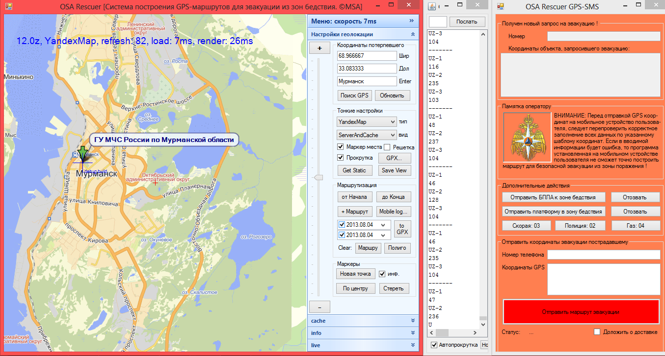
Fig.1. A program installed on a personal computer. Operational point of the rescue service officer.
picture 3 picture 4
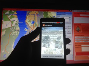
Fig.2. The program installed on the phone of the victim.
Additional functions of the application, provide the victim with the opportunity to describe in more detail the situation in which he fell. He needs to tick off the relevant items, such as "There is a fire in the forest, there are victims, it is necessary to take out, I can not move, and others." There are also instructions for action in various emergency situations, be it a natural, man-made or biological disaster.
The composition of the complex:
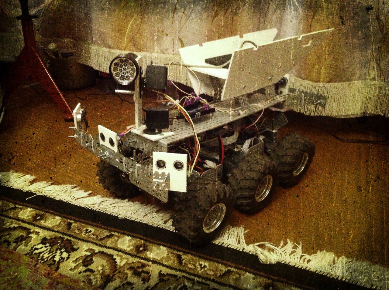
Fig.3. Six-wheeled platform all-terrain vehicle with equipment.
All-terrain vehicle tasks:
1. Delivery to the victims of medicines, products, communications and other things.
2. Implementation of two-way communication with the victims, if it is impossible to contact them in the usual ways.
3. Detailed reconnaissance areas with limited visibility for UAVs (smoke, dense forest, etc.)

Tasks drone:
1. Autonomous movement in the area of emergency. The operator gives a command to take off and indicates the location on the GPS. The drone flies to the designated point and cuts spirals collecting information and compiling a photo map of the area - all received information is sent to the dispatcher's headquarters.
2. Manual control in the emergency area. Transition from AU to RU mode for a more detailed survey of the situation. Perhaps you need to assess the condition of the victim.
In a certain area there must be stationary or mobile points with drones placed on them with a range of tens of kilometers. Thus, rescue services lift into the air the drone nearest to the emergency zone.
3. Fast delivery to the affected medicines, products, etc. Delivery of mobile ground platform closer to the location of the victims. This possibility is necessary in the case when the forest excludes direct contact of the victims with the drone.
The principle of the complex:
The person in trouble runs the application on the phone. The application determines its GPS coordinates. When the “Request route \ SOS” button is pressed from a mobile device via GSM-GPRS communication, an SMS message is sent to the rescue service phone installed in the program. Further, the operator, who is behind the dispatch console, receives an SMS-message, which contains information about the location of the victims. The dispatcher, having this information, finds the area on the map. According to the available reports on the situation in the region (weather reports, fires, etc.) it determines the best escape route from the emergency zone. Next, the program builds a route and sends the victim to the mobile phone. In the phone, the received SMS message is identified by the program and automatically displays route points on the screen. The route is approximate, and it is the most acceptable in this situation. The victim must follow it. If the escape route is unavailable for any reason, it is reported to the operator and he builds a new route.
In the absence of information about the situation in the emergency zone, the operator can use automated systems for remote monitoring of emergencies. According to the GPS coordinates available, the UAV is sent to the zone and patrols the area at a predetermined height, collecting information about the situation. It is possible to install various peripheral devices on the drone to search for the victim, determine the type and causes of emergency situations, communication. You can also send a ground platform with the necessary first-aid equipment, etc.
Responsible for the project implementation: Sergey Melnikov.
The current state of the project: an application is being developed for Android, the application is 70% developed, the rest is information and additional functionality. Operator software has been developed, improvements are required with testing on the prototype. Delivery of parts is expected.
Project Media Library:
UPD: The project is being done for personal purposes, development of software and equipment for its own development + information from the Internet (Directories, Examples, and etc.).
UPD. Delivery of the project
I continue to develop my project, and now the software part for the workstation is already ready - the personal computer is ready. Time to finalize the program for Android is still underway. Since, for the sake of this project, I first became acquainted with the development of programs for Android, now there are a lot of jambs, these are trifles, but over time I will resolve them and fix them. There are still many gaps in knowledge. There is not enough time, you have to burst among 3 elements: study; work, hobby.
This work is done exclusively as a hobby for participating in various competitions. In the future, it will be a good start for me, as well as a reason to offer some ideas of my own.
Below is additional information that I have implemented over the past days:
What is needed for rapid deployment of the complex:
1. The operator’s workplace must have: a) personal computer, mouse, monitor, keyboard, dvd-drive, usb-in; b) Internet connection; c) GSM modem connected via USB interface; d) pre-installed OS Windows XP / 7/8 and higher; e) Updated .NET Framework 4 and higher.
2. In addition to the hardware, the operator must have local maps, up-to-date reports from various situation control services, EDDS, and so on. This is necessary for rapid response and reconnaissance areas.
Installing software and hardware on the operator’s personal computer running Windows:
1. Insert a DVD into the drive.
2. Run Autorun. If this does not happen, run the Setup file, which is located on the disk.
3. Follow the installer instructions. Note: install the software preferably in the root of the drive "C: /".
4. After installation, a program shortcut appears on the desktop.
5. Connect the USB modem to the computer.
6. Install all the necessary software that comes with the modem.
7. Test the modem. Check your Internet connection and the ability to send SMS messages. Note: all these functions are available in the modem control panel.
8. Install SMS-server, which is bundled with the program on a disk in the Utilities folder.
The first launch of the OSA Rescuer PC program:
1. Run the program. On the screen there will be two active windows-GPS-SMS, and OSA Rescuer map, arrange them so that they both are in sight.
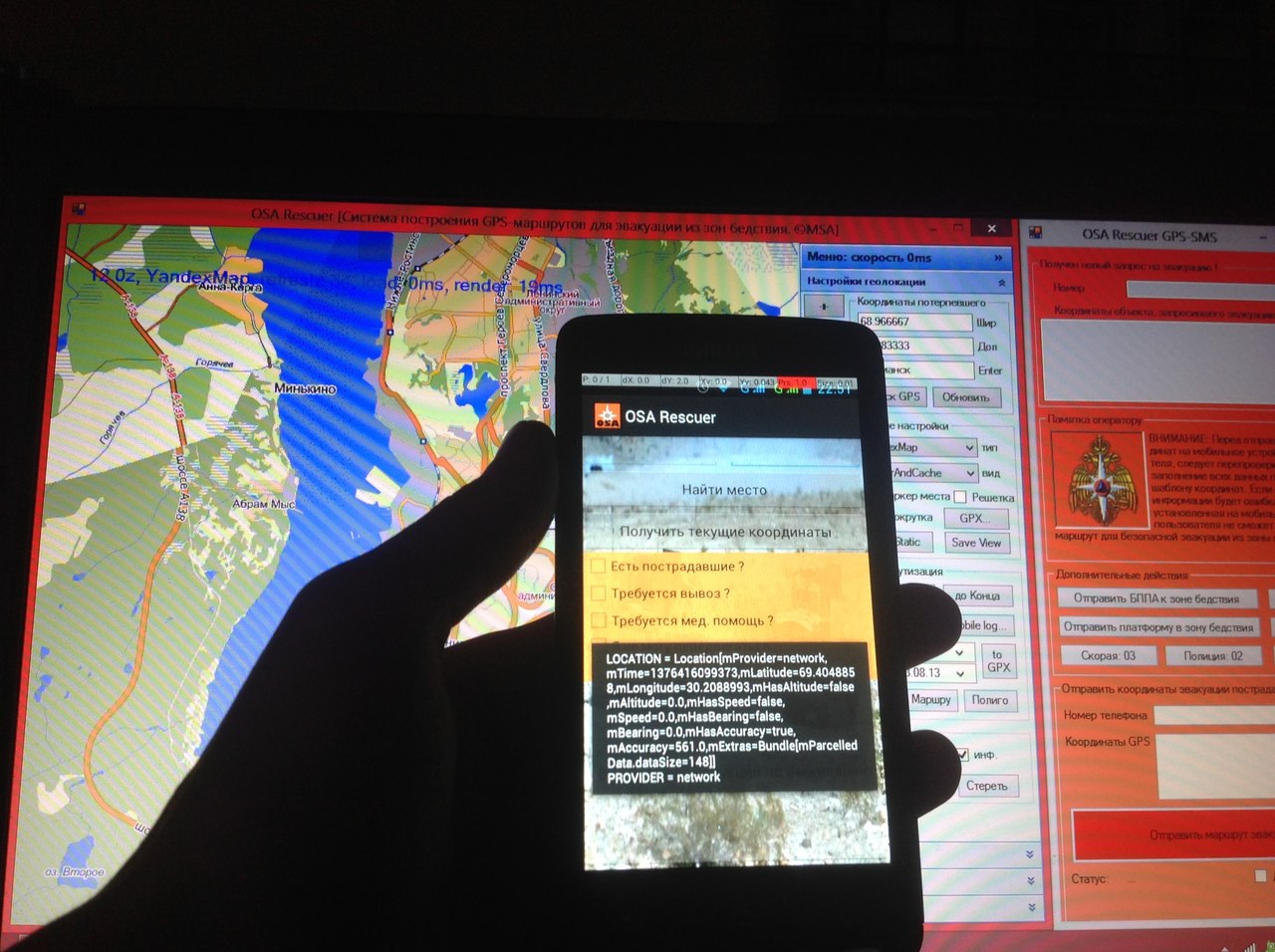
In the “OSA Rescuer” window, where the card is located, you are invited to customize it to fit your criteria. By default, a map of the city of Murmansk, a department of the Ministry of Emergency Situations. In the right corner are all the necessary map settings. GPS coordinates, map view (geographic, high-altitude, city, road, and so on). This window is used to enter the GPS coordinates of the victim, drawing up a route based on the available maps of the terrain and summaries of local terrain monitoring services.
In the “GPS-SMS” window, where the fields of the number, coordinates of the object, a reminder to the operator, as well as the button “send evacuation route” are located, the operator receives and sends gps-coordinates to the victim. In this window, there is a request for evacuation and a mobile number of the victim, which indicates the location of the object, as well as some technical information, which states the situation of the victim, whether he needs medical assistance, whether he can move independently and so on.
2. The operator needs to enter the received GPS coordinates into the “latitude and longitude” fields in the main application window, and press the Enter \ Search GPS button. After that a lighthouse will appear on the map indicating the location of the object and the area in which it is located.
The operator, knowing on the map where the object is located, and having at his disposal all the necessary information about the territory under control, the location of the nearest assistance points, information about emergencies in this area, makes up the route along which the affected person needs to be promoted from the problem area. Sending coordinates is carried out in manual mode, and in a certain sequence in the window of the GPS-SMS program. Next, press the red button "Send evacuation route."
3. In addition to statistical data, the operator is given the opportunity to control automated unmanned vehicles. At the disposal of the complex there is a 6-wheel ground platform, as well as 4-screw aircraft. On board, each has all the necessary equipment to control and receive video broadcast. To manage these funds, you need to activate the manual control of the devices in the GPS-SMS window by clicking on the appropriate buttons - “send ... to disaster area” \ “recall”. Each device has its own control, and the control panel itself opens with a separate window. Each unit is equipped with motion tracking modules - trackers. At any time, the operator may stop controlling the device and be distracted by a more important task, while the device will go into standby mode and will report its location and status at certain intervals.
Installing software on a personal mobile device running Android:
1. Download or copy the installation file “OSARescuer.apk” to your mobile device.
2. Run the installation file, familiarize yourself with the proposed service and the functionality that will be used during the operation of the application. By agreeing to install you agree to the terms of use of this application.
3. After installation, a program shortcut will appear in the phone by clicking on which the application will start. Run the application.
4. The installation file can be deleted as unnecessary.
The first launch of the OSA Rescuer Mob:
1. Users of mobile devices running Android version 4 and above do not need to configure the program. The test application is designed for version 4.0.x and higher. For versions 2.0.x and higher, you need to download another version of the program (in development).
Since the application uses the GPS module built into the device, make sure that it is turned on. To do this, go to the device settings (settings), in the "personal" menu, select the "location services" tab. Next, you need to activate (tick) such functions as: a) by the coordinates of the network; b) gps satellites; c) auxiliary data; d) a-gps.
Also, special attention should be paid to the fact that this application uses the Google Map API services. And, therefore, on your phone should be installed Google map. You can download it in the Google market. After making sure that all services are working, and you can determine your location with standard applications, you can begin to study and work with the program “OSA Rescuer mob.”.
2. When you start the application, you need to familiarize yourself with the user agreement, which states that this program is intended for direct appointment, and not for games. Click the "continue to work ..." button. You will be taken to the main application window.
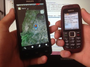
In this window, the most basic actions are: to get current coordinates; find a place. Clicking on the get coordinates button in the upper text boxes displays the latitude and longitude data. They can also be edited or entered manually by clicking on each field. By clicking the "Find a place" button you send a request to the rescue service to the operator. Then it remains to wait for a response from the operator and follow his instructions.
ATTENTION! In any situation where you are in danger and you are waiting for help from the operator, having received instructions from him, further actions depend on you - whether to follow the specified route, neglect it, or follow the specified route, but make your own adjustments as you go. The main thing is that the final point to which you go out should correspond to reality, as rescuers can wait for you there, or move to meet you.
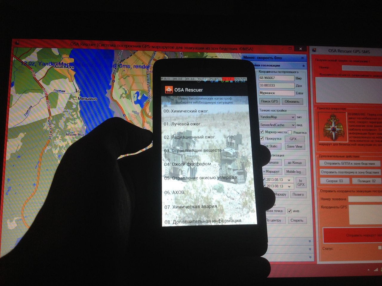
3. In addition to the main functions in the application there is a guide to emergency situations and instructions for survival in a given situation. To get acquainted with the reference information, you must click the "Types of Emergencies and Survival Instructions" button. Next, you need to choose 4 main types: a) first aid; b) Man-made, natural and biological disasters.
In each of the catastrophes are listed the most popular types of situations - floods, fires, fractures, and measures for survival in them.
The scheme of interaction of the operator with additional rescue services and victims:

Interaction with external local authorities:
The work of this complex provides all kinds of interaction with rescue services, local-based. And also with militarized units. For this interaction, appropriate regulations should be developed. Basically, this is the provision of information about the location of the object, for one reason or another, it is unable to independently leave the emergency zone, and in the case when the operator cannot provide quality assistance with the provided software and hardware. This request is considered by the rescue services and measures are taken to fulfill this request. After that the report should be sent to the operator.
During the project implementation the following advantages and disadvantages of this approach were identified.
Pros:
1. This complex is the cheapest to deploy and use in Russia.
2.Easy staff training.
3. Does not require bulky computing centers.
4. Full mobility of the complex.
5. Easily replaceable software and hardware.
6. Each complex can be involved in a certain controlled area, area.
Minuses:
1. Requires a third-party mobile operator and USB-modem to access the Internet and receive SMS-requests for evacuation.
2. Depends on the coverage area of GSM-communication (a little significant minus).
3. Requires a mobile phone with Android operating system v4 and higher.
4. For qualitative location determination, it is desirable to have a connected Internet connection in a mobile device.
5. If there is no GPS signal or no module at all in the phone, you must have an Internet connection \ connected GPRS.
6. The location of the cell towers approximate.
PS: I will not say that I am doing something special, but still doing this project, I learn a lot of new things for myself, both programmatically and technically, and of course this project is my main incentive not to stall in that hole, in which I live now ...
I hope my idea will interest you, and I will be happy to respond to comments, even if offensive [=
All over the world, we will not affect only our country, forests are burning, man-made and natural disasters happen, which we do not always have time to predict, and people often get into these emergencies.
')
Within the framework of the MES assistance program, a prototype automatic complex is being developed, which will be used in real conditions in various emergency situations. At the first stage, the project is aimed at a limited area, and is designed for use in rescue services in small cities and settlements - fire departments, emergency situations, forest areas. The complex is designed as simple as possible in order to maximize speed.
“Imagine the situation: you are in the forest, gathering mushrooms, berries, riding bicycles, hiking, it doesn't matter. You are completely passionate about your business and do not notice the impending danger, or simply ignore it, referring to "Yes, nothing terrible will ..." Meanwhile, in the woods somewhere not smoldering cigarettes smoldering or from the hot sultry weather the peat burned without smoke. The wind rises and inflates the fire, the forest begins to burn rapidly, the fire goes from the lower to the riding one, and the smoke that had previously been moved by the wind to the other side changed its direction and now this whole "threat" is approaching you. You do not see anything at arm's length, the smoke is so dense that only by falling to the ground you can snatch out “fresh” air. What is going on around? Where is the fire? What dear did you come? How to get out of here? In a panic, you can forget everything and do something stupid. In the meantime, you are trying to get out of the burning forest into the fresh air. Your carelessness leads you to another dead end - a piece of burning wood.
... From the author’s own experience of the project. ”
In such situations, it is impossible to manage with simple extinguishing of a fire, here the injured person can do little at all independently. But using the “OSA Rescuer” application developed for mobile devices, it can request from the rescue service, the Ministry of Emergency Situations or the local lesnichestvo a route that can be used to exit the emergency zone and, following which, we will be found and met by 100%.
The project “OSA Rescuer” is a whole complex of autonomous ground and air platforms, as well as software that provides the operator with the necessary means of monitoring emergencies. Autonomous search platforms based on drones and ground-based ATVs should be able to independently get to the place of emergency, after which the operator remotely takes control for a better overview and assessment of the situation. The software package includes a terminal (Fig. 1), where the operator receives requests from mobile devices for evacuation from victims, interactive maps of Russia, mobile mobile control panels with video cameras installed on them for remote attendance TV, GPS systems for autonomous movement at the specified coordinates in the emergency area. Also, the program complex includes a client application program developed for the Android platform (Fig. 2).
Fig.1. A program installed on a personal computer. Operational point of the rescue service officer.
picture 3 picture 4
Fig.2. The program installed on the phone of the victim.
Additional functions of the application, provide the victim with the opportunity to describe in more detail the situation in which he fell. He needs to tick off the relevant items, such as "There is a fire in the forest, there are victims, it is necessary to take out, I can not move, and others." There are also instructions for action in various emergency situations, be it a natural, man-made or biological disaster.
The composition of the complex:
Software part:
1. The program "osa rescuer mob" for a phone running Android. Eclipse development environment, + SDK.
2. The program "osa rescuer pc" for the computer. Used to display maps of various services based on Open Street, Yandex, Google maps. Microsoft Visual Studio C # 2010 development environment.
3. The program "osa rescuer gps-sms pc" for the computer. It is used to automatically receive SMS requests from a client with GPS coordinates in a message. Microsoft Visual Studio C # 2010 development environment. Used in conjunction with a USB modem or GSM module.
Hardware (pic.3):
1. Platform 6-wheeled Wild Trampler Dagu
2. UAV based on multikopter and glider.
3. Microcontroller for Wild Trampler Dagu
4. Fee Arduino UNO.
5. GPS \ GSM \ GPRS-module, compatible with Arduino.
6. GPS-USB-tracker for AR Drone 2.0
7. Ultrasonic sonars, temperature sensors, smoke sensors, video cameras, IR cameras and other equipment as needed.
Fig.3. Six-wheeled platform all-terrain vehicle with equipment.
All-terrain vehicle tasks:
1. Delivery to the victims of medicines, products, communications and other things.
2. Implementation of two-way communication with the victims, if it is impossible to contact them in the usual ways.
3. Detailed reconnaissance areas with limited visibility for UAVs (smoke, dense forest, etc.)
Tasks drone:
1. Autonomous movement in the area of emergency. The operator gives a command to take off and indicates the location on the GPS. The drone flies to the designated point and cuts spirals collecting information and compiling a photo map of the area - all received information is sent to the dispatcher's headquarters.
2. Manual control in the emergency area. Transition from AU to RU mode for a more detailed survey of the situation. Perhaps you need to assess the condition of the victim.
In a certain area there must be stationary or mobile points with drones placed on them with a range of tens of kilometers. Thus, rescue services lift into the air the drone nearest to the emergency zone.
3. Fast delivery to the affected medicines, products, etc. Delivery of mobile ground platform closer to the location of the victims. This possibility is necessary in the case when the forest excludes direct contact of the victims with the drone.
The principle of the complex:
The person in trouble runs the application on the phone. The application determines its GPS coordinates. When the “Request route \ SOS” button is pressed from a mobile device via GSM-GPRS communication, an SMS message is sent to the rescue service phone installed in the program. Further, the operator, who is behind the dispatch console, receives an SMS-message, which contains information about the location of the victims. The dispatcher, having this information, finds the area on the map. According to the available reports on the situation in the region (weather reports, fires, etc.) it determines the best escape route from the emergency zone. Next, the program builds a route and sends the victim to the mobile phone. In the phone, the received SMS message is identified by the program and automatically displays route points on the screen. The route is approximate, and it is the most acceptable in this situation. The victim must follow it. If the escape route is unavailable for any reason, it is reported to the operator and he builds a new route.
In the absence of information about the situation in the emergency zone, the operator can use automated systems for remote monitoring of emergencies. According to the GPS coordinates available, the UAV is sent to the zone and patrols the area at a predetermined height, collecting information about the situation. It is possible to install various peripheral devices on the drone to search for the victim, determine the type and causes of emergency situations, communication. You can also send a ground platform with the necessary first-aid equipment, etc.
Responsible for the project implementation: Sergey Melnikov.
The current state of the project: an application is being developed for Android, the application is 70% developed, the rest is information and additional functionality. Operator software has been developed, improvements are required with testing on the prototype. Delivery of parts is expected.
Project Media Library:
UPD: The project is being done for personal purposes, development of software and equipment for its own development + information from the Internet (Directories, Examples, and etc.).
UPD. Delivery of the project
I continue to develop my project, and now the software part for the workstation is already ready - the personal computer is ready. Time to finalize the program for Android is still underway. Since, for the sake of this project, I first became acquainted with the development of programs for Android, now there are a lot of jambs, these are trifles, but over time I will resolve them and fix them. There are still many gaps in knowledge. There is not enough time, you have to burst among 3 elements: study; work, hobby.
This work is done exclusively as a hobby for participating in various competitions. In the future, it will be a good start for me, as well as a reason to offer some ideas of my own.
Below is additional information that I have implemented over the past days:
What is needed for rapid deployment of the complex:
1. The operator’s workplace must have: a) personal computer, mouse, monitor, keyboard, dvd-drive, usb-in; b) Internet connection; c) GSM modem connected via USB interface; d) pre-installed OS Windows XP / 7/8 and higher; e) Updated .NET Framework 4 and higher.
2. In addition to the hardware, the operator must have local maps, up-to-date reports from various situation control services, EDDS, and so on. This is necessary for rapid response and reconnaissance areas.
Installing software and hardware on the operator’s personal computer running Windows:
1. Insert a DVD into the drive.
2. Run Autorun. If this does not happen, run the Setup file, which is located on the disk.
3. Follow the installer instructions. Note: install the software preferably in the root of the drive "C: /".
4. After installation, a program shortcut appears on the desktop.
5. Connect the USB modem to the computer.
6. Install all the necessary software that comes with the modem.
7. Test the modem. Check your Internet connection and the ability to send SMS messages. Note: all these functions are available in the modem control panel.
8. Install SMS-server, which is bundled with the program on a disk in the Utilities folder.
The first launch of the OSA Rescuer PC program:
1. Run the program. On the screen there will be two active windows-GPS-SMS, and OSA Rescuer map, arrange them so that they both are in sight.
In the “OSA Rescuer” window, where the card is located, you are invited to customize it to fit your criteria. By default, a map of the city of Murmansk, a department of the Ministry of Emergency Situations. In the right corner are all the necessary map settings. GPS coordinates, map view (geographic, high-altitude, city, road, and so on). This window is used to enter the GPS coordinates of the victim, drawing up a route based on the available maps of the terrain and summaries of local terrain monitoring services.
In the “GPS-SMS” window, where the fields of the number, coordinates of the object, a reminder to the operator, as well as the button “send evacuation route” are located, the operator receives and sends gps-coordinates to the victim. In this window, there is a request for evacuation and a mobile number of the victim, which indicates the location of the object, as well as some technical information, which states the situation of the victim, whether he needs medical assistance, whether he can move independently and so on.
2. The operator needs to enter the received GPS coordinates into the “latitude and longitude” fields in the main application window, and press the Enter \ Search GPS button. After that a lighthouse will appear on the map indicating the location of the object and the area in which it is located.
The operator, knowing on the map where the object is located, and having at his disposal all the necessary information about the territory under control, the location of the nearest assistance points, information about emergencies in this area, makes up the route along which the affected person needs to be promoted from the problem area. Sending coordinates is carried out in manual mode, and in a certain sequence in the window of the GPS-SMS program. Next, press the red button "Send evacuation route."
3. In addition to statistical data, the operator is given the opportunity to control automated unmanned vehicles. At the disposal of the complex there is a 6-wheel ground platform, as well as 4-screw aircraft. On board, each has all the necessary equipment to control and receive video broadcast. To manage these funds, you need to activate the manual control of the devices in the GPS-SMS window by clicking on the appropriate buttons - “send ... to disaster area” \ “recall”. Each device has its own control, and the control panel itself opens with a separate window. Each unit is equipped with motion tracking modules - trackers. At any time, the operator may stop controlling the device and be distracted by a more important task, while the device will go into standby mode and will report its location and status at certain intervals.
Installing software on a personal mobile device running Android:
1. Download or copy the installation file “OSARescuer.apk” to your mobile device.
2. Run the installation file, familiarize yourself with the proposed service and the functionality that will be used during the operation of the application. By agreeing to install you agree to the terms of use of this application.
3. After installation, a program shortcut will appear in the phone by clicking on which the application will start. Run the application.
4. The installation file can be deleted as unnecessary.
The first launch of the OSA Rescuer Mob:
1. Users of mobile devices running Android version 4 and above do not need to configure the program. The test application is designed for version 4.0.x and higher. For versions 2.0.x and higher, you need to download another version of the program (in development).
Since the application uses the GPS module built into the device, make sure that it is turned on. To do this, go to the device settings (settings), in the "personal" menu, select the "location services" tab. Next, you need to activate (tick) such functions as: a) by the coordinates of the network; b) gps satellites; c) auxiliary data; d) a-gps.
Also, special attention should be paid to the fact that this application uses the Google Map API services. And, therefore, on your phone should be installed Google map. You can download it in the Google market. After making sure that all services are working, and you can determine your location with standard applications, you can begin to study and work with the program “OSA Rescuer mob.”.
2. When you start the application, you need to familiarize yourself with the user agreement, which states that this program is intended for direct appointment, and not for games. Click the "continue to work ..." button. You will be taken to the main application window.
In this window, the most basic actions are: to get current coordinates; find a place. Clicking on the get coordinates button in the upper text boxes displays the latitude and longitude data. They can also be edited or entered manually by clicking on each field. By clicking the "Find a place" button you send a request to the rescue service to the operator. Then it remains to wait for a response from the operator and follow his instructions.
ATTENTION! In any situation where you are in danger and you are waiting for help from the operator, having received instructions from him, further actions depend on you - whether to follow the specified route, neglect it, or follow the specified route, but make your own adjustments as you go. The main thing is that the final point to which you go out should correspond to reality, as rescuers can wait for you there, or move to meet you.
3. In addition to the main functions in the application there is a guide to emergency situations and instructions for survival in a given situation. To get acquainted with the reference information, you must click the "Types of Emergencies and Survival Instructions" button. Next, you need to choose 4 main types: a) first aid; b) Man-made, natural and biological disasters.
In each of the catastrophes are listed the most popular types of situations - floods, fires, fractures, and measures for survival in them.
The scheme of interaction of the operator with additional rescue services and victims:
Interaction with external local authorities:
The work of this complex provides all kinds of interaction with rescue services, local-based. And also with militarized units. For this interaction, appropriate regulations should be developed. Basically, this is the provision of information about the location of the object, for one reason or another, it is unable to independently leave the emergency zone, and in the case when the operator cannot provide quality assistance with the provided software and hardware. This request is considered by the rescue services and measures are taken to fulfill this request. After that the report should be sent to the operator.
During the project implementation the following advantages and disadvantages of this approach were identified.
Pros:
1. This complex is the cheapest to deploy and use in Russia.
2.Easy staff training.
3. Does not require bulky computing centers.
4. Full mobility of the complex.
5. Easily replaceable software and hardware.
6. Each complex can be involved in a certain controlled area, area.
Minuses:
1. Requires a third-party mobile operator and USB-modem to access the Internet and receive SMS-requests for evacuation.
2. Depends on the coverage area of GSM-communication (a little significant minus).
3. Requires a mobile phone with Android operating system v4 and higher.
4. For qualitative location determination, it is desirable to have a connected Internet connection in a mobile device.
5. If there is no GPS signal or no module at all in the phone, you must have an Internet connection \ connected GPRS.
6. The location of the cell towers approximate.
I post more detailed information on my information resources:
WEAS Robotics
MSA BEAM Robotics
PS: I will not say that I am doing something special, but still doing this project, I learn a lot of new things for myself, both programmatically and technically, and of course this project is my main incentive not to stall in that hole, in which I live now ...
I hope my idea will interest you, and I will be happy to respond to comments, even if offensive [=
Source: https://habr.com/ru/post/197018/
All Articles