About space kindness and Chelyabinsk meteorite
While NASA is in a coma, it's time to talk about how the Russian cosmic kindness, won a small victory over the Russian space indifference. Today again we will talk about our satellite Electro-L, and how Habr can work small wonders.
I hope many already know about the Russian meteorological satellite Electro-L, which has been operating in geostationary orbit for the third year. I have repeatedly told about him, and demonstrated the results of his works. Today I will share one more positive news about the satellite.

He removes the visible disk of the Earth once every half hour, and his pictures are in the public domain. Therefore, everyone can handle them. You can make videos, gifs, desktops, free to download and print photos. Here you can find a program for Windows, which displays images on the desktop. Here - subscribe to Twitter robot, which daily sends a new photo from orbit. In short: the satellite gives the beauty of the Earth to everyone.
')
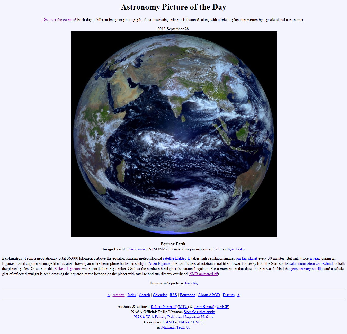
The fact that the results of the work of Electro-L are interesting not only for us, but also for the western audience, even the spoiled abundance of NASA, says, among other things, the recent series of publications in the American media . In addition, his picture on September 28 took place on the nasovskom Astronomy resource Picture of the Day . And this publication has caused a lot of enthusiastic reviews abroad .
His pictures were available to everyone, but not all. The fact is that Electro-L actually has two operators: the Federal Space Agency Roskosmos and the Federal Service of Russia for Hydrometeorology and Environmental Monitoring (Roshydromet). Roskosmos receives and uploads satellite images through its subdivision: the Scientific Center for Operational Earth Monitoring ( NTsOMZ ). Roshydromet accepts and processes images through the FSBI " Planet ".
The problem was that some of the pictures were taken during the day: from 6:30 to 8:00 Moscow time, NTsOMZ did not accept, so they are not on the open server . At this time, the data are taken in Novosibirsk in the Siberian branch of "Planet".
Therefore, videos and animations that were collected on the basis of NTSOMZ images contain an unpleasant leap in lighting, which is too noticeable, and violates the observed harmony of the eternal movement of the Earth:
For the same reason, we could not see the cloudy trail of the Chelyabinsk meteorite, which he left in the morning sky, during his enchanting flight on February 15 at 7:20 AM. On that day, Europeans and Chinese praised the pictures from their companions:
Electro-L has a better viewing angle, but a meteorite fell in an unfortunate “Novosibirsk” time, and the attempt to get the pictures by official means was not successful .
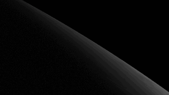
It was necessary to be content only with the spreading shadow, removed after 8:30:
The pictures could not interrogate even the media.
However, recently a letter came to the mail of one of the administrators of the Electro-L Vkontakte group:
Good day. You are welcomed by Mikhail Zakhvatov, head of the scientific department of the Federal State Budgetary Institution “Planet“. Accidentally stumbled upon an article on Habré about Electro-L. Frankly speaking, I was surprised by the existing problem of the lack of information in free access for 4 “our” terms. I was pleased to decide to correct the "defect". As a result, the software was finalized and a new output stream was opened to our public ftp-service. The structure and content were attempted in the format of the NTs OMZ.
ftp1.rcpod.ru/ElectroL
My reaction from reading:
( Careful only with their FTP, and then their power is weaker than NCOMZ, habraeffekt can not withstand )
The data began to load from September, so the February meteorite remained in the depths of Roshydromet. But, you can finally make a smooth animation of the daily movement of the sun:

It was this animation of the autumnal equinox, together with a static photo, that “went around the world” and was lit up on APOD:
It's a shame that these pictures, and the fact of their overseas "tours", almost did not interest the domestic media. Only RIA-Novosti wrote about this in his Twitter . Another news came on gismeteo.ru, astronet.ru and, oddly enough, on the Ukrainian site facenews.ua. I sent a link to the post office in “Rossiyskaya Gazeta”, but, apparently, for them such an event is of no significance. Although, what to take with them if they have the “Cosmos” heading included in the “Humanitarian bloc”?
But space enthusiasts are insatiable! I wrote to Mikhail a request to post pictures for February 15, 2013. And he, although he was on vacation, but turned to his colleagues, who added four archives to the server in the necessary hours.
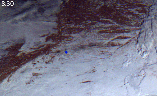
And now, though in half a year, but a Chelyabinsk meteorite, a top view, from a distance of 36 thousand km:
( In the upper left corner )
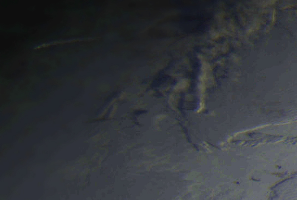
This photograph captured the trail in the sky, which was formed 10 minutes after the fall. It can be seen that it is already illuminated by the sun when darkness is still lower, i.e. is significantly higher than the clouds at that longitude.

If desired, using the satellite image, you can determine the height of the formed cloud, its thickness and length, estimate the direction and place of the supposed fall of a celestial body. I remember in the first hours, and even the day after the event - these were important issues that were fought over by both professionals and amateurs. But there were no pictures from the satellite in open access. I don’t know if Electro-L data was used by our scientists, but something tells me that this possibility has been neglected.

( Blue dot - Chelyabinsk ).
It is curious that approximately at the present time there is an operation to lift the largest fragment of a meteorite from Lake Chebarkul. And we have here our successful excavations on Roshydromet servers.
Now, finally, we have in the open access all the pictures from Electro-L. You can use them at your discretion. For example, it would be great to see an analogue of a weather site like sat24.com or something similar. (It was not possible to implement this idea by the enthusiasts, so I donate a business idea;) The pictures can be used in the design of the premises, especially for schools such a thing would not hurt. Well, I will continue to look for some interesting and / or beautiful events on his staff and, if possible, to talk about it.
In conclusion, I would like to thank Mikhail Zakhvatov for his decision to “correct the defect”; all the staff of SIC “Planeta” and NTCOMZ for sharing with us the results of the work of the domestic apparatus; NPO S.A. Lavochkin, for having built Electro-L; and all space industry personnel involved in the creation, launch and operation of this satellite. I hope this example will show to all responsible persons that open data is the best way to demonstrate the operation of our spacecraft, and that high-quality visual result speaks all languages at once and is better than a thousand loud words.
Thank!
I hope many already know about the Russian meteorological satellite Electro-L, which has been operating in geostationary orbit for the third year. I have repeatedly told about him, and demonstrated the results of his works. Today I will share one more positive news about the satellite.
He removes the visible disk of the Earth once every half hour, and his pictures are in the public domain. Therefore, everyone can handle them. You can make videos, gifs, desktops, free to download and print photos. Here you can find a program for Windows, which displays images on the desktop. Here - subscribe to Twitter robot, which daily sends a new photo from orbit. In short: the satellite gives the beauty of the Earth to everyone.
')
The fact that the results of the work of Electro-L are interesting not only for us, but also for the western audience, even the spoiled abundance of NASA, says, among other things, the recent series of publications in the American media . In addition, his picture on September 28 took place on the nasovskom Astronomy resource Picture of the Day . And this publication has caused a lot of enthusiastic reviews abroad .
His pictures were available to everyone, but not all. The fact is that Electro-L actually has two operators: the Federal Space Agency Roskosmos and the Federal Service of Russia for Hydrometeorology and Environmental Monitoring (Roshydromet). Roskosmos receives and uploads satellite images through its subdivision: the Scientific Center for Operational Earth Monitoring ( NTsOMZ ). Roshydromet accepts and processes images through the FSBI " Planet ".
The problem was that some of the pictures were taken during the day: from 6:30 to 8:00 Moscow time, NTsOMZ did not accept, so they are not on the open server . At this time, the data are taken in Novosibirsk in the Siberian branch of "Planet".
Therefore, videos and animations that were collected on the basis of NTSOMZ images contain an unpleasant leap in lighting, which is too noticeable, and violates the observed harmony of the eternal movement of the Earth:
For the same reason, we could not see the cloudy trail of the Chelyabinsk meteorite, which he left in the morning sky, during his enchanting flight on February 15 at 7:20 AM. On that day, Europeans and Chinese praised the pictures from their companions:
Electro-L has a better viewing angle, but a meteorite fell in an unfortunate “Novosibirsk” time, and the attempt to get the pictures by official means was not successful .
It was necessary to be content only with the spreading shadow, removed after 8:30:
The pictures could not interrogate even the media.
However, recently a letter came to the mail of one of the administrators of the Electro-L Vkontakte group:
Good day. You are welcomed by Mikhail Zakhvatov, head of the scientific department of the Federal State Budgetary Institution “Planet“. Accidentally stumbled upon an article on Habré about Electro-L. Frankly speaking, I was surprised by the existing problem of the lack of information in free access for 4 “our” terms. I was pleased to decide to correct the "defect". As a result, the software was finalized and a new output stream was opened to our public ftp-service. The structure and content were attempted in the format of the NTs OMZ.
ftp1.rcpod.ru/ElectroL
My reaction from reading:
( Careful only with their FTP, and then their power is weaker than NCOMZ, habraeffekt can not withstand )
The data began to load from September, so the February meteorite remained in the depths of Roshydromet. But, you can finally make a smooth animation of the daily movement of the sun:
It was this animation of the autumnal equinox, together with a static photo, that “went around the world” and was lit up on APOD:
It's a shame that these pictures, and the fact of their overseas "tours", almost did not interest the domestic media. Only RIA-Novosti wrote about this in his Twitter . Another news came on gismeteo.ru, astronet.ru and, oddly enough, on the Ukrainian site facenews.ua. I sent a link to the post office in “Rossiyskaya Gazeta”, but, apparently, for them such an event is of no significance. Although, what to take with them if they have the “Cosmos” heading included in the “Humanitarian bloc”?
But space enthusiasts are insatiable! I wrote to Mikhail a request to post pictures for February 15, 2013. And he, although he was on vacation, but turned to his colleagues, who added four archives to the server in the necessary hours.
And now, though in half a year, but a Chelyabinsk meteorite, a top view, from a distance of 36 thousand km:
( In the upper left corner )
This photograph captured the trail in the sky, which was formed 10 minutes after the fall. It can be seen that it is already illuminated by the sun when darkness is still lower, i.e. is significantly higher than the clouds at that longitude.
If desired, using the satellite image, you can determine the height of the formed cloud, its thickness and length, estimate the direction and place of the supposed fall of a celestial body. I remember in the first hours, and even the day after the event - these were important issues that were fought over by both professionals and amateurs. But there were no pictures from the satellite in open access. I don’t know if Electro-L data was used by our scientists, but something tells me that this possibility has been neglected.
( Blue dot - Chelyabinsk ).
It is curious that approximately at the present time there is an operation to lift the largest fragment of a meteorite from Lake Chebarkul. And we have here our successful excavations on Roshydromet servers.
Now, finally, we have in the open access all the pictures from Electro-L. You can use them at your discretion. For example, it would be great to see an analogue of a weather site like sat24.com or something similar. (It was not possible to implement this idea by the enthusiasts, so I donate a business idea;) The pictures can be used in the design of the premises, especially for schools such a thing would not hurt. Well, I will continue to look for some interesting and / or beautiful events on his staff and, if possible, to talk about it.
In conclusion, I would like to thank Mikhail Zakhvatov for his decision to “correct the defect”; all the staff of SIC “Planeta” and NTCOMZ for sharing with us the results of the work of the domestic apparatus; NPO S.A. Lavochkin, for having built Electro-L; and all space industry personnel involved in the creation, launch and operation of this satellite. I hope this example will show to all responsible persons that open data is the best way to demonstrate the operation of our spacecraft, and that high-quality visual result speaks all languages at once and is better than a thousand loud words.
Thank!
Source: https://habr.com/ru/post/196282/
All Articles