PROGOROD: (not only) virtual travels in real cities
And again a woman's look :)
On the May holidays, many of you have already bought tickets to warm countries and interesting cities. In order not to get lost in an unfamiliar place, the advice is obvious: install a navigation application in your smartphone or tablet. And if you want to "visit" in a new place before the trip - put PROGOROD. It is possible to lay a route across almost all of Europe, including resort areas, and navigate the terrain, following the virtual machine, which passes by three-dimensional buildings.
Beautiful Prague with unusual architecture, green spring Berlin, never sleeping seaside Barcelona - in any of these cities you will go with ready-made routes and will not lose precious time to study paper maps purchased at the airport. Tuscany, Protaras, the Southern Coast of Crimea will turn from a set of letters into real coastal zones, which you can ride with a breeze, as if you celebrate Victory Day there every year.
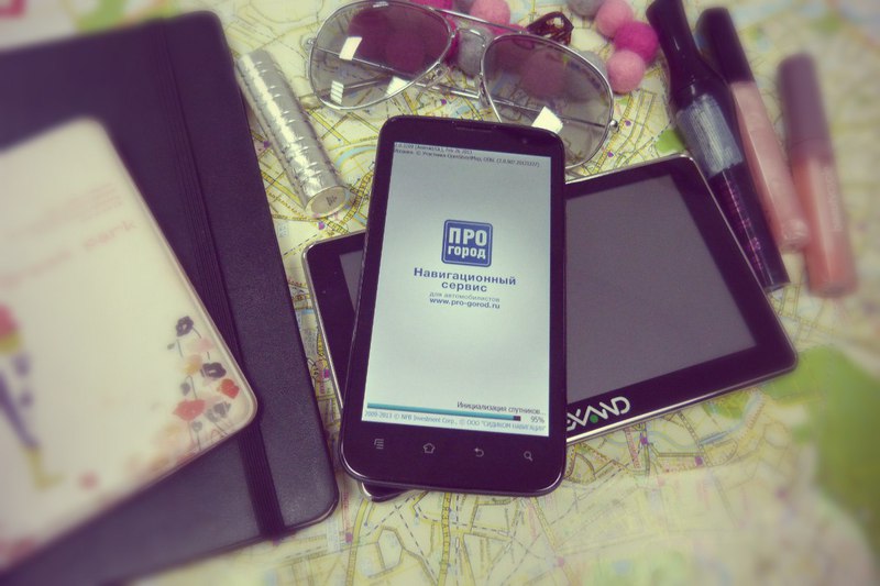
Yes, the May holidays evoke thoughts of travel, but, unfortunately, it does not work out for me in Europe. However, I plan to do it in August. And I was puzzled by what cards I would use. And here here is a PROBOROD with updated foreign maps! I tested it on two Android-powered devices: the Highscreen Explosion smartphone (Samsung Galaxy SIII's half-brother) and the Lexand STA-7.0 navigator (just a good GPS guide), and I can tell you something.
Installation and Setup
Trial versions of programs, as a rule, are either “cut off” functionally, or work for several days. PROGOROD has become generous for a whole month of using all the features and maps, counting on the fact that you stick to it and pay 950 rubles for the Android version and 1 129 for iOS. There is no need to perceive in this discrimination on a material basis: the license is valid for five “apple” devices at once. In other cases, only for one thing. If you have lost your smartphone or tablet, you can write to the developers and ask to transfer the license to another gadget with an explanation of the reasons. So, if you download the app right now, you will be able to evaluate it during a trip to the May holidays.
For Android devices, the PROGOROD application is downloaded from Google Play. Well, if your device does not support the main store - on the site pro-gorod.ru there is a link to the archive, and the program can be installed to bypass restrictions.
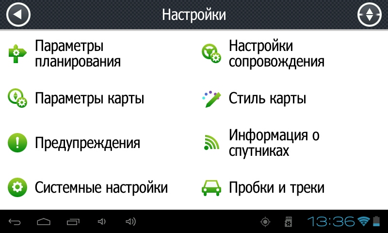
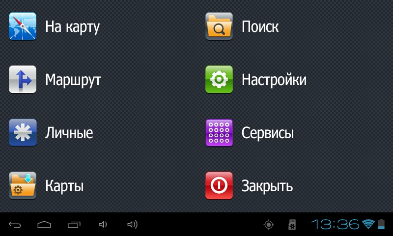
The application menu is extensive and quite understandable.
')
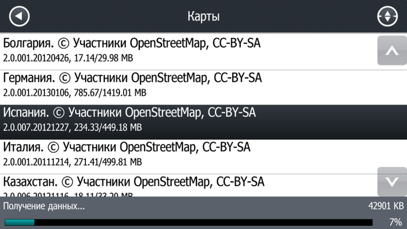
Keep in mind that PROGOROD requires the installation of cards only in the device's memory, and no arguments about the lack of free space can convince him. I tried to cheat by moving the application itself onto a microSD card, but it continued to insist on using the main storage. And there, in the memory of the navigator Lexand STA-7.0, there was no place even for a modest map of the Far East. Well, I had to temporarily rewrite competitor cards to an external hard drive and release the necessary megabytes. Phew ...
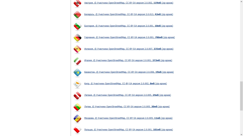
The list of maps from Open Street includes Austria, Bulgaria, my beloved Germany, Spain, Italy, Cyprus, Poland, Turkey, Finland, the Czech Republic, Switzerland, the Baltic States, as well as the USA and some CIS countries (Belarus, Kazakhstan, Moldova, Ukraine). The map of Russia can be downloaded both as a whole and in federal districts so that it does not take up extra space. It's nice that for most operations you do not need to connect to the Internet, it is useful only for downloading other maps, updates and getting information about accidents and traffic jams.
How does it work
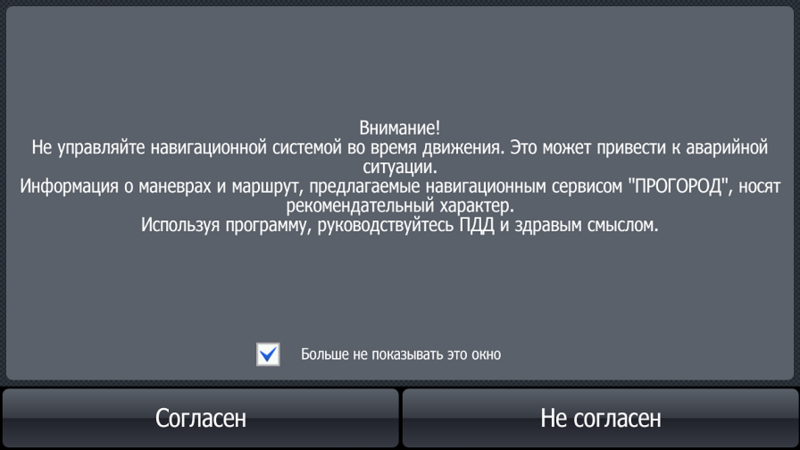
When you first start the application will remind you that they do not need to use while driving. And rightly so - nothing to be distracted from the road, it’s dangerous after all. In the case of PROGOROD, there is no need to risk health and karma: you have mapped a route and go listening to the prompts.
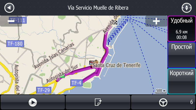
It’s easy to build a route. Choose a starting point, put a green flag there from the menu that appears, and at the end of the path - finish checkered. The program will choose the best route, calculate the distance and time.
Then the fun begins - the journey of the virtual machine. She is driving along the laid route in real time with voice prompts. I did not begin to lead her through the streets of Moscow — that would have been too easy — and sent to Europe. Still, the holiday season on the nose, will the navigation cope?
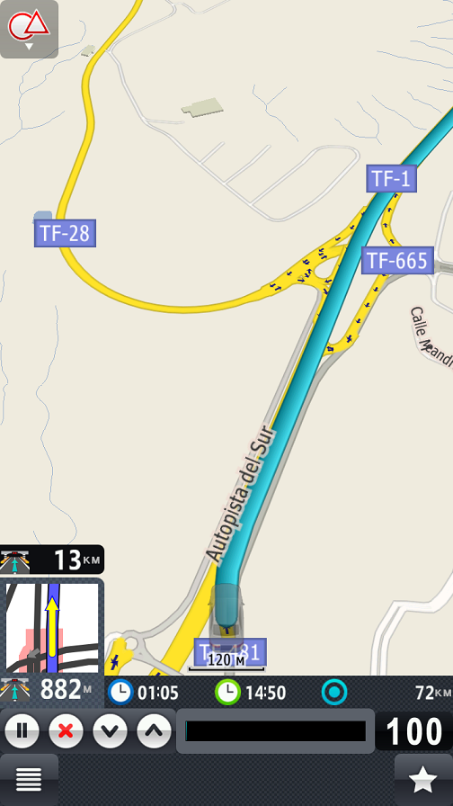
I open the map of Spain and note with pleasure that the Canary Islands are included in it. And there, by the way, it is warm all year round and you can swim. Ah, dreams of dreams ... So I immediately "went" to Tenerife, where I was going in May, but due to some circumstances it did not work out. The virtual machine quickly sped along the beautiful TF-1 motorway, and it seemed as though I myself was taking a familiar route from the resort of Las Americas to the island’s capital, Santa Cruz de Tenerife.
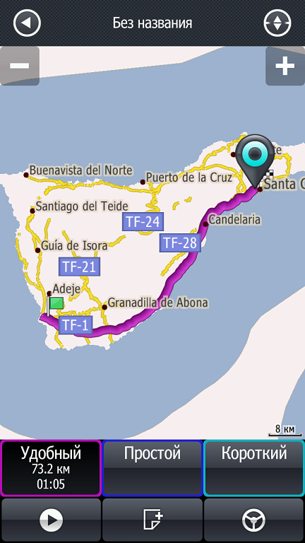
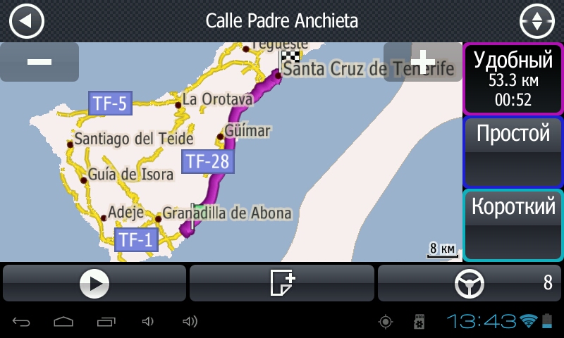
Route on Highscreen Explosion (vertically) and Lexand STA-7.0
The road is drawn in detail, and if you “drive forward”, different options for accessing the end point will be shown.
Such a trip for fun is a great idea for those who travel to an unfamiliar country and want to conduct reconnaissance on the ground. Three-dimensional mapping of buildings in large cities will also help orient, the pictures are close to reality. Of course, to admire the Colosseum or the architectural masterpieces of Gaudi is better alive (and the May holidays are a great occasion, it’s still not +40, but not +10), but knowing in advance where they are located will not hurt. But if you have not decided on a trip, I advise, after reading this review, rush to a travel agency or book tickets yourself, otherwise it will not be the same!
The smartphone coped with the application a little better navigator - thanks to a more powerful processor (four cores and 1.4 GHz versus one core and one GHz) and a gigabyte of RAM, which the navigator has twice as little. However, when used in a real car, this difference will be unnoticeable: you will not start within a split second after creating a route! And on the 7-inch screen from the driver’s seat, it’s even more convenient to watch than the 4.7-inch is a fact.
Bonus Nyashnosti
The PROGOROD application is useful not only when traveling, but also at home. It is always aware of Moscow traffic jams, and in my opinion it builds detour routes more abruptly than Yandex, focusing on the recommended speed, the history of road events, the real state of affairs and the forecast.
From the map you can find out not only about congestion, but also incidents, road works and other events.

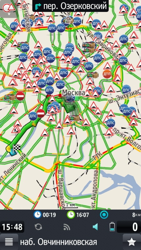
It is clear that even the most advanced program cannot keep track of everything that happens. For reporting accidents, repairs and other troubles, there are “geoblogs”: you can put your tag in the right place and discuss other people. By the way, a funny feature of the program - when you enter a toponym (city name, street, etc.), it leaves highlighted on the virtual keyboard only those letters that can continue the query. This is convenient - even with long nails will not work to miss and enter the wrong name.
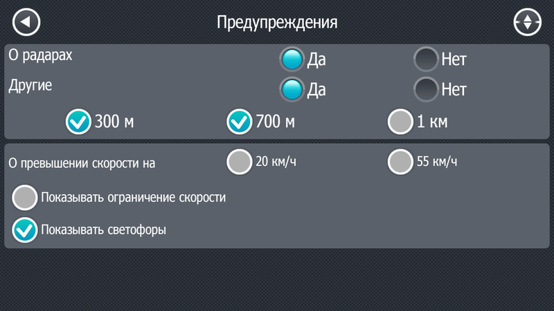
Useful trick - information about radar. The application can report them per kilometer, 700 or 300 meters, and you will have time to slow down if you overshoot by mistake. And yet, when you drive on the highway, where the speed, for example, should be no more than 80, and you accelerate to 90, the program will squeal that you have exceeded the speed. This is the function I was most pleased about on the road :)
Another interesting feature is Augmented Reality. If you turn on the camera of your smartphone or navigator so that the road is visible, PROGOROD will impose on it the location of gas stations, cafes and other useful objects with an indication of the distance to them. Very comfortably!

In the “Maintenance Settings” you can set the map to increase as you approach the difficult interchanges.

And if you also use the service "The right decision", the chances of going through the wrong lane and turning the wrong way will be minimized. Finally, you can choose the quality of the road surface, and then your light city car will not go on a dirt road, and the all-wheel drive SUV will not stand instead with all on a good, but busy road.
Minuses
Maps are not updated daily, and for some users this “tragic circumstance” badly spoils the mood. However, there is not a single service where the most recent versions of maps would always be. I remember my house appeared on the Yandex maps a year later (!) After construction, and on others later. Various mini-updates, such as information about the blocking of roads or changes in their direction of movement, “Progorod” receives daily.
The second minus is that when switching between cards the application is overloaded. It takes 10-15 seconds, which in principle is not long, but causes displeasure with some users.
Finally, foreign audiences do not like the fact that PROGOROD is primarily aimed at Russian-speaking users. Yes, there is English in the settings, but voice prompts and many Russian names are only in Russian.
findings
PROGOROD is extremely convenient on trips and even in front of them: you can drive through unfamiliar terrain in advance to estimate the trip time and upcoming maneuvers. The application rarely needs access to the Internet, which is a great advantage in terms of roaming!
In the hometown, the program is also useful. Traffic jams, radar, traffic accidents - nothing will hide from the gaze of PROGOROD and its users. As a result, the trip will become more comfortable and faster. But the speed, of course, still does not exceed, even if all the ambushes of the traffic police are displayed on the map.
And more ... do not forget to wear your seat belt! And run to book hotels already, if you have not done so! :)
PS If something is missed, clumsily designed - kick. I will correct :)
Source: https://habr.com/ru/post/177961/
All Articles