Microsoft added 121 terabytes of satellite and aerial images to Bing Maps
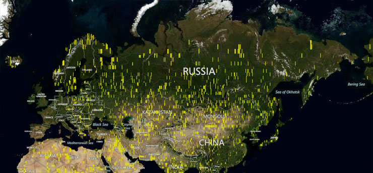
Microsoft announced that they have added an impressive 121 terabytes of new satellite and aerial images (the Global Ortho project) to their Bing Maps . One of the most complete databases of Earth images has become even more detailed. New satellite images cover 15 million square kilometers of the planet, describing many new places, but mainly South America, Africa, Asia and Eastern Europe, including the CIS countries.
Together with satellite imagery, the Bing team also added 800,000 square kilometers of aerial photographs for its Global Ortho project in Eastern Europe, bringing its global coverage to 10.7 million square kilometers. Photos for the Global Ortho are removed from the aircraft carrying a camera on its suspension. This is what provides a much higher clarity of images compared with satellite imagery. Global Ortho achieves a definition of 30cm of the earth’s surface per pixel.
')

Places with Global Ortho images; yellow indicates new images
Other innovations from the Bing Maps team in photo-update are changes to the Windows theme, which uses Bing balloons, pictures before and after Hurricane Sandy, and a whole series of interesting photos on their Facebook page .
Source: https://habr.com/ru/post/160865/
All Articles