City navigation with traffic jams
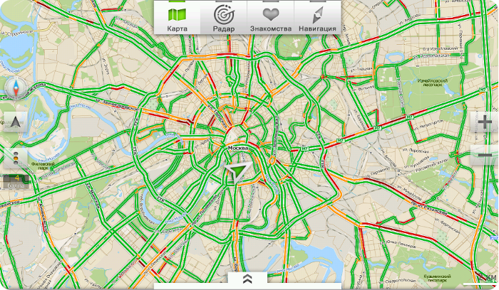
Traffic jams is a concept that is already closely connected with the image of a large developing city, where people are always on the move and every minute counts.
To maintain the desired pace, get to the desired point in time, choose the best way, and most importantly do not keep it all in your head there are many services.
We will tell you about our decision, which not only lays a route from point A to point B, but also does it as accurately as possible.
So, how we build traffic jams and why we have every reason to be proud of their accuracy.
1. Collection of information
As in any process, to get the finished product, you need to collect raw materials and choose exactly what will be necessary in the finished product. We do the same when collecting analytics:
- First, we collect data on the workload of base stations; this technical indicator is monitored by us and serves a host of tasks, for example, to monitor the quality of the network and ways to improve it.
- To build traffic jams, we select data from the Base stations, which are located on the streets of the city (outdoor), for this we separate the data obtained from the total mass, which also includes Base stations, located for example in shopping centers, and offices (indoor) and base stations in subway (metro).
Further, the complex works with the received data on a special platform. This platform can determine the migration of subscribers based on data on changes in the workload of base stations. The platform accumulates such data and analyzes, which allows predicting the further movement of a group of subscribers and organizing an alert in a predetermined zone.
')
Using this technology, we have several services:
- Radar
- Frame control .
- Address notification in case of emergency.
- Geo-analytics to assess the migration of subscribers to the network.
- Mailing geo-targeted mobile advertising.
2. Stream Detection
The obtained processed data must be decomposed on the roads of our city, excluding a massive race in the park of athletes or a shopping trip for beautiful ladies. Thus, for further analysis, there are only flows that move along the roads.
In order for the data to be expanded on the roads, in accordance with the road graph, TMC (Traffic Message Channel) is used - the tables that were created by ProGorod specifically for our Traffic jams.
The cartographic part works on the basis of high-precision maps of the company ProGorod. They cover the whole of Russia, 120,000 cities and towns.
Based on this information, we can come to the conclusion that this is a traffic flow, in which we can determine the speed and traffic. To show the exact condition of the road, more detailed analysis of information is required for each section.
3. Analysis of traffic on the roads
To get the details, the information enters the system, which can determine the speed of movement in each segment of the road and clusters of users on individual segments. To do this, all the information obtained is also analyzed:
- We separate the pedestrians from the drivers, analyzing the dynamics of their movement along the roads.
- We divide the roads into classes and, based on the class of roads, we determine the average and maximum speed of movement on this section. This division will allow you to determine really loaded directions and not to draw a traffic jam on a narrow street in the center of the city, where cars are simply parked.
- Accuracy is ensured by the fact that for analysis there is no need to use data for example from a mobile application - we analyze the total flow of registrations at base stations. Thus, accuracy is influenced not only by the enthusiasm of users who share data, but also by the amount of information that can be obtained from Base Stations.
Unlike traditional navigation systems:
- In the category of loaded road segments is not displayed on the basis of a small speed, but on the basis of the movement of the stream, which begins to form a large cluster of points with decreasing speed. The situation when all the cars on the road slowed down or even rose.
- Data sources for analytics more, since they use not only GPS, but also GSM-data.
4. Displaying the result in the application
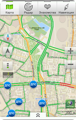
Subscribers-users of the MegaFon Navigation application can use ultra-precise traffic jams. The application helps users:
- Build a route of movement throughout Russia with the forecast time of the journey.
- Use voice guidance during the trip.
- Rebuilds the route if the user decides to deviate from the previously constructed.
- Allows you to find places of interest and places - POI (Point of interest) .
- Displays accurate data on the traffic situation, now you know why they are so accurate.
In addition, it also has other interesting features:
- Radar - Determines the location of your near and dear ones if they let you do it.
- Dating - Allows you to get to know people nearby.
For MegaFon subscribers, the traffic charge received when using the application is not charged.
Our plans for the future
Service continues to evolve in our plans for the near future:
- Update application design.
- Expansion of the search function of interesting objects on the map.
- Web version of dating for PC access.
- The federalization of ultra-precise traffic jams in other cities.
The data obtained in our service can be used not only to create traffic forecasts in accordance with the history of individual sections of roads, but also in other projects where similar analysis is required on the network.
- Service analysis analysis of subway stations.
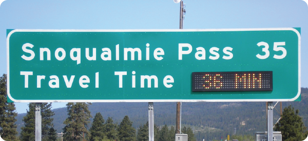
- The designation on road signs of the predicted time of movement on the highway.
- Using statistics for analyzing traffic situations and planning new roads and junctions not only within the city, but also within the region, country.
UPD The data collection and processing technology for the service was developed by MegaLabs , a center for creating new products and services of MegaFon.
 |  |
| Download iPhone App | Download Android App |
Source: https://habr.com/ru/post/158027/
All Articles