Mysterious textures in the Takla Makan desert on Google Earth got an explanation
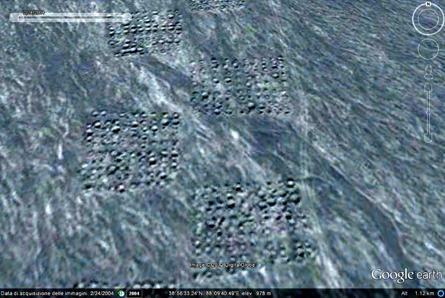
Each square measuring 40x40 meters consists of 100 elements, 10 horizontally, 10 vertically. Total length - about 8 km
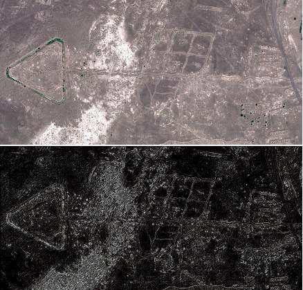
Thanks to satellite photography of the Earth, scientists have a new tool for scientific research. In recent years, the list of scientific discoveries made using Google Earth has been constantly updated. One of the leading specialists in the so-called “home archeology” is Amelia Sparavigna (Amelia Carolina Sparavigna) from the Turin Polytechnic Institute. With the help of open source software, it automatically processes thousands of images from remote corners of the Earth, where scientific expeditions have never reached. Usually these are deserts, hard-to-reach mountainous areas, or in general areas with prohibited access.
Among the previous finds of Amelia Sparavigny are man-made “pictures” in the shape of birds , created by terraforming the earth's surface near Lake Titicaca.

')
As well as the remnants of the fortifications of the Chinese army of the 1960-70s.

In 2010, the mysterious textures in the Takla Makan desert in western China became another discovery of a scientist. They can be seen at coordinates 38.952034,88.167688 . This area was part of the so-called Silk Road, which thousands of years ago brought goods from China to Europe. The first assumption was that the hills could remain from the times of the Silk Road.
Other strange ideas have been expressed: starting with the fact that it is a grid for calibrating Chinese satellites, and ending with traditional UFO assumptions.
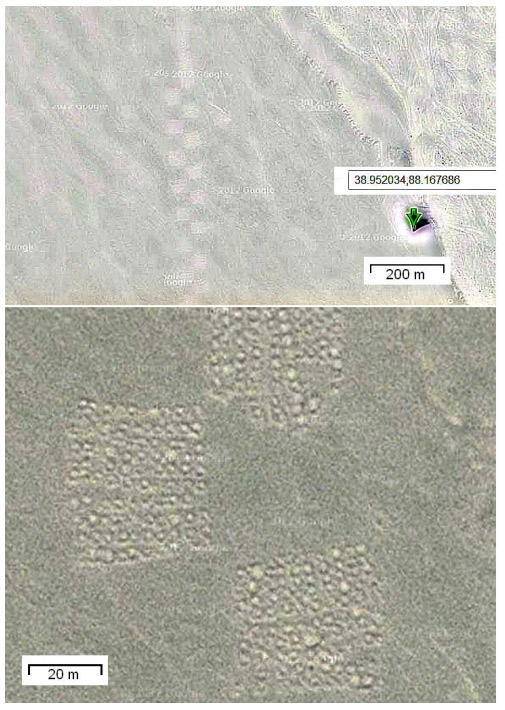
The texture consists of a grid of squares, staggered, about eight kilometers long. Each square has a size of about 40x40 meters and consists of 100 hills, 10 horizontally, 10 vertically. The texture obviously has an artificial origin, but its purpose still remains unclear. Moreover, nowhere else in the world could anything more be found.
The riddle remained unsolved for more than two years, until an article in the Chinese press appeared on October 6, 2012 about the discovery of 1.28 million tons of nickel ore in this area. Amelia Sparavinha suggested that exploration began around 2009. She checked the old satellite images of Bing and Nokia - this structure is absent there, which means that you can roughly set the time of appearance of artifacts. Accordingly, in his new scientific work (pdf), Amelia assumes that mysterious textures can be associated with exploration. She also expresses the idea that the analysis of satellite photographs on Google Maps can be used not only to study the past (archeology), but also to explore the economic potential of the area, that is, to explore the future.
Source: https://habr.com/ru/post/157405/
All Articles