Rambler-Kart API Update
We have released a new version of the API , updated maps and documentation . What's new?
- Globally updated maps of Russia
- Added new geometric layers and opened the overview levels.
- Retina tiles and controls
- Quadtree clustering, improved object grouping methods
- Invisible active areas with tooltips
- Methods of working with basic geometric formats
- New widgets: traffic jams, cameras
- Minimap
Full list of changes in version 0.1.0
')
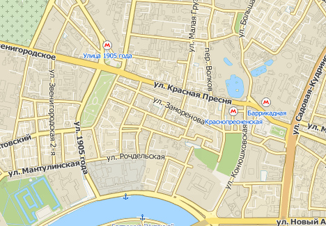
Update maps of Russia
We are pleased to announce a global update of the maps of Russia, which includes clarifying the order of movement in more than 160 localities and more than 10 Russian regions, adding new addresses in 60 cities. In addition, 23 localities with a detailed road network were added.
We also introduced in the display of the state of the road (traffic) another gradation of speed. Burgundy color, we show the movement at a speed of less than 10 km / h.
Finally, we added overview levels to the API.
New layers
- Retina map layer - map scaled for high resolution devices
- Traffic jams with semantics - traffic jams with names over the road surface (experimental)
- Retinal layer of traffic jams - similar to the retina layer of the map (experimental)
- Simplified layer (15-17 levels) - a layer without such objects as buildings, their names, parking, traffic lights, POI. It will be convenient for those who want to draw their objects on the map, for example, three-dimensional buildings from OSM;).
- Retine Simplified Layer - Simplified Layer for High Resolution Devices
How to get access to them, read our documentation .
Retina tiles and controls
Connect automatically if you, for example, use iPad 3.
Clustering
Now you can group markers at higher levels and customize their appearance. As a clustering algorithm, we use quadtree .
Active Areas
On the basis of invisible active areas, you can create your own convenient widgets. For example, this is how our new camera widget works.
GeoFormats Parsers
The GeoJSON, GPX, KML, NMEA, WKT parsers allow you to quickly draw basic objects using the API.
New Widgets:
Traffic jams
Cameras
Minimap
Customizable minimap in the lower right corner of the screen, disabled by default.
New and updated methods
- Made additions to the setCenterByBbox method
- Added getPixSize method that returns the real pixel size of the geometry.
- The new fitToView method allows you to center several geometric objects (or, for example, a marker with an open balun) under the map scope
- Zoom by clicking the area on the map
- The multiObj method has been moved to the constructor.
- Added makeControl method
Source: https://habr.com/ru/post/152083/
All Articles