Yandex scored on your cards?

Last week there is a feeling that Yandex scored on their cards.
Below are some observations about this.
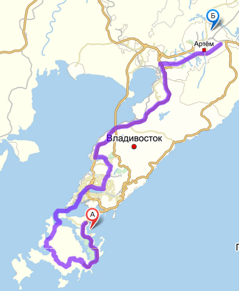
The question arose because of the banal idea of planning the route to the airport. But everything would be banal and uninteresting if the route was not laid in the city of Vladivostok to the terminal that was recently commissioned, and from the new terminal to the Russian island ...
A rather interesting blockhead came out here:
')
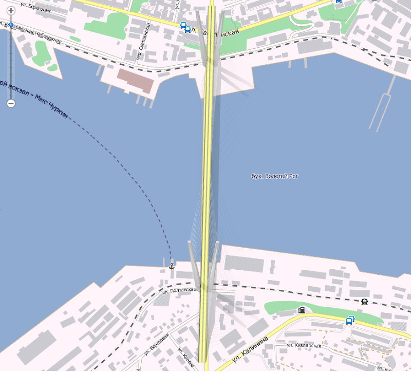
Yandex offered to drive about a kilometer along the sea, despite the fact that the bridge to Russky Island has been open for a month and a half to traffic…
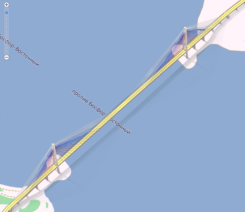
Although, in theory, the route should look like this:

(drawn by hand for clarity).
After the trip, it became interesting, but why did such a squiggle appear?
Began to look closely at the maps of Yandex:

Of the three bridges built over the past 4 years in Vladivostok (2 cable-stayed and 1 low-water), not a single one is indicated on Yandex maps ...
Well, well, maybe from a long distance they are not visible, and if you choose a different scale, then they will surely appear:
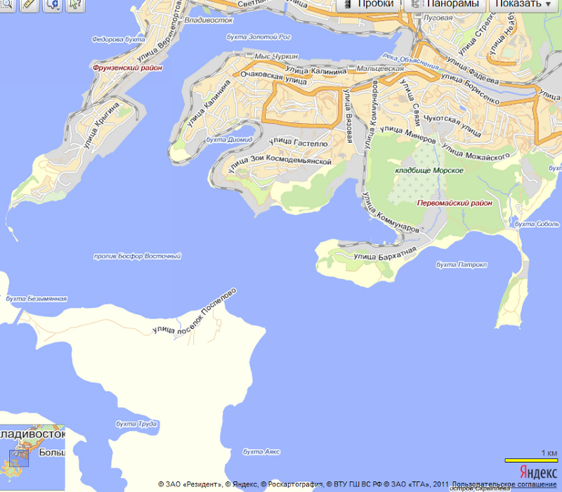
The miracle did not happen. The vector map of Vladivostok has not changed.
Well, look at the satellite images:

Hmm ... Satellite image roughly corresponds to the beginning of summer 2010 ...
Let's take a closer look at the satellite image from Yandex maps of the world's largest cable-stayed bridge to the Russian Island:
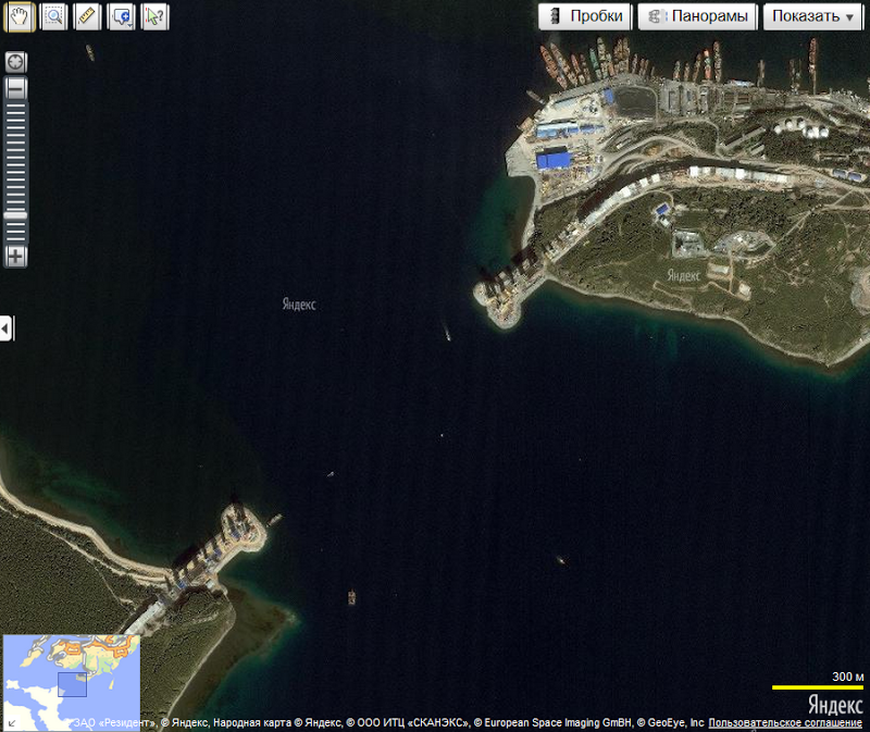
Well, exactly, satellite imagery two years ago.
Taak, maybe Google knows more?
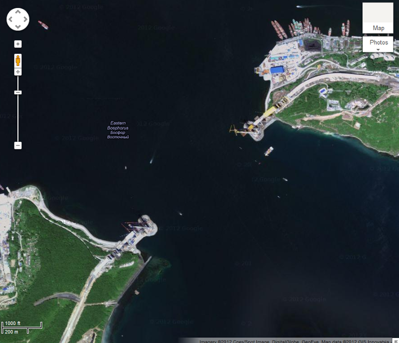
In general, yes, Google satellite images are fresher for a year than at Yandex, but still irrelevant, since significant changes.
To hell with him with Google. The American company, they don’t care about Russia, they probably didn’t hear about Vladivostok. But after all, Yandex is a domestic company. After 10 days, there will be a summit of heads of state in Vladivostok, a lot of journalists will arrive and they will try, out of habit, to look for routes on maps ... And the hell they will find with this approach ...
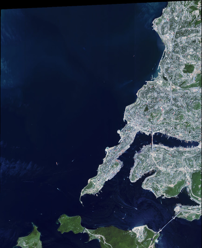
But wait, maybe there are still no fresh satellite images of Vladivostok this year, because objects just built ...
And then, what is this?

How well the difference between 2011 and 2012 is noticeable ...
Or a bridge to the Russian island closer:
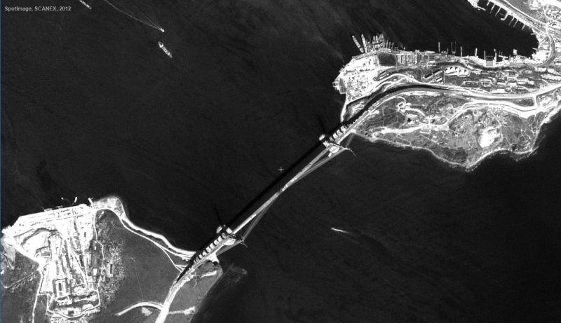
Or several bridges at once:
Those. There are satellite images, just big companies are stupid ...
In the meantime, the giants of Vladivostok, a well-known in narrow circles, draw their cards with bridges and airports :

Just look with what love the details of the bridges are drawn:
Or a bridge to the Russian island:
Verdict on the current state for Yandex:

I’m ready to take back my words if Yandex corrects the current situation by September 5, namely:
1. Upload fresh satellite images of the city of Vladivostok;
2. In the vector will draw the objects that appeared before the summit (bridges, airport, campus on Russky Island, new roads);
3. Make a high-quality routing on the updated map of Vladivostok.
The strength and resources of such a giant is more than enough to cope in a short time.
If someone doubts that the bridges are built and cars are driving on them, then you can see a small photo sample made on the route, which was discussed at the beginning of the article.
UPD:
At the moment (18-00 Vladivostok) the post has collected more than 70 comments and 115 votes (75 per minus).
Thanks to everyone who made sensible suggestions.
Now a few sober thoughts:
There are many good and not very good cards:
| Yandex maps | google maps | 2 GIS | OSM | maps.vl.ru | Yandex folk maps | |
| Vector drawing of cards | Not all | Not all | In detail | In detail | In detail | In detail |
| Satellite imagery | There are 2010 | There are 2011 | not | not | not | not |
| Snap to coordinates to enable navigation | there is | there is | there is | not | not | there is |
| Drawing traffic jams and traffic | there is | not | not | not | not | not |
| Laying routes | Yes, but inaccurate | Yes, but inaccurate | There are in the desktop version | Not | Not | Similar to Yandex maps |
Something good are some, something else, but the closest to the ideal (at least for Vladivostok) are Yandex maps.
Not enough to the ideal of the following things:
1. Update satellite images;
2. Update vector drawing (add new ones);
3. Update the drawing of routes.
Again, we are talking about the city of Vladivostok, because IMHO, the upcoming events and the money invested by the state and other investors over the past 4 years deserve the attention of not only different Navalny, but also such monsters as Yandex.
There is a suspicion that Yandex is already preparing updates for Vladivostok before the summit, but I could be wrong. At least, the company should have enough manpower and resources. Just with relatively small investments now you can get positive feedback for the company in a couple of weeks. Or you can score and do nothing and then there will be less and less positive feedback ...
Source: https://habr.com/ru/post/150338/
All Articles