Key moments of the Martian journey
At the end of the week Mars rovers on Habré would like to consider the most important moments after the launch of the launch vehicle.
Let's see how the spacecraft traveled, where the rover landed, and what issues NASA is facing right now ...
On Habré already discussed topics:
- 7 minutes of horror
- NASA Mars Rover successfully primarsy.
- What's inside the Curiosity Mars Rover
- Feel like a rover! Interactive panoramas of Mars
- NGINX to Mars will bring
- Martian orbital grouping
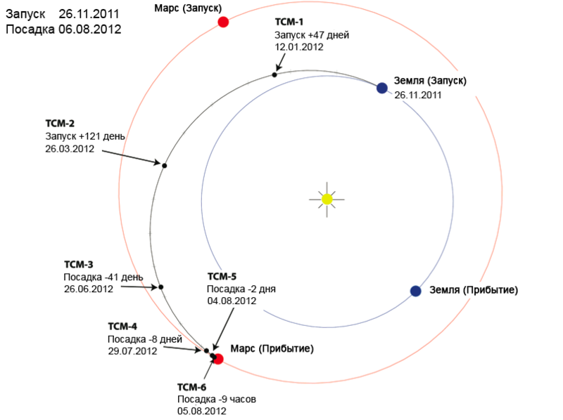
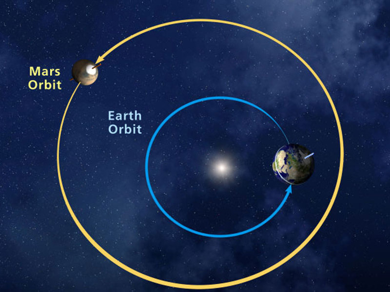
As we already know, the launch was made from the spaceport on Cape Canaveral on November 26, 2011. The image below (all objects are moving counterclockwise) shows the trajectory of the Curiosity orbit. To reach a given orbit, the ship needs to increase its speed to 40,000 km / h or about 11 km / s relative to the Earth. When the ship reached the desired speed and direction, its path was adjusted to the intersection with the orbit of Mars. This was the most important (for experts' opinion) adjustment made on January 11, 2012 for the rover. A total of 6 intermediate course adjustments were planned. The TCM-5 adjustment was canceled due to a sufficiently accurate trajectory. The flight duration was 254 Earth days.
')
Jeditobe has already explained how data from Curiosity comes to Earth. I will add only that on Earth communication signals receive 3 centers with large antennas - in California, Spain and Australia.

The signal between Mars and Earth will travel from 5 to 20 minutes, depending on the position of the planets in their orbits. At the current time on Earth, the signal is received with a delay of 13 minutes 46 seconds.
NASA Curiosity Mars Rover Landing Scheme (Readable)
The rover landed in the area of the Gale Martian crater. It was assumed that the landing will occur in the center of the circle, and this will be the starting point of the mission on Mars.
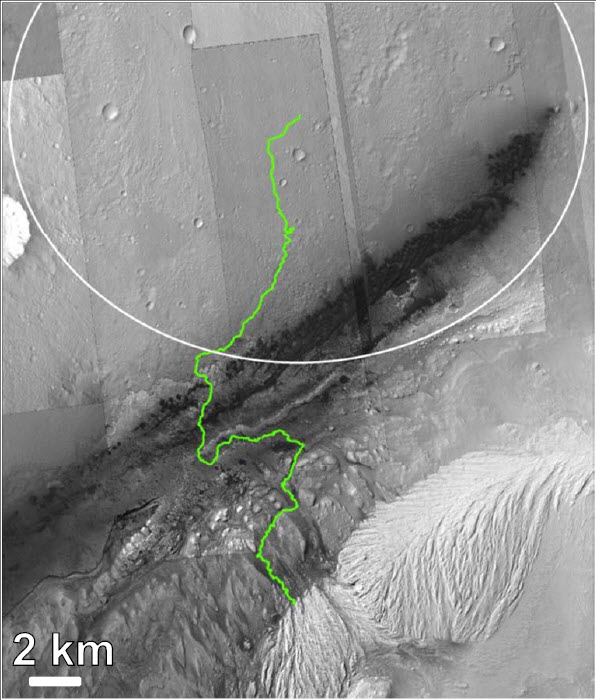
However, in practice, it does not always work out according to plan. And Curiosity primarced a little further from the planned point. The red dot is the landing site of the rover. Blue dots - sky crane, heat shield and parachute. Yellow lines indicate possible return paths to the route.
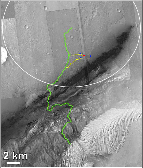
The JPL team is now faced with the question of how to be, because if you return along the indicated routes, then the first two phases of the mission on Mars disappear. Either they will have to be transferred, or the turtle rover will be driven to the starting point, for which it will take several days. After all, the maximum speed of the rover is 4 cm / sec.
Details in the presentation of the research plan for the Gale Martian crater.
Elevation Difference Chart

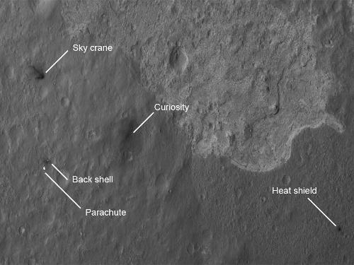
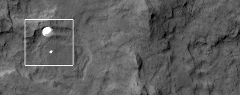
With the Mars Reconnaissance Orbiter artificial satellite Mars, the high-resolution HiRISE camera took the first photo of Curiosity at the time of the fixing (a strange word came out )
For those who always want to be aware of what the rover is doing there, NASA developed a special application .

Android | iPhone | Windows phone
Source: https://habr.com/ru/post/149340/
All Articles