Google Earth Engine - a platform for monitoring the state of the Earth
On July 23, 1972, the longest running satellite satellite mapping program was launched — within the Landsat mission, first under the auspices of NASA, and then, thanks to the efforts of private companies, seven satellites were launched into the near-earth space, the last of which, Landsat 7, began work in orbit 15 April 1999 and is still in operation. The satellite is located at an altitude of 705 km and repeats the survey of the Earth's surface once every 16 days.
In honor of the 40th anniversary of the start of the Landsat program, the search giant launched the Internet platform Google Earth Engine , which is positioned as a system for monitoring the Earth’s environment and the satellite data of which is formed thanks to the Landsat mission satellites. During the mission's work, petabytes of satellite images were accumulated, which became the cartographic basis of the global service.
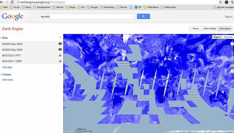
Technically, the service is a dataset with an indication of geographic and time reference, which can be opened on the map as layers (layers) approximately the same as it is done in a number of GIS programs, such as ArcView or ArcGIS. There is also the possibility of data analysis, however, quite modest. In addition, judging by the short announcement, there is also an API for accessing the capabilities of the Earth Engine, which is currently available only to a limited number of project partners.
Thus, the global index map of snow cover looks, obtained on the basis of a higher reflectance of the visible part of the spectrum compared to the average values of the infrared range on the planet.
')
The visual component of the platform is formed in this way - satellite data are combined by the system into short videos, where you can see, for example, the deforestation of the Amazon or the growth of Las Vegas infrastructure over time based on data collected over nearly half a century. In order to emphasize the importance and quality of service data, the authors of the service make the following comparison: if you expand one frame of the received video in full resolution, the snapshot will have a resolution of 1.78 Trp, which is 18 football fields that will be covered with monitors stacked each other. to a friend.
The Earth Engine presentation video can be viewed below:
[ Source ]
In honor of the 40th anniversary of the start of the Landsat program, the search giant launched the Internet platform Google Earth Engine , which is positioned as a system for monitoring the Earth’s environment and the satellite data of which is formed thanks to the Landsat mission satellites. During the mission's work, petabytes of satellite images were accumulated, which became the cartographic basis of the global service.
Technically, the service is a dataset with an indication of geographic and time reference, which can be opened on the map as layers (layers) approximately the same as it is done in a number of GIS programs, such as ArcView or ArcGIS. There is also the possibility of data analysis, however, quite modest. In addition, judging by the short announcement, there is also an API for accessing the capabilities of the Earth Engine, which is currently available only to a limited number of project partners.
Thus, the global index map of snow cover looks, obtained on the basis of a higher reflectance of the visible part of the spectrum compared to the average values of the infrared range on the planet.
')
The visual component of the platform is formed in this way - satellite data are combined by the system into short videos, where you can see, for example, the deforestation of the Amazon or the growth of Las Vegas infrastructure over time based on data collected over nearly half a century. In order to emphasize the importance and quality of service data, the authors of the service make the following comparison: if you expand one frame of the received video in full resolution, the snapshot will have a resolution of 1.78 Trp, which is 18 football fields that will be covered with monitors stacked each other. to a friend.
The Earth Engine presentation video can be viewed below:
[ Source ]
Source: https://habr.com/ru/post/148417/
All Articles