Travel to Antarctica on Street View
It seems that Google has covered all the continents of our planet with its Street View service. This does not mean that users can view every square centimeter of the area of the continents, no. So far, the service offers only a viewing of most large and medium-sized settlements, various sights, forests of the Amazon, US national parks and much more (for example, Australia's Great Barrier Reef). In addition, Street View users now have the opportunity to admire the vast expanses of Antarctica.
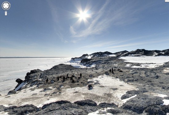
The official statement says that the developers have added Brazil, Ireland and the Antarctic to watch. In this case, the South Pole is one of the most interesting regions to view, if only because the vast majority of users of the service do not even know what Antarctica looks like. Yes, it's cold there, yes, there's a bunch of penguins there. But in general, this is an amazing region that so far very few people have seen in person.
')
On the panoramic pictures, loaded into the service, there is a lot of interesting things. For example, amazing pictures of the surrounding nature. In addition, the developers made sure that the users of the service could also admire the homes of Antarctic researchers, both our contemporaries and scientists of the past decades.
For panoramic images, of course, google mobiles were not used. These cars did not surf the South Pole. Instead, cameras with fisheye lenses were used. The result can be viewed on video, plus directly on the service itself.
Source: https://habr.com/ru/post/148070/
All Articles