Google Earth adds pictures from balloons
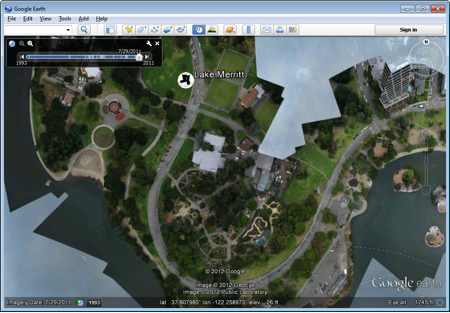
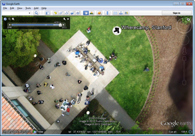
The Google Earth service is not just in demand, but very in demand. But despite the fact that the service now offers a large number of regions in a good resolution, there is still something to work on. Now Google has begun a new phase of work, together with the organization “The Public Laboratory for Open Technology and Science”. The job is to download images obtained with the help of balloons and kites. That is, not these aircraft themselves, but the cameras attached to them.
According to the developers, this method of obtaining images gives excellent results - because the photos are made in very high resolution, which has a positive effect on the quality of maps available in Google Earth. Now the partners are deploying a large-scale work on attracting volunteers to the project (work is not paid, equipment too), which will expand the number of available regions with high-resolution photos.
')
The " The Public Laboratory " team has developed a package of tools and software for work, which allows anyone to become a participant of the project without any special expenses. The total amount required to receive a set of these tools is about $ 100 (the balloon itself, helium, etc.).

In addition, access is provided to the Internet service MapKnitter , which brings all the images to a single sample, as well as combines photos into a single system. The result obtained can already be used in Google Earth.
Volunteer image archives have already been uploaded to Google Earth. In order to view all this, you can download a KML file on your PC and open it in Google Earth.
Via google-latlong
Source: https://habr.com/ru/post/142348/
All Articles