Overview of the navigation program Progorod for Android
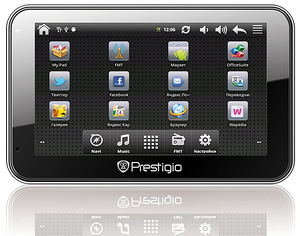
I am quite an active user of devices based on Android, and the information guide for this review was the news about the release of a navigator based on this operating system, Prestigio GeoVision GV5500AND, which, by the way, has become the millionth sold navigator of the brand. This navigator works with the navigation program Progorod, which was the starting point for me in this review. I decided to find a more functional, rather than pre-installed service from Google, a navigation program that would be convenient to use on the tablet and on the phone.
Actually, the discussion today is not about him (not about Prestigio GeoVision GV5500AND), but about the “Progorod” navigation program, which has versions for most popular mobile operating systems - it is installed on satellite navigators running Windows CE, has versions for iOS and Bada, Well, under Android, by itself. (There is also a version for Windows Mobile, but new devices on this OS have not been released for a long time.)
I tested the program on the ZTE V9 + tablet and on the LG P350 phone.
The screenshots to the article were made with the help of the latter, since it was rather easy to ruin it, unlike the tablet.
')
Installation is possible both through the Google Play Market, and from the installation file, which can be downloaded from the program's website.
Full installation instructions are on the same page, in addition, it is described in detail in the User Guide. After installing the program, it is better to connect to the Wi-Fi network, since after launching it will offer to download maps of the region you need, I immediately downloaded a package of maps for all of Russia about 512 MB in size - the other day my wife and I are going to go on vacation to St. Petersburg. And then - a lot is not enough, maybe it will come in handy. You can also download maps by archive from the site before launching the program and put them on a memory card. On iOS, you will have to download maps, apparently, only through the program.

Download maps directly from the device.
Buying a license on iOS devices is done only through the AppStore, on Android we download the program for free, then we buy a license on the site, and we are given an activation key and a file that we need to put on the memory card in the program folder.

The form of obtaining a license.
Then I acted as a beta tester for another not obvious point: I initially put the program on the tablet and registered it to this device. It seemed logical to me, because and it works better with GPS than my LG P350, and its screen is larger, but then it suddenly turned out that I had upgraded to the latest firmware in vain, therefore, I won’t get root rights on it and not make screenshots for the article. However, this moment, it turns out, is provided for in the Progorod. Through a personal account in a special form, it is enough to write a support request with the name of the device on which the program is installed, and indicate for what reason a license transfer is required. I pointed out that the current device is faulty (the absence of the root is a malfunction in our case, isn’t it ?!);) and prepared to wait a day or two, knowing from experience how such services are usually loaded. My surprise knew no bounds when, after a maximum of 30 minutes, I received a notification in the mail that the license transfer had been completed, and I could register it on the new device. Five points to support service, you are great!

Here is a letter about re-registering a license to another device.
We installed the program, maps, now we can run the program. At the first launch, we agree with the use of the "plug-in" service in the beta mode (for Russia), otherwise it will not work, which is logical. In Ukraine, this service has not yet been implemented, but there is information that the joint autonavigation product MAPS.UA, travelGPS and Progorod will be launched soon, which will lead to the emergence of more accurate and relevant maps of Ukraine and, probably, support for online services.
It turned out that Progorod for Android and iOS supports OpenGL and can display 3D maps, which is quite convenient. I liked the ability to twist, tilt and scale the map with multi-touch gestures, in addition, the three-dimensional terrain scheme is similar to the real world. However, in the settings, all these bells and whistles can be turned off in order to increase speed.

The main menu of the program.

The main menu of the program is quite intuitive, with a lot of useful functions to get confused in them can hardly even inexperienced users.
The item "On the map" will move immediately to the map and allow you to quickly navigate the terrain.
"Search" works quite well, there is a POI search, search by address, by coordinates. The history and our “Favorites” are also stored here.

Quick menu available on the map screen.
“Route” allows you to view info about the current route, maneuvers, detours, build a return route and save the trip log file.

"Settings" redundant, see for yourself on the screenshot.


Map view settings.
The item “Personal”, it duplicates information from the “Search” on the history of routes and favorites, also here we can get access to the log and “my warnings”.

“Augmented Reality” is an interesting feature, you can see when the camera is on, aimed at the road, what are the POIs nearby. Something I have stopped normally update "Street View on Google Maps", so I will definitely use this chip.

The main menu displays a map (you can select 2D or 3D modes, day and night, or automatic), several control buttons (menu, quick menu with access to your most popular items, zoom, traffic light and compass, clicking on which will turn the map on North) and various indicators: speed, satellite signal reception level, time, etc.

View of the city map

Poi Setup

Route Planning Options


The program has two quite pleasant voices (male and female), commenting on the situation on the route, in addition, the function Junction View pleases - a photorealistic image of a complex interchange that appears when approaching it. This feature will help newcomers driving or in unfamiliar terrain.

Junction view

About the program.
My conclusion - the program is convenient and easy to learn, it is functional - it allows you to consider all the necessary interchanges, 3D-models of buildings, taking into account the number of floors, if you have an Internet connection, and even “traffic jams” (though not everywhere). The support service works quickly, in case of problems, it helps quickly, which is also a definite plus. In general, I liked the program, I will use it. You can make your own opinion by downloading the 30-day trial version.
Good luck!
Actually, the discussion today is not about him (not about Prestigio GeoVision GV5500AND), but about the “Progorod” navigation program, which has versions for most popular mobile operating systems - it is installed on satellite navigators running Windows CE, has versions for iOS and Bada, Well, under Android, by itself. (There is also a version for Windows Mobile, but new devices on this OS have not been released for a long time.)
I tested the program on the ZTE V9 + tablet and on the LG P350 phone.
The screenshots to the article were made with the help of the latter, since it was rather easy to ruin it, unlike the tablet.
So, the installation:
')
Installation is possible both through the Google Play Market, and from the installation file, which can be downloaded from the program's website.
Full installation instructions are on the same page, in addition, it is described in detail in the User Guide. After installing the program, it is better to connect to the Wi-Fi network, since after launching it will offer to download maps of the region you need, I immediately downloaded a package of maps for all of Russia about 512 MB in size - the other day my wife and I are going to go on vacation to St. Petersburg. And then - a lot is not enough, maybe it will come in handy. You can also download maps by archive from the site before launching the program and put them on a memory card. On iOS, you will have to download maps, apparently, only through the program.
Download maps directly from the device.
Buying a license on iOS devices is done only through the AppStore, on Android we download the program for free, then we buy a license on the site, and we are given an activation key and a file that we need to put on the memory card in the program folder.
The form of obtaining a license.
Then I acted as a beta tester for another not obvious point: I initially put the program on the tablet and registered it to this device. It seemed logical to me, because and it works better with GPS than my LG P350, and its screen is larger, but then it suddenly turned out that I had upgraded to the latest firmware in vain, therefore, I won’t get root rights on it and not make screenshots for the article. However, this moment, it turns out, is provided for in the Progorod. Through a personal account in a special form, it is enough to write a support request with the name of the device on which the program is installed, and indicate for what reason a license transfer is required. I pointed out that the current device is faulty (the absence of the root is a malfunction in our case, isn’t it ?!);) and prepared to wait a day or two, knowing from experience how such services are usually loaded. My surprise knew no bounds when, after a maximum of 30 minutes, I received a notification in the mail that the license transfer had been completed, and I could register it on the new device. Five points to support service, you are great!
Here is a letter about re-registering a license to another device.
We installed the program, maps, now we can run the program. At the first launch, we agree with the use of the "plug-in" service in the beta mode (for Russia), otherwise it will not work, which is logical. In Ukraine, this service has not yet been implemented, but there is information that the joint autonavigation product MAPS.UA, travelGPS and Progorod will be launched soon, which will lead to the emergence of more accurate and relevant maps of Ukraine and, probably, support for online services.
So, we have the main menu.
It turned out that Progorod for Android and iOS supports OpenGL and can display 3D maps, which is quite convenient. I liked the ability to twist, tilt and scale the map with multi-touch gestures, in addition, the three-dimensional terrain scheme is similar to the real world. However, in the settings, all these bells and whistles can be turned off in order to increase speed.
The main menu of the program.
The main menu of the program is quite intuitive, with a lot of useful functions to get confused in them can hardly even inexperienced users.
The item "On the map" will move immediately to the map and allow you to quickly navigate the terrain.
"Search" works quite well, there is a POI search, search by address, by coordinates. The history and our “Favorites” are also stored here.
Quick menu available on the map screen.
“Route” allows you to view info about the current route, maneuvers, detours, build a return route and save the trip log file.
"Settings" redundant, see for yourself on the screenshot.
Map view settings.
The item “Personal”, it duplicates information from the “Search” on the history of routes and favorites, also here we can get access to the log and “my warnings”.
“Augmented Reality” is an interesting feature, you can see when the camera is on, aimed at the road, what are the POIs nearby. Something I have stopped normally update "Street View on Google Maps", so I will definitely use this chip.
Navigation:
The main menu displays a map (you can select 2D or 3D modes, day and night, or automatic), several control buttons (menu, quick menu with access to your most popular items, zoom, traffic light and compass, clicking on which will turn the map on North) and various indicators: speed, satellite signal reception level, time, etc.
View of the city map
Poi Setup
Route Planning Options
The program has two quite pleasant voices (male and female), commenting on the situation on the route, in addition, the function Junction View pleases - a photorealistic image of a complex interchange that appears when approaching it. This feature will help newcomers driving or in unfamiliar terrain.
Junction view
About the program.
My conclusion - the program is convenient and easy to learn, it is functional - it allows you to consider all the necessary interchanges, 3D-models of buildings, taking into account the number of floors, if you have an Internet connection, and even “traffic jams” (though not everywhere). The support service works quickly, in case of problems, it helps quickly, which is also a definite plus. In general, I liked the program, I will use it. You can make your own opinion by downloading the 30-day trial version.
Good luck!
Source: https://habr.com/ru/post/141140/
All Articles