50 thousand images of Amazon appeared on Google Maps

Not so long ago, the initiative group of Google Maps decided to create a fairly large 3D model of the underwater world of the Australian Great Barrier Reef. Now, another team has laid out 50 thousand images of the Amazon and coastal rainforests, combining images into a panorama. Now any user of the service can admire the pictures by logging on to the Google Maps service. Some of the panoramic images are available directly in the corresponding entry in the company's official blog.
It is clear that the pictures were not taken in a couple of weeks, work on this project was started in August last year. The initiative project team, as well as a team of specialists from Brazil, were able to obtain permission to access the closed areas of the Amazon and rain forests. As a result, photographs of places that very few people have seen so far have been obtained.
')
To take pictures, the team worked with boats that served as cars from the Google Street View project. Same cameras, about the same layout. In some photographs, these boats and cameras are clearly visible, as are the people who worked with this equipment.
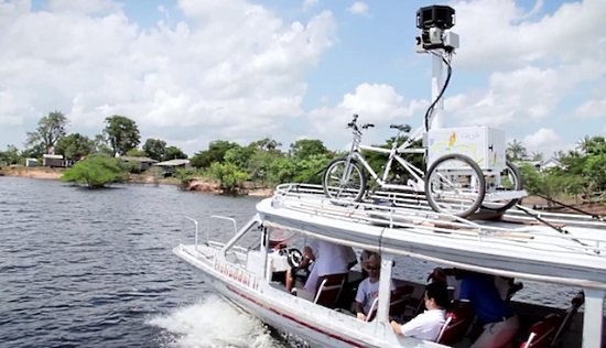
There are, by the way, and photos of coastal villages. In this case, not boats, but google-bicycles worked. Yes, yes, such a big bike, with a bunch of equipment. Probably, driving this is not very easy, but the comrade in the photo seems to be coping.

Here is a little video:
Source: https://habr.com/ru/post/140503/
All Articles