GPS Past, present and future through the eyes of the inhabitant
Introduction
Currently, when modern phones have become ten times more powerful than the first supercomputers, when the first iPhones, iPads and a lot of Android devices appeared, we received a new ideology of using these resources. Pocket gadgets are now not just computers reduced to the size of a palm, but tools that allow the user to control entire areas of his life with one finger — all areas into which the Internet has penetrated: communication, entertainment, travel, information search ...
The list can be continued indefinitely. In many ways, the navigation of the Internet into our lives has been facilitated by GPS navigation. Now, when almost everyone has a GPS receiver in his pocket, many services have had the opportunity to improve our lives. However, we first consider the history of the origin of GPS.
1. The history of the emergence and development of navigation technology
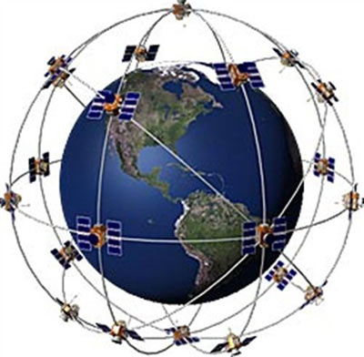
GPS (from the English. Global Positioning System) is a satellite navigation system that provides distance, time measurement and determines the location of objects (see Figure 1).
The project was implemented and belongs to the US military. The main objective of the project is to determine the current coordinates of the user on the surface of the Earth or in near-Earth space [4].
')
The idea of creating satellite navigation was born in the 50s. At the moment when the USSR launched the first artificial satellite of the Earth, American scientists, led by Richard Kershner, observed a signal coming from a Soviet satellite and found that due to the Doppler effect, the frequency of the received signal increases as the satellite approaches. distance away The essence of the discovery was that if you know your coordinates on Earth accurately, then it becomes possible to measure the position and speed of the satellite, and vice versa, knowing the satellite’s position accurately, you can determine your own speed and coordinates (see Figure 2).

This idea was implemented in 20 years. The first test satellite was put into orbit on July 14, 1974 in the USA, and the last of all 24 satellites needed to fully cover the earth’s surface was put into orbit in 1993, thus the global positioning system was put into service. It has become possible to use GPS for accurate guidance of rockets at fixed and then at mobile objects in the air and on Earth.
Initially, the global positioning system was developed as a purely military project. But after a Korean airline with 269 passengers aboard, which invaded Soviet airspace in 1983, was shot down, US President Ronald Reagan allowed partial use of the navigation system for civilian purposes. But the accuracy was reduced by a special algorithm.
Then information appeared that some companies deciphered the algorithm for reducing the accuracy at the L1 frequency and successfully compensated for this component of the error, and in 2000 this degradation of accuracy was canceled by a decree of the US President [2].
The table below shows the chronology of GPS development (see Table 1).
Table 1- GPS Development Timeline
Date Event
1973 Decision on the development of a satellite navigation system
1974-1979 testing system
1977 Reception of a signal from a ground station simulating a satellite system
1978-1985 Launch of eleven satellites of the first group (Block I)
1979 Reduced program funding. The decision to launch 18 satellites instead of the planned 24
1980 In connection with the decision to curtail the use of the Vela satellites for tracking nuclear explosions, it was decided to assign these functions to GPS satellites. The launch of the first satellites equipped with sensors registering nuclear explosions
1980-1982 Further cuts to program funding.
1983 After the death of the aircraft of the Korean Airline, shot down over the territory of the USSR, it was decided to provide a signal to civilian services.
1986 The death of the Space Shuttle space shuttle "Challenger" suspended the development of the program, as the latter was planned to put a second group of satellites into orbit. As a result, the Delta launch vehicle was chosen as the main vehicle.
1988 Decision to deploy an orbital constellation of 24 satellites. 18 satellites are not able to ensure the smooth operation of the system
1989 Activation of satellites of the second group
1990–1991 Temporary SA shutdown (eng. Selective availability — an artificially created rounding of positioning to 100 meters for unauthorized users) due to the Gulf War and the lack of military receiver models. Inclusion SA June 1, 1991
12/8/1993 Report on the initial readiness of the system. In the same year, the final decision was made to provide a signal for free use to civil services and individuals.
1994 Satellite constellation manned
07/17/1995 Full system availability
1.05.2000 Disabling SA for civilian users, thus, the accuracy of determination increased from 100 to 20 meters
06/26/2004 Signing of a joint statement to ensure the complementarity and compatibility of Galileo and GPS
December 2006 Russian-American negotiations on cooperation in ensuring complementarity of the GLONASS and GPS space navigation systems
2. GPS today
2.1. GPS games
The revolution of geo-targeting services, that is, built around locating something (user or point on the map), could have been predicted before the advent of new-fangled smartphones. People began to go crazy about GPS navigation as soon as it became widespread. On May 1, 2000, the White House press service announced that the deliberate deterioration in the accuracy of civilian GPS receivers had been stopped, and already on May 3, one of the GPS fans Dave Ulmer decided to check the accuracy of navigation. He called this idea “a big American cache hunt using GPS” and reported it to other users via the Internet. The idea was very simple: somewhere in the forest a container is hidden, and its geographical coordinates are recorded. Other players must find the “treasure” using their GPS receivers. The rule for the finder: take some things, leave something of your own. Ulmer placed his own container (black bucket) near Portland. Together with the magazine, where participants could mark their visit, and with a pencil he left small gifts: videotapes, books, CDs and a slingshot. Within three days the cache was found by two players who read about it on the net. Other enthusiasts began to place their own caches and publish their coordinates, supporting the initiative. Like many other ideas on the Internet, the new game very quickly gained popularity and eventually got a new name - geocaching. The site Geocaching.com remains to this day a popular resource for geocashers from all over the world, and in Russia there is a geocaching.su resource. The Russian version is slightly different from the western one: it is recommended to create caches in the domestic version of the game in places that have historical, cultural or natural significance [1].
2.2. GPS tags
On the basis of geocaching, GPS tag ideas were implemented. Foursquare service offers users to mark on the map interesting places, bars, cafes, theaters, in other matters, anything that may interest others. Thanks to this service, it is much easier to find a bar where your friend recently noted, rather than resort to an Internet search. However, foursquare has no less successful counterparts, both Russians - AlterGeo, and foreign - Gowalla. Similar services are also developing inside social networks: on Facebook - Places, on VKontakte - places that allow you to check in any place and mark friends who are next to you. It can be assumed that "Places" will pervade almost the whole world.
2.3. The virtual reality
Already began to appear the first GPS navigators, conducting the route lines directly in the image from the built-in video camera. True, they work worse than ever, it is difficult to combine an inaccurate GPS tag on a map with a video image. However, the creators of Layar, an augmented reality browser, managed to do this. It is capable of combining information maps with the readings of a GSP receiver and a compass, superimposing the result on the image from the video camera (see Figure 3).

However, this is just a browser, not a navigator, that is, you can only know about the point, the distance that separates you, but you won’t know how to get to it and what is between you.
An interesting application released site "Around the World." It is able to determine the location and automatically begins a story about the nearest sight. Pleases also the fact that there is a manual mode and, in case of a GPS error, you can select the object of interest manually.
2.4. GPS maps
Of course, it is impossible not to mention the main consumers of this technology - mobile cards. Google Maps, pre-installed in every decent smartphone, and “Yandex. Maps, which have a more accurate map of Russia today, fight for our market, continually adding new functions and services, becoming better and more complex. Three-dimensional view and fast vector map from Google against more competent navigation and more accurate raster map from Yandex. Unconditional leadership in displaying road congestion and car routing, as well as nearly becoming “geo-targeting twitter” user comments on Yandex’s map versus Google’s recently launched full-featured navigation mode. More competent search in Russian-speaking names at Yandex against pedestrian routing taking into account public transport at Google. You can choose endlessly, but in the end, each user has both cards. It is necessary for “Yandex” to release a car navigator inside maps, similar to Google, and this will forever change the GPS navigation market, giving us a choice of two free, quickly updated and compact navigators. And this will make the usual GPS navigators archaism [1].
3. Who needs it?
What will help an ordinary person in the life of a GPS device (see Figure 4)?
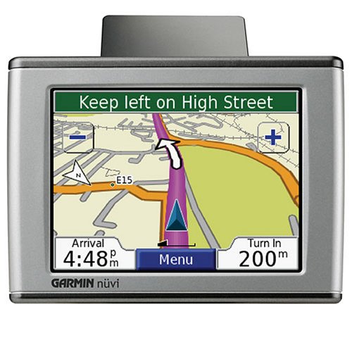
The best city navigation program will pave the way for you to a given address. And if you ask for a good one, then there are several routes to choose from. Moreover, if you chose one, but on the way decided to deviate from the recommendations, right there, on the go, the route will be recalculated. She also predicts the expected speed and arrival time to the destination, guides you to the place, warning you in advance on the screen (and if you turn on the voice mode, then with your voice) about turns, turns and other shifts of simple direct movement. And also, if you have to face any difficult interchange, it will automatically increase its image to full clarity and indicate which of the sleeves you need to move. Moreover, some programs (and low-cost subscription services attached to them) make it possible to take into account in the calculations data on real traffic jams and suggest routes that are longer, maybe long, but at the moment faster. True, these services are still just beginning to develop, and the infrastructure designed to provide them is not yet fully established.
If we are talking about driving and driving in a foreign city, and that Pushcha is abroad, here without a navigator (connected to a smart program and equipped with the most recent maps, which are usually updated frequently via the Internet), you simply cannot do [3].
Conclusion
One can only guess what development navigation will receive in the future. Perhaps all movement, including personal transport, will be controlled by automatic computer systems, and navigation will control movements, preventing you from going astray and preventing collisions with other objects. Perhaps, GPS will be replaced by a more advanced technology, which allows receiving a signal at a depth of several kilometers and not losing accuracy from external factors. However, it is clear that development is just beginning.
Bibliography
1. Banin, D. Everything is at stake / D. Banin, R. Kitaev // Tester. - 2011. - № 3. - p. 21-25.
2. History of the creation of satellite navigation systems [Electronic resource] / Unknown author // How the GPS system works. - 2009. - Access mode: www.glonax.ru/history-gps.html
3. Kozlovsky, E. The Art of Positioning / E. Kozlovsky // Around the World. - M .: 2006. - № 12. - p. 204-280.
4. Network satellite radio navigation / V. Shebshaevich [et al.]. - 2nd ed., Pererab. and add. - M .: Radio and communications, 1993. - 408 pp., Ill.
Source: https://habr.com/ru/post/136658/
All Articles